Leaving the motorway at the Pont-Saint-Martin toll booth, after 100m turn left to follow the state road in the direction of Aosta. After 500 metres, at the roundabout, take the second exit and continue on the state road for 3 kilometres to the next roundabout. Take the second exit and follow the regional road in the Champorcher Valley. Continue on the regional road for 14.7 kilometres up the valley and through the villages of Hône and Pontboset before reaching Château, the centre of Champorcher. Turn right, following the signs for Dondena and climb up the little communal road for about 7.9 kilometres until you reach the Dondena car park 🅿️ where you can leave your car.
[0h52'] - [30.6km] How to get there with GMaps How to get there with Apple Maps
The information provided here has been verified as of the date the route was surveyed. Before setting off, it is advisable to ensure that no substantial changes have occurred on the route to the starting point. We therefore recommend the use of the satellite navigation apps provided by Google or Apple for up-to-date and detailed directions.
Introduction
Alternative route in the upper Champorcher valley, suitable for those who already know the area around Lake Miserin and want to escape the crowds. It also crosses into Piedmont. It can be partially covered by mountain bike, but with more effort than on foot (at least uphill).
Description
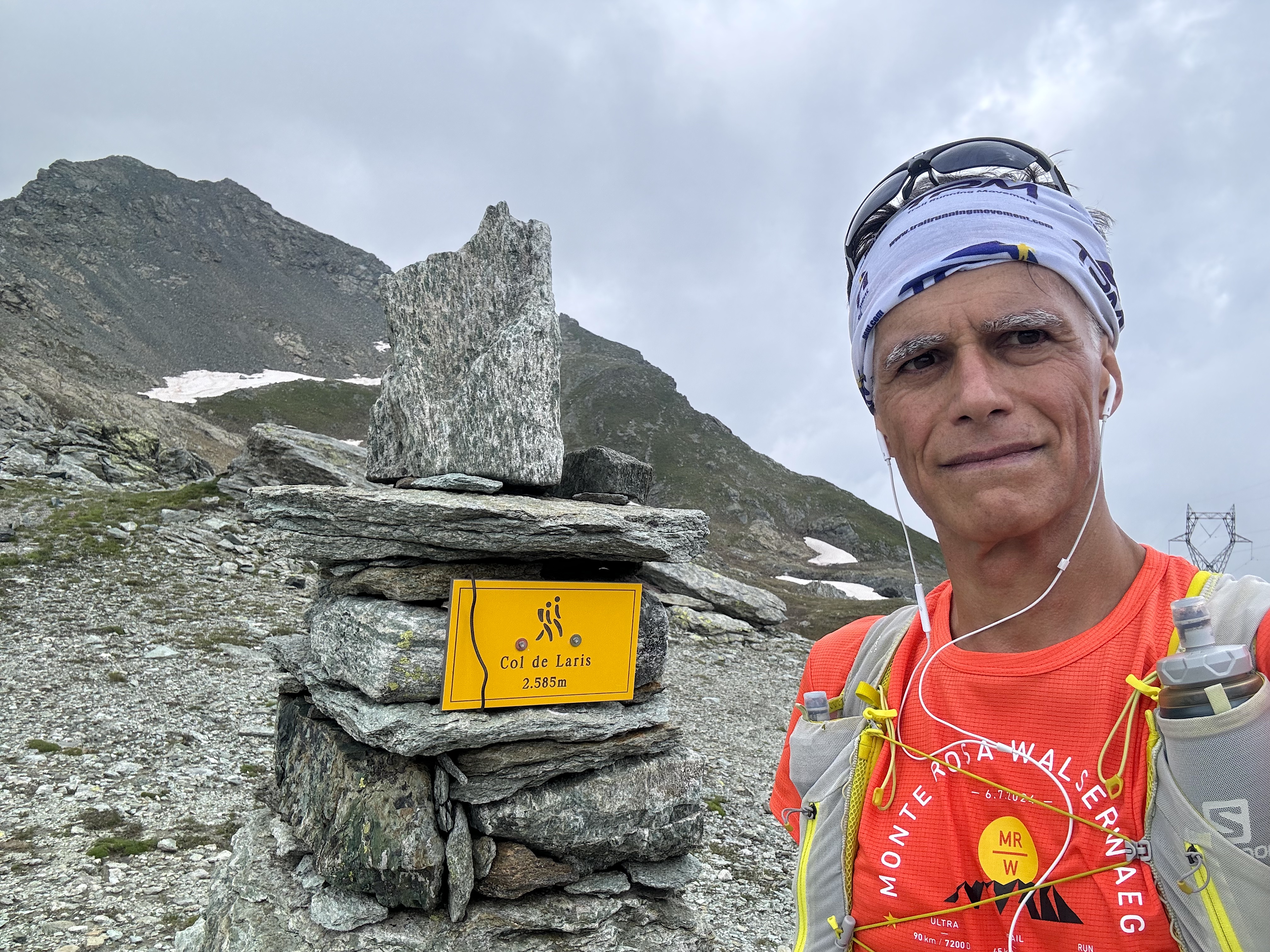
Reach Champorcher by car from Hône; shortly after the centre of the village, turn right for Dondenaz. The road will then become unpaved and not easily passable with sports cars. At Dondenaz (2110 m) there is a no-transit sign and the hike begins on foot (or with mountain bikes). Along the farm road you reach the Dondenaz hut (2200 m; water), then continue left towards Larissaz. The path is obvious, but to get an idea of the itinerary, just follow the high-tension pylons with your eyes: in fact, you will follow them step by step, crossing them several times (which is the only strongly negative note of the walk). Having crossed the Banchi stream on a convenient little bridge, the first real climb begins, which can be done either by following the farm road (by bicycle) or by cutting across it several times thanks to the remnants of the old mule track. The trail comes to the top at Cimettaz Rousse (2466 m), which corresponds to the arrival point of a ski lift: the pedalling section ends. Cross a valley populated by marmots by descending and ascending an easy path, and across a scree slope you reach Larissaz Lake (2486 m). The pass of the same name is just above, between Pic Mollère (2638 m) to the left and Bec Pragelas (2908 m) to the right. This is where the signs with the numbering of the Aosta Valley end and the panorama of the Val Soana can be enjoyed. A little further down you can see the La Reale lake, which can be reached in about twenty minutes by following the obvious path.
Descent time: almost the same, along the outward route Marking sequence: Alta via No. 4 Characteristics: Naturalistic Difficulty: Medium Easy walkers (MCF) Recommended period: (we recommend the month of June to appreciate the flowering of the pastures) Height of the starting point: 2110 m Height difference: Ascent 474 m Height of the finishing point: 2584 m (Col Larissaz) 2412 m (Lake La Reale)


Comments (0)
Sign in to leave a comment