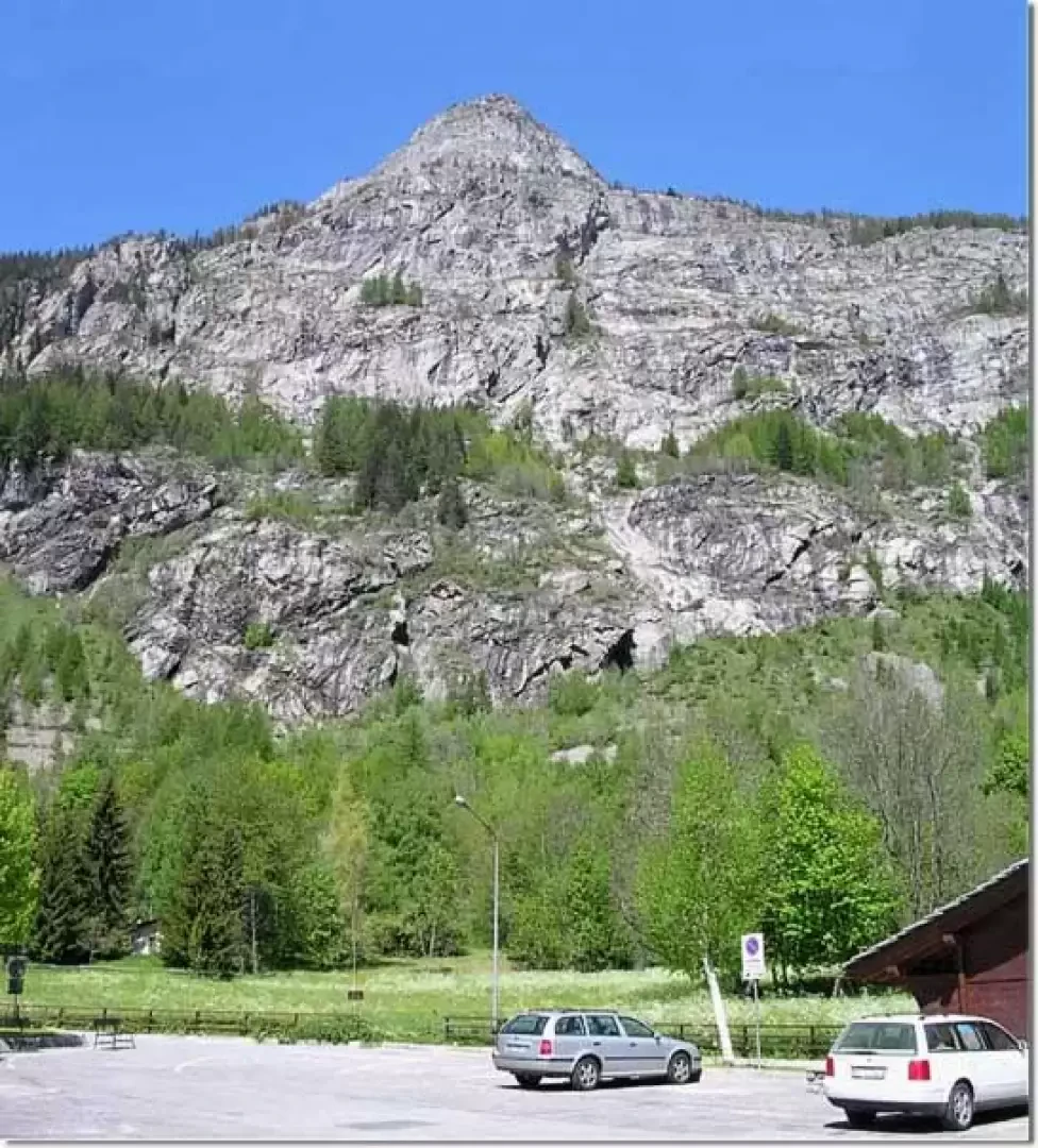
Mont Chétif, from Dolonne


Edited by:
Gian Mario Navillod
Updated at: 13/07/2025
Introduction
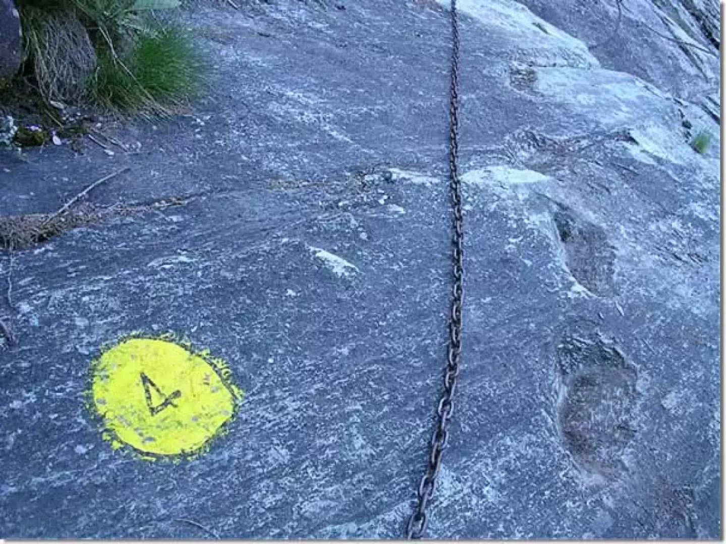
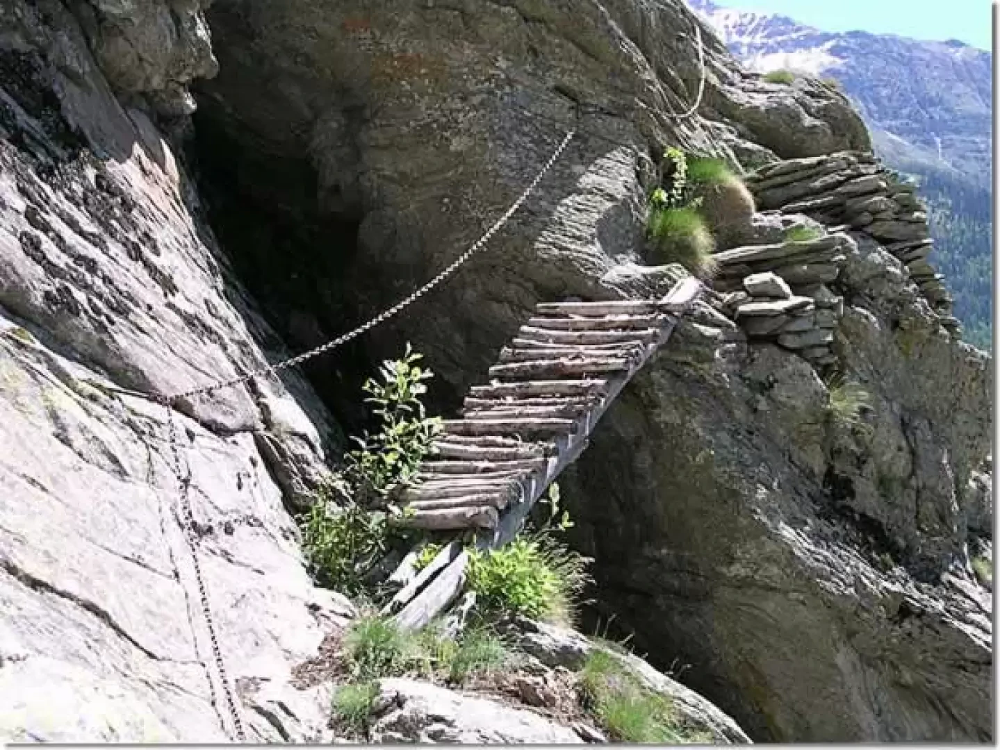
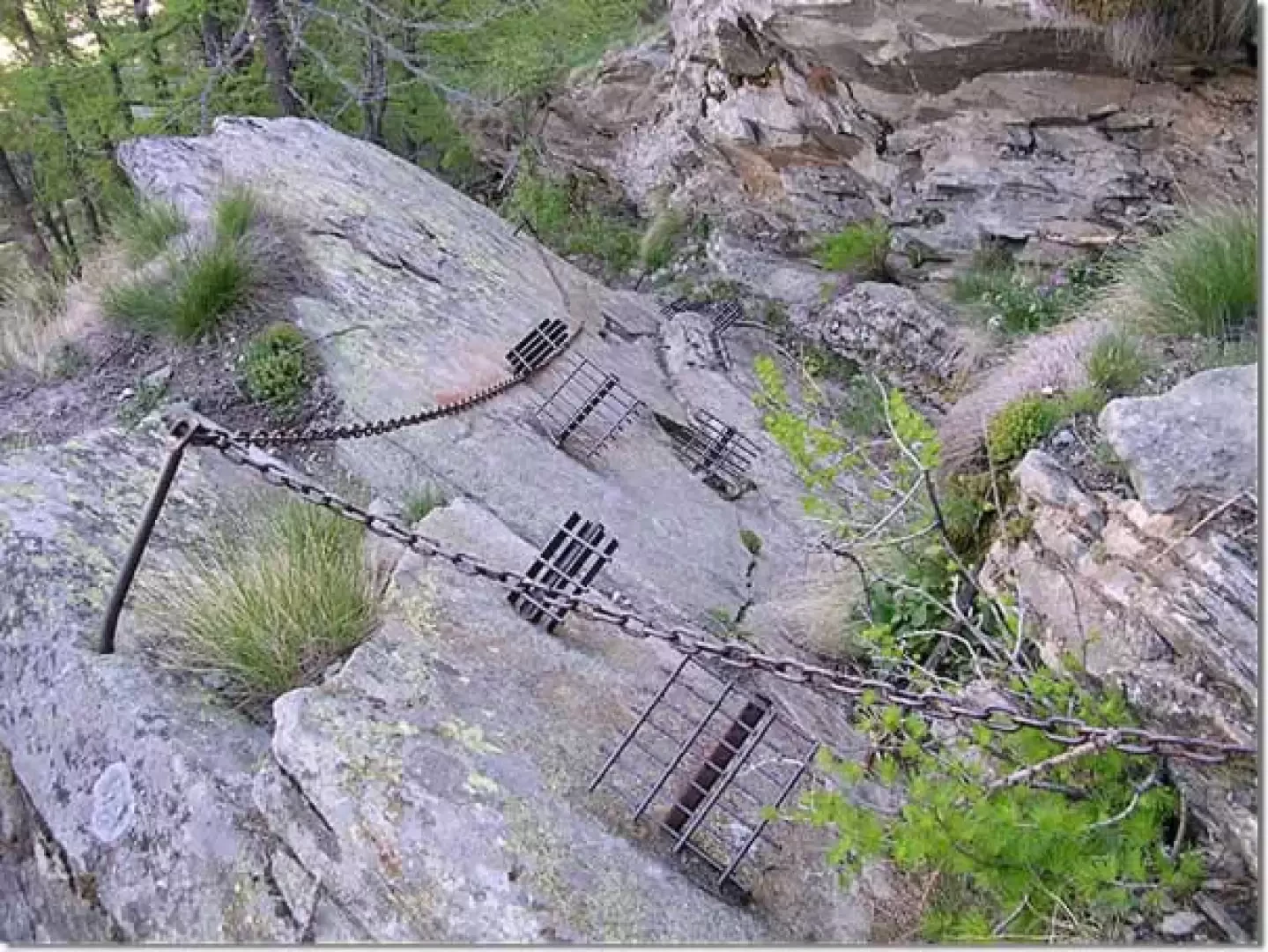
The short ferrata that makes access to Mont Chetif safer is all concentrated in the slabs above the Dolonne climbing wall and ends below the belvedere. To make the path connecting the hamlet with the woods and meadows above safer, a hundred metres of chain and a few dozen iron steps were laid. In the most slippery sections, the steps carved into the rock by the valley dwellers are still clearly visible. Once past this short rocky section, the ferrata becomes a pleasant path that climbs to the summit, interrupted from time to time by very short equipped sections. The chains are made of iron, with 4-mm-thick links, and as you ascend you cross two small wooden bridges several metres long that facilitate passage over two cracks in the rock.
Description
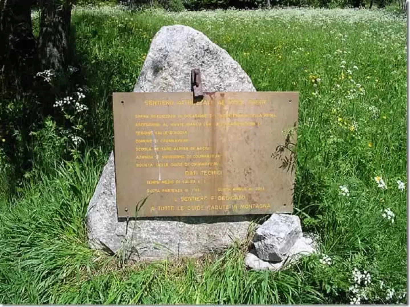
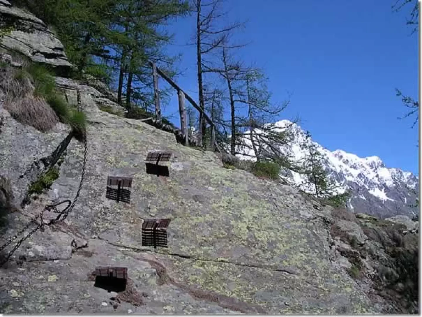
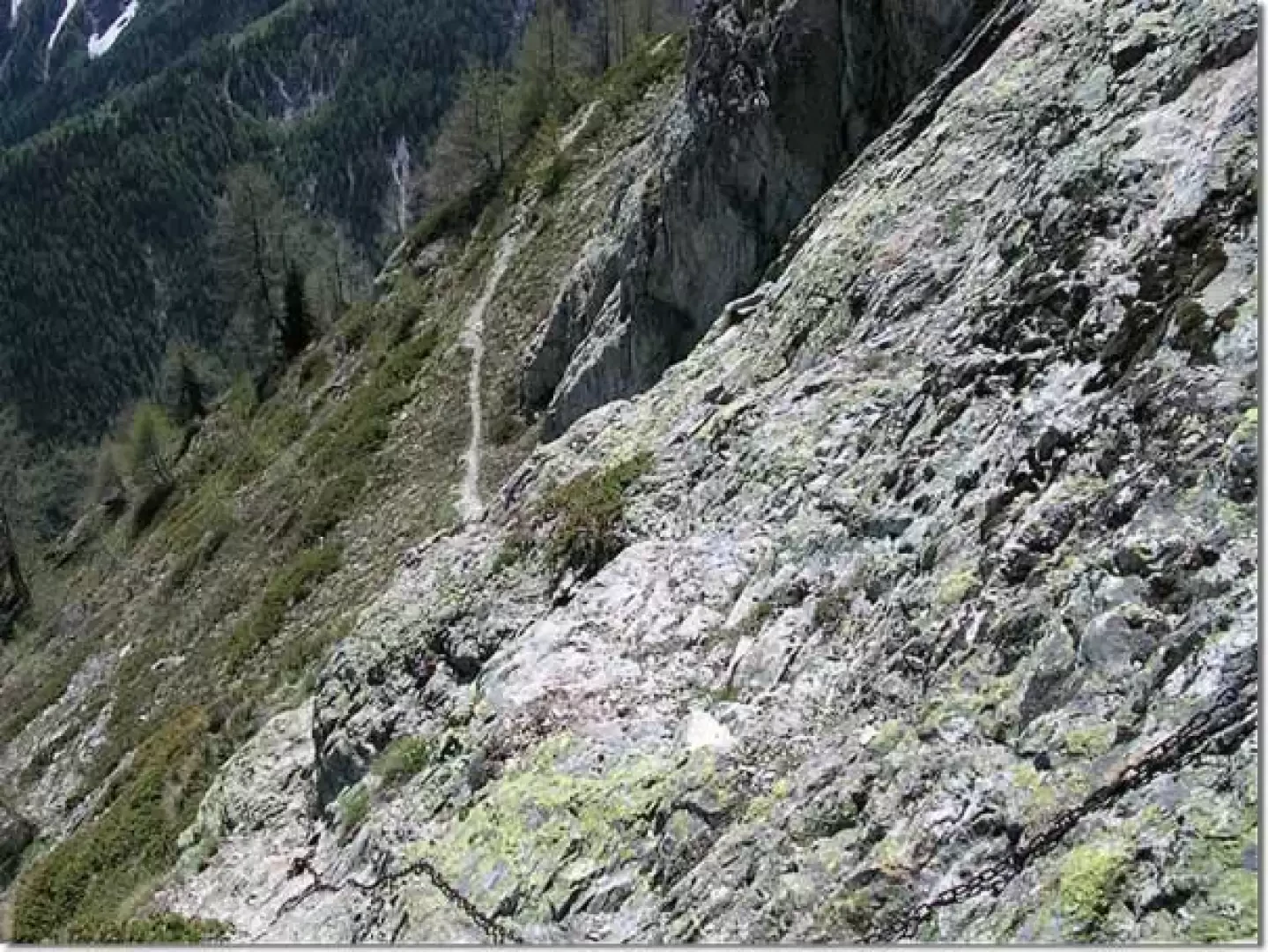
The path starts at the entrance to the north car park of the Dolonne arena. It crosses a level meadow and at the foot of a clump of trees is a plaque, flanked by two small menhirs, commemorating the year the ferrata was built. A little further on one enters the broadleaf scrub dotted with the orange of the martagon lilies and the white flowers of Solomon's seal. One walks in the cool shade of the forest until one meets the much wider path that climbs along the pastures towards the climbing wall. When you reach the foot of the sloping slabs where the climbing routes are marked, turn left, descend a few metres in altitude and then walk along the level path that skirts the terraces until you come to the marker indicating the start of the diversions for the ferrata. From this point, the path increases in gradient and climbs in regular hairpin bends among the broad-leaved trees that are beginning to thin out and a few rare larches. One crosses a scree slope where the path widens out, passes a large cavity in the rock, formed by a roof that protrudes a couple of metres, where one can find shelter in case of bad weather, and shortly afterwards the first chains are found.
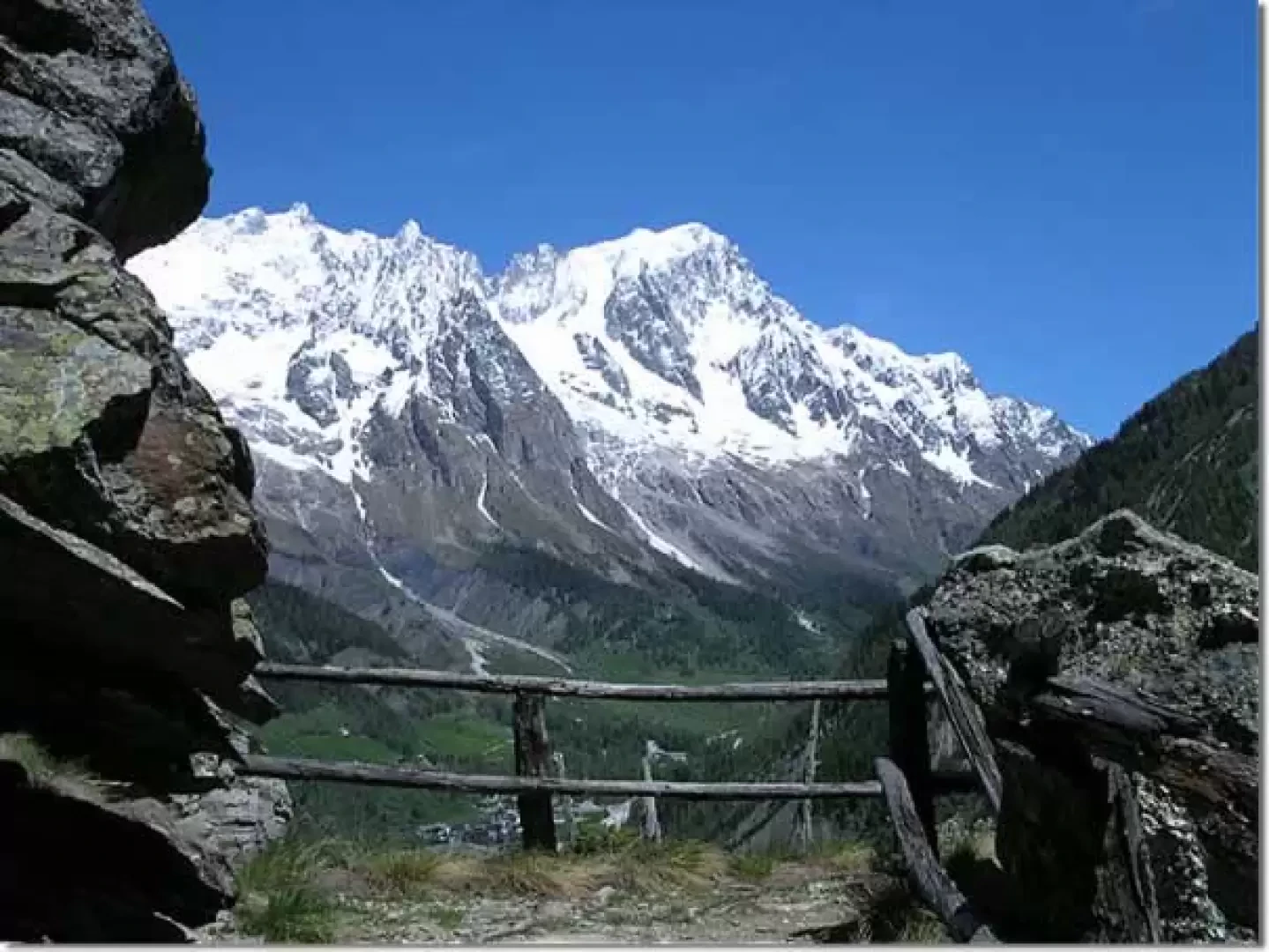
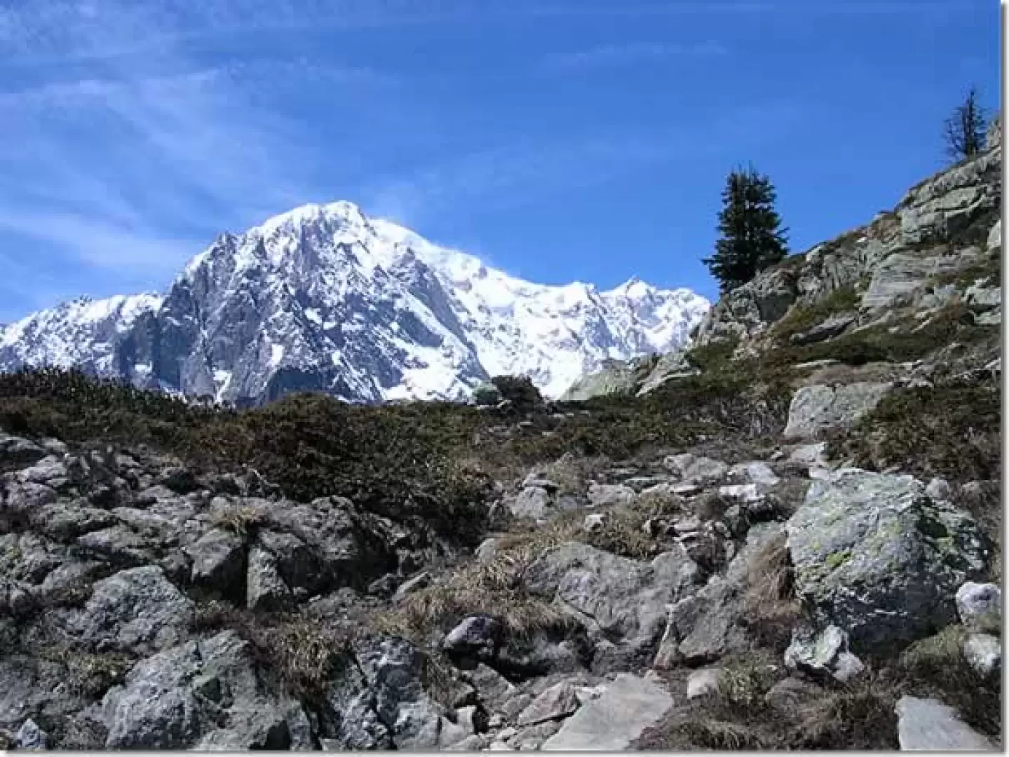
The ferrata begins with a long traverse to the east, interrupted more or less in the middle by a small wooden bridge a couple of metres long that crosses a crack in the rock. The chains are not essential for progression but only made the route safer, as it was used by mountaineers to access the pastures above. Steps chiselled into the soft rock to overcome the more slippery sections can still be found, especially in the lower part. At the end of the traverse, the track climbs up between broken rocks and the sparse vegetation typical of arid places until it reaches a coniferous forest, which is crossed on the pavement carved out of the stony ground colonised by larches. On the old slabs a thick layer of fallen autumn needles muffles the sound of footsteps and the balsamic smell of resin fills the lungs. A little further on is the first of the many viewpoints one encounters on the ascent to the summit. Framed in the rocky walls, a window suddenly opens up on the massif of white, which covers the sector between the Pic della Brenva with the Entrèves glacier and ends with the Grandes Jorasses. All along the ascent there will be a succession of splendid views of the grey of the rocky walls, the dazzling white of the snows and the intense blue of the sun until the superb 360-degree panorama offered by the summit of Mont Chetif, but the first view of the Mont Blanc massif, with the dark flanks of the mountains on either side, punctuated by the green of the conifers and dominated by the intense blue sky, leaves an indelible memory in the eyes.
We continue along the path that climbs the eastern flank with a moderate slope between the larches and some fir trees until we come to a smooth but very steep gully that we cross with the help of a dozen steps, cross a scree slope and arrive at the base of a very short slab at the end of which there is a small wooden bridge a few metres long that crosses a hollow in the ground. The equipped section ends a little further on with a three-metre high wall that gives access to the upper belvedere. A few chains follow to help you climb up two steep gullies and then a short section halfway up the traverse below the summit, but the technical difficulties are now behind you.
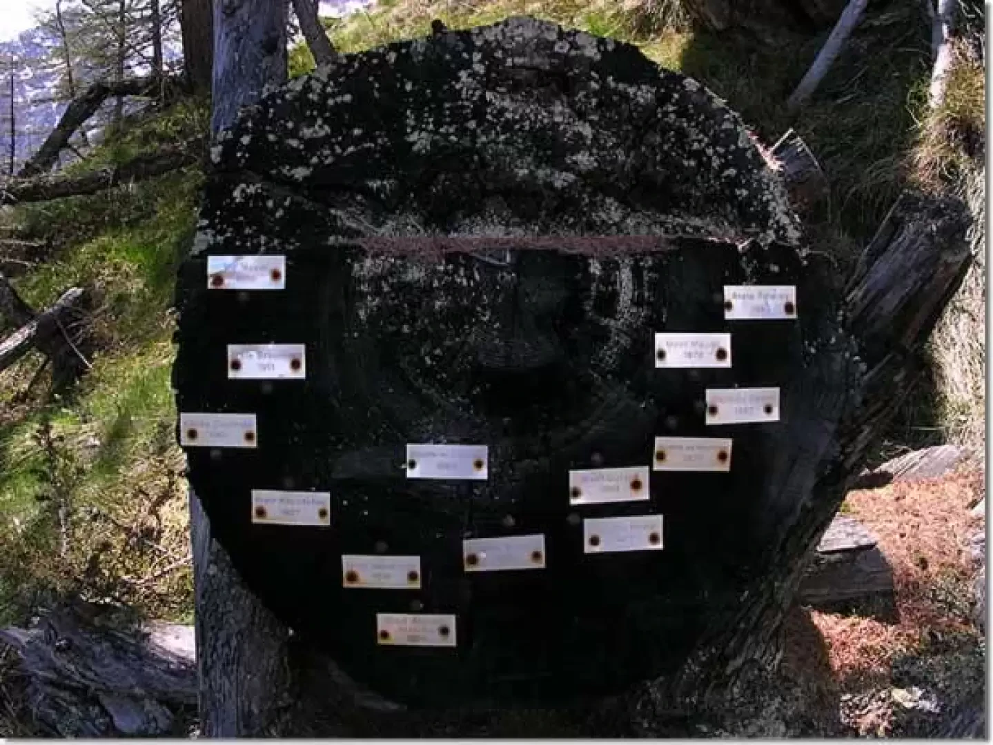
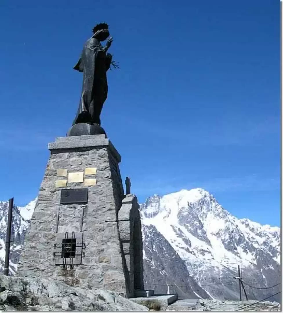
At a hairpin bend, the summit of Mont Chetif with its statue of the Virgin Mary stands out between the branches of a fir tree, and further on, you come across some rocks dotted with lichen, with the Mont Blanc massif in the background, and a little further on, the trunk of a weathered larch tree. On its growth rings, the dates of the main ascents on the Mont Blanc group are indicated with a few plaques.
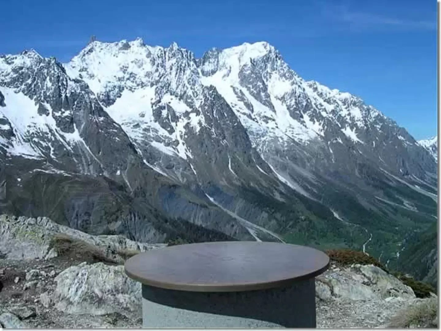
At the junction with the path that climbs from Pré De Pascal, take a left and proceed halfway up the steep and exposed slopes at the base of the summit tower. About halfway down the traverse, there is a broken rock bank about twenty metres long and equipped with chains, which you follow downwards until you come in sight of a repeater. From here the path climbs straight up in the direction of the pass, the gradient gradually decreases and suddenly the summit of Mont Blanc de Courmayeur appears between the rocks and the rhododendrons. You soon reach the junction with the path that climbs from Comba Dzeleunna and then continue along the ridge until you reach the summit from which you can enjoy a breathtaking panorama. The view encompasses the entire Val Veny with the Seigne pass and the Miage glacier, the Mont Blanc massif, Val Ferret and the Dora Baltea valley as far as Pré Saint Didier, with the isolated peak of the Grivola in the distance. Near the summit is a plaque on which the most important peaks and the distance to the main towns are indicated. Continuing eastwards for a few tens of metres, one arrives at the foot of the statue dedicated to the Madonna that dominates Courmayeur.
The ferrata was equipped in 1986 as part of the celebrations for the 200th anniversary of the first ascent of Mont Blanc. In the same year, Pope John Paul II celebrated the Angelus from the summit of Mont Chétif.
Photo gallery
Comments (0)
Sign in to leave a comment