Leaving the motorway at the Verrès exit, at the roundabout take the third exit onto the state road following the Aosta. After 450m, at the next roundabout, take the first exit continuing on the for 1.3km. Turn left onto the regional road signposted Valle di Champdepraz - Parco del Mont Avic. Go up the for about 10km before coming to a caertello with signs for the main car park in the resort: turn left, following the signs for Blanchet and Fusse and, after about 200m, park your car in the convenient car park.
Set in a basin bordered by conifers and erratic boulders, Lake Servaz is one of the easiest and yet most rewarding destinations within the Mont Avic Nature Park.
Description
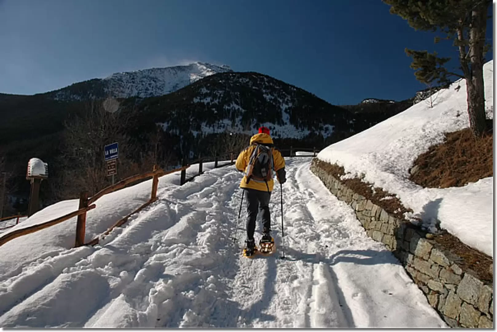
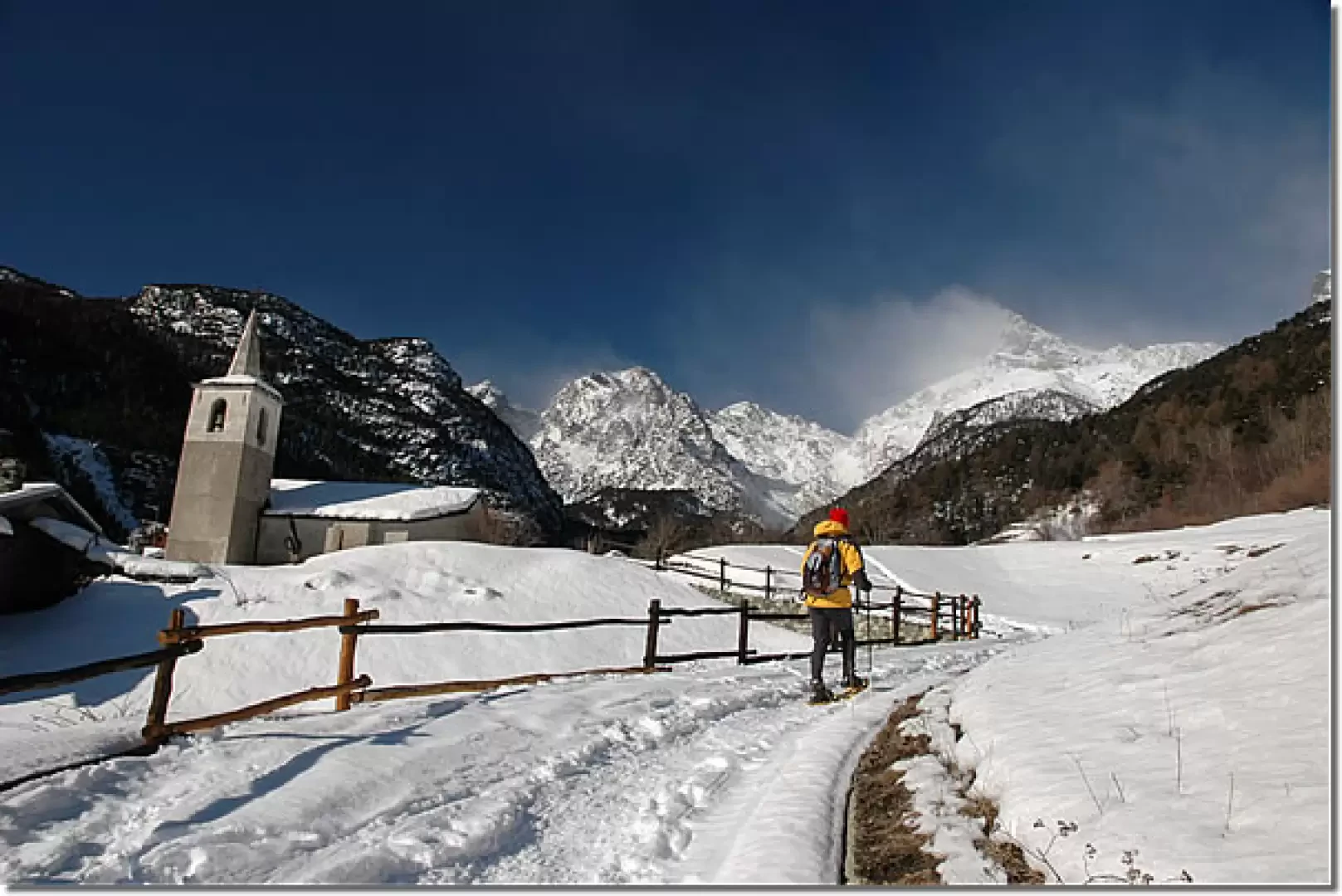
Leaving the car behind, we take a snow-covered track that ascends briefly towards the characteristic little church in the village of Veulla. The track near the little church slopes slightly and, following the wooden fence, continues in the direction of the sharp silhouette of the Mont Avic. After crossing a small wooden bridge, we ascend a short stretch of road until we reach Crest (1365m, 0h10'): from here, the path (7) leads to Praz Orsie (1794m) and the Mont Barbeston (2483m). We disregard this diversions and proceed straight along the road lined with information panels set up on site by the Park Authority to better understand the peculiarities of the protected area's ecosystem. Slowly one enters the forest consisting of hazel (Corylus avellana), white alder (Alnus incana) and above all conifers, including the peculiar Pinus uncinata (Pinus uncinata): the absolute dominance of this species is certainly unusual in the Alps. We cross a new wooden bridge, after which the road becomes slightly steeper until we reach the locality known as Magazzino (1461m, 0h30'): in this short clearing there is an information board with the Park's trail map. Turn left and follow the signs for Servaz (1540m) and Coucy (2061m) with the path (5C). After a short flat section, a short descent begins, which, after crossing a small tributary of the Chalamy stream on a small wooden bridge, reaches the edge of the stream and then begins to climb again. After crossing another small wooden bridge over another tributary with crystal-clear water, the trail proceeds under a rocky outcrop and then below a pastureland area; the road makes a couple of twists and turns until it reaches Servaz Desot (1540m, 0h50'). The trail passes under the rural buildings of the alpine pastureland until it meets a new signpost indicating to turn right and follow the signs to the lake. You immediately begin to climb up the snowy slope. You quickly enter the coniferous forest as the twists and turns follow one another. Along the ascent, we first come across a clearing where an old charcoal pile once stood, then the path passes under some mounded rocks before coming to a small balcony with a splendid view of the lower Val d'Ayas. The route proceeds over fairly varied terrain with a fairly steep ascent in places; at an altitude of around 1700 m the path flattens out slightly, crosses a small scree slope and then starts to climb again for the last stretch. The destination is now near, the path begins to level out and after a few minutes you reach Lake Servaz (1806m, 1h45'). The descent follows the same route as the ascent (1h00').
This route is often beaten and often proposed by environmental guides to describe the special features of the Park.


Comments (0)
Sign in to leave a comment