Take the Turin-Aosta motorway, pass the Aosta East barrier and exit at the next tollbooth, Aosta West. Take the direction for Courmayeur and when you reach Aymavilles take the junction for Valsavarenche; continue along the valley floor road past the main town of Degioz and continue until you reach Pont where the road ends and where you can leave your car in the convenient car park.
.
Introduction
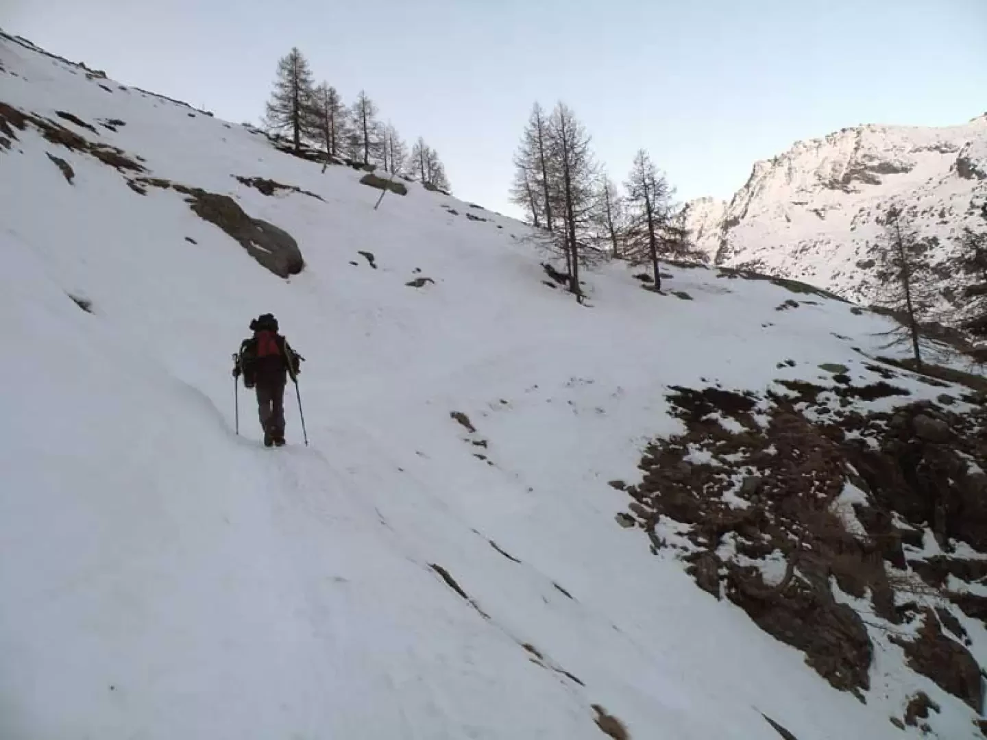
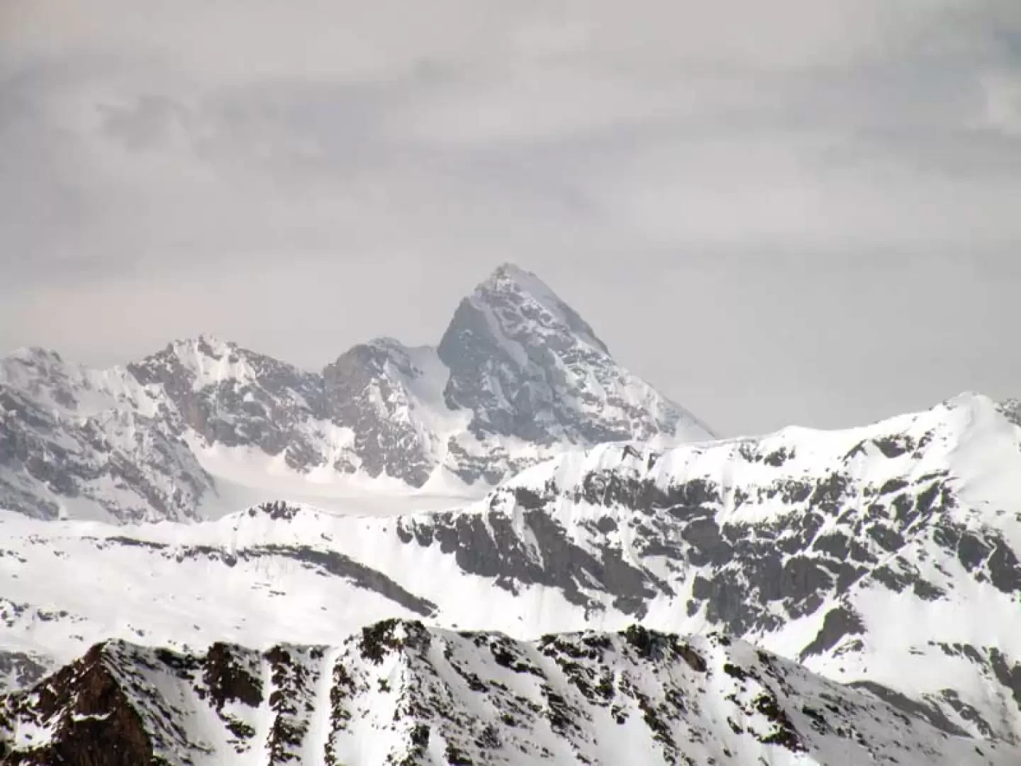
The Trésenta is the first peak to be found to the south of the Gran Paradiso massif just after the col du Mont Paradis and its ascent, of an alpine nature, does not entail excessive technical difficulties except for the final stretch where, from the Montcorvè glacier to the summit, it is necessary to tackle very steep and exposed slopes along the north-west ridge: for these reasons, the ascent must be planned in late season and with well-seasoned snow. A day's ascent of this mountain requires adequate training for the considerable difference in altitude and a very early morning start in order to be back on the Montcorvè glacier plateaus before the snow begins to melt in the steep section from the summit to the base of the glacier. A section where the danger must not be underestimated either on the ascent or descent is also a series of hairpin bends, on the approach path to the hut, exposed in a long, very steep gully that begins at an altitude of about 2170 m. The panorama is barely limited to the north because of the proximity of the imposing Gran Paradiso massif, but otherwise it is simply superlative over the snow-covered peaks of the Piedmont, French and Valle d'Aosta valleys.
Description
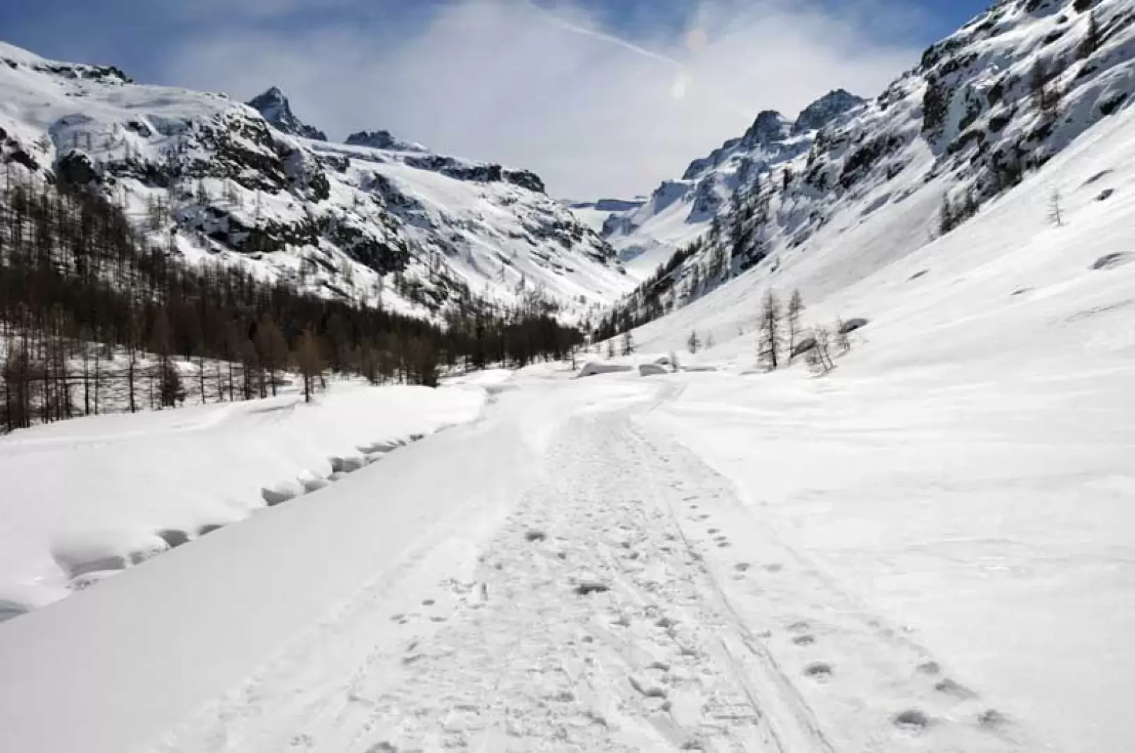
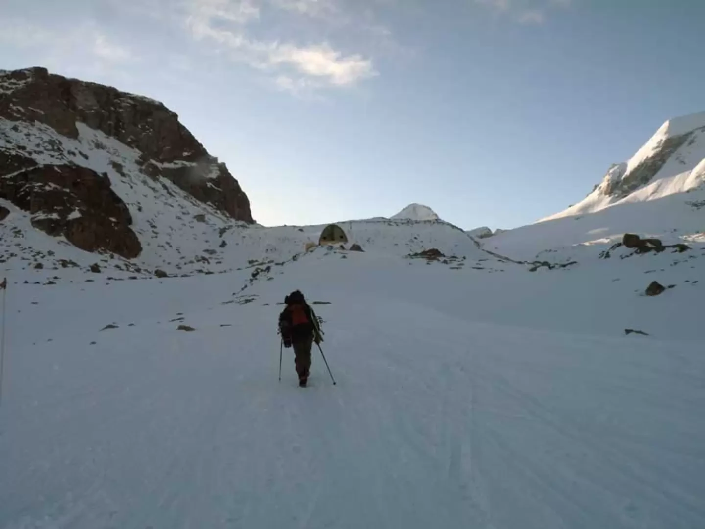
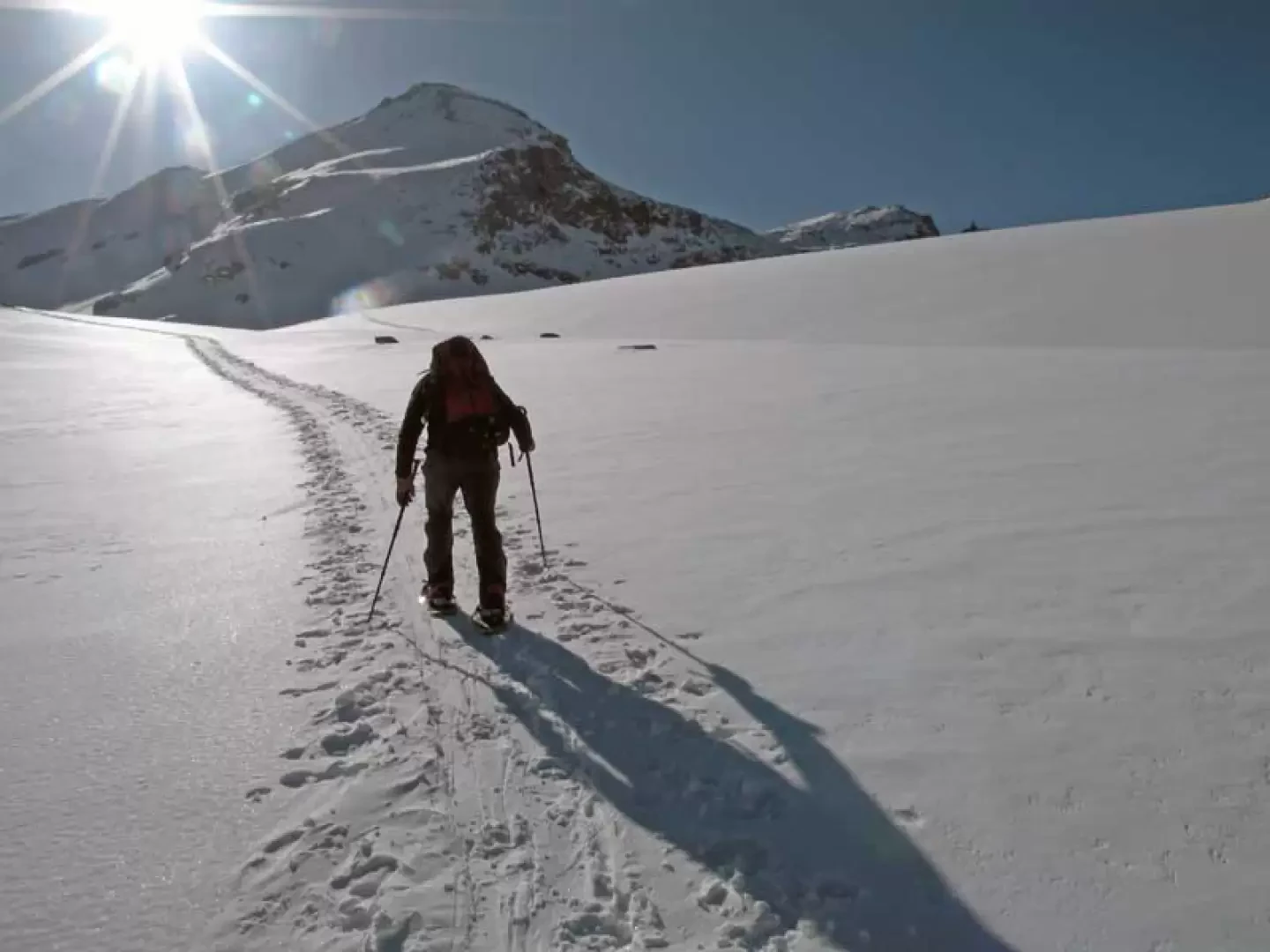
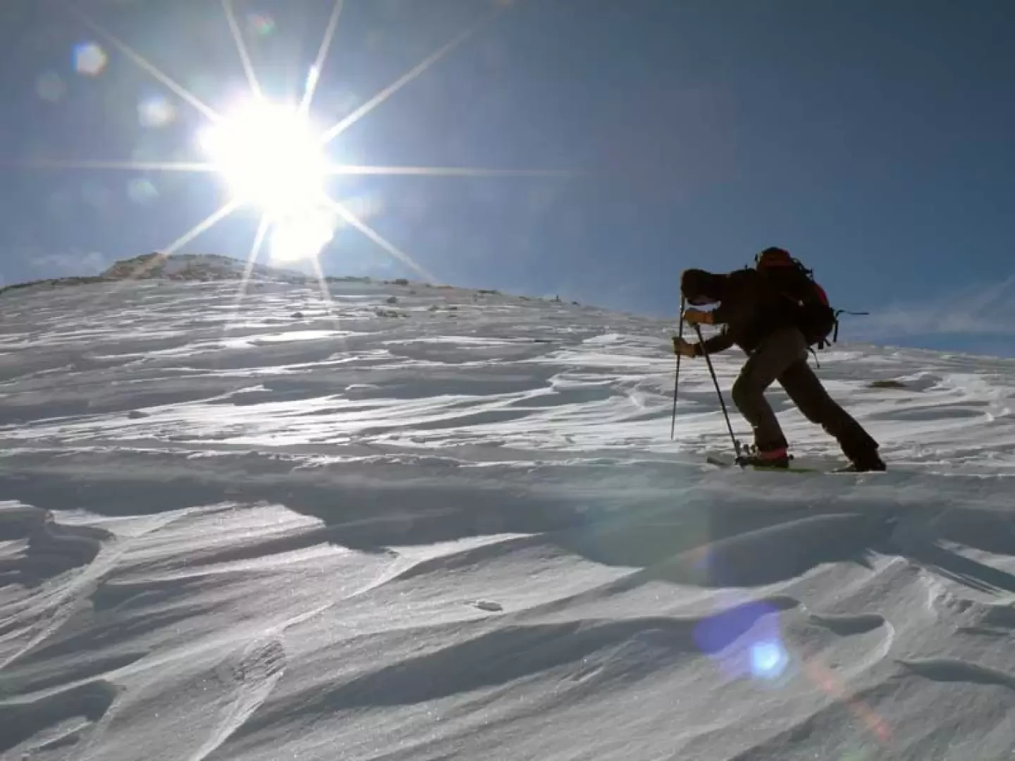
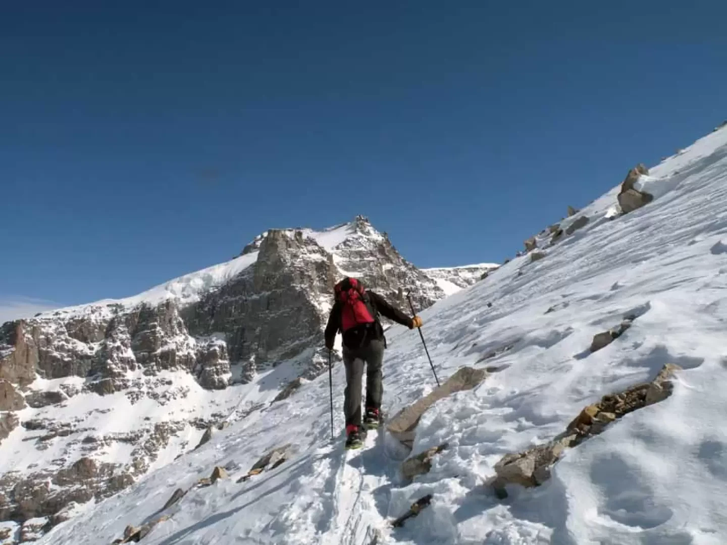
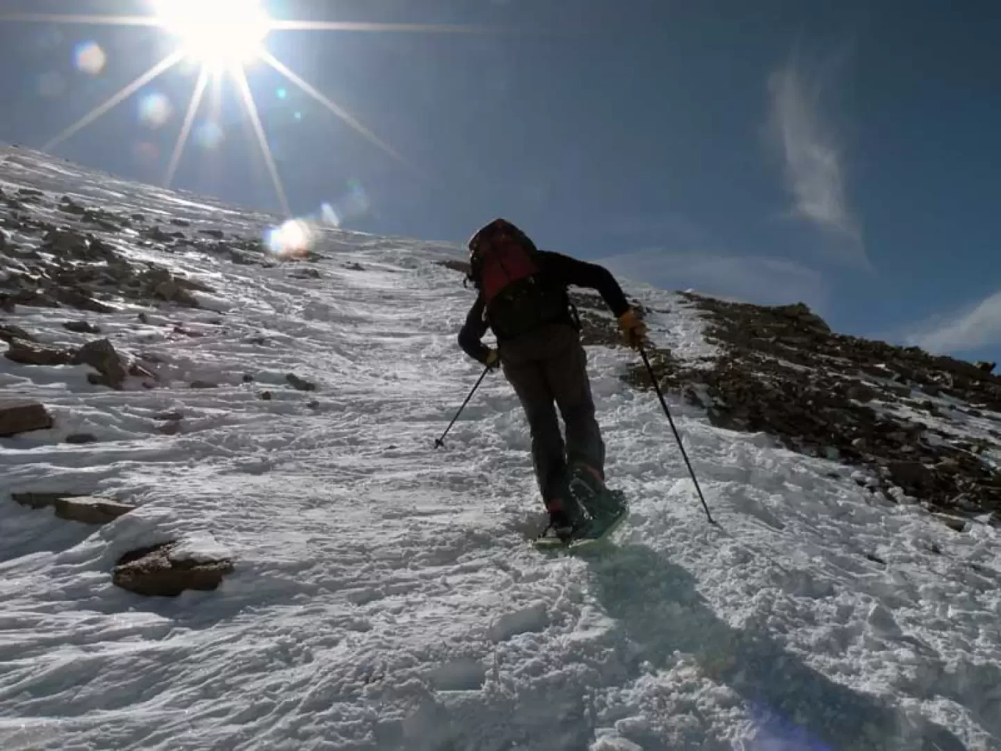
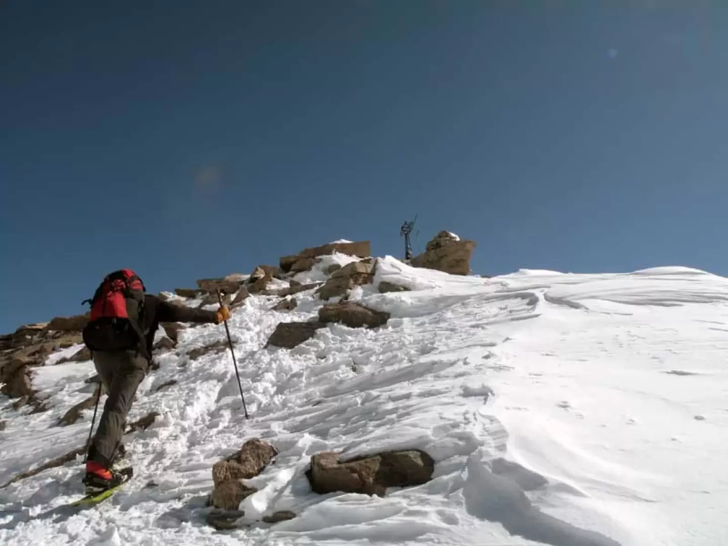
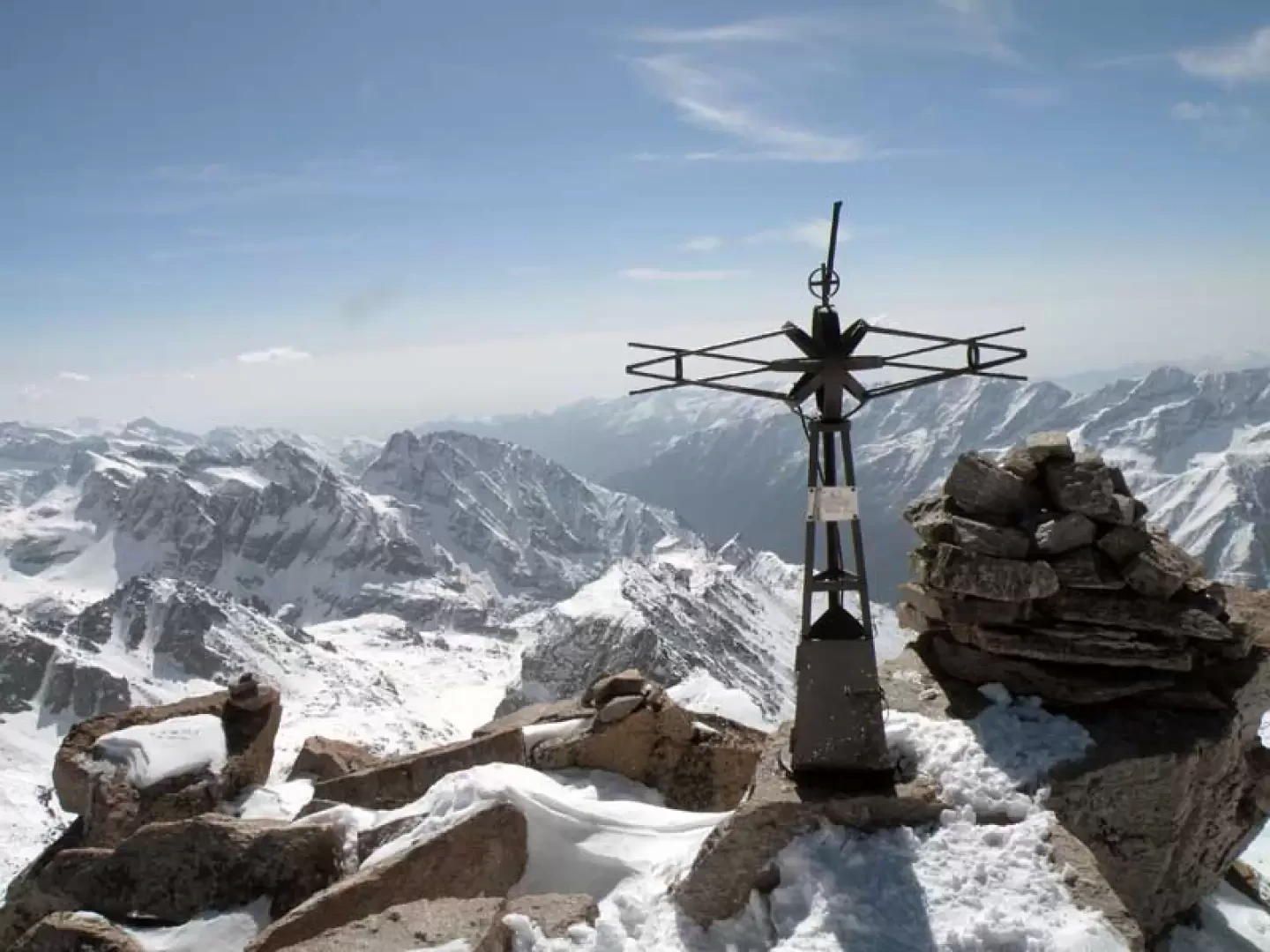
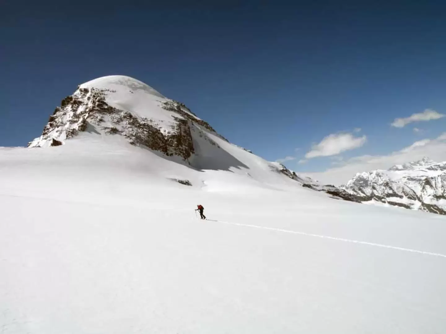
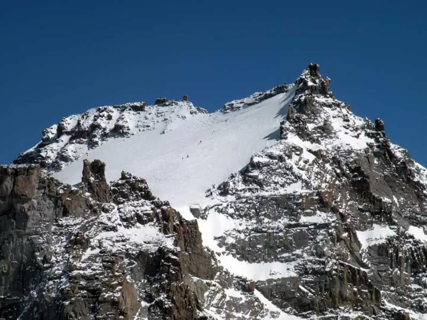
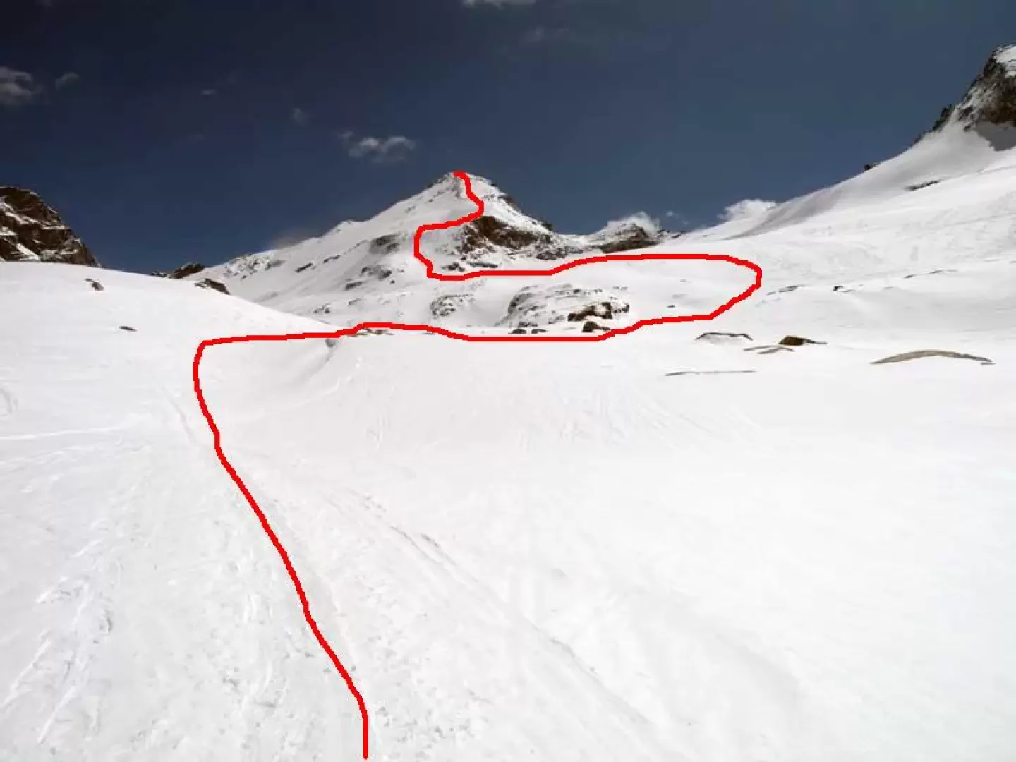
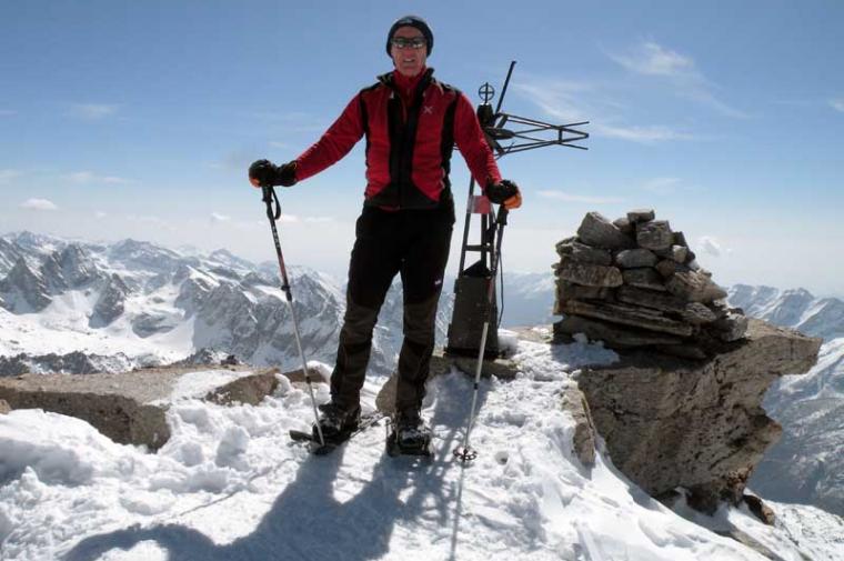
From the car park, reach the little house located at the beginning of the cross-country skiing track and follow the signs for the footpath, which skirts the summer camping area and continues to the right of the stream. Entering the valley, you reach a bridge on the left that you must cross and begin to climb along the path leading to the Vittorio Emanuele hut, following the almost always present ski-mountaineering tracks. After a stretch of ascent through the sparse forest, you arrive at an altitude of about 2170 m, where you have to negotiate some hairpin bends that cross a long, steep gully and where you must be extremely careful because of their exposure. Once this section has been passed, the ascent continues more easily on gentle, more open slopes that, depending on the snow cover, alternate between stretches on the ground and vast snowfields in the process of melting: the winter track usually passes a little to the left of the one taken by the summer path and, in any case, remaining in the middle of the moraines, you can reach the Vittorio Emanuele hut without difficulty. From the hut, the steep moraine behind it is circled on the right, beginning the ascent of the gentle slopes at the bottom of which our destination can be seen, situated between the Gran Paradiso on the left and the Ciarforon on the right. At first we keep to the centre of the vast plateau and then gradually move to the right, aiming for the base of the steep drop (40°) at the start of the north-west ridge and begin the laborious ascent, paying attention to the condition of the snow on the slope and making a few hairpin bends, traversing somewhat exposed and delicate traverses. When you reach a small wall where the slope decreases noticeably, begin the ascent of the last section between the mobile rocks, which is also steep but about 30°, keeping a little to the right of the line in order to seek out the slope with more uniform snow, passing to the left of a clearly visible cairn of stones that is about halfway up the slope. To ascend this last section when there is little snow, it is a good idea to consider putting on crampons in order to progress safely among the icy rocks. When you reach a point where the slope begins to decrease, you can already clearly see the summit, which you will soon reach and which is topped by an original metal cross.
Saliti senza racchette sino al rifugio su neve ben portante; stare attenti ai tornanti nel ripido canale nella parte iniziale del sentiero. Calzate le racchette appena oltre il rifugio camminando su neve sempre portante sulle tracce di scialpinisti mentre se si usciva si sprofondava di poco. Praticamente una passeggiata sino alla base della dorsale dove si deve risalire il primo ripido pendio che abbiamo trovato senza tracce perchè cancellate da quelle di discesa con gli sci e che comunque comporta traversi esposti. Nella seconda parte della dorsale, quella con le roccette, trovato un po' di ghiaccio alternato a neve dura mentre poco sotto la vetta era già trasformata dal primo sole. Indispensabile, se fatta in giornata, la partenza al mattino molto presto e comunque è meglio essere sul pianoro del ghiacciaio non dopo le 11-11.30 perchè la neve mollava di molto e può rappresentare sicuramente un pericolo nella dicsesa dei tratti ripidi. Gita remunerativa e di soddisfazione per gli ambienti che si attraversano, per la vista del Gran Paradiso da un'angolazione inconsueta e per il resto del panorama veramente spaziale.


Comments (0)
Sign in to leave a comment