Mont Gelé, from Ru


Edited by:
Giancarlo Beretta
Updated at: 10/11/2025
Access
Leaving the motorway at the Aosta Est barrier, turn right and take the dual carriageway to follow for 8.4 kilometres. At Signayes, turn right onto the regional road following the signs for Bionaz/Laravoire. Pass a roundabout and continue on the regional road along the entire length of Valpelline. Pass through the villages of Valpelline and Oyace until, after about 27 kilometres, you reach the hamlet of Dzovennoz. Turn left, following the signs for Chez Leo Merloz Ru, Ley Cretes. Go up the little communal road for 1.3 kilometres until you reach the free car park 🅿️ before the village of Ru.
[0h39'] - [29.2km
How to get there with GMaps
How to get there with Apple Maps
The directions given here were verified on the date of the route survey. Before setting off, it is advisable to ensure that no substantial changes have occurred on the route to the starting point. We therefore recommend the use of the satellite navigation apps provided by Google or Apple for up-to-date and detailed directions.
Introduction
Mont Gelé is located just in front of the Grand Combin massif in the upper Valpelline and with its soaring silhouette it juts out like a balcony from which the view is simply exceptional over the most important peaks of the Alps, both Italian and Swiss, and the pre-Alps for a full 360° arc. The approach to the Mont Gelè pass, where the glacier begins, takes place for the most part on long, steep moraines, which are, however, well marked by a few yellow marks and a good track, while beyond the pass, the progression becomes more pleasant and, in the rocky part, also fun and very scenic; due to its technical ease, length and the completeness of the factors (path, moraines, glacier and rocky part) it is particularly suitable for those who want to approach the mountaineering world.
.Description
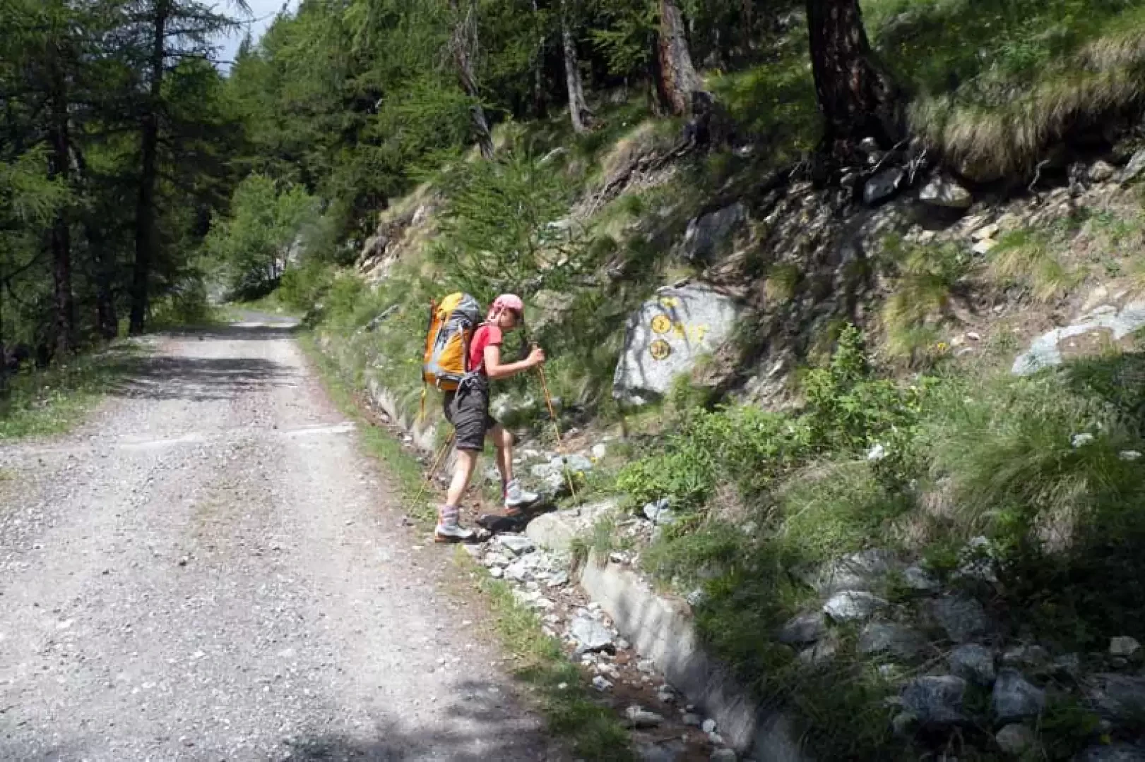
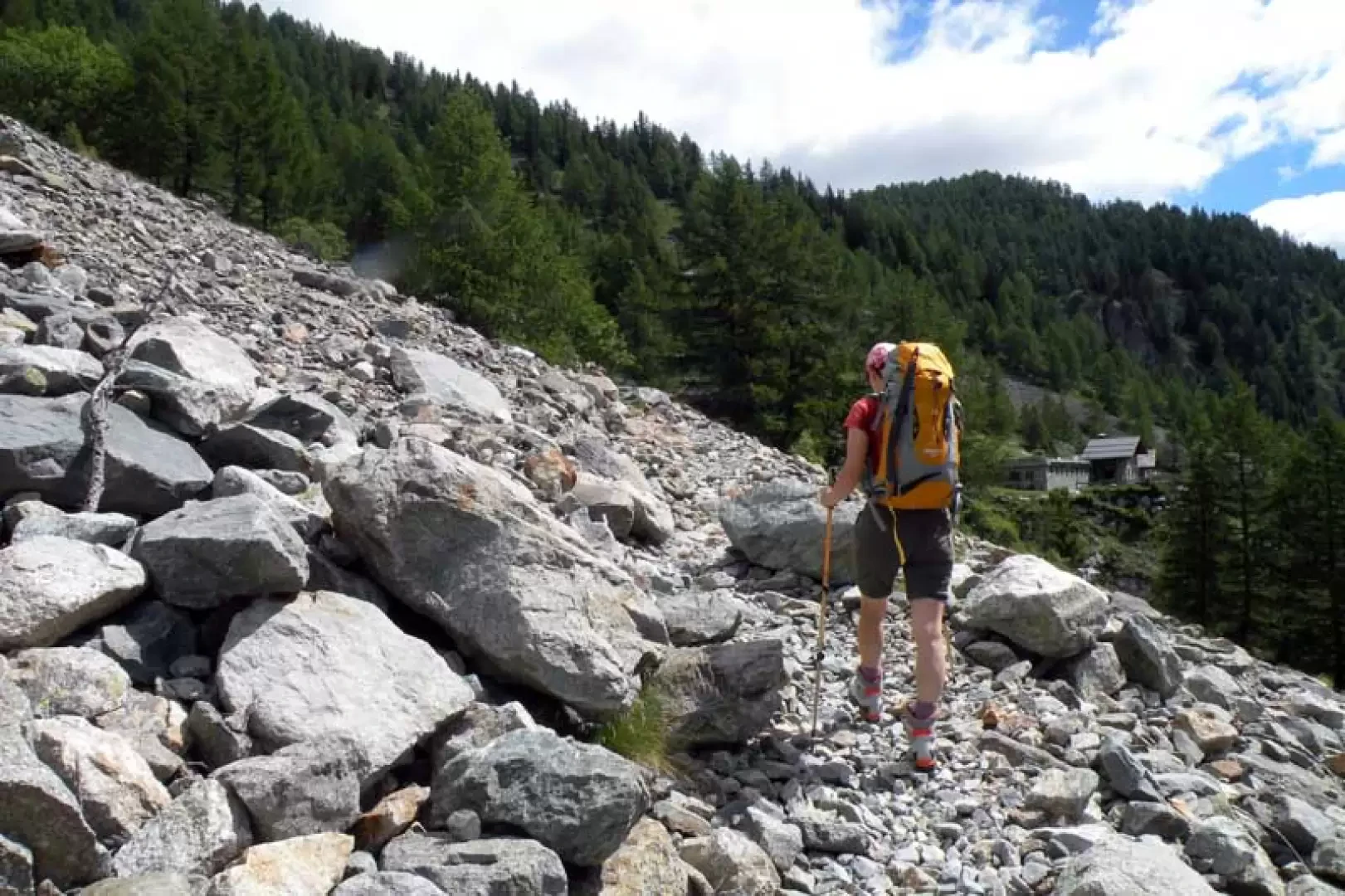
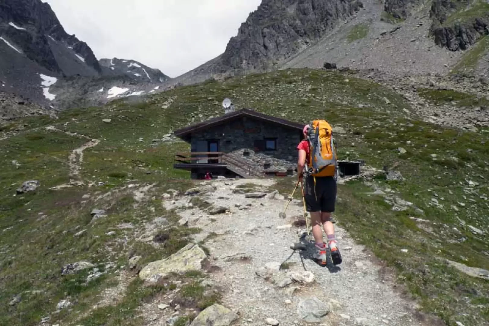
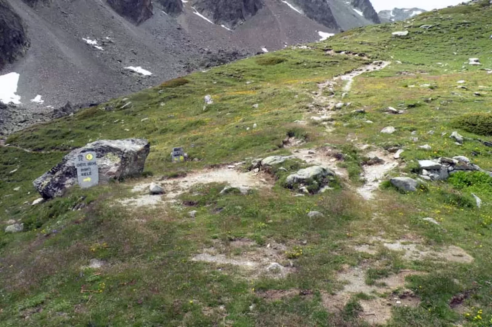
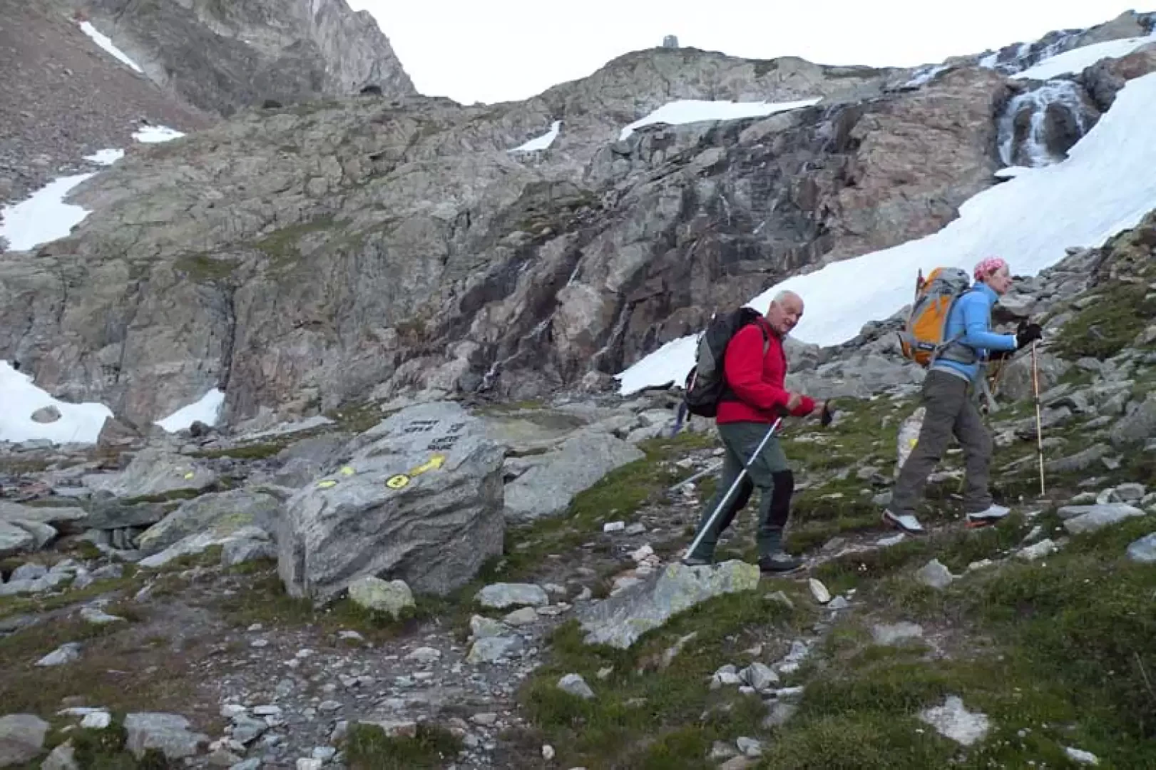
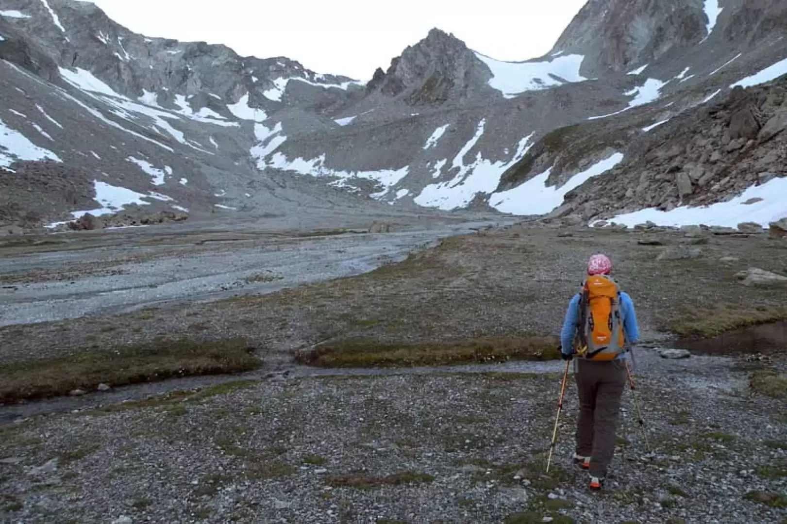
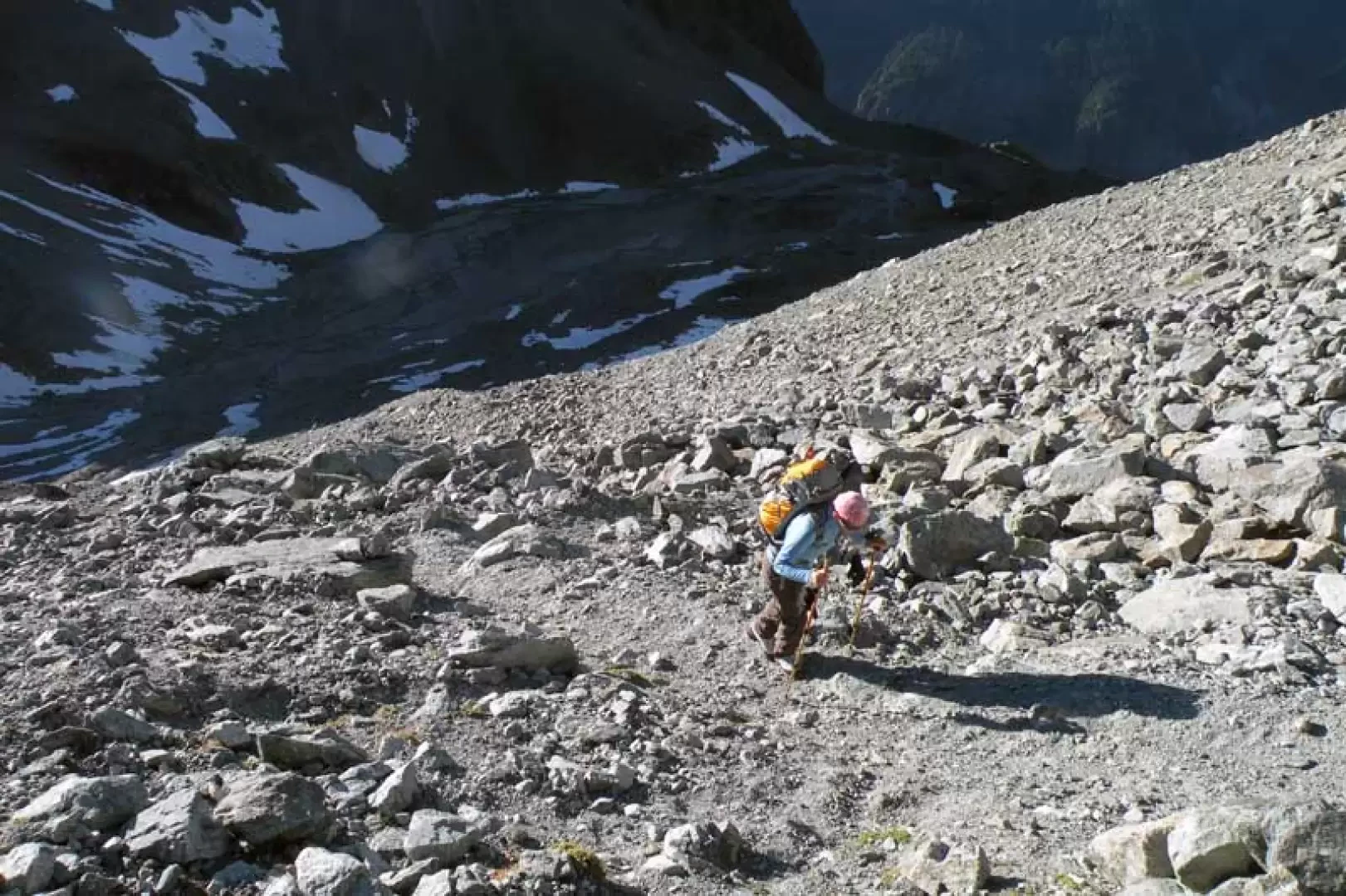
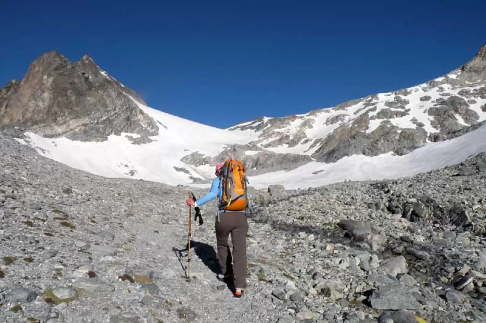
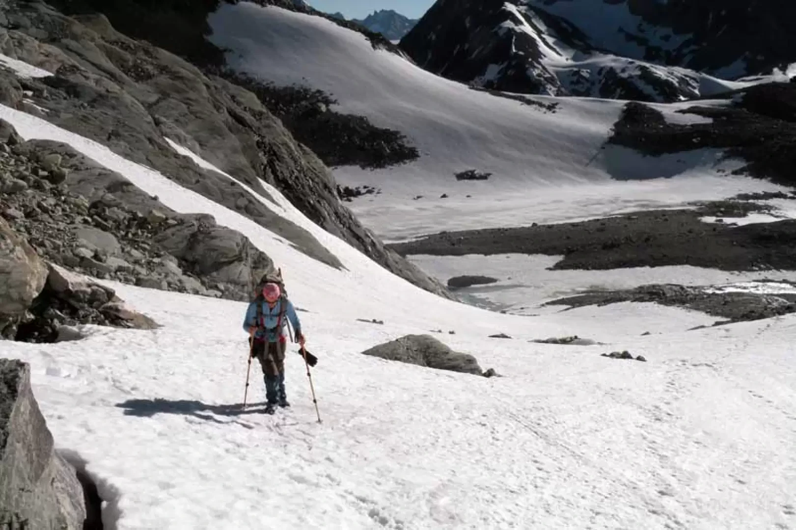
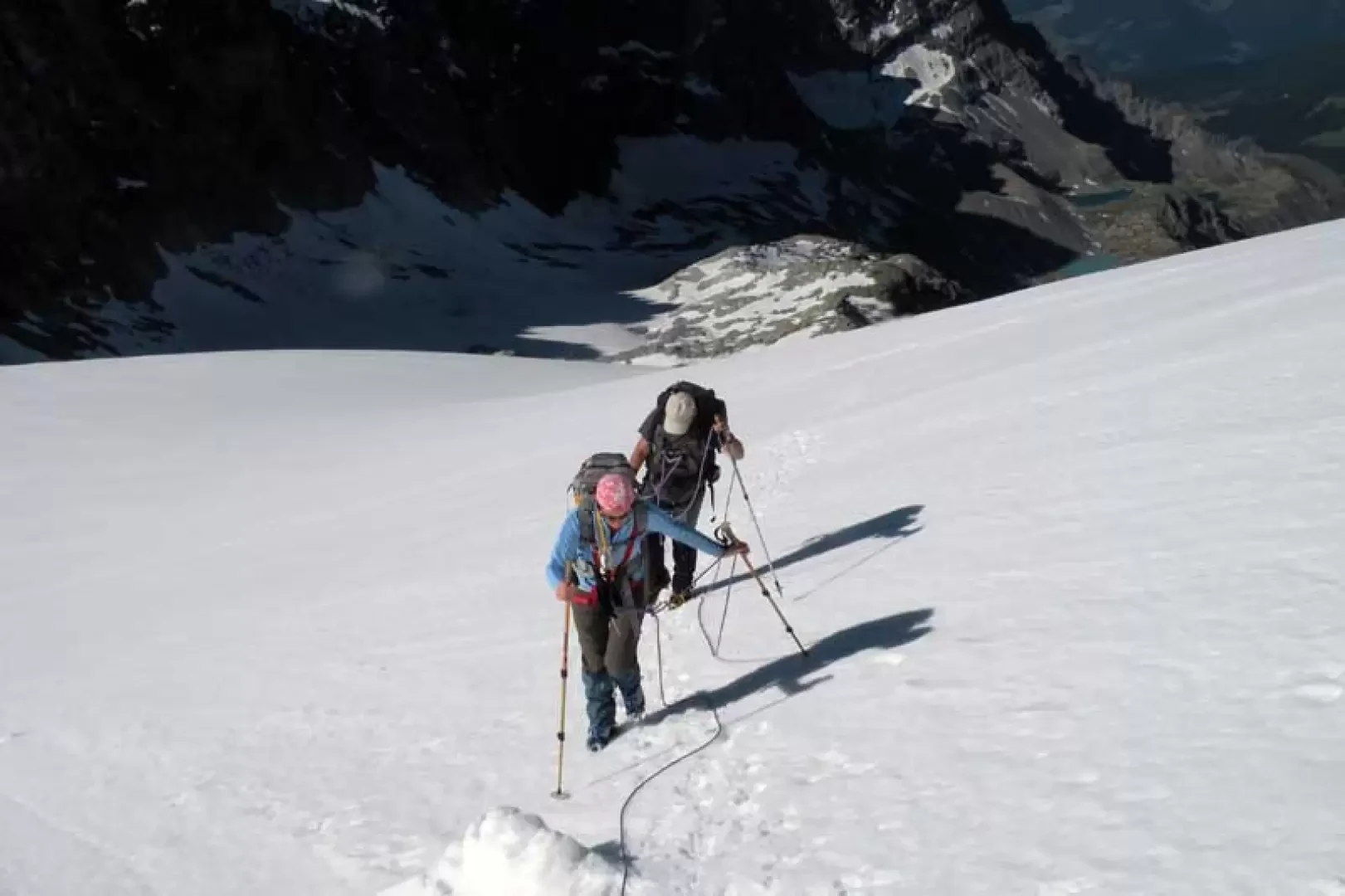
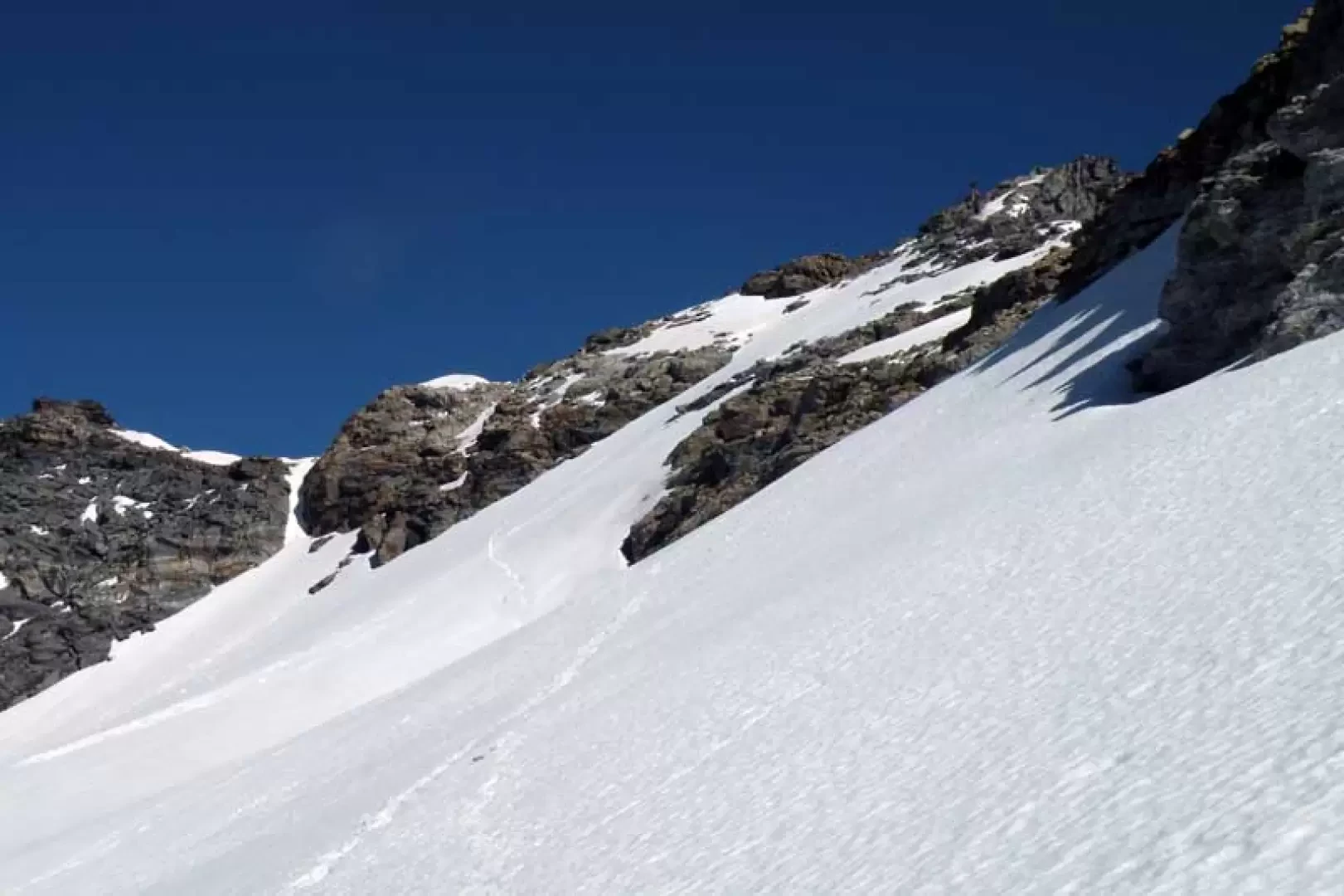
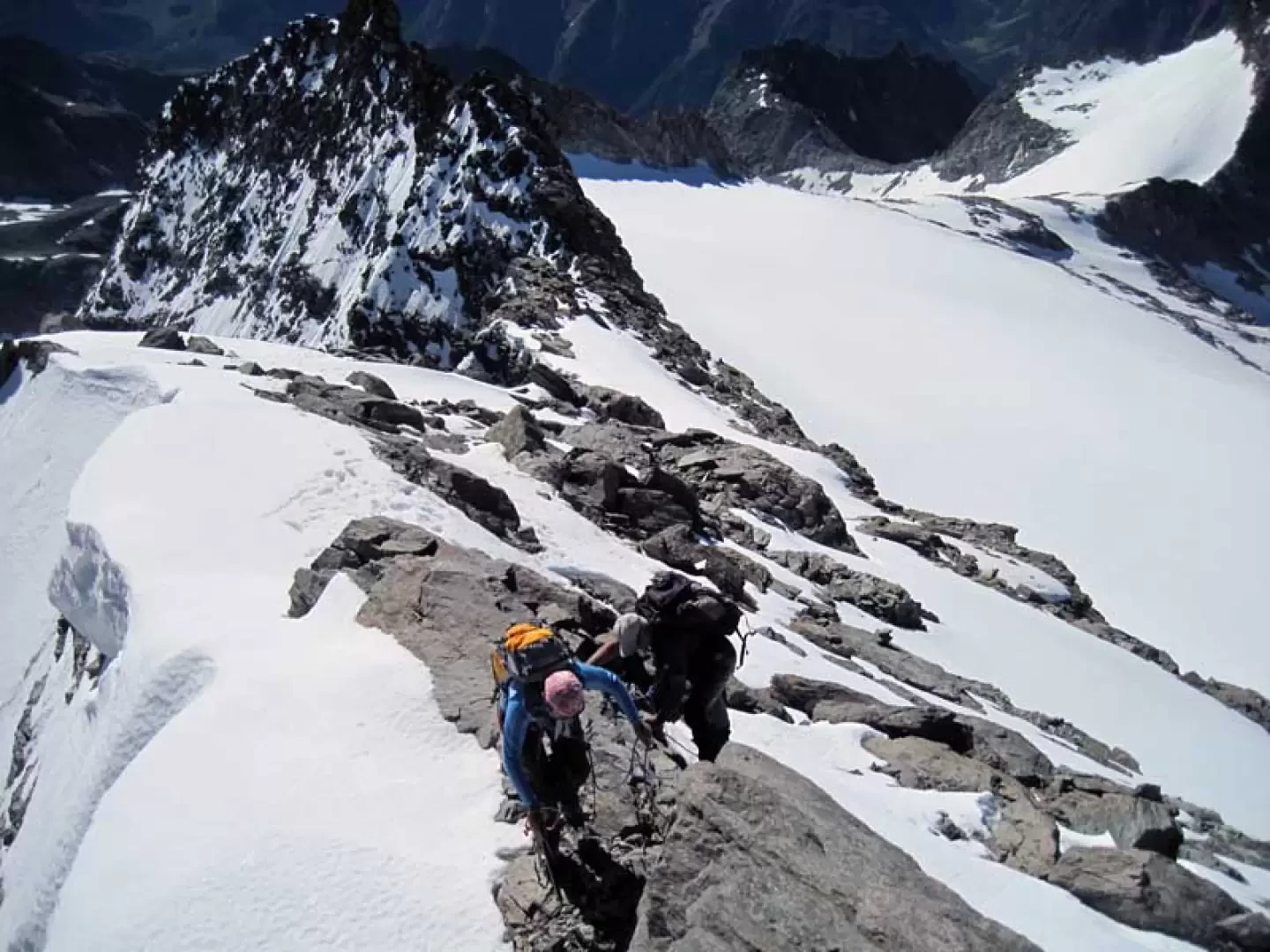
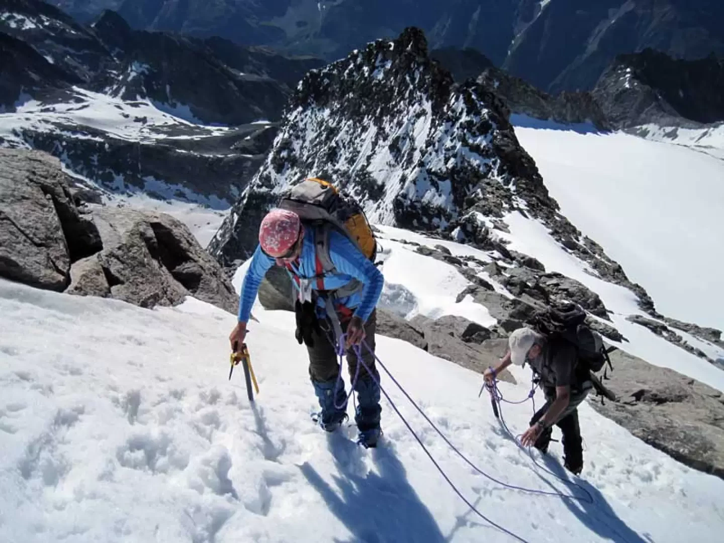
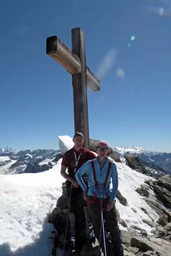
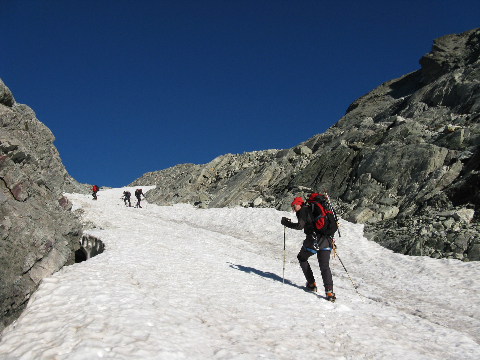
From the car park, head towards the few houses, passing them and continuing on the farm road that rises with gentle bends on the wooded side of the mountain; after a few bends, on the left, there is a path indicated by yellow marks that cuts across the farm road in several places. After crossing the road several times, there are now clearly visible yellow marks on a rock (1839 m) indicating the direction of ascent of the path, which, with a stretch on a slope, crosses a small rockslide and reaches the huts of Primo (1892 m); from here, go up again to the left with the path that soon reaches the road again and follow it for a short distance, arriving, near a bend, to take it again towards some small waterworks. Without reaching them, turn left, crossing the road again just above where, just in front, a clear, unmarked track rises up, a convenient shortcut, that climbs a wide grassy-detritic slope at the end of which the path for the hut (2,253 m) is found. Turning left, walk along it, skirting the side of the mountain until you come to another track (2286 m), which you ignore, taking the last stretch that reaches a marked ridge above some avalanche barriers; now walk along it briefly to reach the small clearing where the hut is located. From here, go up the path that, starting with the marker on a stone just in front of the entrance, heads right up the low grassy heights that penetrate the small valley; at the beginning, walk comfortably on a dirt surface and then go up on stones and dirt, but the path is always clear and marked. One heads towards the upper part where there is a rocky rampart, the base of which is reached by turning right at a crossroads (2,500 m) with clearly marked bolts on a rock, and then one begins to ascend it, always on the right-hand side, with numerous steep hairpin bends that immediately gain altitude. When the slope diminishes, we arrive at the large detrital plateau known as Plan de la Sabla, where we continue following a few cairns and then cross to the left at its best point the various rivulets that descend from the snowfields above; continuing towards the bottom of the plateau we arrive at a large boulder (2611 m) where, following the indications of the painted marks on it, we leave the path that continues straight on and, turning left, we head towards a large moraine. Its ascent is immediately tiring, both because of the quality of the terrain and the accentuated slope, and we follow it on a well-marked track, with a few yellow marks on the stones, which with numerous hairpin bends takes us almost to the summit where we turn right to take the steep ridge of another moraine. Then, decreasing the slope a little, we enter a wild valley, well directed by cairns of stones that direct us towards the low snowfields at the base of the small Arolletta glacier; here the ascent routes can vary depending on the snow cover on the slopes and on the existing tracks, and in any case we usually keep a little to the right to reach another low moraine ridge from which we enter a wide snow gully. Climb up with varying, but never excessive, gradients, alternating between a few short stony stretches and snowfield chutes. A little to the right of the Col du Mont Gelè, you will reach a high stone cairn (3190 m) situated on the watershed ridge with the valley that rises from the Regondi bivouac and then from the valley of Ollomont: from this point, the upper part of the itinerary is clearly visible, which, skirting the Mont Gelè glacier, reaches the final rocky outcrops. From this point, continue on a slight incline, walking between the boulders of the ridge to get to the edge of the glacier under a rocky triangular point; staying on the high part, continue around the rocks of the long ridge; when the ridge lowers to a small col, turn right to set foot on the little pronounced rocks of the final part of the ridge. Remaining on the side of the Mont Gelè glacier, go up the crest with easy passages, never obligatory, between large boulders, crumbly soil and a few small snowfields that soon lead to the large wooden cross on the panoramic summit.
.Photo gallery


We have been there

Edited by:
andream
Mont Gélé, da Ruz
Da parecchio tempo avevo in animo di salire sul Mont Gelé. Non sapevo però se occorresse pernottare al Rifugio o se si potesse compiere l'ascensione in giornata, quindi sono partito senza prefissare un obiettivo particolare. Quel giorno non si poteva salire al Rifugio di Crêteseche partendo da Ruz poiché la strada per arrivare fino lì era stata riservata alla Corsa dei Tzarettouns, pertanto ho dovuto passare da Chez les Chenaux lasciando l'auto qualche centinaio di metri prima di Gran Rond a quota 1800 m. slm. Devo dire che la salita al Rifugio passando da questa parte è forse più comoda essendo meno ripida, ma anche più piacevole poiché si attraversano dei bei boschi e un bell'alpeggio. Partito di buon'ora non mi sono neanche fermato al Rifugio per non perdere tempo e ho tirato dritto fino al Bivacco Spataro laddove ho sostato un attimo per un breve ricordo (da qualche tempo all'interno, oltre alla foto del giovane Spataro cui il Bivacco è intitolato, compare anche la foto del fratello Remo perito sotto una slavina di neve nel 1998). Oltre il Bivacco ho percorso il Plan de la Sabla in direzione del Colle di Crête Sèche e puntando verso il conoide che scende sul lato destro orografico (a sinistra salendo) ed incontrando ad un certo punto un bivio con le due indicazioni scritte su una pietra: • Colle di Crête Sèche • Mont Gelé Ho scelto senza esitazione la seconda e mi sono inerpicato sul conoide che diviene sempre più ripido fino a che il sentiero si perde in corrispondenza di una evidente strozzatura (direzione Ovest). A questo punto mi sono portato sulla destra (salendo) e ritrovando, fra le roccette lisce, il sentiero che punta ripido verso una sovrastante roccia con un grosso triangolo giallo segnavia visibile dal basso. All'uscita della strozzatura mi sono trovato di fronte a quella che una volta era la sede del Ghiacciaio dell'Aroletta e che ora è una morena di sassi e pietra nella parte inferiore e pianeggiante, mentre più in alto, laddove è più ripida, è dominata da rocce lisce. Il ghiacciaio si è invece ridotto a coprire solamente la spalla de l'Aroletta. Da questo punto ho proseguito verso il Col du Mont Gelé ben evidente davanti a me e raggiunto seguendo esclusivamente gli ometti in pietra uno dopo l'altro poiché non c'era più traccia di sentiero, attraversando di tanto in tanto qualche piccolo nevaio residuo. Arrivato al Col du Mont Gelé e dato uno sguardo all'intorno scattando alcune foto sono ripartito subito calzando dopo un centinaio di metri i ramponi per salire sul ghiacciaio sottostante la cima. Non avevo con me la piccozza ma mi sono servito molto bene dei bastoncini da trekking. Salendo ho notato come il ghiaccio avesse, sotto qualche centimetro di neve, un colore marrone-nero come la liquirizia e come ci fossero in alcuni punti delle sottili fenditure. Mano a mano che mi avvicinavo alle rocce sottostanti la cima notavo alcune persone che, a gruppetti di due-tre, le salivano attaccandole da punti diversi. Io mi sono portato in un punto che mi permetteva di imboccare una cengia obliqua senza dover necessariamente arrivare alla crepaccia terminale del ghiacciaio. Mentre mi toglievo i ramponi ho riscontrato che il tempo, magnifico per tutta la gran parte della mattinata, stava peggiorando notevolmente con vento freddo e nuvoloni neri. Queste condizioni mi hanno fastidiosamente accompagnato lungo la salita alla cima; quasi alla fine ho dovuto fermarmi per lasciare scendere un gruppo di svizzeri, uomini e donne alcune delle quali un po' incapaci e inesperte. Gli uomini sembravano tuttavia muoversi bene e sicuri anche nell'aiutarle e nell'accompagnarle. Proprio mentre raggiungevo la cima cominciava a nevicare ed in quel momento la gioia della conquista è stata sopraffatta dalla preoccupazione, quindi ho affrettato il saluto ad una coppia di toscani, ho dato uno sguardo veloce al panorama che in altre condizioni poteva essere grandioso e bellissimo, ho scattato poche foto e ho cominciato a scendere il più in fretta possibile. Soprattutto sul ghiacciaio ho cercato di fare in fretta poiché assieme alla neve scendevano dietro di me anche le nuvole e pensavo alla poca visibilità che ci sarebbe stata specialmente lungo le rocce lisce della morena sotto il Col du Mont Gelé. Ancora sul ghiacciaio ho raggiunto la comitiva svizzera rimanendo colpito dalla apparente calma e lentezza delle loro operazioni, ad es. al momento di togliere i ramponi, mentre io avevo fretta di scendere. Ad un certo punto questa fretta mi ha fatto sbagliare strada in mezzo alle rocce lisce, le quali erano già diventate bagnate e pericolose a causa della neve che scendeva: me ne sono accorto perché non mi sembrava di essere passato in quel punto al momento della salita. Sono pertanto risalito fino all'ultimo ometto lasciato per strada e da lì ho ritrovato la via giusta avendo intravisto le mie tracce precedentemente lasciate salendo obliquamente lungo un nevaio. Più scendevo più la visibilità diminuiva e più pensavo agli svizzeri ma io dovevo continuare fidandomi dei provvidenziali ometti che incontravo uno ad uno, fino alla fine della morena del Ghiacciaio dell'Aroletta cioè all'inizio della strozzatura dove si poteva riprendere il sentiero. Più sotto, quasi ritornato al Plan de la Sabla, la neve aveva lasciato il posto ad una fitta pioggia ed anche ad una migliorata visibilità, ma ormai il brutto era passato…..e, guardando indietro, avevo nuovamente rivisto gli svizzeri che avevano cominciato la discesa non lungo la strozzatura ma in corrispondenza di un'altra pietraia che comunque li avrebbe portati tranquillamente a valle…tutto bene! Anche in questo caso non ho sostato al Rifugio, ho continuato celermente fino all'auto alla quale sono arrivato bagnato fradicio a causa della continua pioggia.
Tabella di marcia Località Quota Dislivello Partenza Arrivo Natura del percorso Grand Rond 1800 m h 6.30 Sentiero Rifugio Crête Sèche 2410 m Salita610 m h 8.00 h 8.00 Sentiero e pietre Bivacco Spataro 2610 m Salita 200 m h 8.45 h 8.50 Sentiero e pietre. Prima lungo il Plan de la Sabla e poi, piegando verso sinistra, lungo una evidente ripida strozzatura Uscita dalla Strozzatura 2980 m Salita 370 m h 10.30 h 10.40 Pietraia e roccette (residuo di morena) Col du Mont Gelé 3144 m Salita 164 m h 11.30 h 11.40 Ghiacciaio e roccette nella parte terminale Cima 3518 m Salita 374 m h 12.30 3518 m h 12.40 Come sopra all'inverso Grand Rond 1800 m Discesa 1718 m h 16.15 Galleria fotografica Mont Gelé (3518 m) - © 2005 Andrea Motta Mont Gelé (3518 m) - © 2005 Andrea Motta Mont Gelé (3518 m) - © 2005 Andrea Motta Mont Gelé (3518 m) - © 2005 Andrea Motta Mont Gelé (3518 m) - © 2005 Andrea Motta Bivacco Spataro e Vierge de l'Aroletta Plan de la Sabla Plan de la Sabla Salendo verso la strozzatura Sguardo indietro al Plan de la Sabla Mont Gelé (3518 m) - © 2005 Andrea Motta Mont Gelé (3518 m) - © 2005 Andrea Motta Mont Gelé (3518 m) - © 2005 Andrea Motta Mont Gelé (3518 m) - © 2005 Andrea Motta Mont Gelé (3518 m) - © 2005 Andrea Motta Mont Berlon All'uscita della strozzatura Becca di Faudery Becca di Chardoney Ghiacciaio de l'Aroletta Mont Gelé (3518 m) - © 2005 Andrea Motta Mont Gelé (3518 m) - © 2005 Andrea Motta Mont Gelé (3518 m) - © 2005 Andrea Motta Mont Gelé (3518 m) - © 2005 Andrea Motta Il ghiacciaio del Mont Gelé Panorama sulla conca di By Il bacino di Mauvoisin In vettaMont Gelé (3518 m) Autore: Andrea Motta * Altre escursioni dello stesso autore Nessun Commento Non c'è stato nessuno Ultima modifica: 19.03.07 Mont Gelé (3518 m) - © 2005 Andrea Motta Mont Gelé (3518 m) - © 2005 Andrea Motta Scheda dell'escursione Tipo itinerario: a/r Difficoltà Tecnica : Alpinistico Facile (F) - ghiacciaio Sforzo Fisico: Medio (il percorso è abbastanza lungo con tratti di sfasciume, roccia, nevaio e ghiacciaio) Pericoli oggettivi: Basso Segnavia: Sentiero N° 2 Attrezzatura: Ramponi, piccozza, corda Tempo complessivo: 9h35' Tempo di salita: 6h00' Tempo di discesa: 3h35' Quota alla partenza: 1724 m Quota all'arrivo: 3518 m Dislivello: Salita 1974 m Max quota raggiunta: 3518 m Esposizione: Sud, Est Periodo consigliato: luglio, agosto, settembre Bibliografia: * L.Zavatta, Gran San Bernardo, Valpelline e Conca del Fallère, Rimini, 2004 * G. Buscaini, Alpi Pennine I, Guida dei Monti d'Italia, CAI e TCI, Milano, 1970 Cartografia: * L'Escursionista Editore – Valpelline e Saint-Barthélemy - Carta dei sentieri 6– scala 1 : 25.000

Edited by:
Ermanno Panara
Mont Gelé
desiderio appagato dopo anni. Giornata magnifica. Saliti direttamente dal canalino nevoso sino in vetta, discesi per la più sicura via su roccette. Una menzione al Rifugio Crête Sèche e ai due gestori che ci hanno attribuito un'accoglienza fuori dal comune. Mai mangiato pane fresco fatto in rifugio, per non parlare del resto della cena.desiderio appagato dopo anni. Giornata magnifica. Saliti direttamente dal canalino nevoso sino in vetta, discesi per la più sicura via su roccette. Una menzione al Rifugio Crête Sèche e ai due gestori che ci hanno attribuito un'accoglienza fuori dal comune. Mai mangiato pane fresco fatto in rifugio, per non parlare del resto della cena.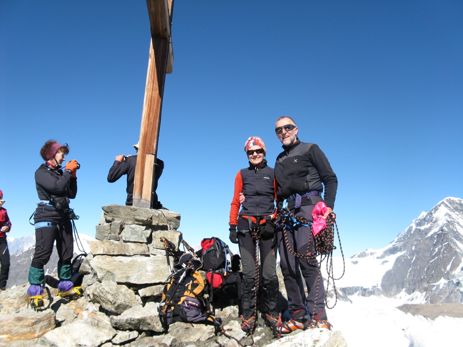
Edited by:
Giancarlo Beretta
Mont Gelé
Pochissimo rigelo notturno, e solo in quota, per cui la salita si è svolta su neve portante mentre per la discesa si sfondava sempre più a mano a mano che si scendeva. Con queste temperature sono da preferire le roccette alla salita diretta per lo scivolo sotto la vetta che, già al mattino presto, era al limite e proseguendo con questo clima la situazione non può che peggiorare. Giornata dal meteo spaziale con visibilità perfetta a 360° sulle vette circostanti. Brava Stefania per la sua prime vetta alpinistica salita senza problemi in compagnia di Vittorio. Una nota di merito al gestore del rifugio che offre ottima ospitalità e cena altrettanto ottima e abbondante (anche con "bis"). Avvistamenti faunistici: Rupicapra rupicapra, Capra ibex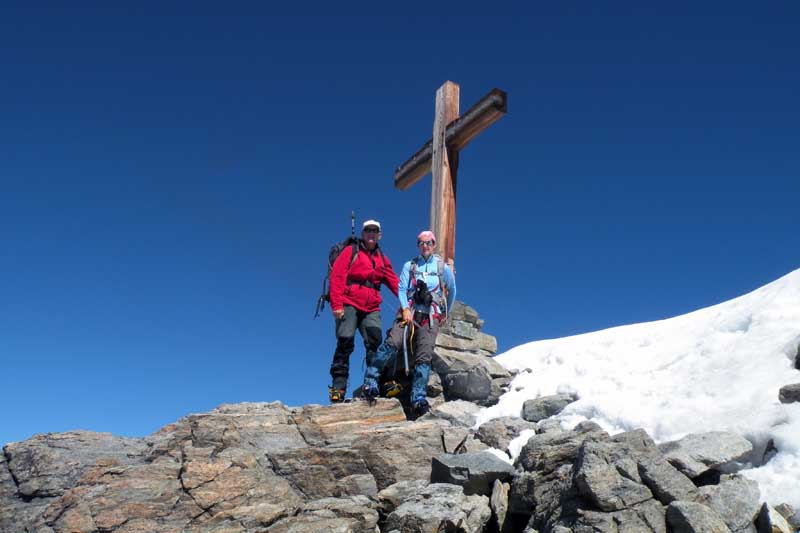

Edited by:
elenapollo
Mont Gélé
Da Ruz (o Ru), bivio a sin. in Dzovenno, poco dopo Oyace, si sale al Rif. Crête Sèche. Seguire il sentiero 2 o si può salire lungo la strada interpoderale fino al bivio per il rifugio. Attraversato l'ampio pianoro a monte di quest'ultimo, seguire per un tratto il segnavia 2 che porta al Colle Crête Sèche, ma abbandonarlo ben presto per prendere a sinistra (sasso con chiare indicazioni) un ampio pendio di sfasciumi alla sua destra un rigagnolo di acqua, sbucare sopra in un ampio pianoro e seguire i segni gialli che su sfasciumi portano al Colle del Mont Gelé (m. 3.180). Calzati i ramponi e legatisi in cordata, si attraversa in direzione NO la modesta pendenza della parte sommitale del ghiacciaio del Mont Gelé verso l'evidente cima, contrassegnata da una croce. ultimo tratto più ripido, si può salire al centro del pendio (30°-35°) oppure spostarsi sulle instabili roccette alla sua destra. dalla vetta notevole panorama!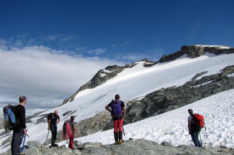
Comments (0)
Sign in to leave a comment