Lasciare l’autostrada allo svincolo di Verrès. Entrare nella rotatoria e imboccare la terza uscita per immettersi sulla Strada Statale in direzione Aosta. Dopo circa 450 metri, alla successiva rotonda, prendere la prima uscita e continuare sulla statale per altri 1,3 chilometri. Svoltare a sinistra imboccando la strada regionale con indicazioni per la Valle di Champdepraz e il Parco del Mont Avic.
Risalire la per circa 10 chilometri, superando l’abitato di Champdepraz e inoltrandosi nella valle. Raggiunto il pannello con le indicazioni per Blanchet e Fusse, svoltare a sinistra e percorrere la strada comunale per circa 200 metri. Raggiungere l’ampio parcheggio 🅿️ gratuito e lasciare l’auto.
Nel periodo estivo (luglio e agosto) è attivo un servizio navetta Trek Bus Avic che da Verrès conduce alla località di Chevrère (Covarey), sede del centro visitatori del Parco del Mont Avic. Si consiglia di verificare orari e disponibilità su questo sito.
Distanza e tempo di percorrenza
🕒 Tempo di percorrenza: 23 minuti 📏 Distanza: 11,7 km
Le indicazioni fornite sono state verificate alla data del rilievo dell’itinerario. Prima della partenza, è consigliabile verificare eventuali variazioni del percorso. Per ottenere indicazioni aggiornate e dettagliate, si consiglia l’uso di Google Maps o Apple Maps.
Introduction
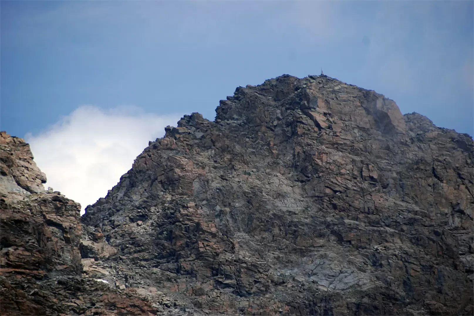
Up the valley of Champdepraz, we cannot fail to be enchanted by the magical pyramid that rises at the bottom of the valley. Mont Avic is certainly one of the most beautiful mountains in Valle d'Aosta, and what we describe below is certainly a challenging itinerary, but one that will allow you to penetrate this still intact alpine territory.
Description
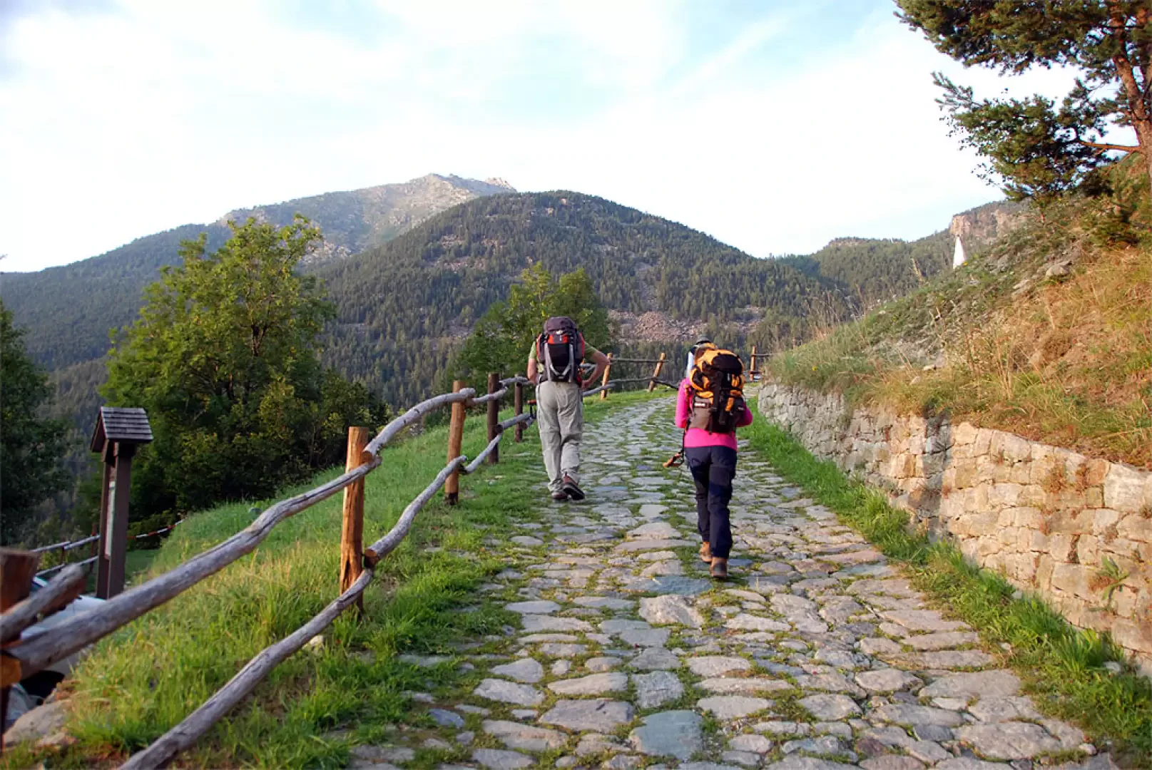
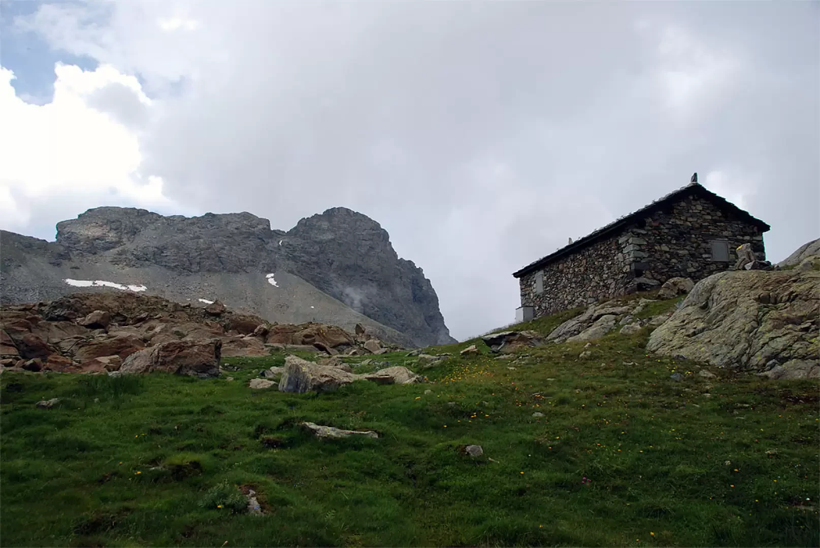
From the car park in front of Veulla (1300m) take the easy paved road, signposted
, which after a short climb passes near the little church. After passing the village, continue along a flat stretch until you reach a small bridge; the road turns left and after a short climb reaches the junction with path
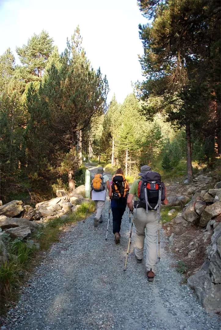
for Praz Oursie and Mont Barbeston. Neglect the diversions to the right and continue straight ahead on the road that enters the Mont Avic Regional Park (there are explanatory panels along the way); without much effort you reach a crossroads in the locality known as Magazzino (1461m, 0h30'). Follow the signs for path
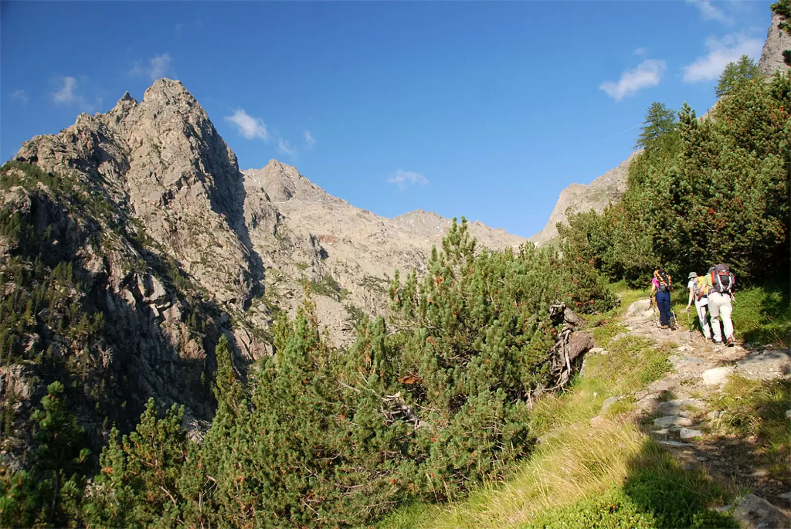
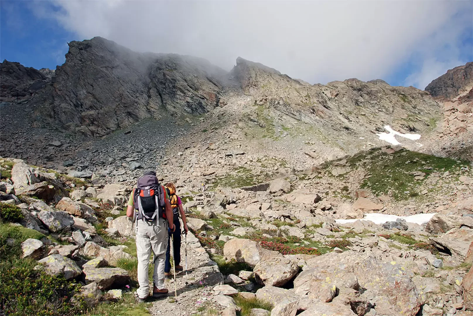
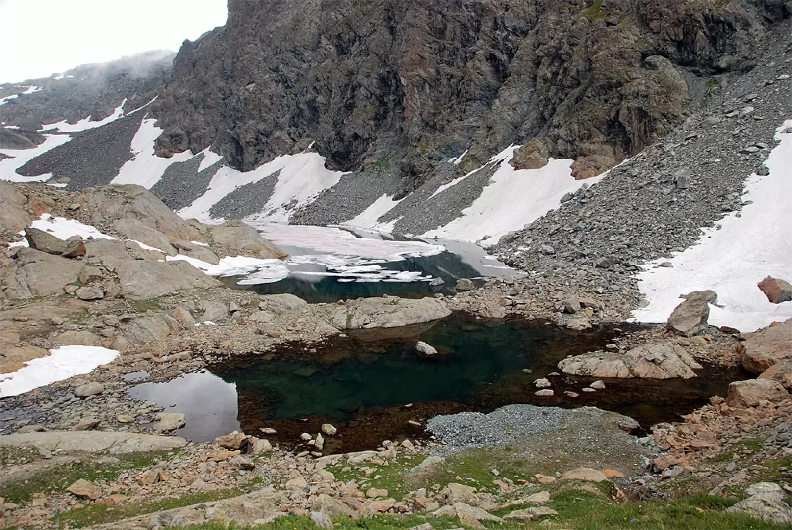
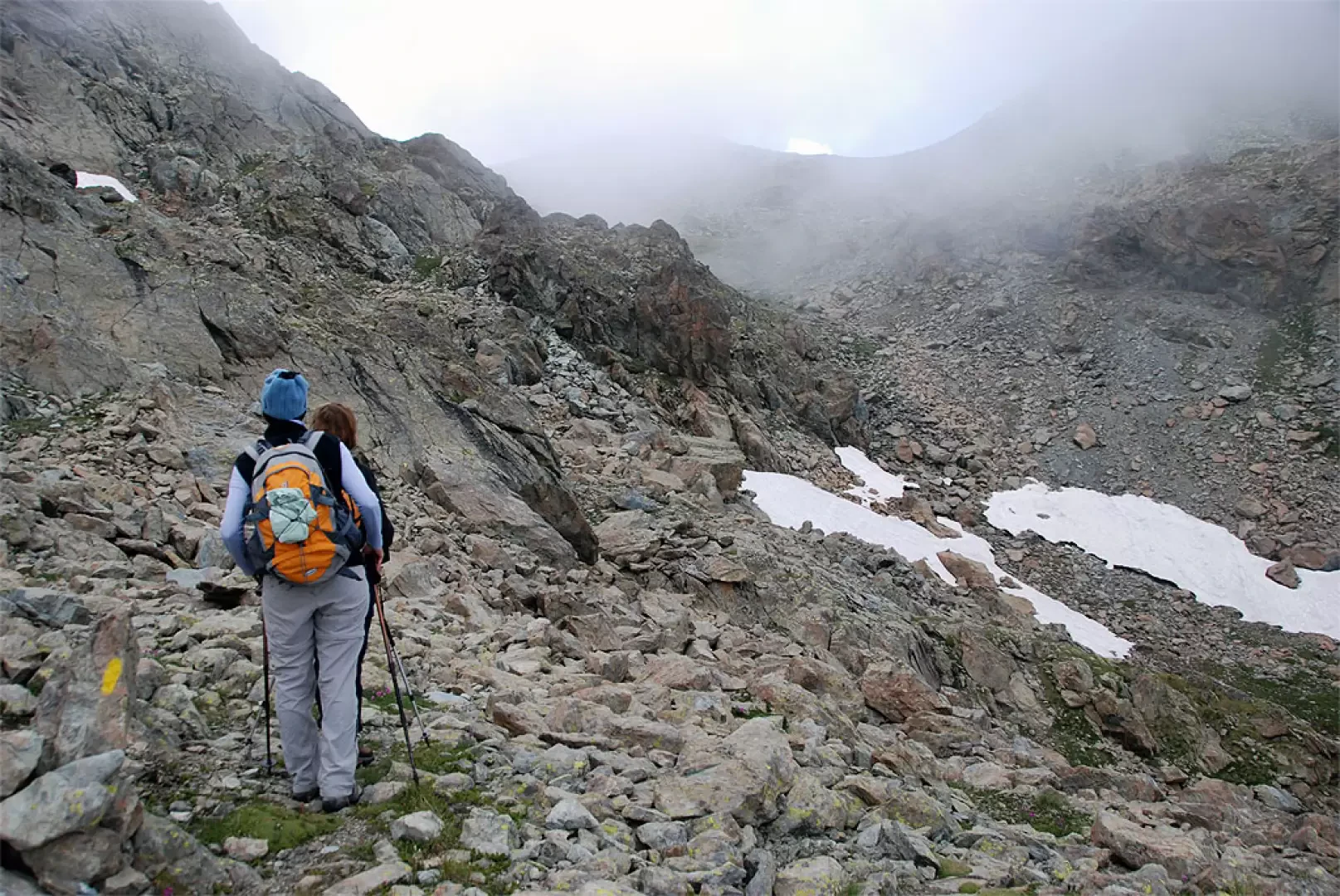
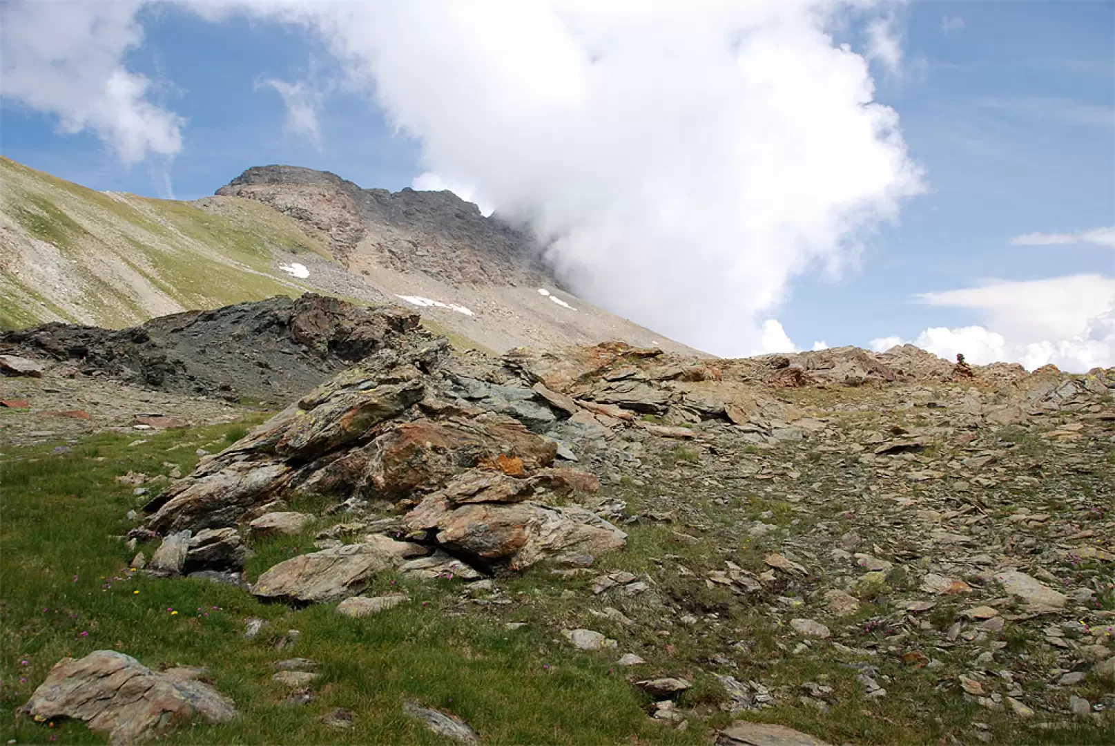
to Lac Gelé and take the path that branches off to the right: climb in a north-westerly direction through the Scots pine forest and a few fine specimens of hooked pine, an endemic species in the park. The path turns to the west, just before meeting a pair of wooden footbridges used to cross a small stream. After a short, almost flat stretch, we come to the Ru de Montjovet (another footbridge). From here on, you begin to climb more steadily: you pass a nice stretch of mule track at the foot of a steep rock face and, still in the forest, slowly enter the Vallone del Lago Gelato. The tall vegetation slowly fades away and we begin to see a few glimpses of the valley, the Bec de l'Espic and the route still to come. Still halfway up the slope under the rocky walls, one comes out of the forest and, after another stretch of path under the walls, begins a series of bends that allow one to gain height. The path reaches a short col (normally preceded by a small snowfield at the beginning of the season): shortly afterwards the mule track becomes decidedly spectacular, a true work of ingenuity built at the time of ore mining. Follow the mule track that crosses a small combe and, after a wide turn to the left, continues with a long diagonal that precedes a series of rapid turns that allow you to reach the area of the mines and, a little further on, Lac Gelé (2599m, 3h30'). On reaching the lake, you will come to a fork in the road: continue to the right following the marker
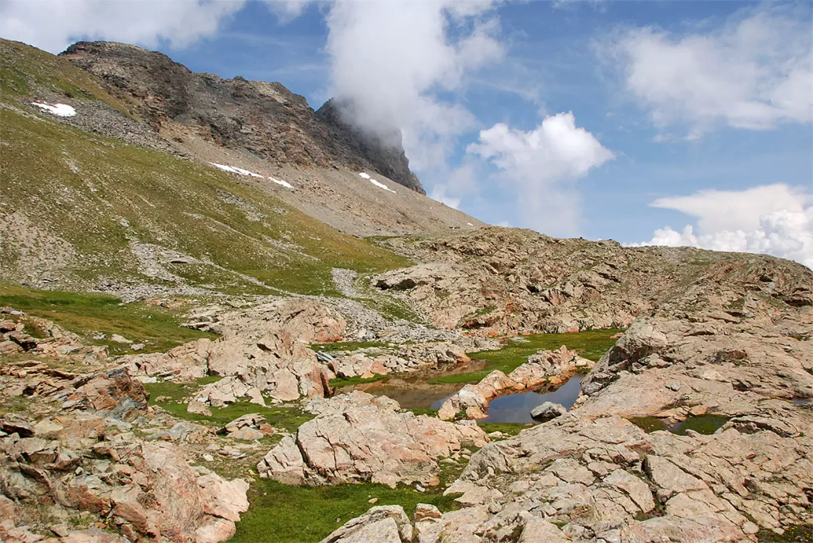
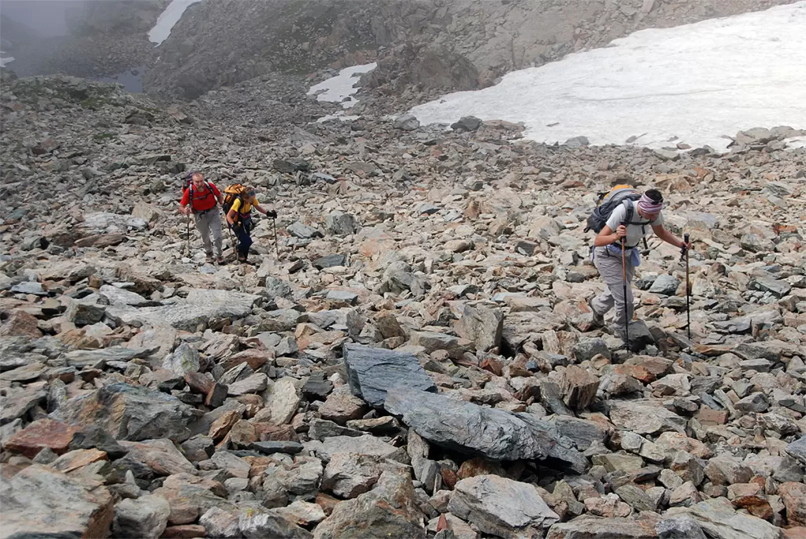
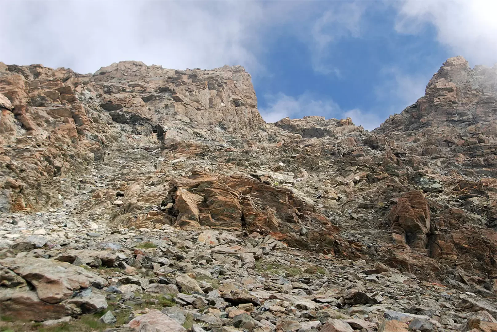
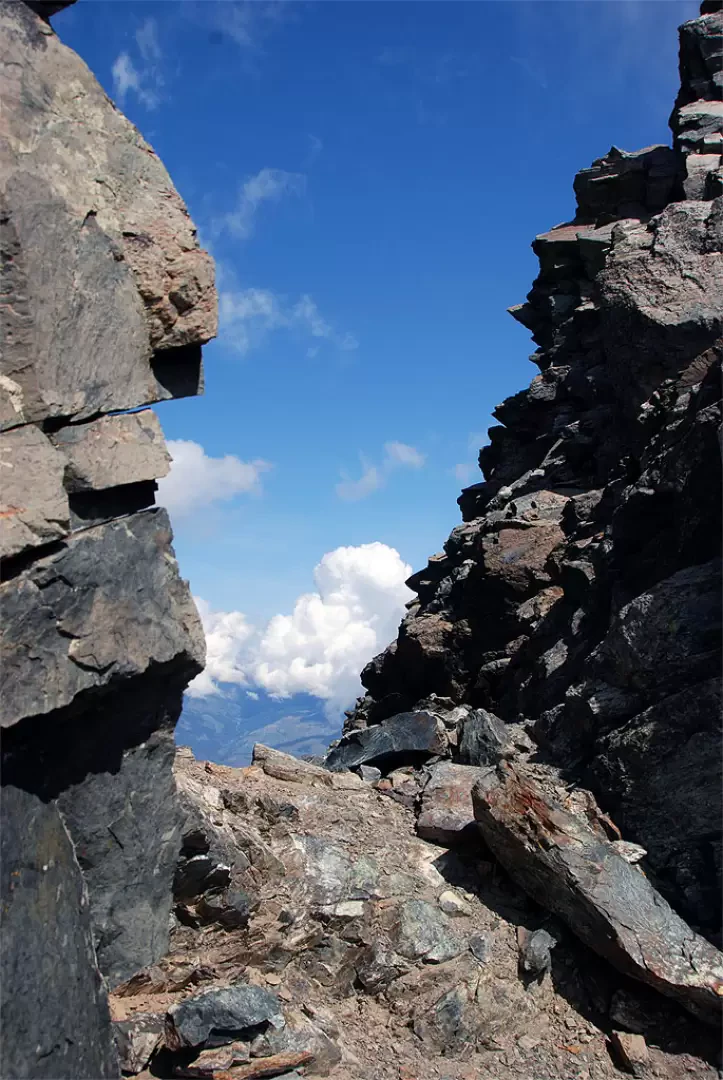
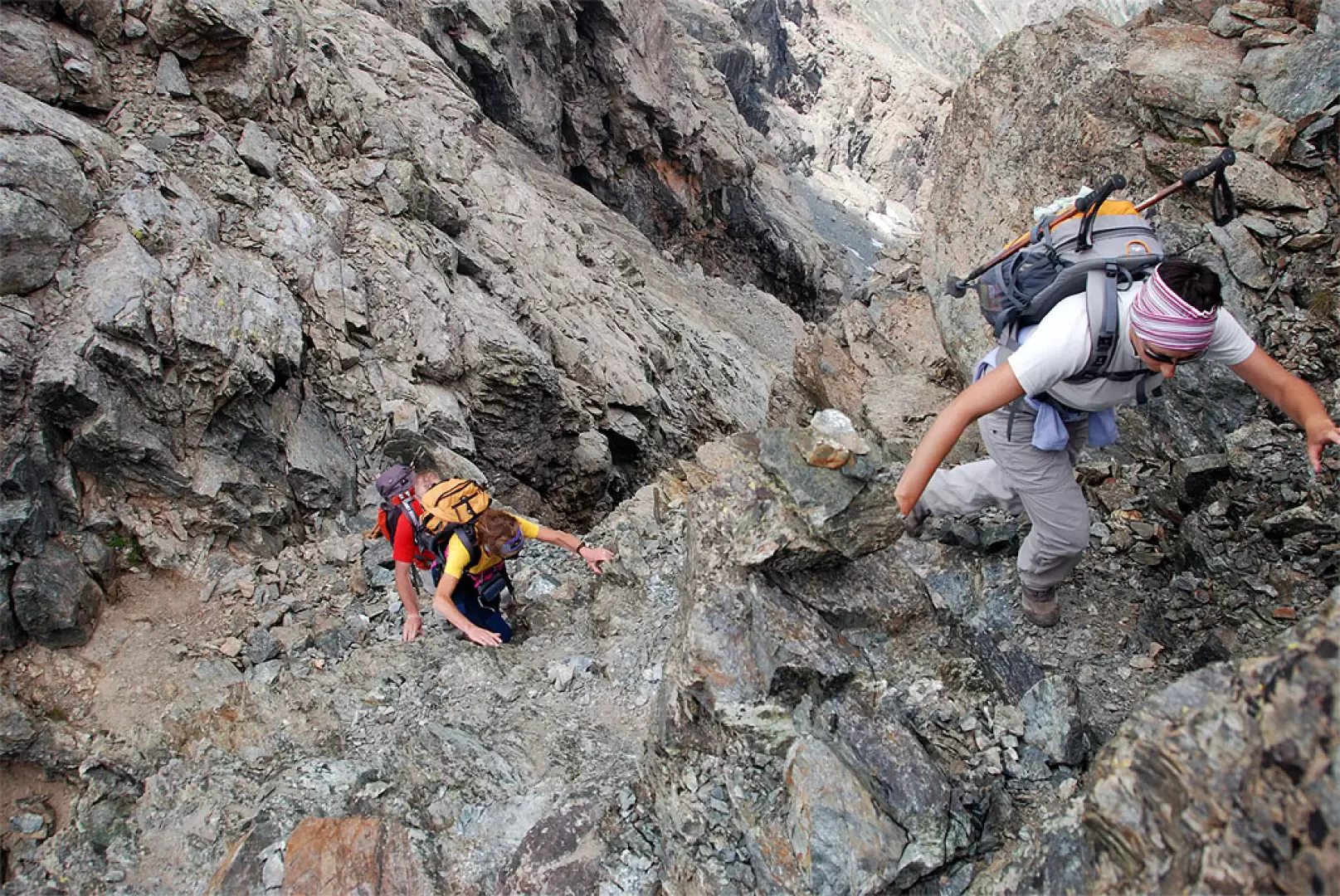
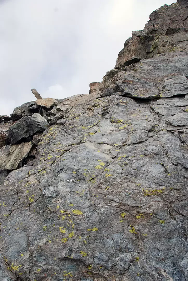
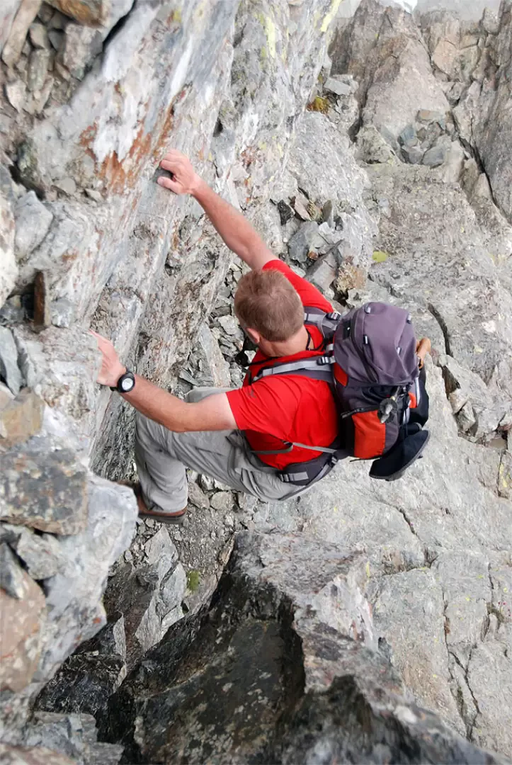
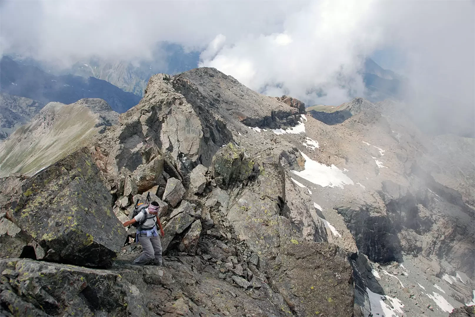
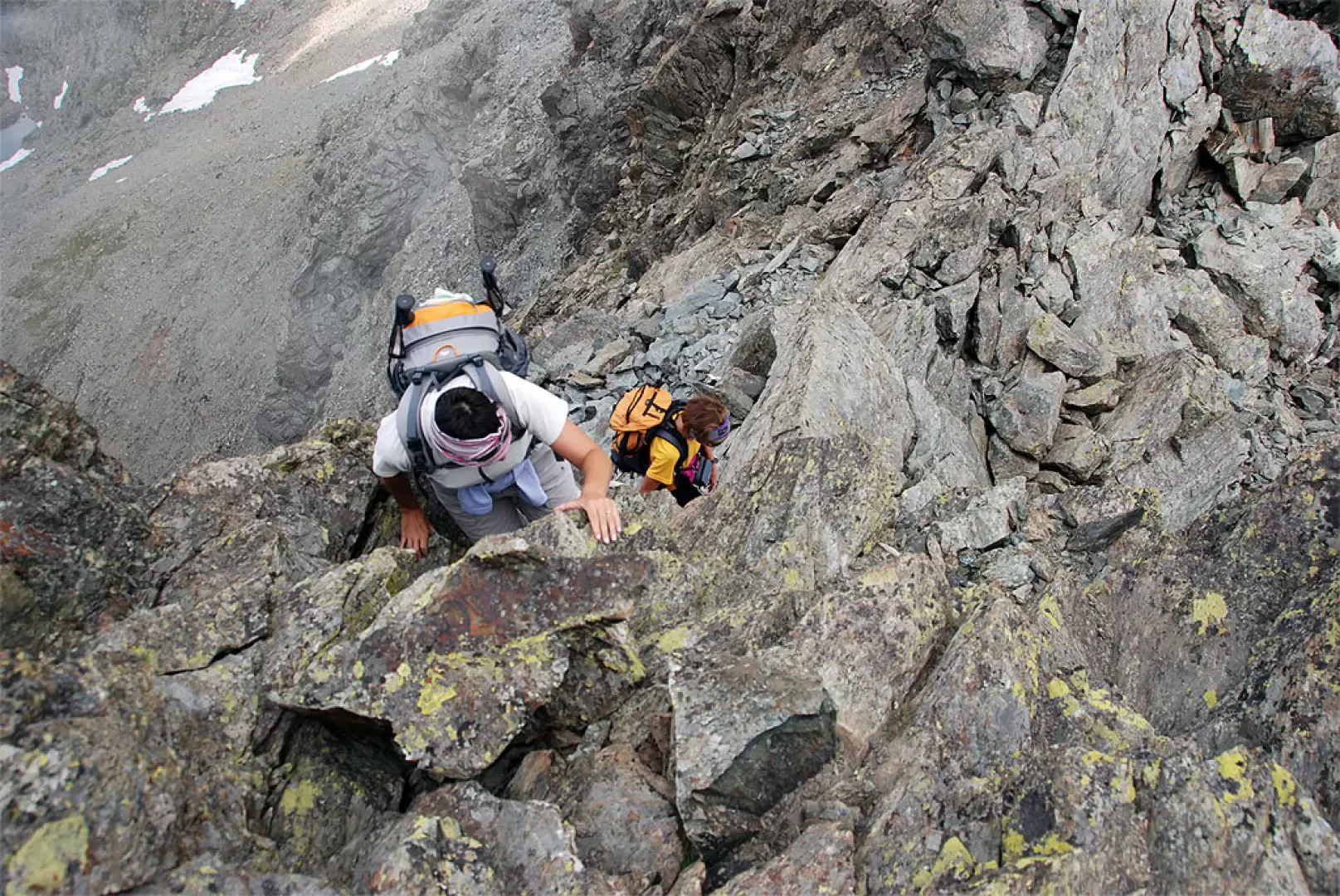
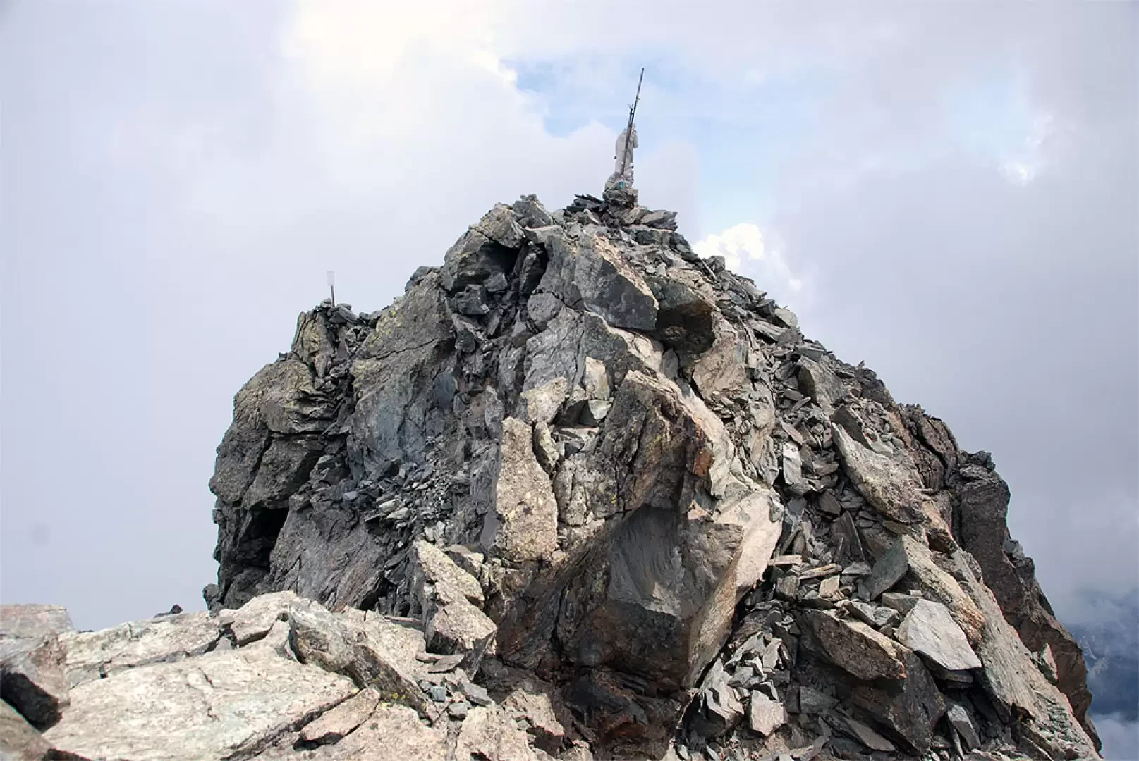
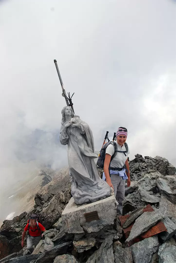
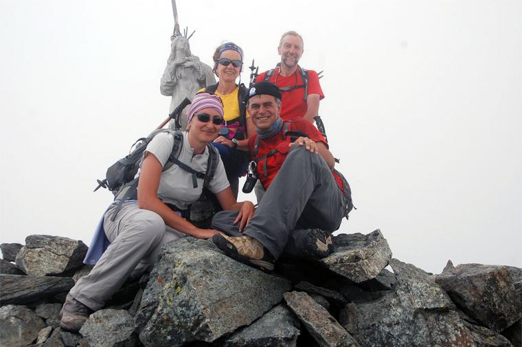
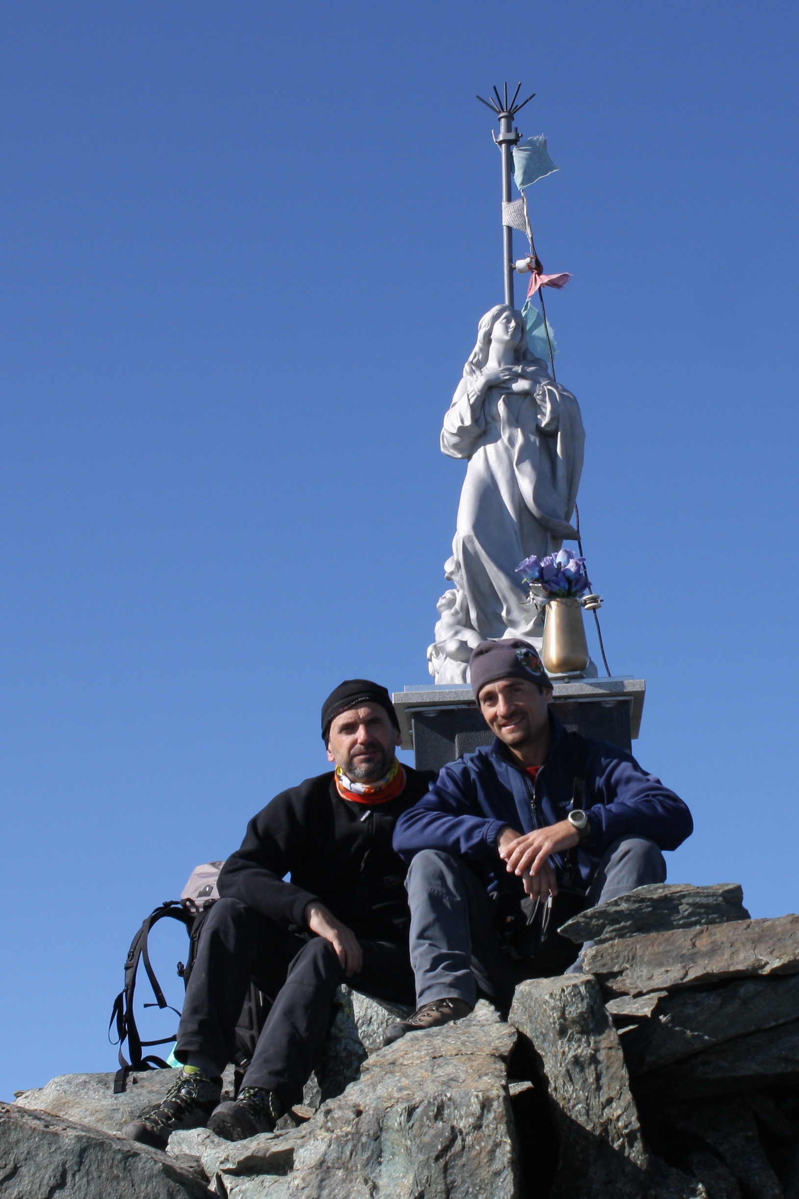
for Col de Raye Chevrère. Climb up a promontory where you will come across a mine hut and continue northwards following the yellow marks between rocks and tracks. Descend slightly by taking the north-west direction. A few snowfields can be found in this section, but the horizontal markings are well made and it is easy to keep to the line of the path. After a few ups and downs on stony ground, you briefly climb a wide valley that leads practically to the foot of the pass. Walk across the entire plateau and, just before the final ascent of the col, look for a large cairn on the right. Once you spot the cairn, proceed in a northerly direction, leaving the cairn to the right. This point is fundamental for the continuation of the ascent: from the first cairn, follow a faint trace of path, corroborated by the continuous presence of cairns that allow you to proceed with certainty. Cross a long terrace filled with small lakes on whose waters Mont Avic begins to reflect. After passing several small lakes, you reach the scree gully that you will have to climb up to its summit. Still following the cairns, take a path that with many twists and turns and a lot of effort leads to the foot of the rocky buttress to the west of the peak; the gully narrows and the little path wedges between the rocks until it reaches a notch at an altitude of 2920m: from the col (aerial) you can catch a glimpse of the Pointe de Charmontane and the Ponton valley. Now the mountaineering part of the climb begins: ascend a first grade section made a little treacherous by debris (be careful!) until you reach a track that, with a few steps and short ledges, allows you to climb up to the foot of a rock. Here, turn left and, a little further on, go over a short sloping slab: this passage, which is well gripped, can be tackled if you are experienced or you can pull yourself up thanks to the numerous handholds present (I+). Shortly afterwards, turn left and climb up a short II- pitch thanks to an easy ledge. Now continue until you reach the edge of the ridge. Continue with a few uncomfortable passages until you are on the right of the ridge and then climb up a well gripped step (II-). Go back to the ridge and you will soon reach the summit: descend a short distance and you will reach the Madonnina di Vetta (3006m, 5h30'). On a clear day, the view from the summit is exceptional: a 360° over the whole region! The descent follows the same route as the ascent.
In conclusion, a recommendation: this itinerary falls into the category of hikes that can be defined as mountaineering, although it is considered as "Easy". Assessment of the weather conditions and possession of the appropriate equipment will avoid unpleasant consequences. The excursion should only be tackled by experienced people, otherwise it is advisable to refer to a mountain guide or an experienced climbing partner who can belay some slightly delicate passages.


Comments (0)
Sign in to leave a comment