Lasciare lo svincolo autostradale di Châtillon-Saint-Vincent, svoltare a sinistra e proseguire per 300 metri fino alla rotonda. Prendere la terza uscita per immettersi su Via Émile Chanoux e percorrerla per 600 metri, attraversando il centro storico di Châtillon. Svoltare leggermente a destra su Via Menabreaz e continuare per 450 metri fino alla rotatoria con il monumento del Cervino al centro. Prendere la seconda uscita ed entrare sulla Strada Regionale in direzione Valtournenche. Proseguire sulla per 26,70 km, attraversando i comuni di Antey-Saint-André e Valtournenche, fino a Breuil-Cervinia, dove, appena dopo la galleria paravalanghe, sulla sinistra si trova l’ingresso del grande parcheggio 🅿️ gratuito, situato prima del centro abitato.
Il punto di partenza dell'itinerario è servito dai mezzi pubblici. Per consultare gli orari, visita il sito aosta.arriva.it
Distanza e tempo di percorrenza
🕒 Tempo di percorrenza: 39 minuti 📏 Distanza: 28,40 km
Le indicazioni fornite sono state verificate alla data del rilievo dell’itinerario. Prima della partenza, è consigliabile verificare eventuali variazioni del percorso. Per ottenere indicazioni aggiornate e dettagliate, si consiglia l’uso di Google Maps o Apple Maps.
Introduction
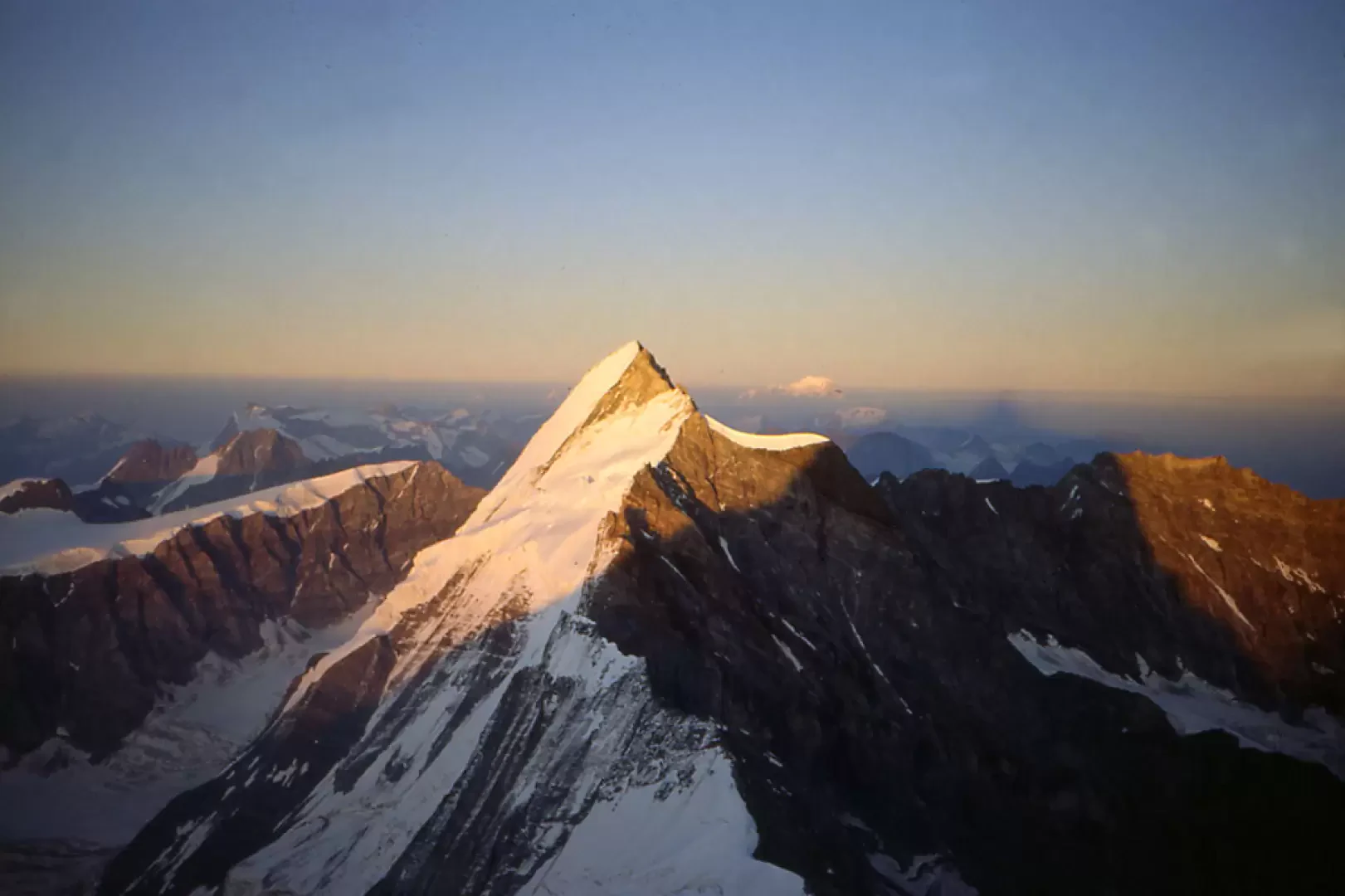
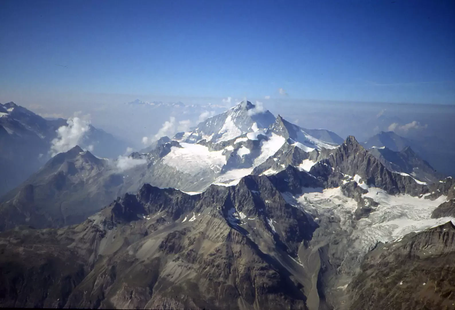
The Matterhorn, a magnificent mountain unique in appearance, rises isolated and boldly to dominate the Valtournenche on one side and the Zermatt Valley on the other. I will not describe its beauty any further: thousands of pages have already been written on the subject. Needless to say, to tackle this traverse you need to be well trained, especially if you do not want to spend the night at the Hörnlihutte or the Schwarzsee and be in time to take the cable cars to Piccolo Cervino and then the one that descends from Plateau Rosa to Cervinia. Despite the presence of many fixed ropes, it is not to be considered an elementary or easy climb in the same way as the via ferratas.
Description
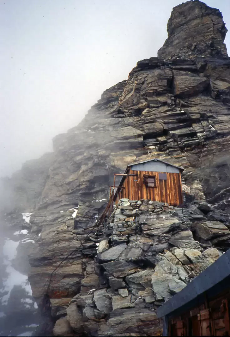
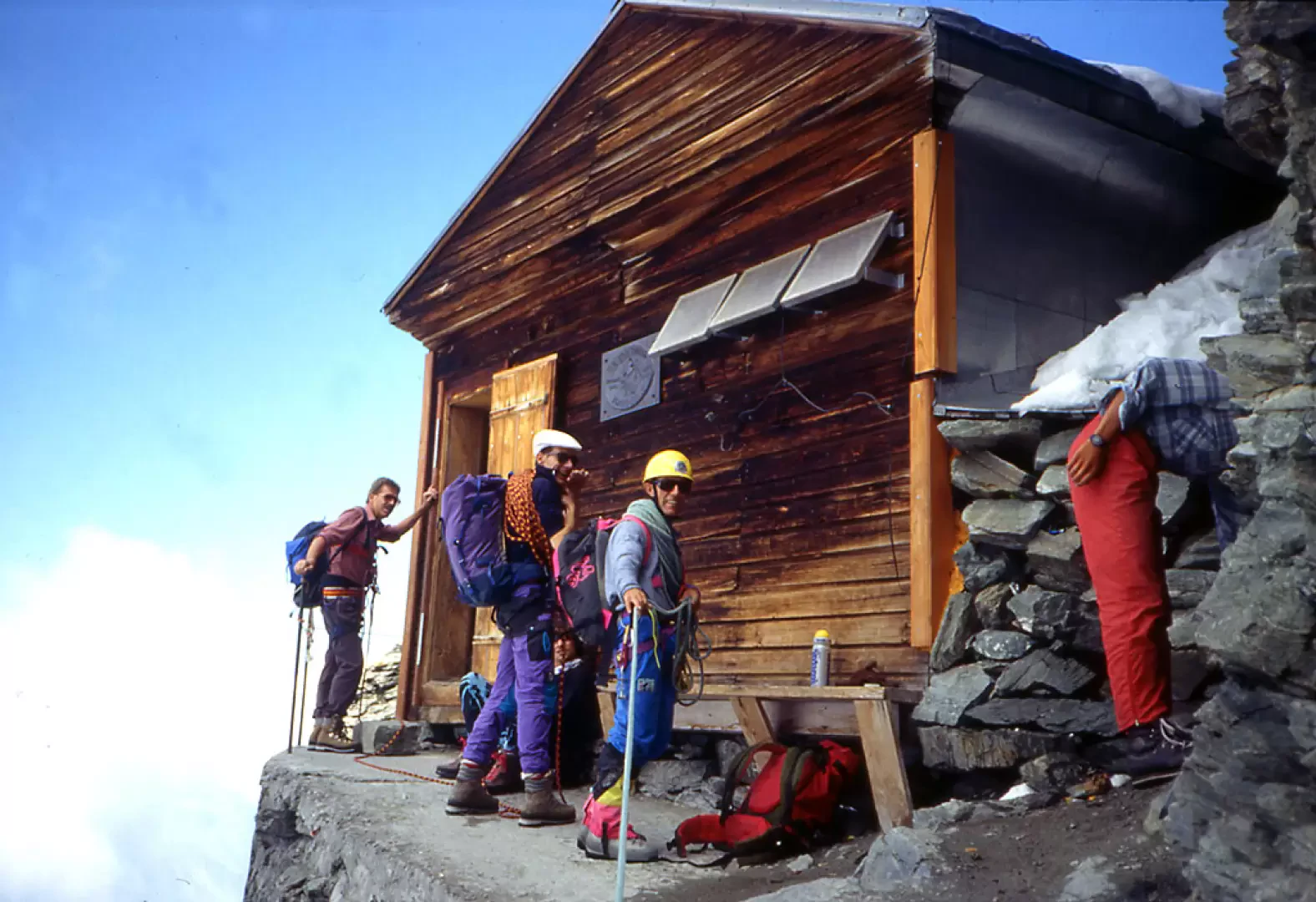
1st day Go up following the path (13) to the Duca degli Abruzzi Refuge and from there reach the Carrel Hut at an altitude of 3835m.
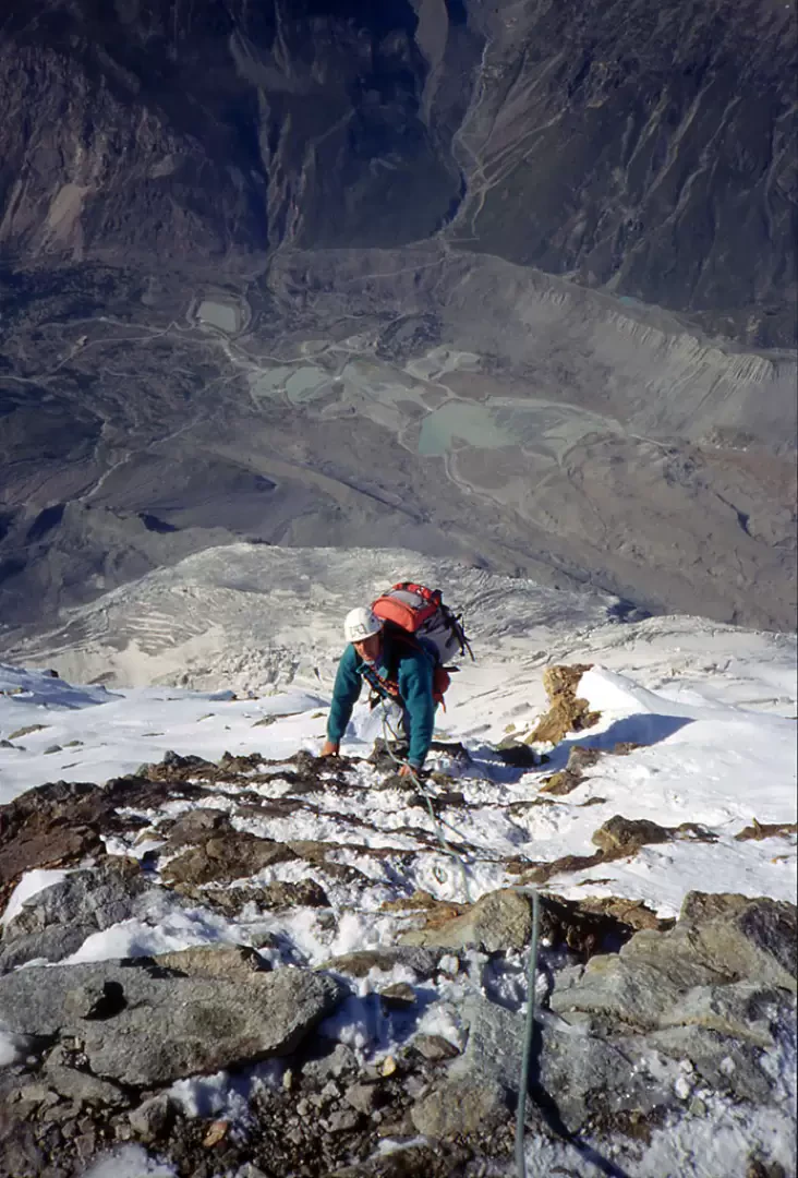
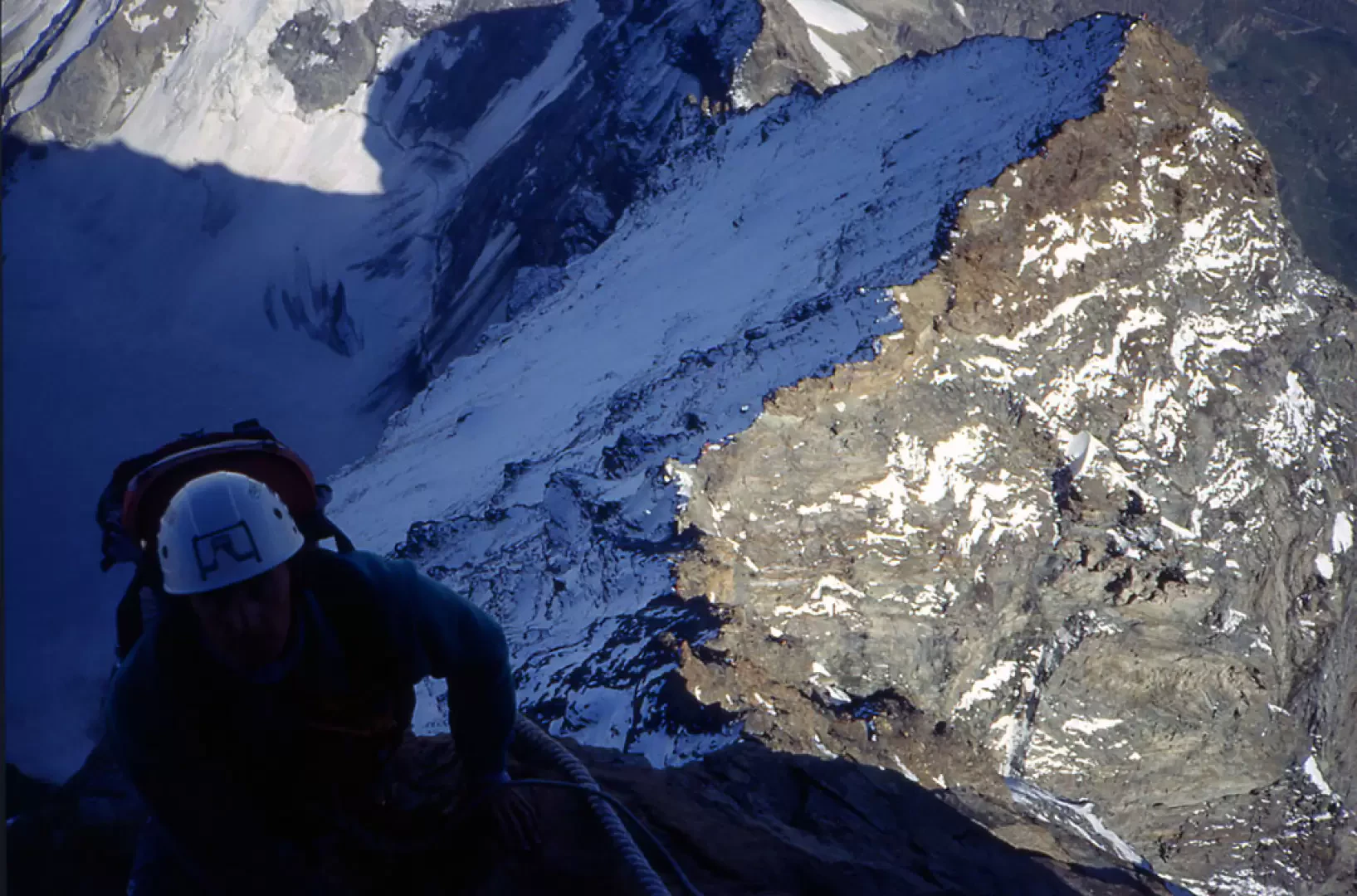
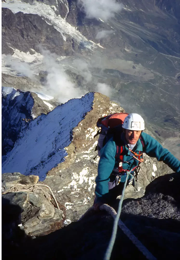
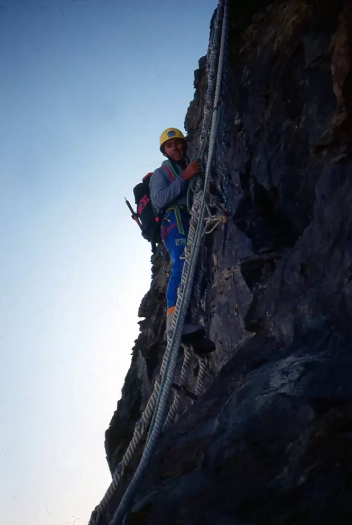
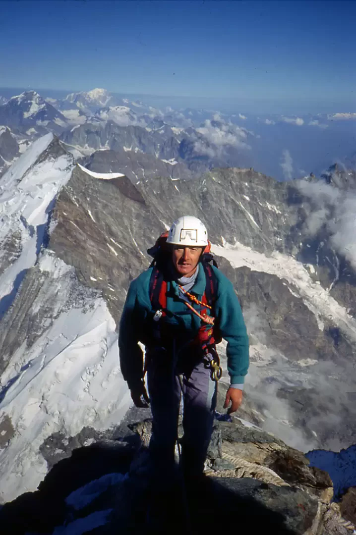
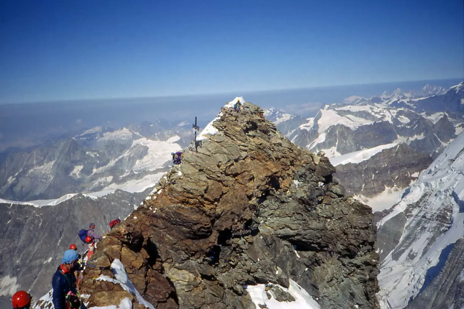
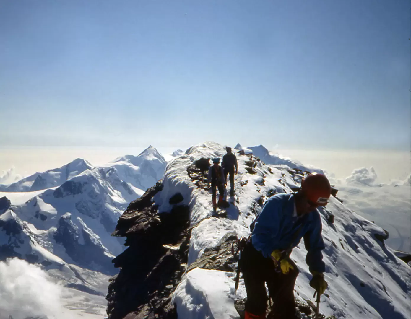
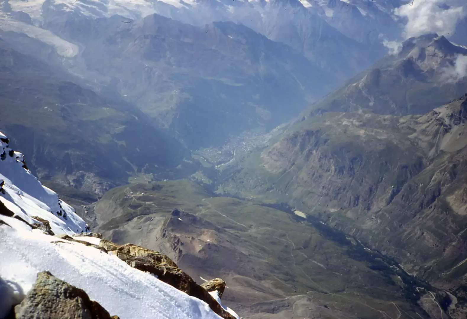
2nd day From the Hut walk along the horizontal ridge, where the old Luigi Amedeo Hut was also located (now on display in the small square of Valtournenche) and climb a succession of steep steps, also using a fixed rope (alarm clock rope) that slants to the right, allowing you to overcome smooth slabs with a small central overhang. At its end grasp, a few metres to the right, another fixed rope to overcome less steep slabs and continue along a debris terrace. Remaining below and to the right of the ridge line, enter a short steep gully with a rope in the middle and at its end, after following a narrow horizontal passage to the right, go along a ledge-sentiero that you leave almost immediately to climb to the left an easy gully that leads to a notch on the jagged ridge line. The first part goes around the right flank and then, after a second notch, the ridge rises steeply. Follow to the right a narrow, exposed horizontal ledge with a bulge that pushes outwards and ends on a small terrace at the top of a small spur from which the first sun can be seen on the Dent d'Hérens. A short descent and here is a small, very smooth section with the engravings of the initials of Whimper and M. Luc, then cross some slabs on a slight descent to approach the hanging glacier of Linceul, cross it on its upper edge with the help of a steel cable to reach the summit of large boulders from which you rise up a little marked gully located just to the left of the visible "Gran Corda" and reach it. Continue climbing on the ridge line until you reach a large boulder on the left and thus reach a terrace. From here, continue until you reach the first summit of Pic Tyndall: follow the narrow and fairly long ridge line to reach the foot of the terminal peak of the head of the Cervino and pass a few notches, resuming the ascent on the line and reaching and passing a dihedral to the left below the line. Continuing to ascend to the left, you reach a surge which, crossed and then returned to the wire, allows you to reach the vertiginous Jordan ladder after which you cross another rope after which, via a ledge, you resume the ridge line where the last two ropes are located, then the slope softens and you soon reach the Italian summit (4476m). The Swiss summit (4478m) is reached by descending to a gap and walking along the snowy ridge that joins the two summits. The panorama is truly priceless and Cervinia is so small below us.
Descent
From the Swiss summit we continue eastwards to start descending on the easy but not trivial ridge line until we reach a series of fixed ropes anchored to the taproads: If you manage to abseil down from these ropes without using the fixed ropes (so that you are independent of those who climb in large numbers from the Hörnlihutte and thus do not have to wait for the line to finish), you will soon find yourself above the Solvay Hut, a small bivouac to be used only in case of danger or bad weather. From the Solvay Hut, the descent is very easy and consists of passing tracks that alternate with small, easily surmountable rock jumps that shortly lead to the Hörnlihutte. From the hut, descend to the clearly visible Schwarzsee below, from where you take the cable car that connects it to Trockener Steg and from there the cable car that reaches the Little Cervino. You descend keeping to the edge of the ski slope and finally arrive at the Plateau Rosa station: a few more minutes by cable car and you are back in Cervinia.
Bibliography
Gino Buscaini, Alpi Pennine volume II, Guida dei Monti d'Italia, CAI / TCI, Milano, 1970
Cartografia
Valtournenche Monte Cervino Val d'Ayas west, Hiking map sheet 7, 1:25000, L'Escursionista Editore, 2004
Riferimenti Bibliografici
Alpi Pennine volume II
- Gino Buscaini
- Guida dei Monti d'Italia, CAI / TCI, Milano, 1970


Comments (0)
Sign in to leave a comment