Punta Leysser


Edited by:
Stefano Alberto Malan
Updated at: 23/10/2025
Access
Leave the motorway and, after 450m, leave the motorway junction turning right onto the regional road for the Cogne valley. After 400m at the roundabout, take the second exit and enter the state road , to be followed for about 3km, passing through the village of Saint-Pierre, until you reach the village of Luboz. Turn right onto Via Corrado Gex (to be followed for 300m) and then turn right onto the regional road to be followed for about 7.7km until Saint-Nicolas and, just beyond the main centre, a crossroads: continue straight on the regional road following the signs for Vétan. When you reach Petit Sarriod, leave the regional road and turn left. Follow the communal road through the villages of Person, Grand-Sarriod, Gerbore until you reach, after 4.2km, Vétan and the large car park at the end of the road.
How to get there with GMaps
How to get there with Apple Maps
Introduction
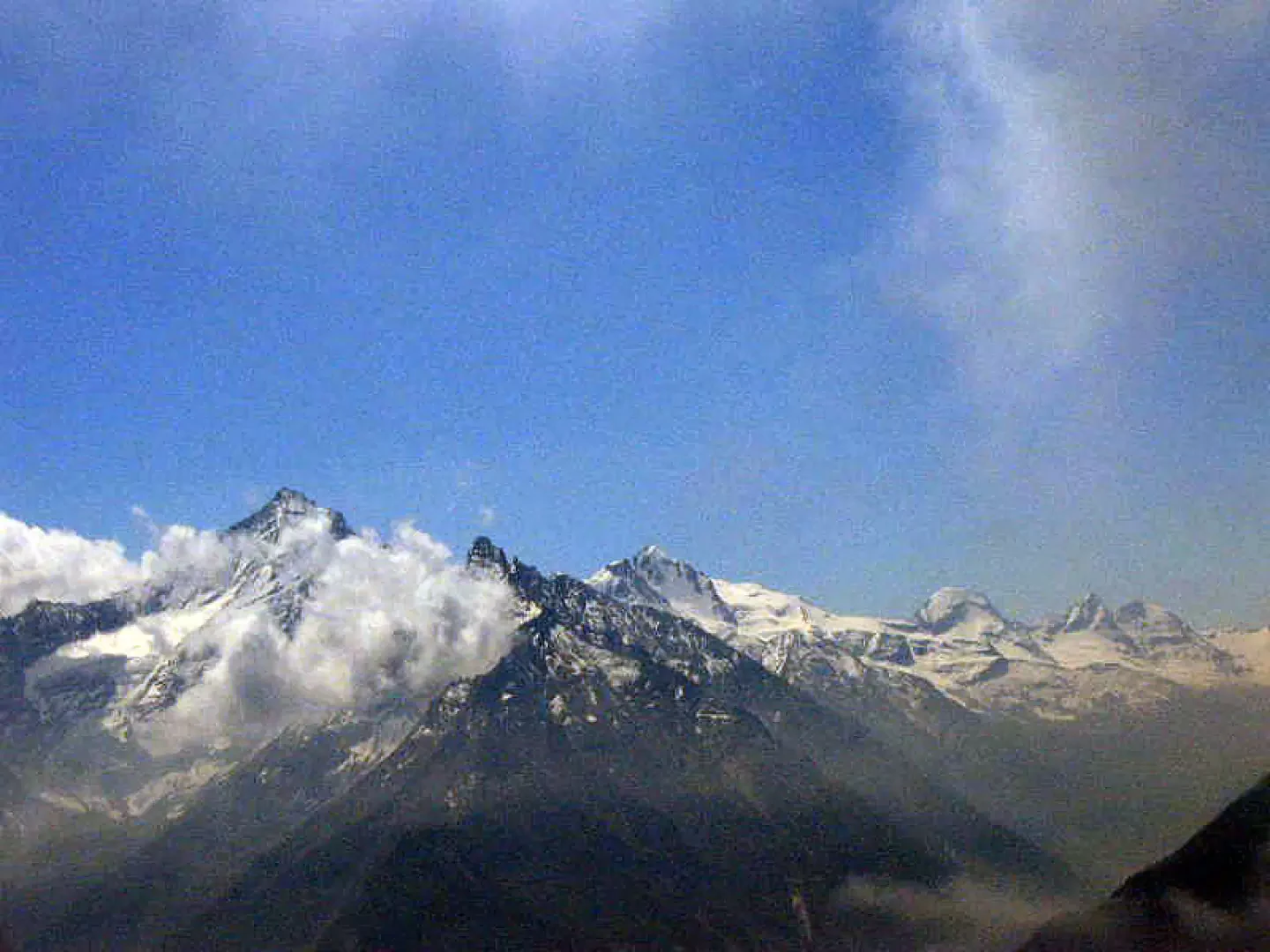
The Punta Leysser is a splendid vantage point over the Gran Paradiso and Bianco massifs. Numerous marmots are encountered during the ascent.
Description
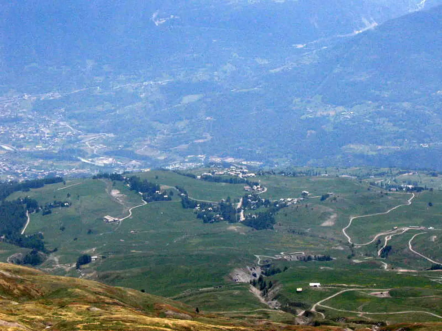
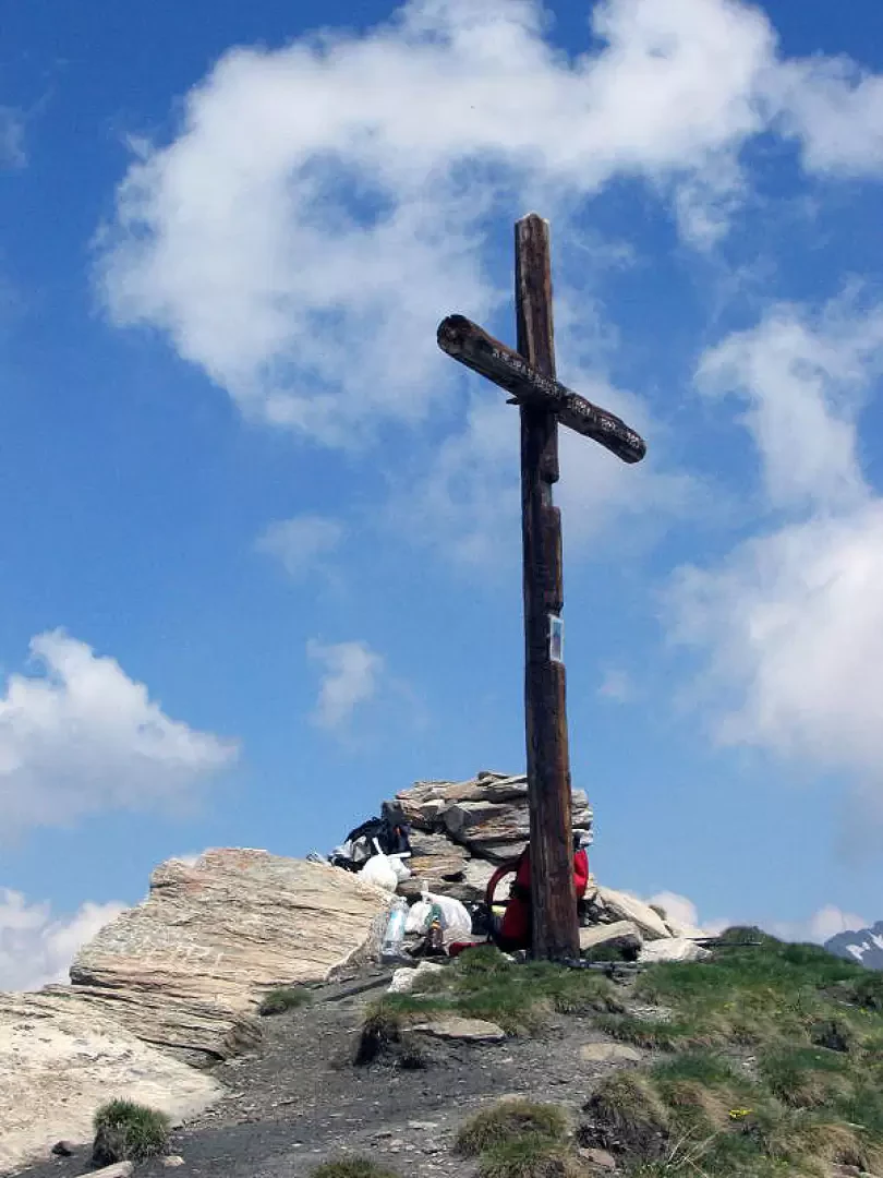
From Vétan, the summit, surmounted by a cross, is visible in a north-westerly direction and can be reached without an obligatory path. From behind the Notre Maison hotel, a path starts, skirting the football pitch and heading towards the farm roads that lead into the valley. You can freely ascend the easy bumps that lead below the summit, or you can initially follow the farm road that leads to Grandes Arpilles. From here, in either case, it is necessary to ascend on meadows or on tracks dug by grazing cattle and runoff water. When you reach the last plateau below the summit, it is best to climb to the right (east of the summit) to the ridge and follow it to the top. The descent can be made by moving along the ridge to the west to the next point on which there is a cairn, and from there descend freely towards Vétan, clearly visible from the summit.
Photo gallery
Comments (0)
Sign in to leave a comment