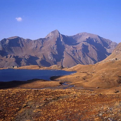
Rosa dei Banchi, from the Dondena car park

Access
Road directions
At the motorway junction at Pont-Saint-Martin, turn left and take the national road [SS26] towards Aosta. Continue for 2.2 km (2.2 mi), passing through the village of Donnas, until you reach a roundabout. Take the second exit and continue on the road for 3km (5.2km), skirting the Fortress of Bard, until you reach the next roundabout. Here take the third exit and take the regional road della Valle di Champorcher. Continue on for 14.3km (19.5km), climbing the entire valley and passing through the villages of Hône and Pontboset, until you reach Château, the centre of Champorcher. After passing the main town, turn right and continue for about 7.9km on the municipal road, initially asphalted and then unsurfaced, until you reach Dondena.
At the motorway junction at Pont-Saint-Martin, turn left onto the main road in the direction of Aosta. Continue for 2.2 km (2.2 mi) through the village of Donnas until you reach a roundabout. At the roundabout, take the second exit and continue on the road for 3.0km (5.2km), skirting the Fortress of Bard, until you reach the next roundabout. Take the third exit and take the Valle di Champorcher regional road. Continue on for 15.3km (20.5km), climbing the entire valley and passing through the villages of Hône, Pontboset, before reaching Château, the centre of Champorcher. After passing the main town, turn right and continue for a further 9.8km (30.5km) on the communal road, first asphalted then unpaved, until reaching the locality of Dondena.
Description of the car park
In the locality of Dondena there is a large car park 🅿️, generally free of charge, located at the end of the road and in direct proximity to the start of the hike. The car park is located on a large dirt forecourt, used as a starting point for itineraries in the upper valley; in the immediate vicinity there are seasonal alpine pasture facilities and information panels.
Access by public transport
To reach the starting point of the itinerary, a private vehicle is necessary, as the village of Dondena is not served by public transport.
Distance and travelling time
🕒 Travelling time: 55 minutes
📏 Distance: 30.3km
GPS navigation
📍 How to get there with Google Maps
📍 How to get there with Apple Maps
ℹ️ Important note
The directions provided have been verified as of the date of the survey of the route. Before departure, it is recommended to check possible changes in the route or road conditions. For up-to-date information, please consult Google Maps or Apple Maps.
.Introduction
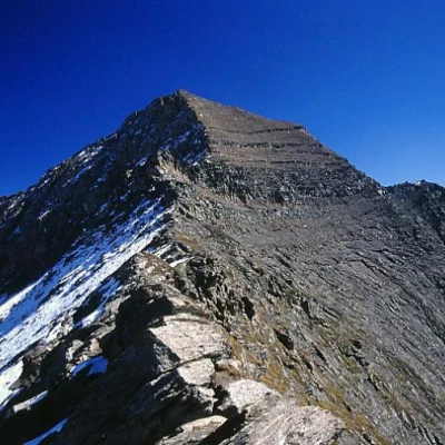
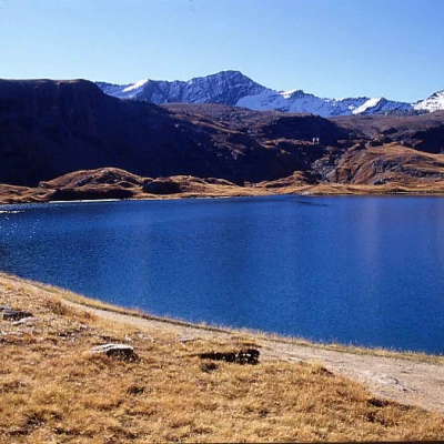
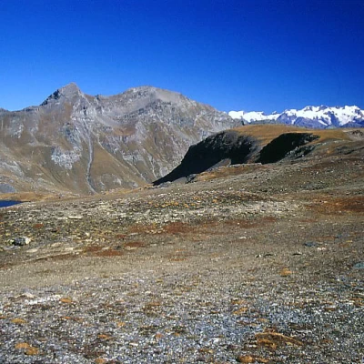
A wide-ranging hike in the beautiful upper Champorcher valley, beyond Dondena, amidst broad meadows unfortunately disturbed by high voltage pylons. Just under halfway along the route is Lake Miserin, one of the largest natural lakes in the Aosta Valley. Beyond the Col de la Rosa, the ridge leading to the summit is fairly easy, but aerial, with a leap about halfway up that can be overcome on the N side (grade II wall), or in an easier but more delicate way, with a traverse on the south-west flank of the mountain to reach the south ridge that climbs just as easily to the summit of the Rosa dei Banchi (more discontinuous grade II steps alternating with scree).
Description
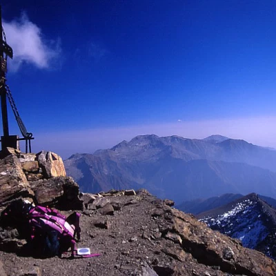
From Dondena, cross the watercourse and climb directly up the path into the main valley, without following the dirt road that passes by the private Dondena hut, but linking up with it further on; leave the branch-off on the right for Mont Glacier and then the one for the Finestra di Champorcher, reaching Lake Miserin, which is skirted on the left. It then climbs up through meagre pastures, bumps and scree until it reaches the remains of the Banchi glacier, which it climbs up to the colletto della Rosa. We now turn left along the easy but airy ridge, first on traces of a path on the south side, then on the edge, until we reach some commemorative plaques at a crest jump. The route normally followed involves crossing this jump on the left (northern) side by means of a small ramp and a subsequent small wall (grade II) and then continuing to the summit along the final western ridge, but it is also possible (and advisable if the northern slope is snow-covered) to traverse on mobile but easy ledges along the entire south-western side of the mountain until taking the edge of the southern ridge that leads to the summit, first with some easy climbing steps (grade II) and then along debris and scree.
Mountaineering grade: II-
Exposed sections:South-west flank (if you opt for this ascent option)
Equipment: Lanyard (optional)
Water: Dondena
Riferimenti Bibliografici
- Valle d'Aosta Oltre il sentiero - Pietro Giglio e Matteo Giglio -
- In cima: 78 normali nel Gran Paradiso - SUCAI Torino -
