Leaving the motorway at the Verrès exit, enter the roundabout and take the second exit. Proceed in the direction of the town centre and, after 300m, turn left onto the regional road for Val d'Ayas. Follow the regional road for 6.5 kilometres, passing the village of Challand-Saint-Victor and, at the village of Châtaignere, turn left following the signs for Abaz. Go up the communal road, pass the village of Abaz and, after 2.5 kilometres, reach Col d'Arlaz where, on the left, there is a car park 🅿️ where you can leave your car free of charge.
[0h16'] - [9.0km] How to get there with GMaps How to get there with Apple Maps
The information provided here has been verified as of the date the route was surveyed. Before setting off, it is advisable to make sure that no substantial changes have occurred on the access route to the starting point. We therefore recommend the use of the satellite navigation apps provided by Google or Apple for up-to-date and detailed directions.
Introduction
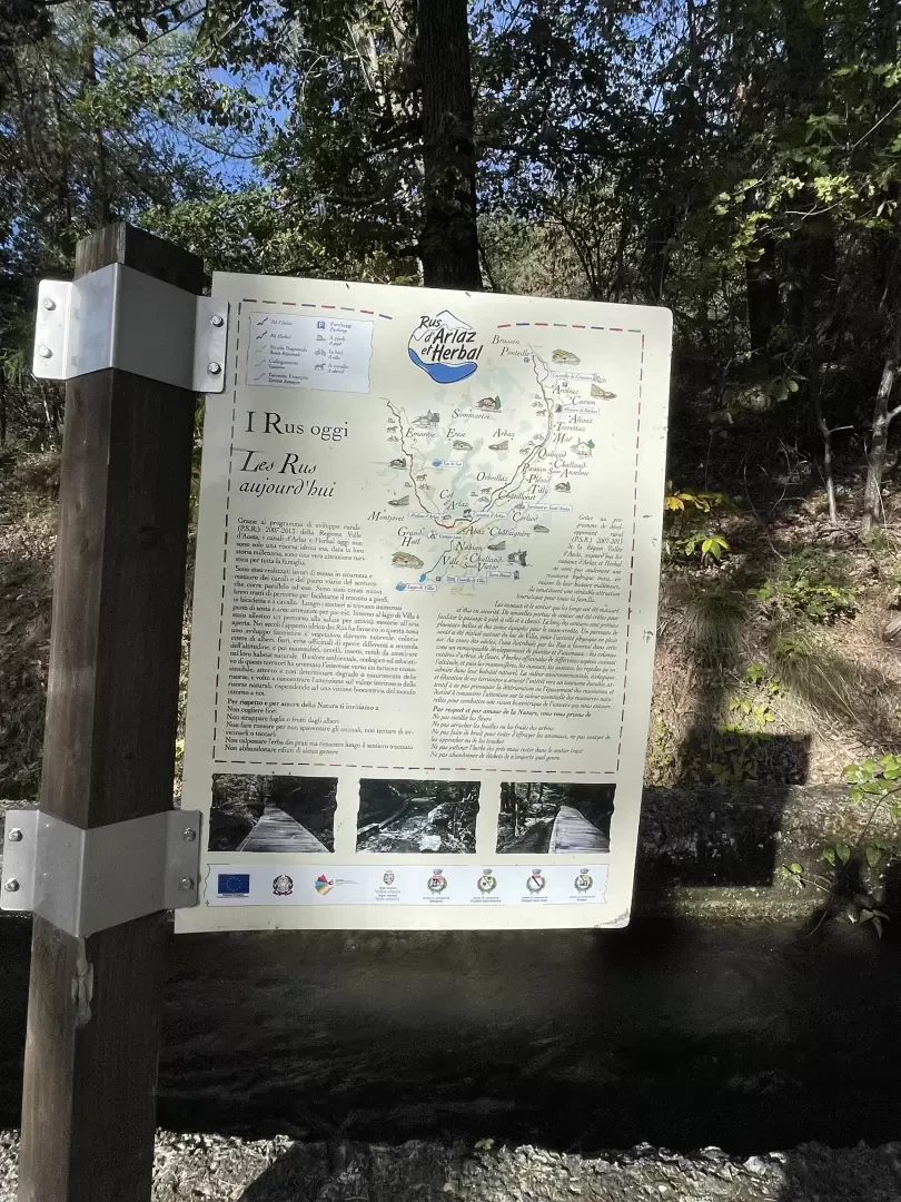
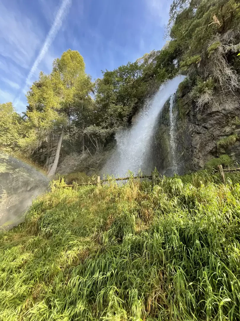
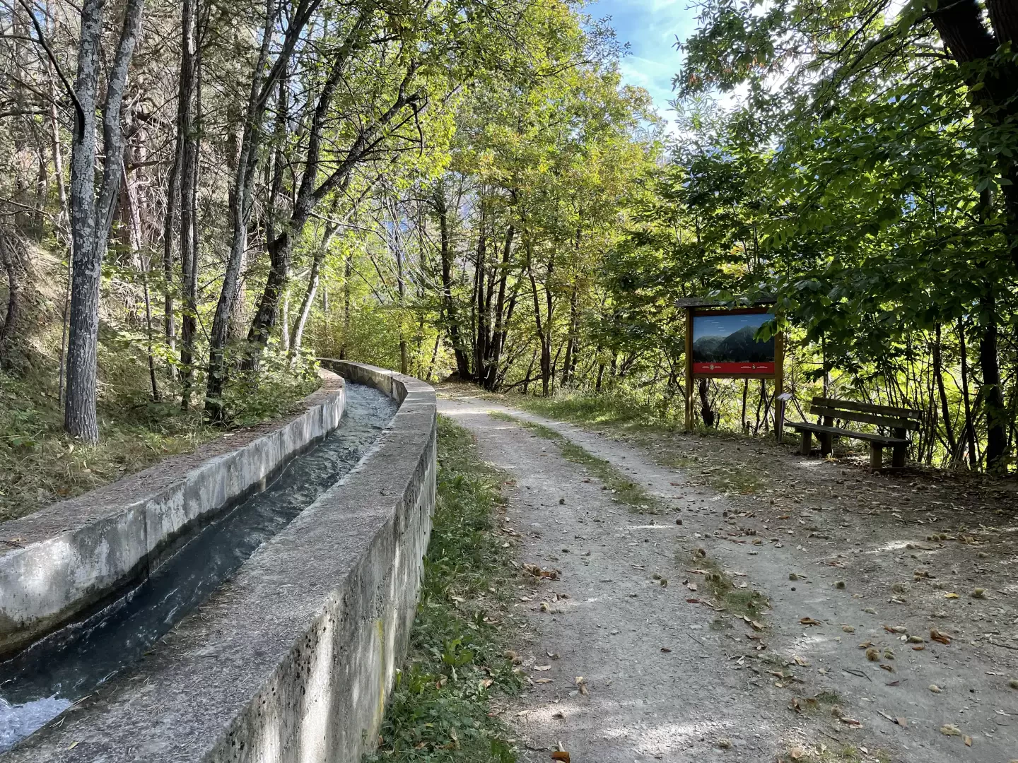
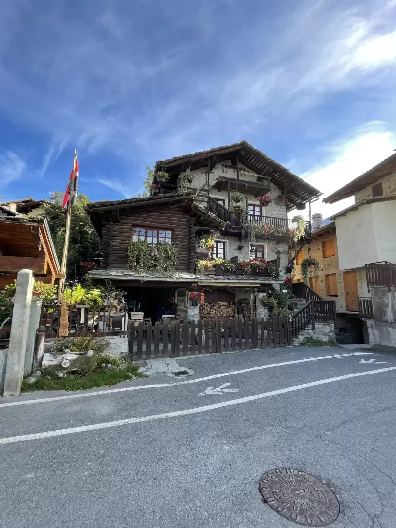
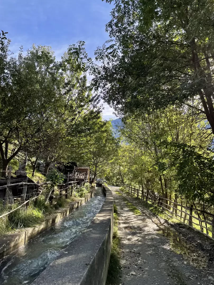
Orbeillaz is a pretty village located on the slopes of Mont de Ros in the municipality of Challand-Saint-Anselme. It is inhabited all year round and features fairly interesting houses that are examples of rural architecture. The destination coincides with the arrival in front of the chapel dedicated to Santa Maria Maddalena. The route described here is a small part of the long itinerary along the Ru d'Arlaz, but it captures some aspects of interest such as the beautiful Arlaz waterfall, the penstocks of the Isollaz hydroelectric power station and some panoramic views of the peaks of the lower Val d'Ayas. All this makes the itinerary described here very pleasant and often fairly busy at any time of year. Along the route, some explanatory panels illustrate the system of the Arlaz and Herbal ruins, which lead the waters of Val d'Ayas into the central valley.
Description
0h00'0.00km
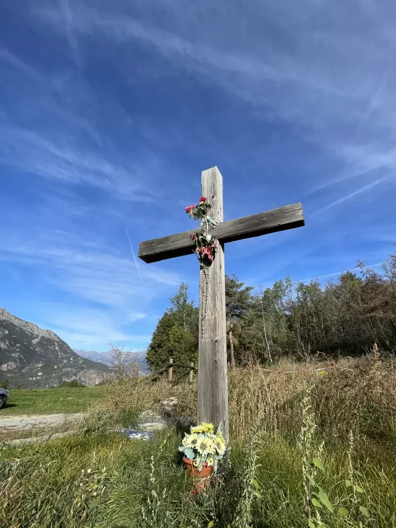
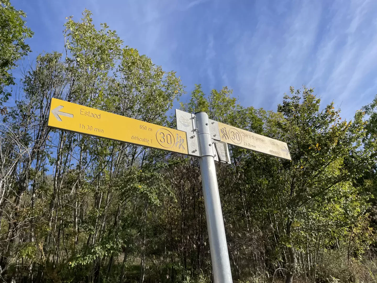
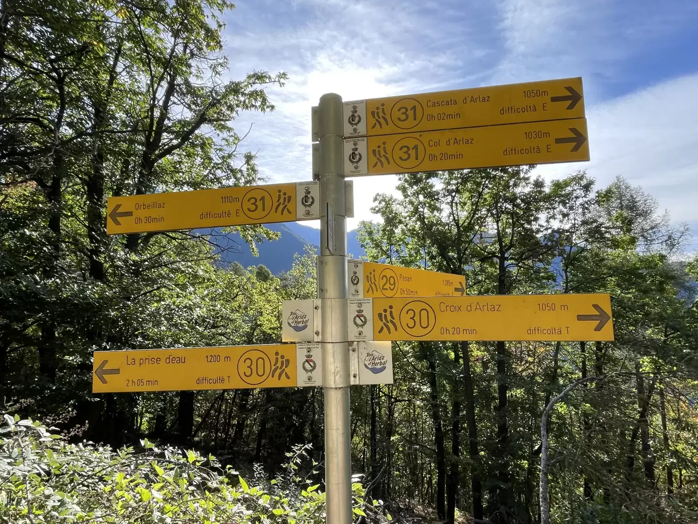
From the car park, head towards the Croix d'Arlaz, a wooden cross located near the water collection plant of the Ru d'Arlaz, and reach the signpost with directions to the water intake
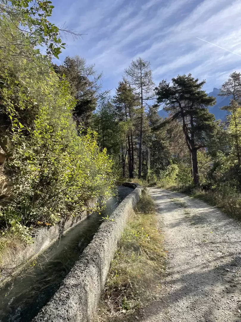
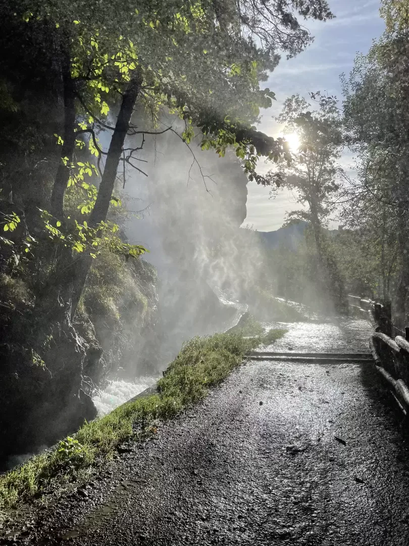
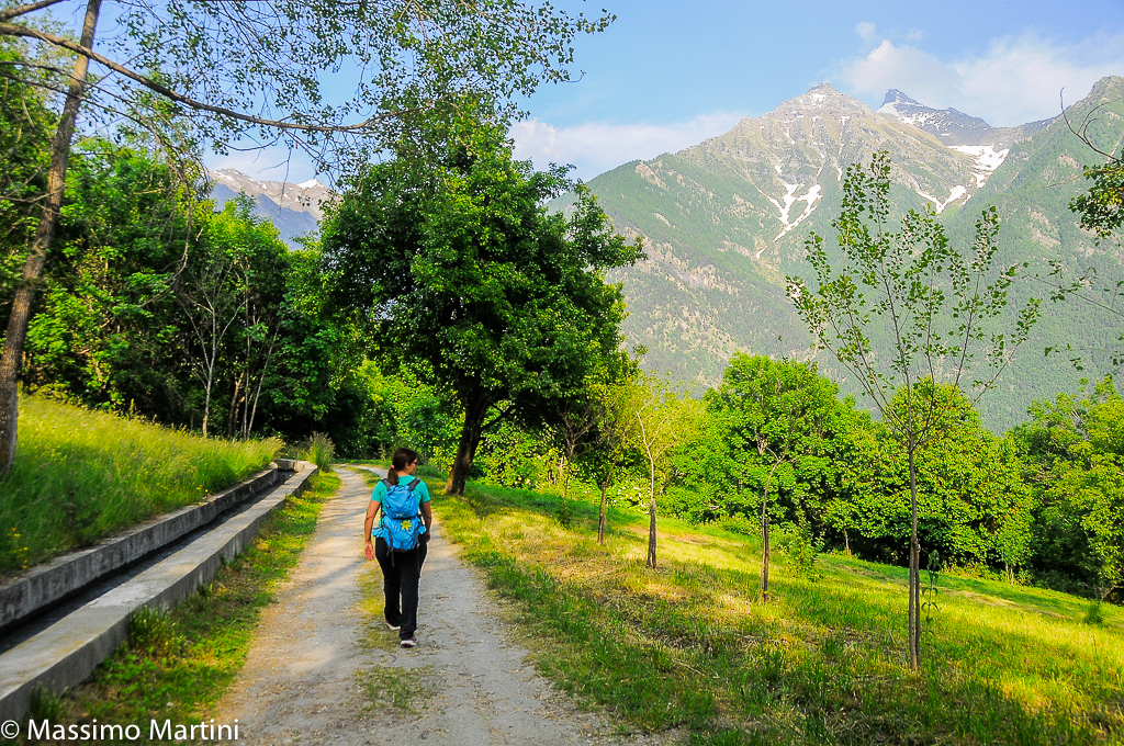
. Continue along the flat dirt road, which runs alongside the Ru d'Arlaz through a sparse oak forest (Quercus pubescens). As one progresses, the vegetation changes to give way to Scots pine (Pinus sylvestris). The path turns left, then bends slightly to the right until it reaches a small footbridge over the ru.
0h08'0.4km
Disregard the turnoff for Érésaz
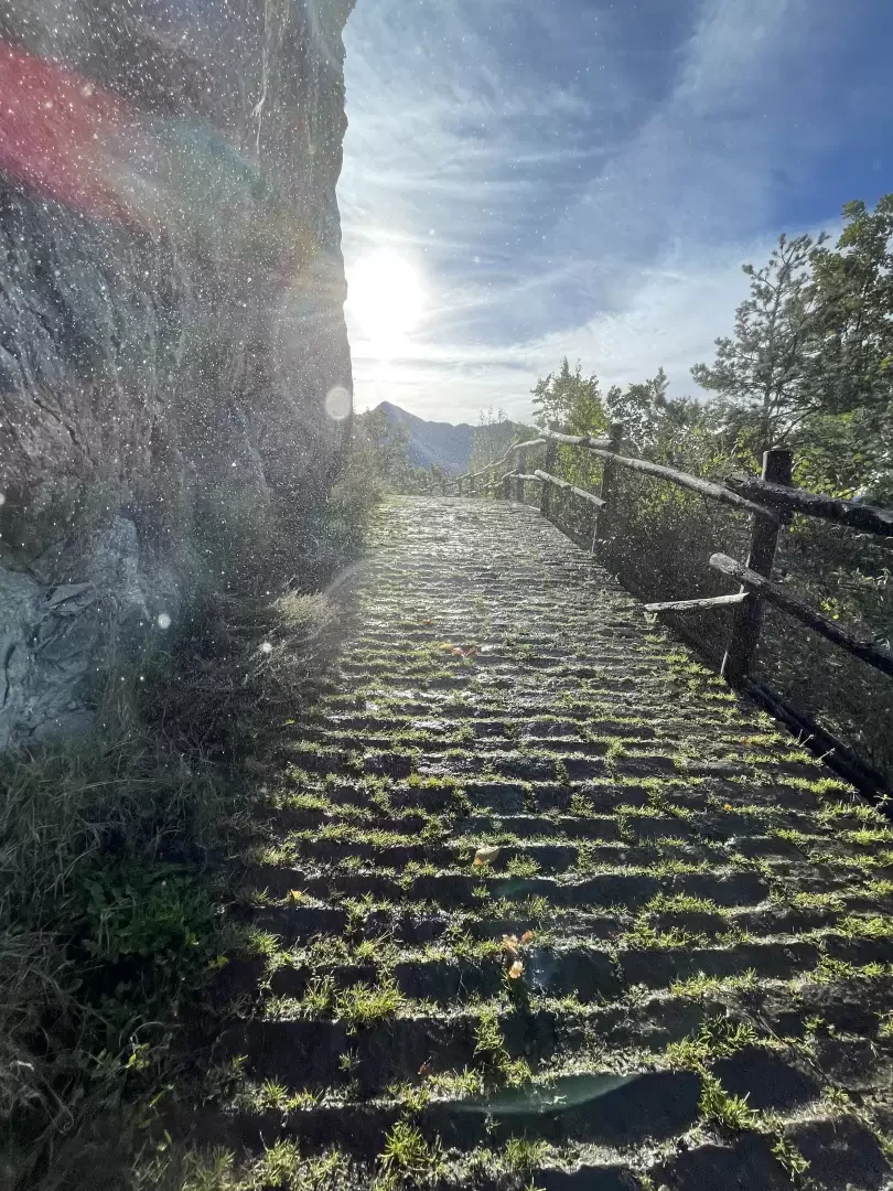
and continue along the little road, which turns first left, then right, until you reach the characteristic waterfall formed by the cascading waters of the ru. Continue on an uphill paved section until reaching a bench with a viewpoint over nearby Mont Avic. A little further on, you will come across a new marker post.
0h15'0.92km
Neglect the paths
to Châtillonnet and
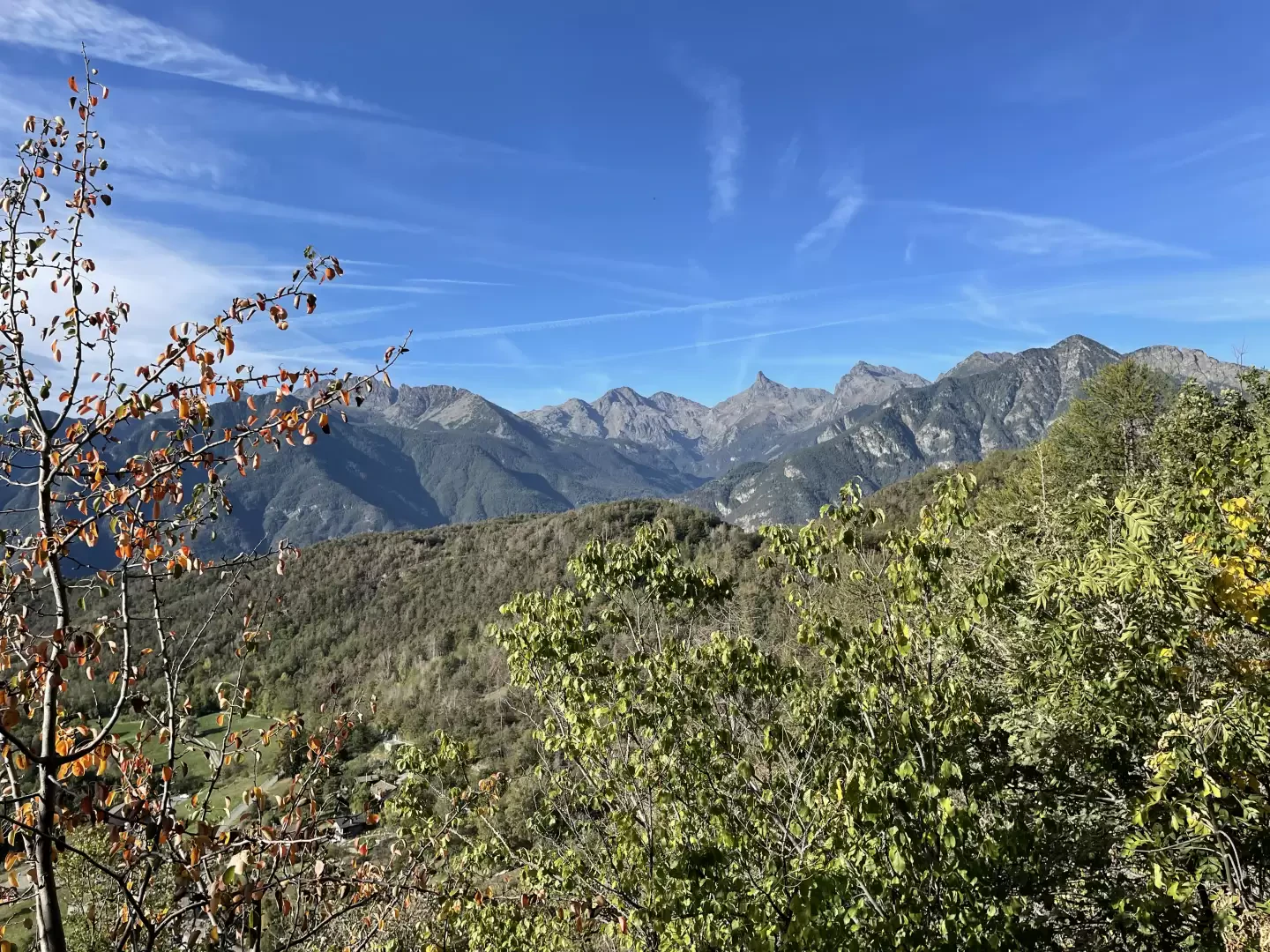
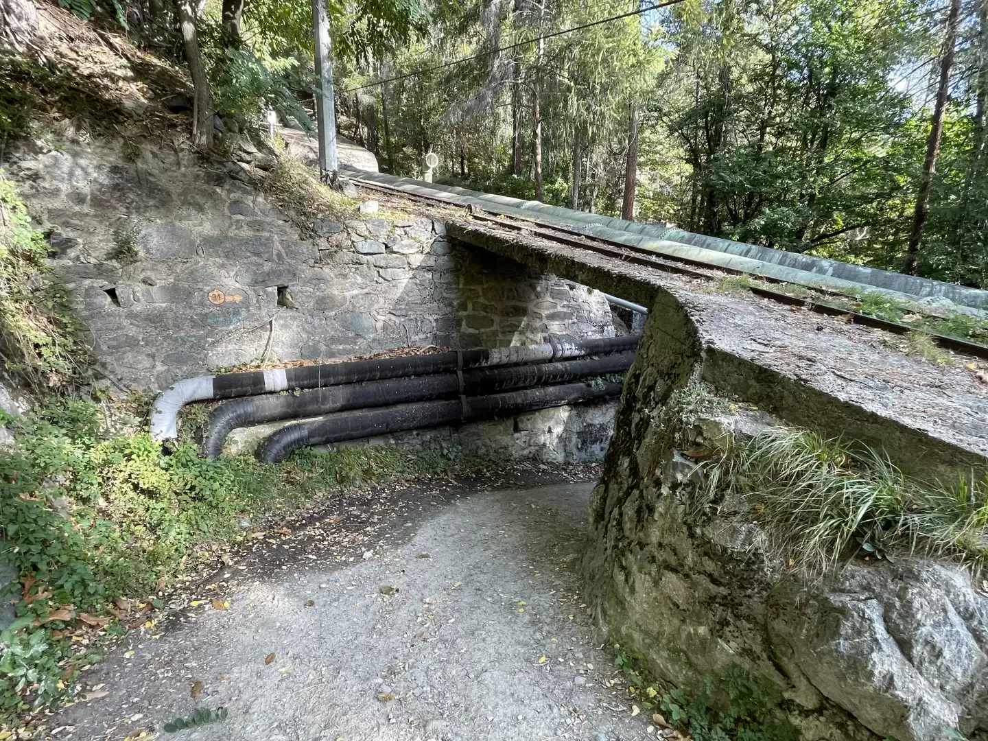
to Pésan on the right, and continue on the main trail, climbing a short distance to reach the penstocks of the Isollaz hydroelectric power station. Climb along the path, parallel to the pipelines, and then cross them via a subway. Start climbing again until you reach a new signpost and return to the dirt track. Now proceed on the level, again skirting the Ru d'Arlaz, until you come to a slight climb, preceded by an illustrated panel describing the main peaks of the Challand-Saint-Anselme area, visible between the openings in the wood. After the uphill section, continue on the level until reaching the marker indicating the start of the path
for Bec de l'Ouia, also known as Flambeau d'Arlaz.
0h40'2.16km
Continue straight on until reaching the car park 🅿️ in Orbeillaz. Pass the clearing and follow the little road through the village until you reach the chapel dedicated to the Visitation of Mary and finally the centre of Orbeillaz (1113m) 0h45'2.65km .
The return is along the same route as the outward journey, retracing the little dirt road that runs alongside the Ru d'Arlaz until reaching the Col d'Arlaz (1031m) 0h35'2.65km .


Comments (0)
Sign in to leave a comment