From the motorway exit at Châtillon, turn left along Via E. Chanoux. Go past the roundabout, third exit, and continue through the town centre for about 600m and then turn right into Via Menabrea, which you should follow until you reach the roundabout with the "Cervino" on the inside. Follow the regional road for 26.1km to Breuil-Cervinia where, at the roundabout before entering the town centre, take the first exit and go straight ahead until reaching the small church dedicated to Saint-Théodule. Turn right, then left, following the signs for the 🅿️ free cable car park, which you will reach after about 800m.
[0h43'] - [28.4km] How to get there with GMaps How to get there with Apple Maps How to get there with Moovit
The information provided here has been verified on the date of the survey of the route. Before setting off, it is advisable to ensure that no substantial changes have occurred on the route to the starting point. We therefore recommend the use of the satellite navigation apps provided by Google or Apple for up-to-date and detailed directions.
Introduction
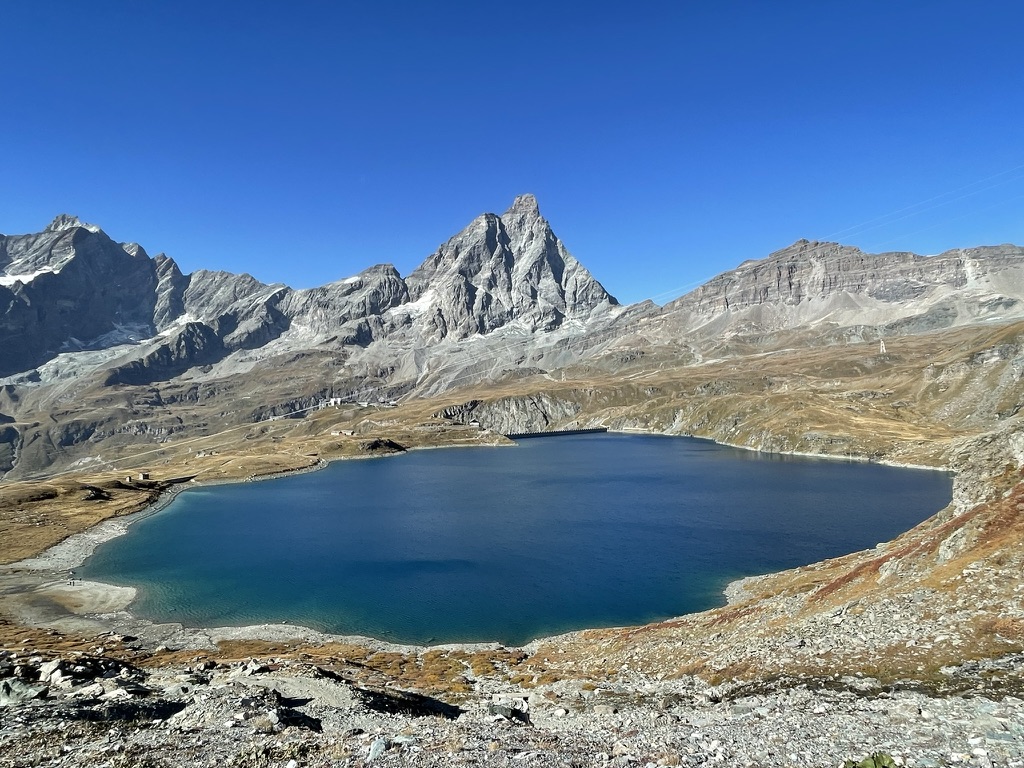
A beautiful panoramic walk on the slopes of the Cervinia ski resort. The view of the Matterhorn reflected in the reservoir alone is worth the ascent.
Description
0h00' Once you reach Breuil-Cervinia you can leave your car in the car park of the cableway to Plan Maison, cross the Barmaz stream and set off along a farm road that runs along the orographic left. After a few hundred metres you come to the path
and climb it, passing the last trees, up to the alpex\ Chavanon (2226m): you can reach the lake by continuing the walk along the farm road taken at the beginning, but we recommend the path, which is shorter and on which you will not come across the various off-road vehicles on duty. During the ascent, allow yourself to be tempted to turn around and look at the Breuil basin and its beautiful mountainous backdrop. The path climbs halfway up the ridge and crosses the rails on which a small train used to pass, carrying materials for the construction of the dam (of Lake Goillet). By now, we are only a few hundred metres from our destination, and after rejoining the dirt road, we finally cross the small pass that leads to the lake. On a fine day, in addition to the fantastic panorama of the Breuil basin, we can also enjoy the reflected image of the Cervino in the waters of the lake. Lake Goillet is an artificial lake produced by a barrage in the Barmaz valley. Its waters are channelled in penstocks that transport them to the hydroelectric power station of Perrères.


Comments (0)
Sign in to leave a comment