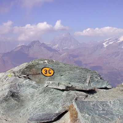
Corno Boussolaz, from the Fenillettaz car park

Access
Lasciare l’autostrada al casello di Verrès. Entrare nella rotatoria e prendere la seconda uscita in direzione del centro storico. Dopo circa 300 metri, svoltare a sinistra imboccando la strada regionale per la Val d’Ayas. Proseguire lungo la per circa 16,5 chilometri, risalendo il fondovalle e attraversando i borghi di Challand-Saint-Victor e Challand-Saint-Anselme, fino a raggiungere l’abitato di Brusson. Attraversare il paese e, poco prima del bivio per il Col de Joux, svoltare a destra seguendo le indicazioni per Estoul. Risalire la strada comunale per Estoul per circa 6,1 chilometri, affrontando curve strette e tratti boschivi. Superato il piccolo villaggio di Estoul, proseguire ancora per circa 800 metri fino a raggiungere l'ampio parcheggio di Fénillettaz, accessibile con una svolta a U verso sinistra. Qui è possibile lasciare l’auto 🅿️.
🚫 Il punto di partenza dell’itinerario non è raggiungibile con i mezzi pubblici, quindi è necessario utilizzare un mezzo privato.
Distanza e tempo di percorrenza
🕒 Tempo di percorrenza: 38 minuti
📏 Distanza: 22,5 km
Navigazione GPS
📍 Come arrivare con Google Maps
📍 Come arrivare con Apple Maps
ℹ️ Nota importante
Le indicazioni fornite sono state verificate alla data del rilievo dell’itinerario. Prima della partenza, è consigliabile verificare eventuali variazioni del percorso. Per ottenere indicazioni aggiornate e dettagliate, si consiglia l’uso di Google Maps o Apple Maps.
Introduction
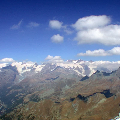
Relatively long but rewarding walk, in fact, after 3½ hours of walking through the Palasinaz lake group, you can enjoy a privileged viewpoint of the imposing Monte Rosa massif: this splendid view repays all effort.
Description
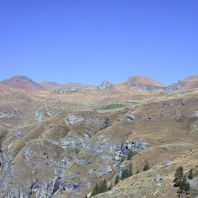
Park your car and walk along the entire rest area until you reach the signpost at the start of our itinerary. We immediately take a flat farm road and follow it for a few hundred metres, turning first right and then left into a larch forest. After a few minutes, still following the signs for the Arp Refuge, we turn right up a ski slope; slowly the forest thins out and gives way to large areas of pastureland. The wide and evident path rejoins the farm road (1992m, 0h20'): at this point, turn left and start climbing up the comfortable farm road. Along this stretch, you can enjoy an excellent panoramic view of the lower Val d'Ayas (Challand-Saint-Anselme and Challand-Saint-Victor), of Issogne and of all the peaks of the Avic area (Mont Avic, Mont Glacier and Punta Tersiva).
After the Chanlossère alpine pasture, on our right, the track leads upwards with several hairpin bends: on our left we can admire a beautiful panorama of the Dames de Challand (the Becca Torché and the Becca di Vlou). The road then enters the valley of the Messonère stream and, after about 0h35' of walking, we come to the turnoff for the Bringuez lake (3): we overlook it and continue along the farm road, which, without any great difference in altitude, runs along the orographic left of the Messonère stream. We then reach the diversions (2165m, 0h45') to Lake Litteran and Mont Bieteron, but to reach our destination, we must continue straight on, ignoring this diversions.
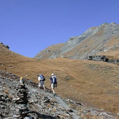
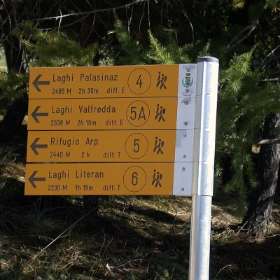
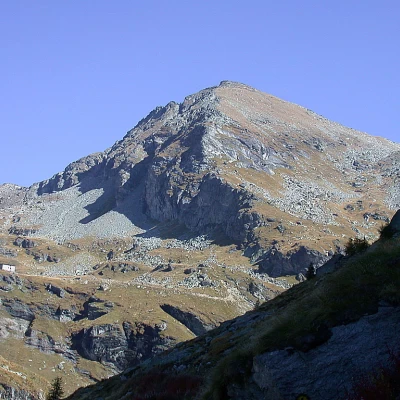
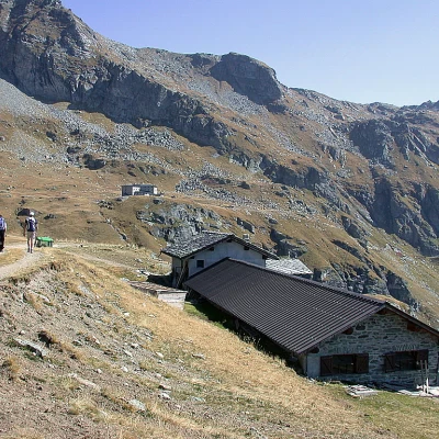
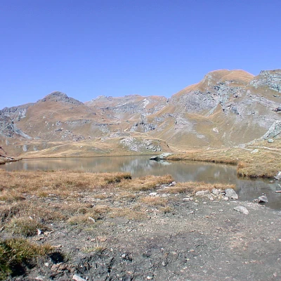
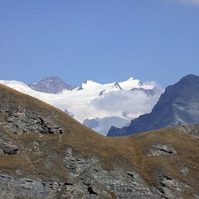
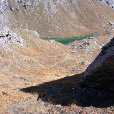
For a few moments the Arp Refuge has been visible at the bottom of the valley, and the road climbs it, passing under the rocky slopes of Mont Bieteron and offering excellent views of the route we are about to take. After 1h00' of walking, at an altitude of 2228m, we reach a fork in the farm road, ignore the turnoff to the right for the Rifugio Arp and continue on the farm road, which from here on will begin to climb the ridge with a series of hairpin bends. During the ascent, you will come across signs for the path (5): these are shortcuts that can be used if necessary, so that you do not have to follow the same route all the way up and down. After passing several alpine pastures, after about 1h 30' you reach, near Alpe Palasinaz (2406m), a further fork: continue to the left, ignoring the signs for the Rifugio Arp, Corno Vitello, Punta and Laghi Valfredda. One ascends the road again and, having passed one more mountain pasture, one reaches its end. From there, take a path up the orographic right-hand side of the Laghi della Battaglia (2487m) outflow: after 1h 45' you reach the lake basin. You skirt the lake on the right and after a few minutes reach a second lake, the Green Lake, and then the path turns to the left and begins to climb halfway up the ridge on which the Couloir Lake is located. After about ten minutes, you first reach a signpost, which indicates the junction between the path (4) leading to the Couloir lake (2607m, 0h20') and Col Palasinaz (2670m, 0h45'), and then cross the inviting plateau of Lake Pocia (2518m). Once past the lake, the path becomes steeper and climbs another step that soon takes us to the vicinity of Lago Lungo (2632m, 2h30'). The path does not reach the lake directly, only passing close to it, and begins to climb up the right-hand ridge of an unnamed peak with an altitude of 2899m. After an initial, fairly steep section, the trail turns right (there is a small path to the left that should be overlooked) and goes along a section without too much difference in altitude: if we raise our heads we cannot fail to notice the beautiful view of the Punta Dufour, Zumstein and Gnifetti in the Rosa group.
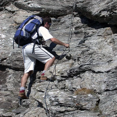
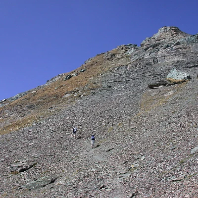
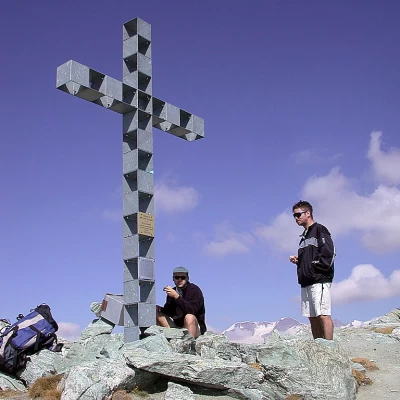
On reaching Col Bussola (2824m) after a few minutes we encounter the only difficulty on the route: a first degree passage that can be easily overcome with the help of a fixed steel cable. From here on, the path climbs the last remnants of the prairie with a series of hairpin bends until turning left towards the summit. Having comfortably passed a section of scree, the path tackles the last section below the summit, climbing the last, fairly steep ridge, at the end of which is the wide summit (3023m, 3h30') topped by a cross.
The panorama from up here is exceptional, the view over the whole of the Aosta Valley alpine arc amply repays the effort of the climb.
The descent is along the same route as the ascent.
Galleria fotografica
We have been there
Corno Boussolaz, anello dal parcheggio di Fénillettaz
Con Sabrina e Sergio super anello con discesa sulla dorsale erbosa che conduce al Col Palasinaz!
Corno Bussola
Saliti lungo il sentiero 3C, scesi per la piacevole e panoramica cresta est contrassegnata dal 3D.Saliti lungo il sentiero 3C, scesi per la piacevole e panoramica cresta est contrassegnata dal 3D.Corno Boussolaz, dal parcheggio di Fénillettaz
Con Andrea e un suo amico bella ascensione in una fresca giornata di inizio autunno.
