An easy and little-visited hike among beautiful pastures and great views. The destination, Mount Grand Pays, is a great belvedere over much of the Upper Aosta Valley.
Description
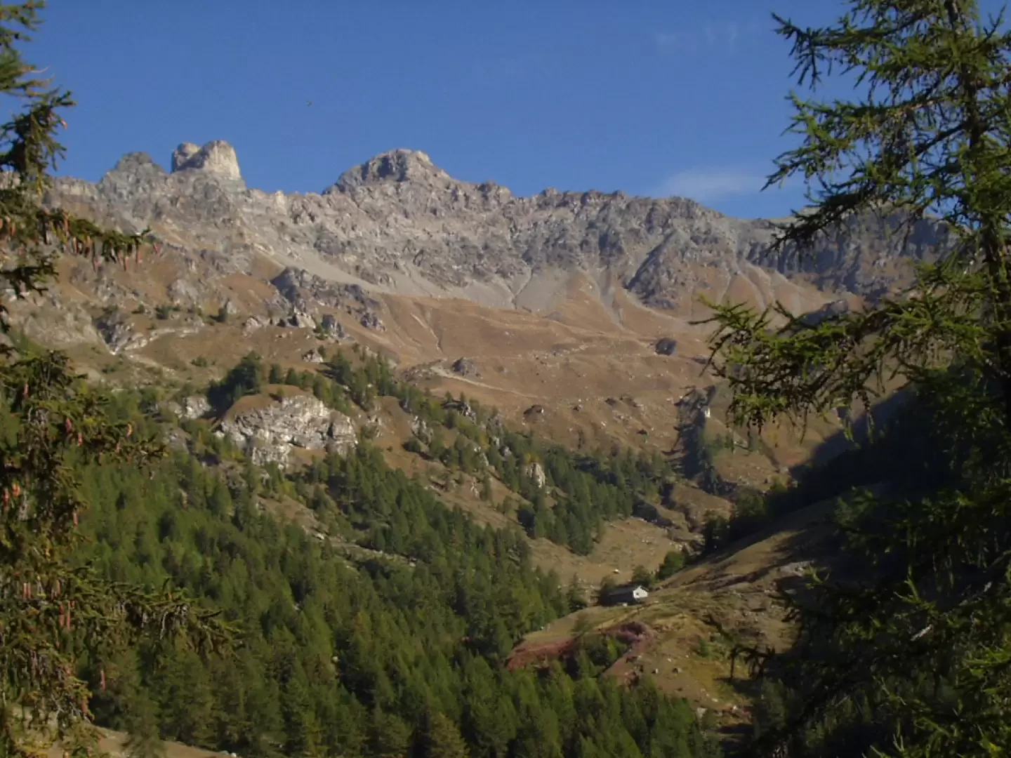
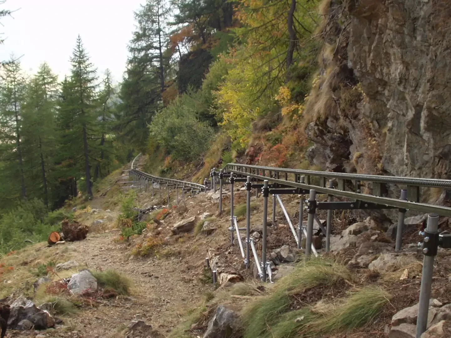
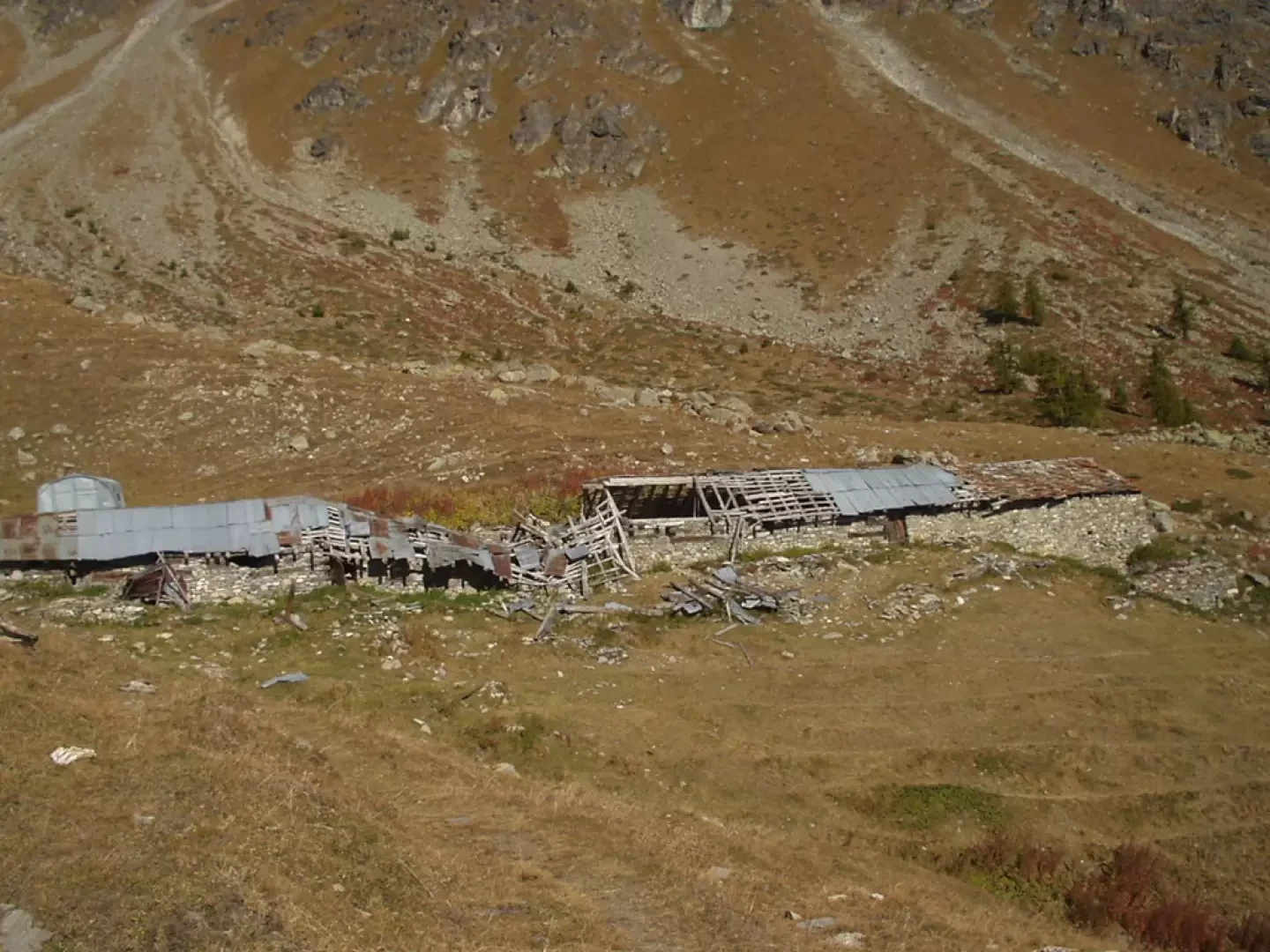
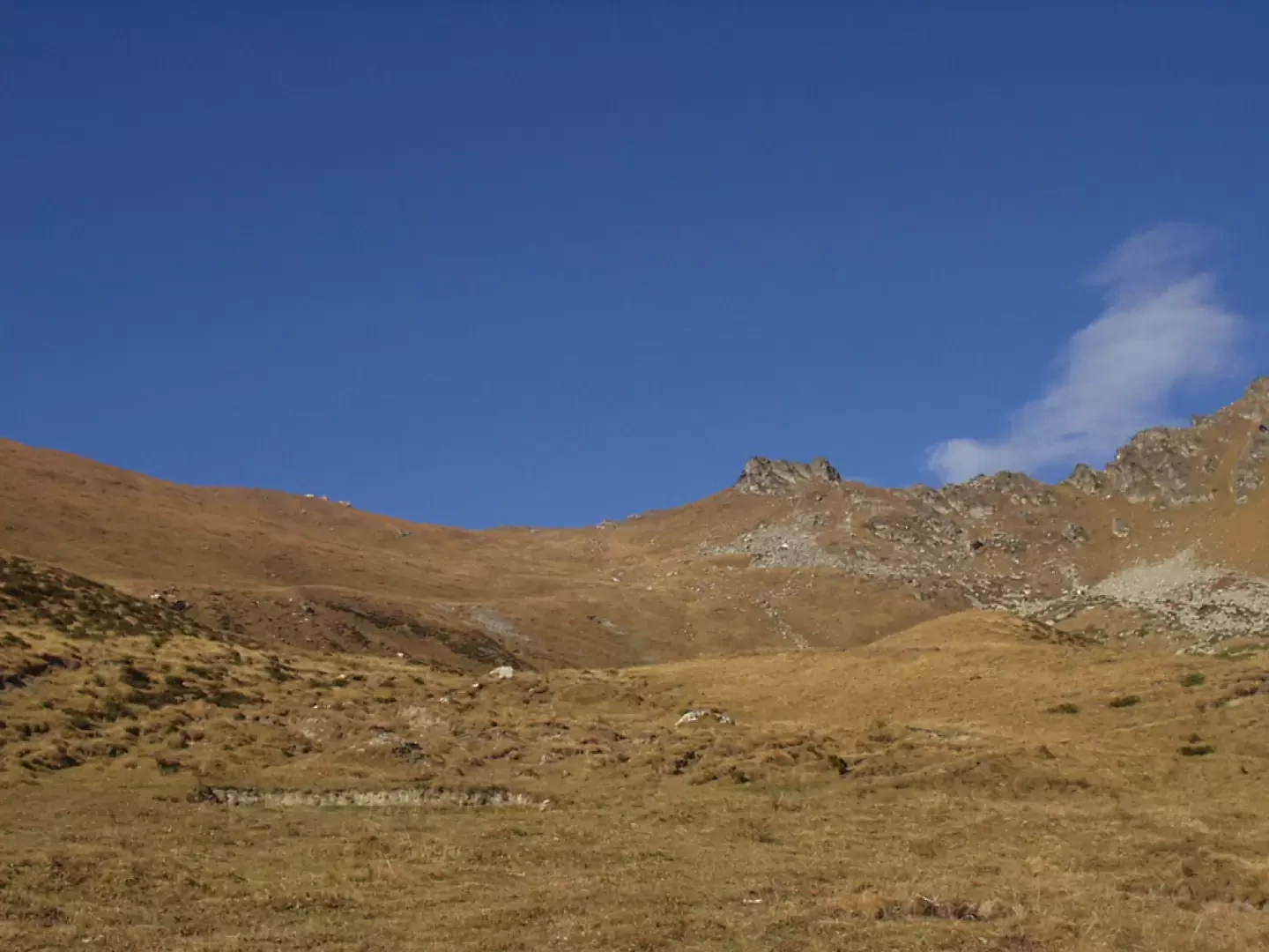
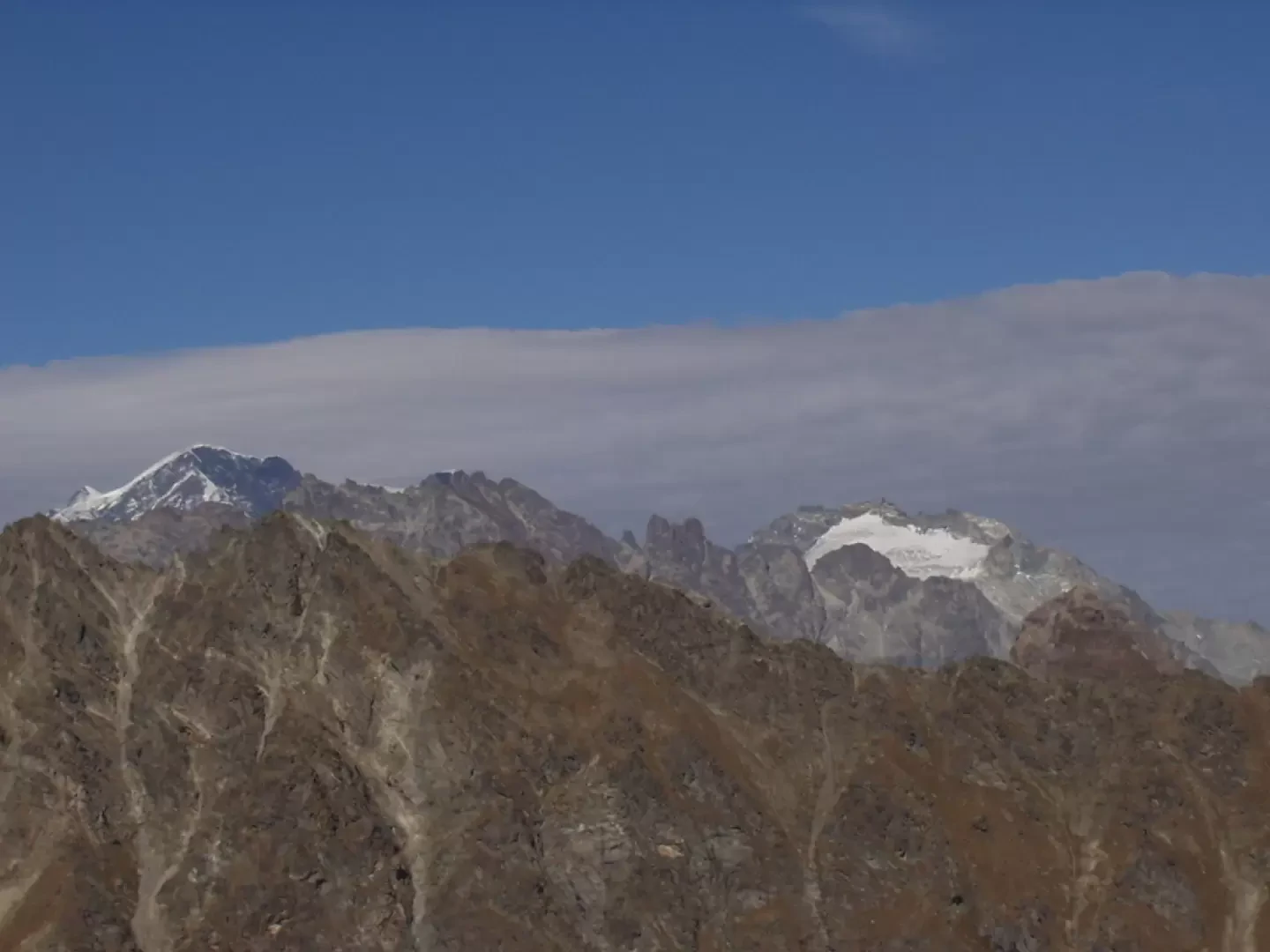
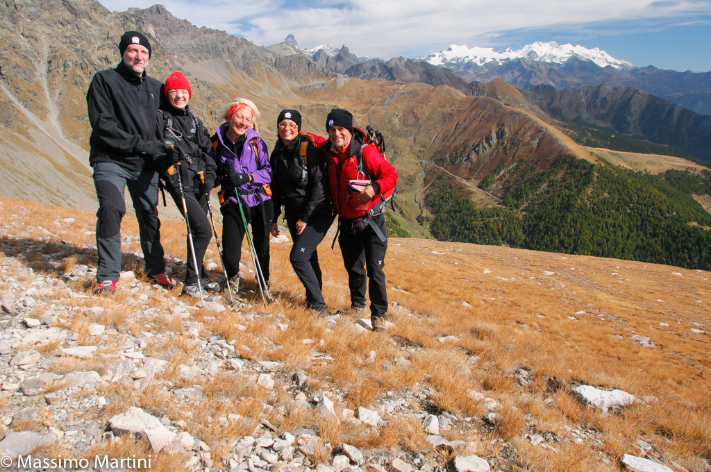
From the hamlet of Clemenceau, proceed by car on a paved road for about one kilometre to where the road crosses the Chaleby stream. Park in the small clearing on the right (if the clearing is already occupied, it is better to return to the hamlet of Clemenceau, park in the square and go up the path, marker 105, which, passing by the astronomical observatory, leads to the wide mule track that goes up to the left and which then crosses the itinerary of this description). The dirt track, after a five-minute walk, ends near an aqueduct outlet. Cross, on traces, the Chaleby stream and ascend along the orographic left by means of a second mule track that, above, intersects the dirt track coming from Lignan and Clemenceau. Shortly afterwards, pass by a second aqueduct outlet and cross the Chaleby stream again on the left (the mule track on the right from the bridge is blind). A few minutes later you cross a new dirt track that you climb up on the right. There is now a beautiful view to the north over the Chaleby and Champanement pastures. The road forks again. Take the dirt track on the left and follow it for a few minutes until you cross, on the right, the markings for trail marker 105. The path now climbs steeply up some wooden steps. Immediately afterwards, a service monorail is clearly visible on the left, running alongside the path. It can happen, on weekdays but not only, to be accompanied, unfortunately, by the dull sound, transmitted by the track and sleepers, of the movement of the motorised wagon. We cross a stream, climb in twists and turns through a sparse forest until we reach a grassy strip of pastureland. Now the track, marker 105 and (8), is less visible and it is necessary to help oneself by looking for the yellow markings often painted on stones and boulders. When you reach a grassy spur, the trail bends to the left and, on a slight incline, reaches the ruins of Alpe Léché (2298m), located at the foot of the southern opinion of Mont Faroma. The trail bends to the left and then merges among countless little paths that all go up the stream at the same time. Higher up, the trail becomes single again, passing by characteristic rounded boulders and climbing up to Colle Léché (2588m). From the pass, to the north-east, the Monte Rosa massif is clearly visible, while to the west, the Col de Saint-Barthélemy can be seen. To the south, a beautiful little path starts out on a wide grassy ridge that soon leads to the summit of the Gran Pays (2726m). From the summit, to the south, you can see the Becca d'Avuille and much of the upper Aosta Valley, to the north-east the Matterhorn and the Monte Rosa massif and to the north-west the Gran Combin. The descent is along the ascent route.


Comments (0)
Sign in to leave a comment