Lasciare l'autostrada al casello di Pont-Saint-Martin, svoltare a destra dopo 100m e alla prima rotonda prendere la seconda uscita. Proseguire fino alla seconda rotonda e prendere la terza uscita per entrare nel centro abitato di Pont-Saint-Martin. Dopo alcune centinaia di metri, svoltare a destra e imboccare la (1,2km) in direzione della Valle del Lys. Percorrere la strada regionale per 10,2km (11,4km) e attraversare i centri abitati di Lillianes e Fontainemore. Circa 1km dopo il centro di Fontainemore, svoltare a destra e seguire le indicazioni per Pian Coumarial. Attraversare il ponte sul torrente Lys e imboccare la strada comunale in salita. Proseguire per 7,5km (18,9km) e oltrepassare le località di Colombit, Pacoulla, Pianpervero, Jugeo, Chouchal, Pra Dou Sas, Cios, Challasc, Colla, Grange, Savaroy, Goy e infine Coumarial.
Parcheggio
Al termine della strada si trova un parcheggio 🅿️ gratuito in prossimità dell'area picnic, dove è disponibile un fontanile 💧 per il carico dell'acqua, poiché lungo il percorso non sono presenti altri punti di approvvigionamento.
Accesso con mezzi pubblici
Per raggiungere il punto di partenza dell'itinerario è necessario un mezzo privato, poiché Coumarial non è servita da trasporti pubblici. Nel periodo estivo è attivo un servizio di navetta che collega Coumarial al lago Vargno.
Le indicazioni fornite sono state verificate alla data del rilievo dell'itinerario. Prima della partenza si consiglia di verificare possibili variazioni del percorso o delle condizioni stradali. Per informazioni aggiornate si raccomanda di consultare Google Maps o Apple Maps.
Introduction
Description
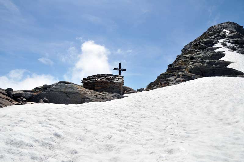
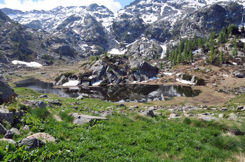
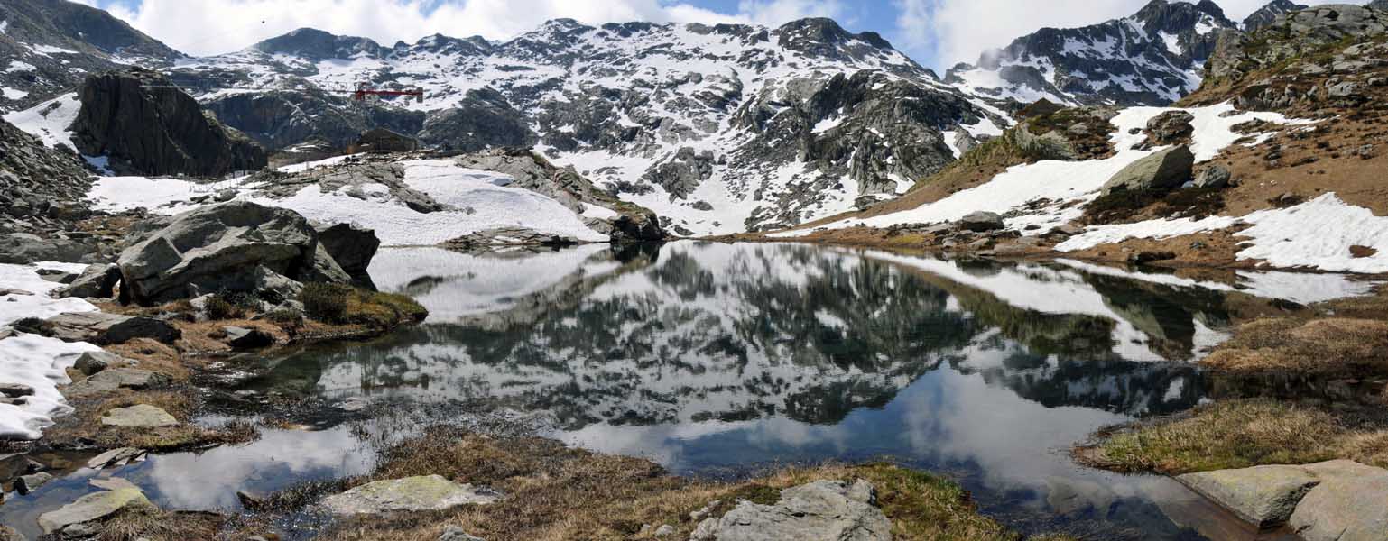
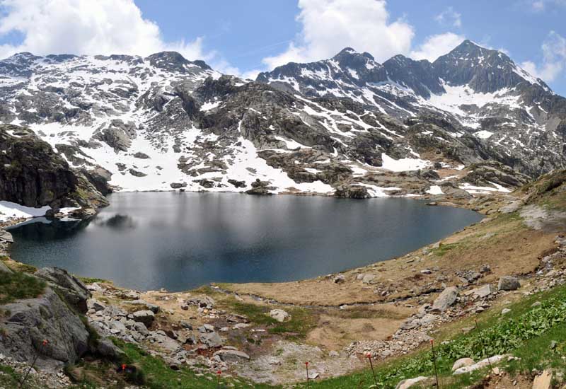
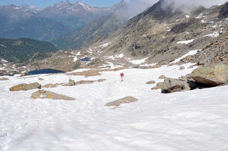
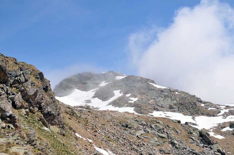
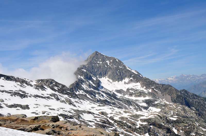
After a kilometre's walk, you will come to a signpost indicating the turnoff for Pian Coumarial, signpost (2E) (1410m, 0h20'). Disregard the track to the right and continue straight on until reaching a second fork: go straight on, disregarding the little road that descends to the left. A few minutes' walk and you come to a small votive shrine; from here the road begins to climb with greater intensity. After a straight stretch of ascent, the road takes a few hairpin bends that allow you to gain a hundred metres in height, at the end of which the road reduces its gradient and soon reaches the vicinity of the stream. Cross the stream at an artificial ford and start climbing again with a couple of hairpin bends that lead to the junction for Col Marmontana, marker (2A) (1664m, 1h20'). Neglecting the path, continue along the little road until you reach the first of the Vargno cottages and, shortly afterwards, the Alta Via 1 and the path to Balma di Oropa (1,700m, 1h25'): turn left and take the mule track that crosses the scattered cottages of Vargno. Climb up the lovely mule track until you reach the last cottages, then walk along the lovely paved section that approaches a scree slope: from the top you can appreciate interesting views of Lake Vargno below. You cross two strips of scree and up to a grassy stretch again; take a few hairpin bends and you will reach Lé Lounc (1942m, 2h00'). Leave the houses of Lé Lounc and immediately come to the junction for Col Chardoun, marker (2B) (1932m, 2h05'): ignore the path to the right that descends towards the upper lake of Lé Lounc and continue on the trail until reaching, after a short descent, the first of the Barma lakes. Start climbing again, passing near the future refuge of the Laghi della Barma lakes and entering, still on the mule track, a wide gully at the edge of a knoll. Having climbed up the gully, the trail proceeds for a short stretch that is almost flat and then begins to climb again in the presence of the broad peak of Balma di Oropa. The path, paved in places, climbs up the ridge towards the wide final saddle. The itinerary proceeds over flat rocks in some sections, always well signposted by yellow markers and cairns, until it reaches the wide Col da Barma saddle (2256m, 3h00'). At the pass there is a small chapel topped by a metal cross dated 1963. The descent follows the same route as the ascent.
Escursione con scopo di salire il mont Rous ma alcuni traversi esposti su neve dura (inaspettata) dopo la prima anticima quota 2325 m ci hanno fatto desistere. Come detto ancora tanta neve per la quota bassa, e rispetto anche al resto della Valle, a partire dal rifugio in costruzione a 2050 m ca.
Bellissimo l'ambiente ed il sentiero (un po' monotona come al solito la poderale alla partenza).
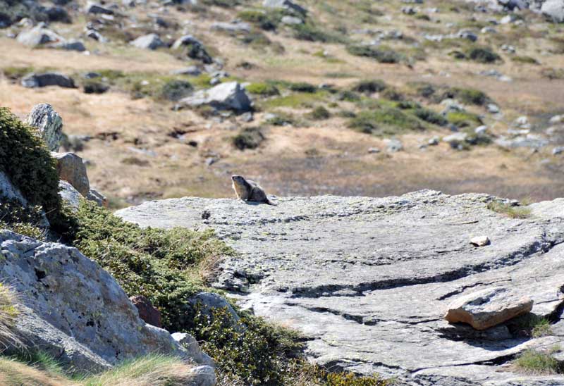
Avvistamenti faunistici: Marmota marmota, Rupicapra rupicapraEscursione con scopo di salire il mont Rous ma alcuni traversi esposti su neve dura (inaspettata) dopo la prima anticima quota 2325 m ci hanno fatto desistere. Come detto ancora tanta neve per la quota bassa, e rispetto anche al resto della Valle, a partire dal rifugio in costruzione a 2050 m ca.
Bellissimo l'ambiente ed il sentiero (un po' monotona come al solito la poderale alla partenza).
Avvistamenti faunistici: Marmota marmota, Rupicapra rupicapra


Comments (0)
Sign in to leave a comment