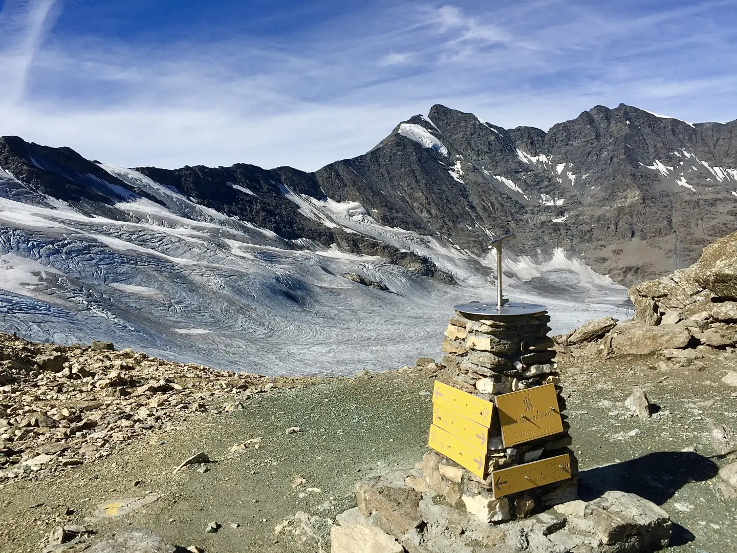
Col Bassac Déré, from the Surrier car park

Access
From the motorway barrier at Aosta-West, keep left and follow the signs for Aosta - Saint-Pierre. After one kilometre, at the roundabout, take the second exit to join the national road . Continue on the state road for 4.3 kilometres, passing the village of Saint-Pierre until you reach a new roundabout with the Gran Paradiso National Park sign. Take the first exit and continue on the state road for 4.2 km until reaching Arvier and its roundabout dedicated to cyclist Maurice Garin. Take the second exit and continue on Via Corrrado Gex until you reach the village of Leverogne, one kilometre further on, where, at the fork, keep left and take the regional road . Go up the regional road for 15.8 kilometres, passing the main town of Valgrisenche and reaching the village of Bonne: from here, proceed on the narrow communal road for another 5.9 kilometres, going up the valley on the orographic left until reaching, after a short descent, the free car park 🅿️ di Surrier where you can leave your car.
Distance and travel time
🕒Travel time: 43 minutes
📏 Distance: 32.1 km
GPS navigation
📍 How to get there with Google Maps
📍 How to get there with Apple Maps
ℹ️ Important note
The directions provided have been verified as of the date of the survey of the route. Before departure, it is advisable to check for any changes to the route. For up-to-date and detailed directions, we recommend the use of Google Maps or Apple Maps.
Introduction
The Col Bassac Déré (3,082m) links Valgrisenche with Val di Rhêmes, forming a pass used for transits between the two sides. The hike starts in Surrier, climbs the valley to the Mario Bezzi hut (2,284m) and continues along a path and glacial tracks to the pass, crossing high altitude pastures, moraines and the Gliairetta glacier. The itinerary is demanding in terms of development, altitude difference and the presence of residual snow, even in late season; it requires sure-footedness on scree terrain and orientation skills in a glacial environment.
Description
0h00' 0.00km From the car park in Surrier, descend a short distance along the tarmac road until you reach the signposts indicating the routes in the area.
0h02' 0.10km Take the dirt road on the right, passing near the Il Chiosco refreshment stall, renowned for its excellent bar service. Continue uphill along the same road until you reach a fork in the road.
0h15' 0.68km Continue straight on, ignoring the track to the left that leads to the Chalet de l'Épée hut. After a short climb, you reach the Tsalé esplanade (1,931m). From here, after an almost level stretch, cross the stream of the same name on a small wooden bridge; near the ruins of Saxe de Savoie (2,036m), cross a second stream via a wooden footbridge, then leave the track to take the path. Continue towards the narrow, where a snowfield may be encountered at the beginning of the season; approach the Doire de Valgrisenche and start climbing a grassy slope dotted with boulders. Reaching the arrival station of the cableway used for supplies at the hut, we cross the Vaudet plateau, where we come across a pretty little lake; a little further on we arrive at the Mario Bezzi hut (2.284m), built on the edge of the Vaudet alpine pastures.
2h00' 5.64km Just beyond the hut is a crossroads, where a new signpost is located. Continue straight on, following the signs for Col Bassac Déré, along the path that crosses a beautiful alpine meadow. The track, narrow but well marked, climbs gently up the hillside between pastureland and scree, keeping below rock jumps. At around 2,700m, patches of snow appear at the beginning of the season; the route is marked by cairns and tracks. After passing a scree gully and a band of broken rocks, a grassy shelf is reached. From here, cross the moraines of the Bassac Déré glacier until reaching the edge of the Gliairetta glacier. It then traverses to the left, skirting the ridge and the west face of the Punta Bassac Sud, always slightly uphill. A last slope, steeper and partly snowy, leads to Col Bassac Déré (3,082m) 4h30' 10.98km , from where there is a wide panorama of the opposite slope and the surrounding peaks, from Mont Blanc to the Grandes Sassière.
The return follows the same route as the outward journey, retracing the path until returning to the starting point at the Surrier 3h00' 10.98km (32D+) car park.