Leave the motorway and, after 450m, leave the motorway junction, turning right onto the regional road for the Cogne valley. After 400m at the roundabout, take the second exit onto the state road to be followed for 32.4 kilometres, passing through and skirting the villages of Saint-Pierre, Villeneuve, Arvier, Avise, Derby, La Salle, Morgex and Courmayeur until reaching the exit for Larzey - Entrèves. Turn right and take the communal road for 12.5 kilometres, passing La Palud, Planpincieux and Lavachey before reaching the end of the road near Arp Nouva: cross the Dora di Ferret on a small wooden bridge before reaching the car park 🅿️ at the end of the wooded scrub.
Please note that access is regulated during the summer period: normally in July and August access is permitted before 8.00 am until the available car parks are full. After this time, a shuttle service is available from La Palud. For any additional information, please consult the special section of the Courmayeur municipality website.
[0h57'] - [45.8km] How to get there with GMaps How to get there with Apple Maps
The directions given here have been verified as of the date of the route survey. Before setting off, it is advisable to ensure that no substantial changes have occurred on the route to the starting point. We therefore recommend the use of the satellite navigation apps provided by Google or Apple for up-to-date and detailed directions.
Introduction
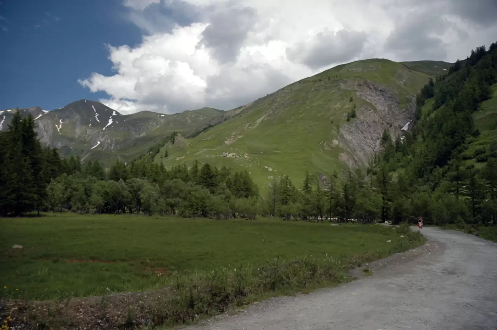
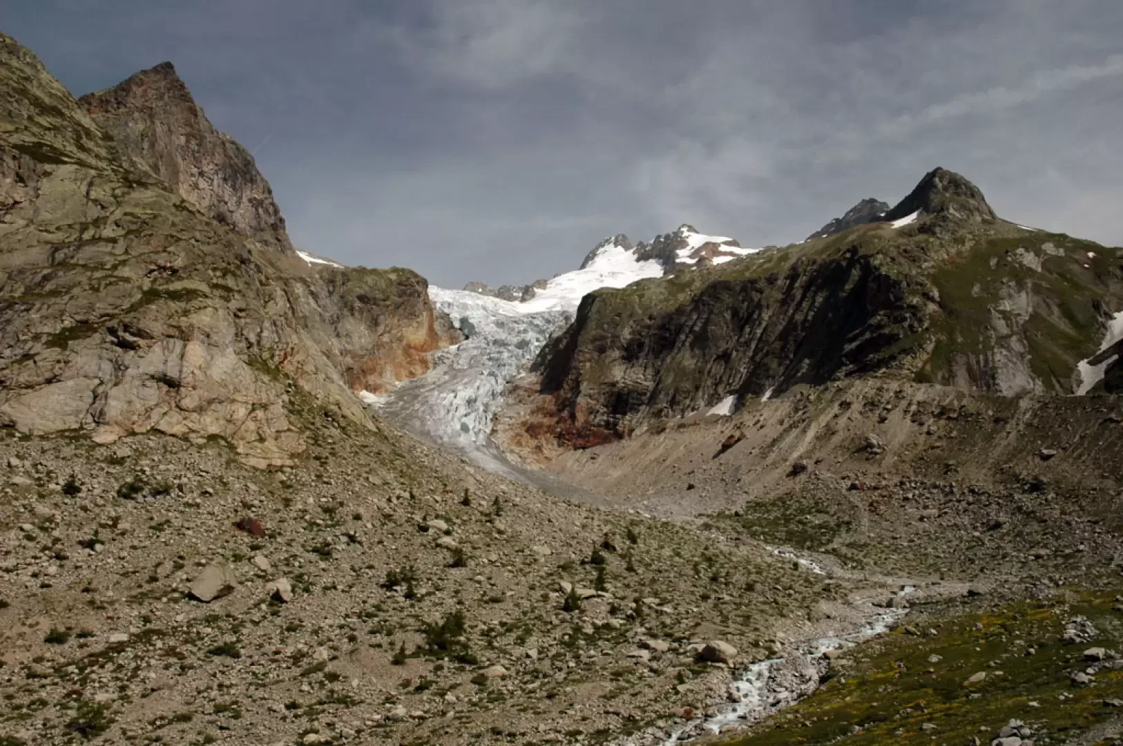
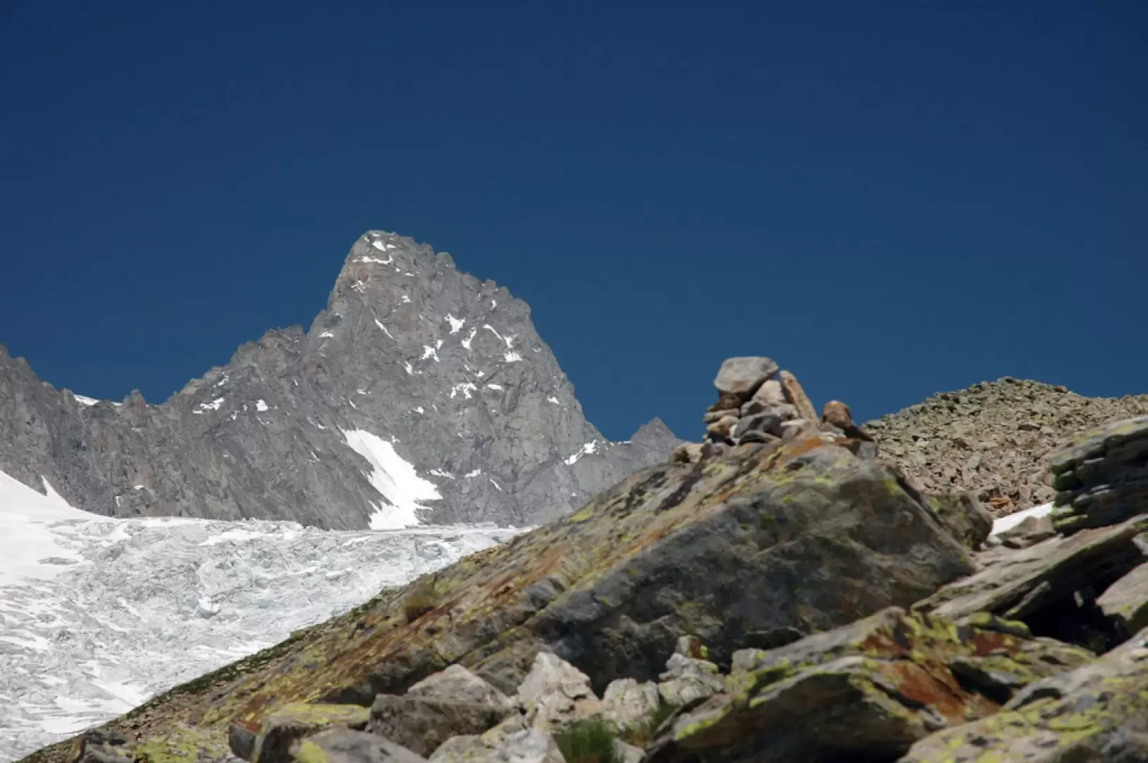
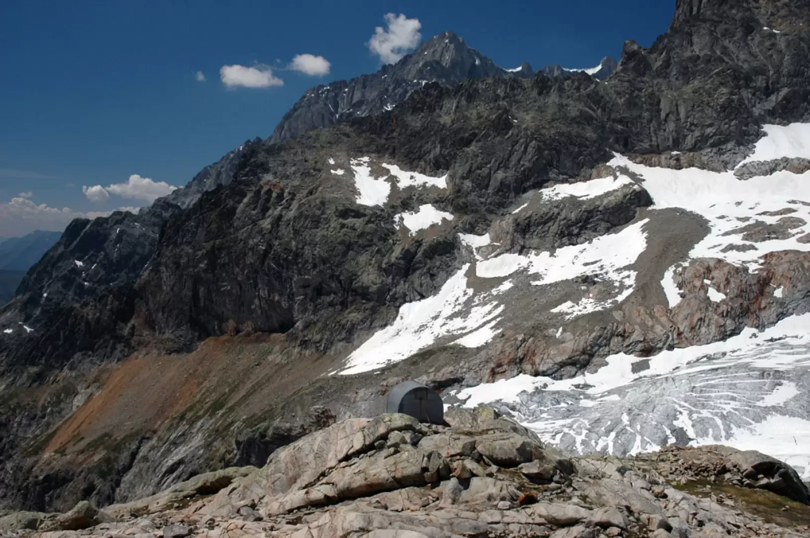
Located at the foot of Mont Dolent and on the edge of the Pré de Bard glacier, the two bivouacs are an attractive destination for hikers. The steep ascent to Col du Petit Ferret is the toughest part of the route, which is well rewarded by the splendid views of Val Ferret and the north-eastern side of the Mont Blanc range.
Description
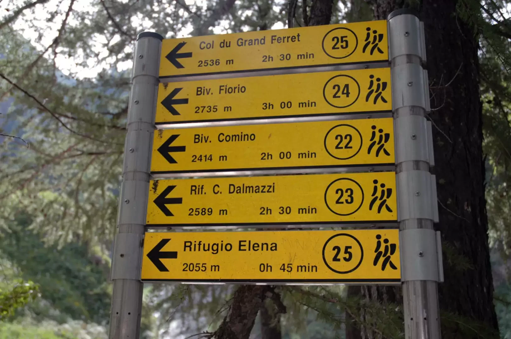
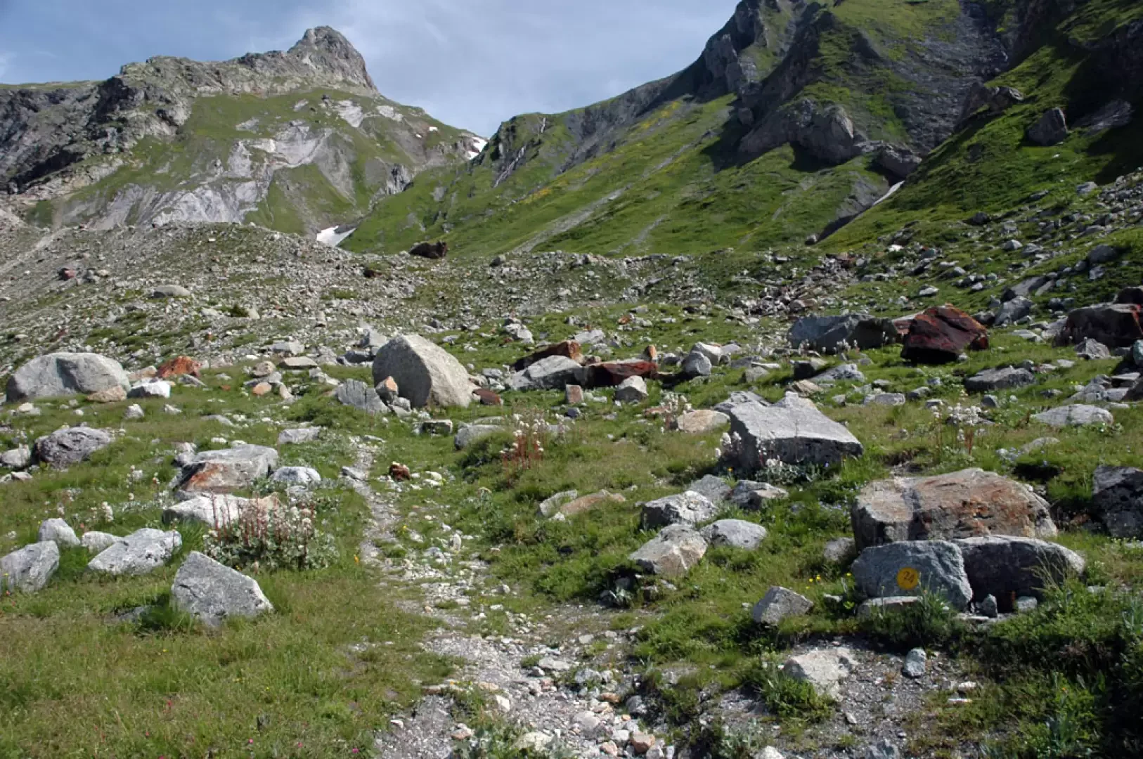
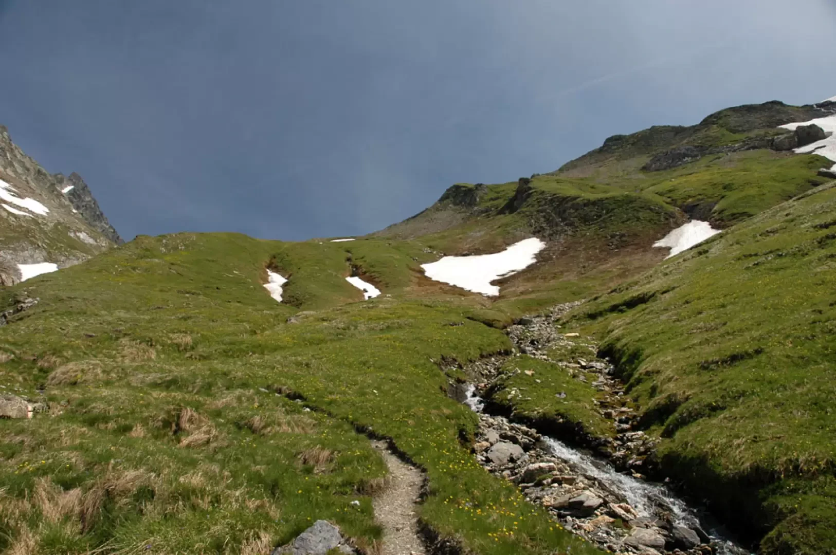
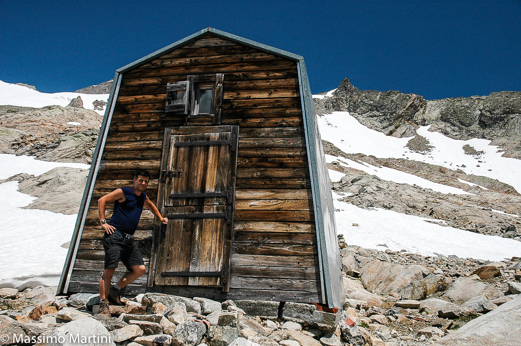
Park at Arnouva (1769m) just before the Val Ferret shuttle bus terminus (if the Val Ferret road is closed to traffic, you can get to Arnouva by shuttle bus). Leave the car and immediately cross a small wooden bridge over the stream coming from the Vallon de Bellecombe. Proceed along a practically level farm road. After a few minutes, you will come across a signpost indicating the direction to take. Proceed for a short stretch on the level until you reach the junction for the Bivacco Comino (1785m, 0h10'): ignore the path and continue along the road as it begins to climb.
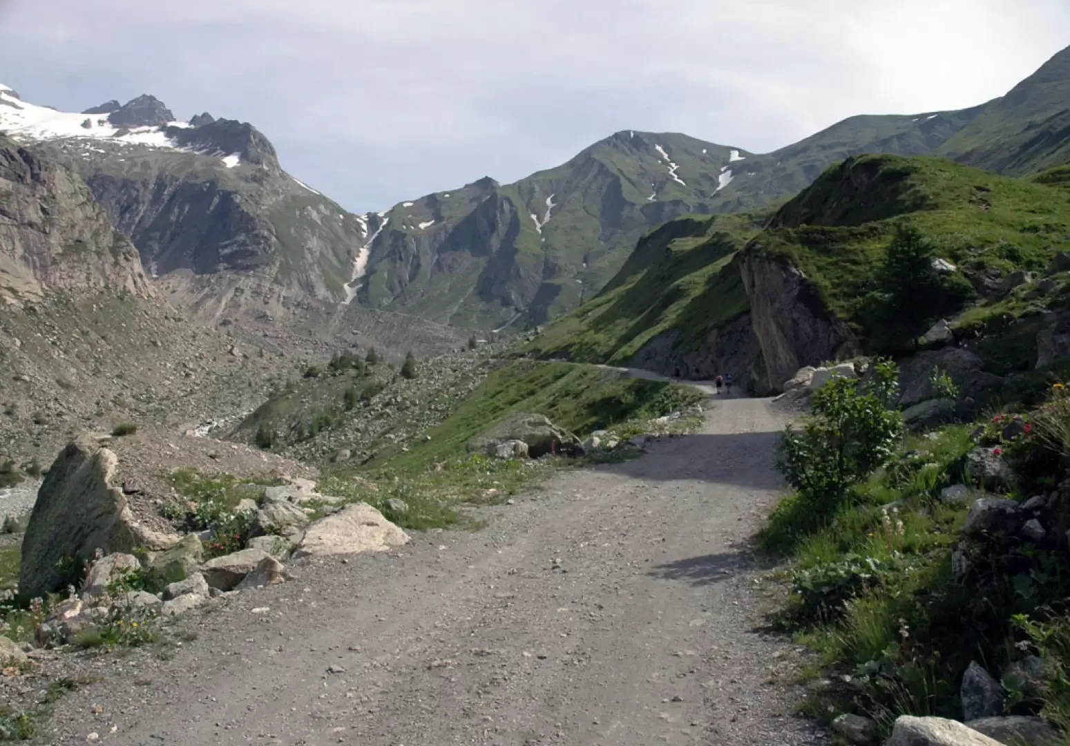
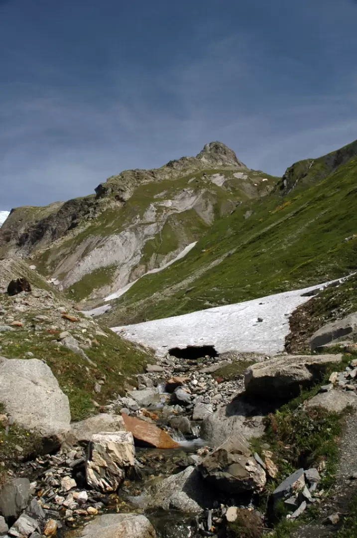
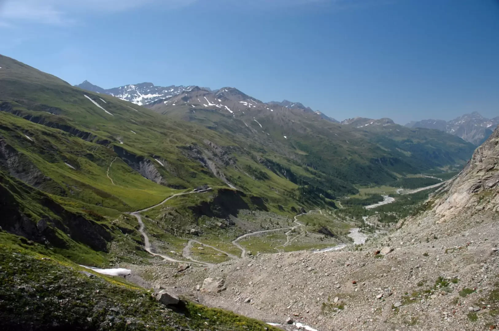
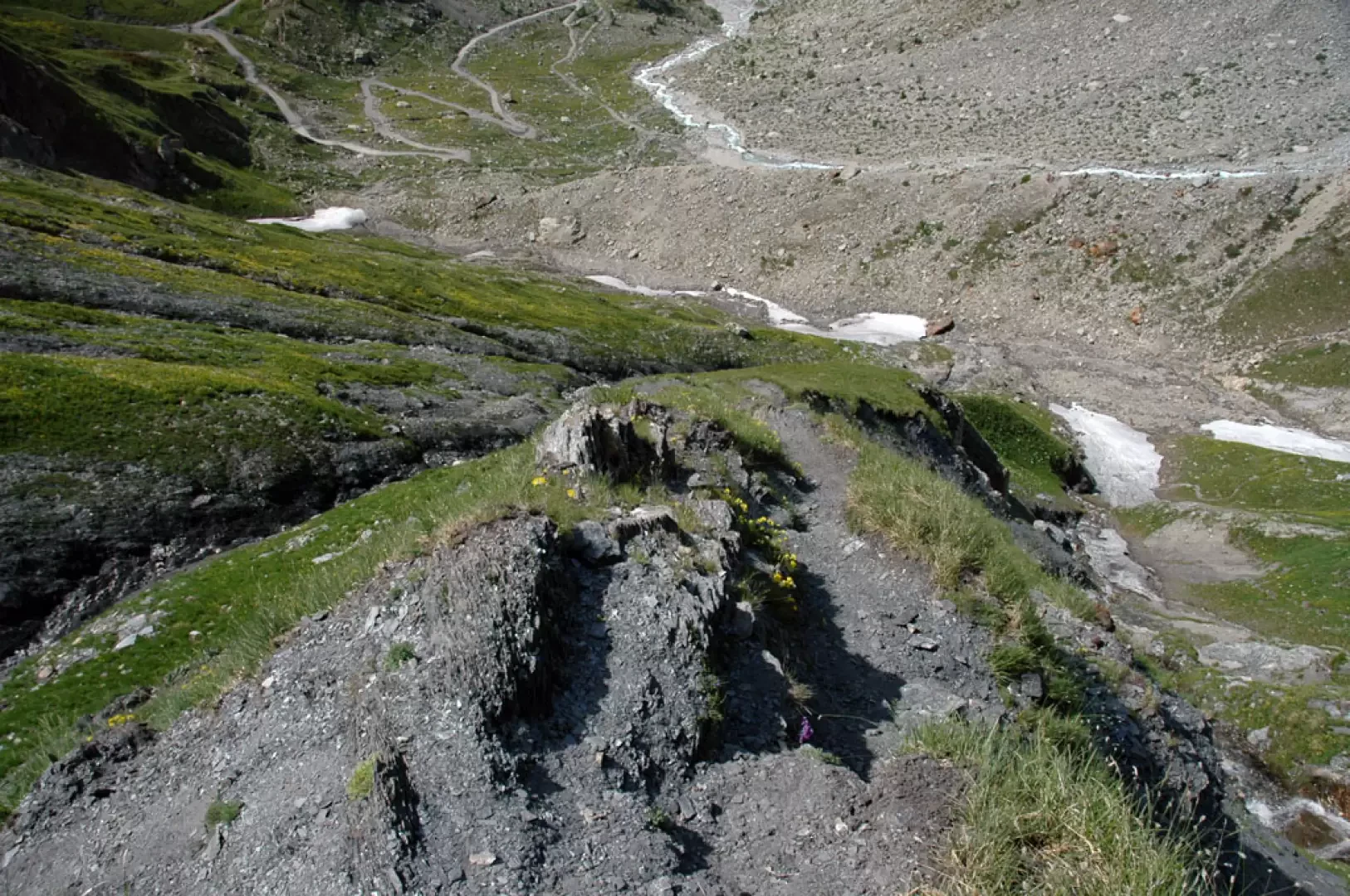
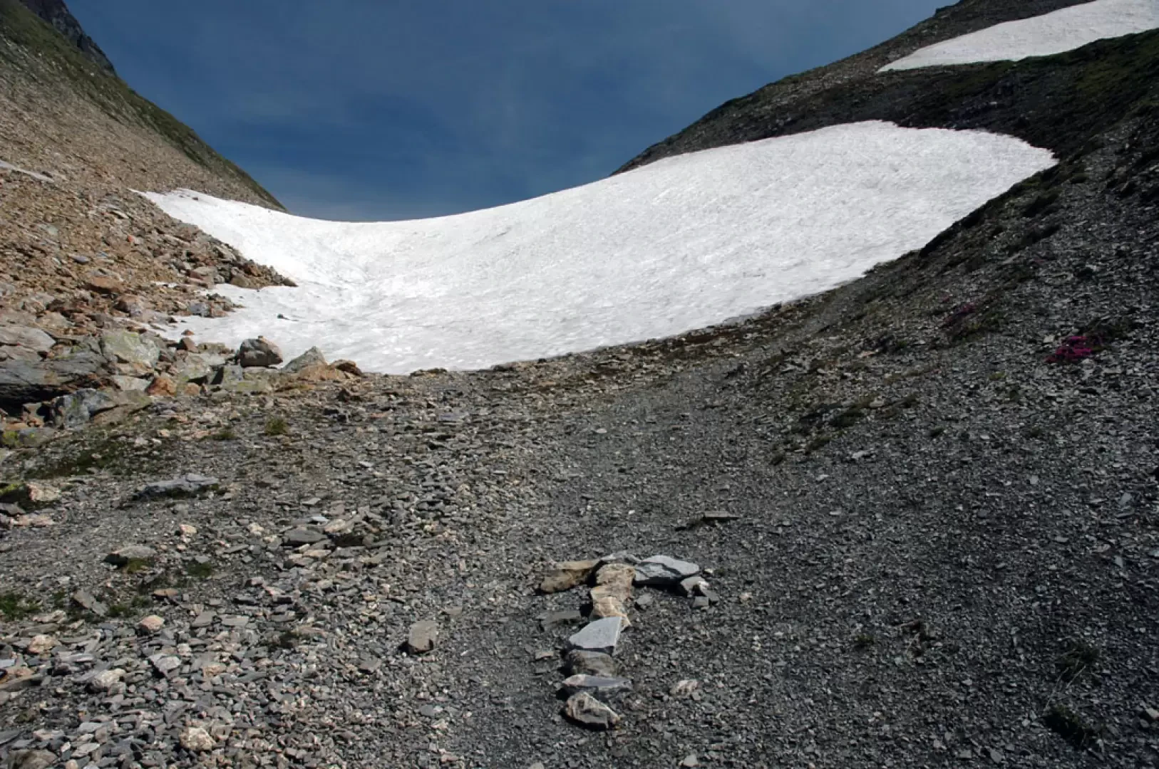
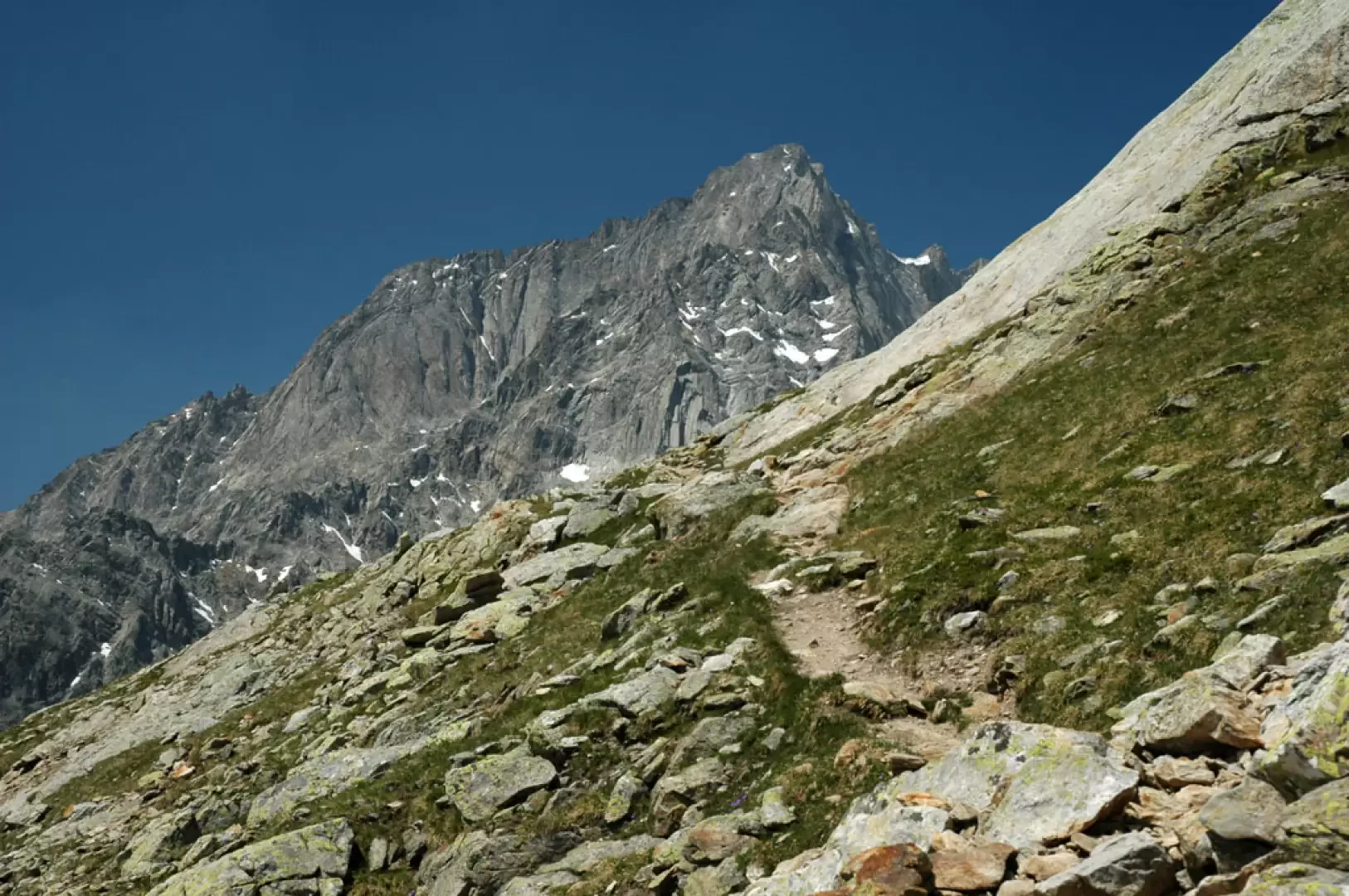
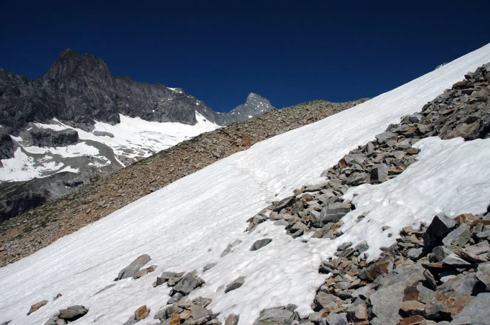
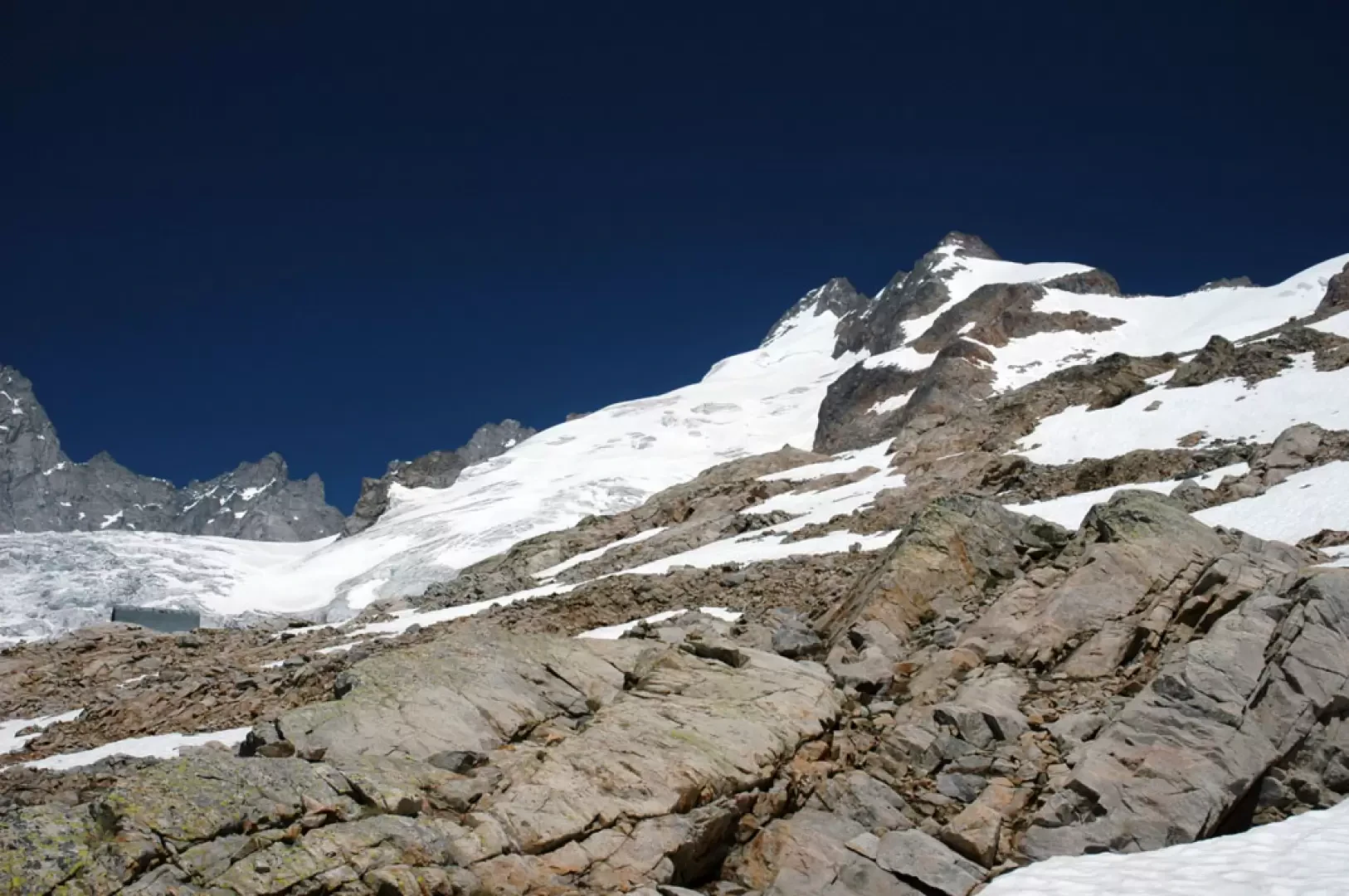
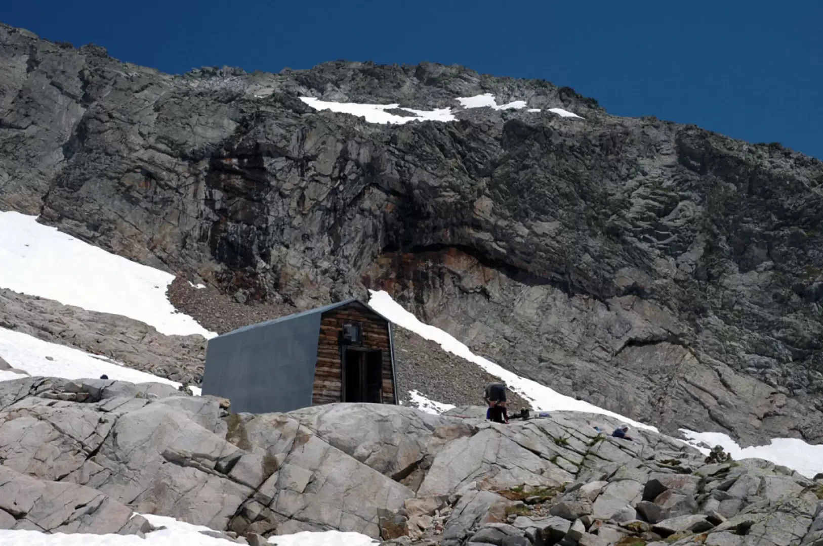
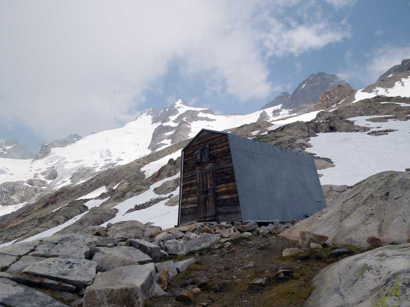
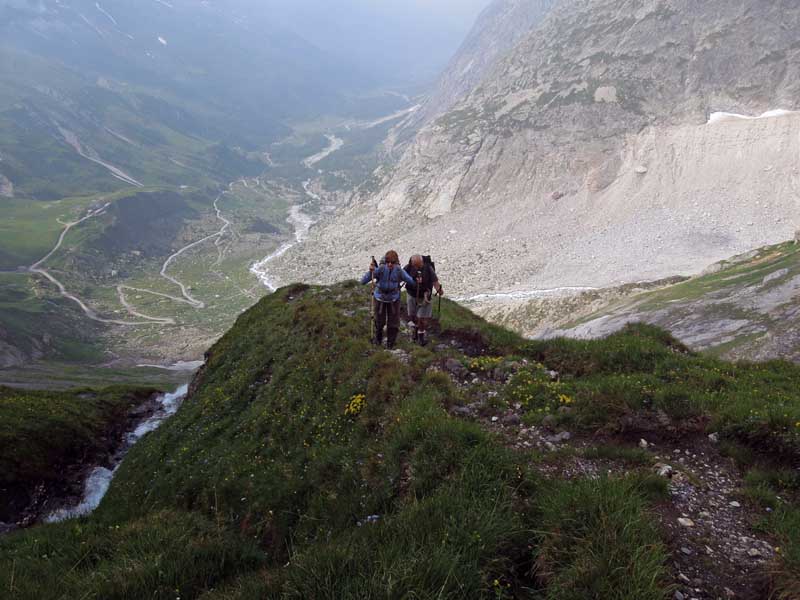
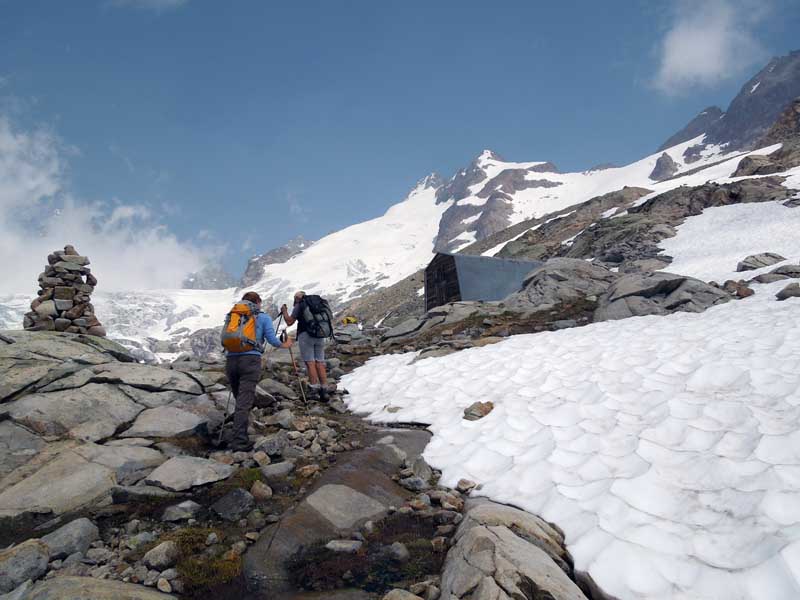
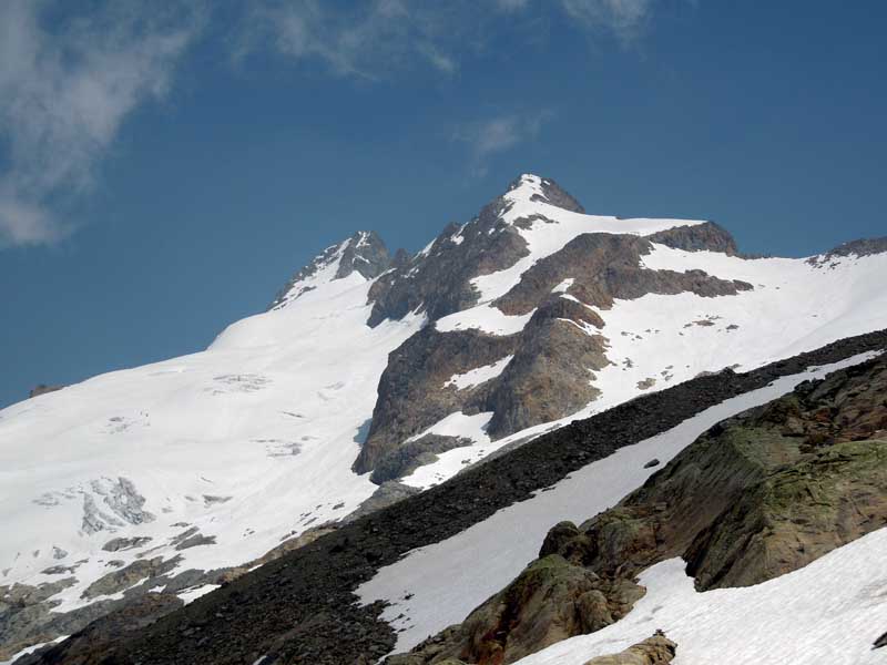
Slowly a splendid view opens up over the Triolet glacier. You briefly skirt a branch of the Doire de Ferret until, at a hairpin bend, you reach the start of the path to the Dalmazzi hut (1857m, 0h15'). With a couple of hairpin bends, the trail gains altitude slightly, continuing halfway up the slope, passing under a sloping rock. There are hairpin bends and semi-straight stretches until you reach the last turning, to the right, before the hut: after a few metres you will notice a yellow mark on a stone, this is the start of the path to the bivouacs (2038m, 0h40'). Take a left onto a nice path that proceeds in the direction of the morainic ridge that descends from the Pré de Bard glacier. After a few minutes, turn left, marching parallel to the aforementioned ridge: at this point, it is possible to encounter some snowfields at the beginning of the season. After a short, slightly uphill stretch, turn right to begin a long, steep climb. The path climbs up a small grassy ridge sandwiched between two small depressions in which steep streams flow. With rapid turns, you gain height and begin to skirt a small waterfall until you cross it (2300m, 1h35'). From here, the trail proceeds with less intensity, heading in the direction of the Col du Petit Ferret depression. One more small climb and you reach the col depression: cross a few snowfields (early in the season) and, just below the col, turn left (2445m, 1h50'). The col is just above and is not touched by our itinerary. We continue for a short distance in the direction of Val Ferret, then the path begins to climb towards the final section of the ridge descending from Punta Allobrogia. In a few minutes, you enter the splendid glacial cirque of Pré de Bard. The environment now becomes harsh and pre-glacial; the path, marked with yellow bolts and cairns, now crosses large scree slopes and some snowfields, while the Aiguille de Triolet and Mont Dolent stand out majestically before us. By now the goal is near, one last effort and we finally reach the two Cesare Fiorio bivouacs (2735m, 2h30'). The return is along the same route as the outward journey.
📎 Don't be frightened by the steep section: just keep a steady pace, without forcing, and this difficulty is also solved.
📎 At the beginning of the summer season there are still some snowfields along the path: crossing them is not difficult but you still need to pay due attention; the use of poles is recommended in order to have more stability when crossing them.
Gita effettuata con Stefania e l'amico Vittorio con l'intento di monitorare la zona Dolent. Qualche innocuo nevaio residuo per arrivare al bivacco; visto tracce presenti sulla normale al Dolent. Rientrati compiendo il giro dei colli Petit e Grand Ferret.
Avvistamenti faunistici: Capra ibex
La giornata presentava una particolare luminosità, fin dalla partenza ad Arnouva. Superato il tratto di poderale che conduce al Rifugio Elena mi sono infilato nel sentiero 24 che, dopo l'attraversamento di un nevaio (ancora corposo a fine giugno) si inerpica ripido sul versante con una serie di svolte delimitate da colatoi detritici. Poco prima del colle il sentiero si addolcisce leggermente sino ad arrivare nell'ampia insellatura del valico ancora ricoperta dai nevai. Ho trascurato il bivio per i Bivacchi Fiorio ed ho proseguito sino al colle tenendomi sulla destra, al margine del nevaio. Il panorama è molto interessante: il massiccio del Bianco visto da inconsueta prospettiva! Salita finale ai bivacchi sotto lo sguardo vigile degli stambecchi.


Comments (0)
Sign in to leave a comment