Ferrata Béthaz-Bovard, from Vieux Quartier


Edited by:
Massimo Martini
Updated at: 30/11/2024
Introduction
Surrounding the village of Valgrisenche is an imposing rocky bastion: the Becca de l'Aouille. The impervious rock is traversed by a ferrata equipped in the early 1990s by the Guides of Valgrisenche. The climb is not easy, there are vertical sections combined with some somewhat physical passages, but along the ascent the views of the Valgrisenche mountains are truly spectacular.
Description
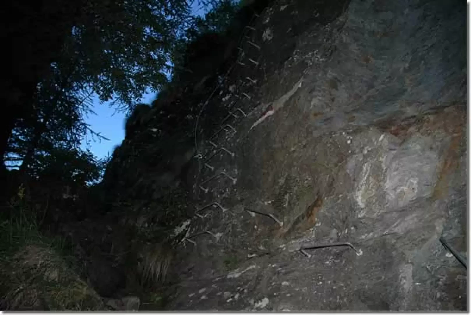
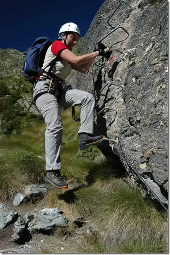
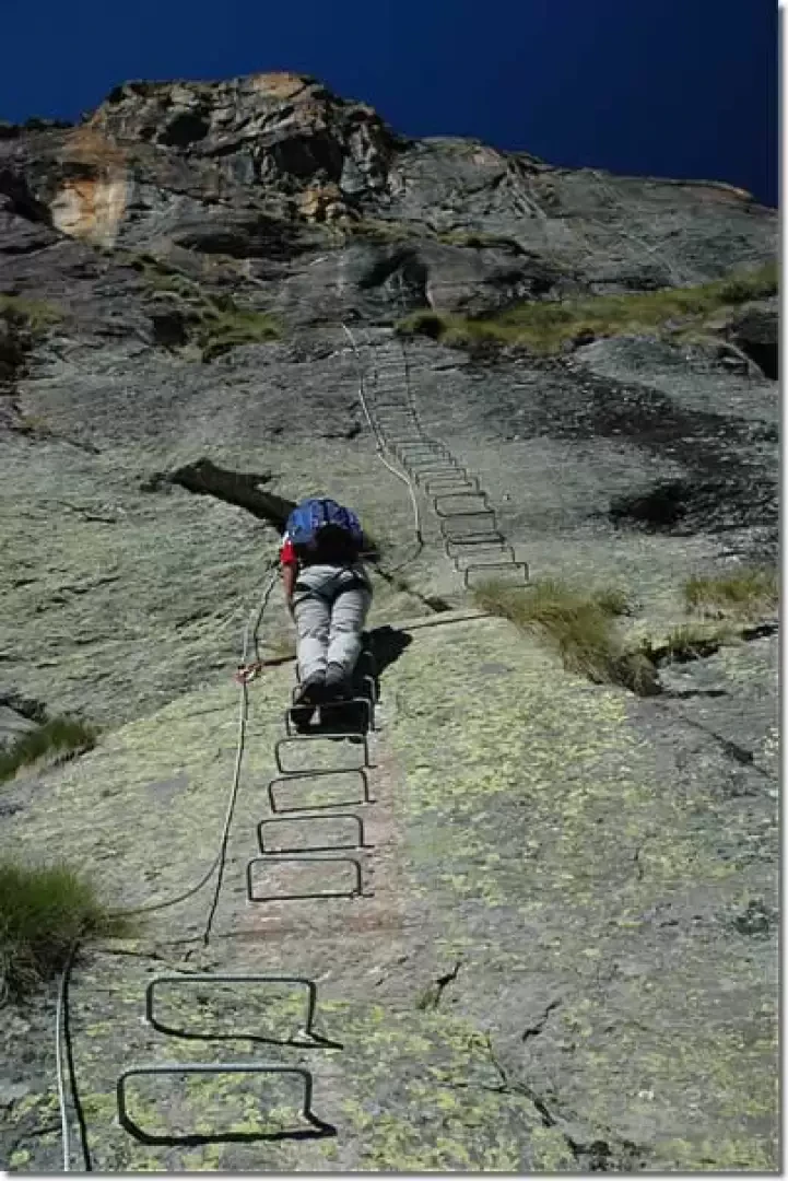
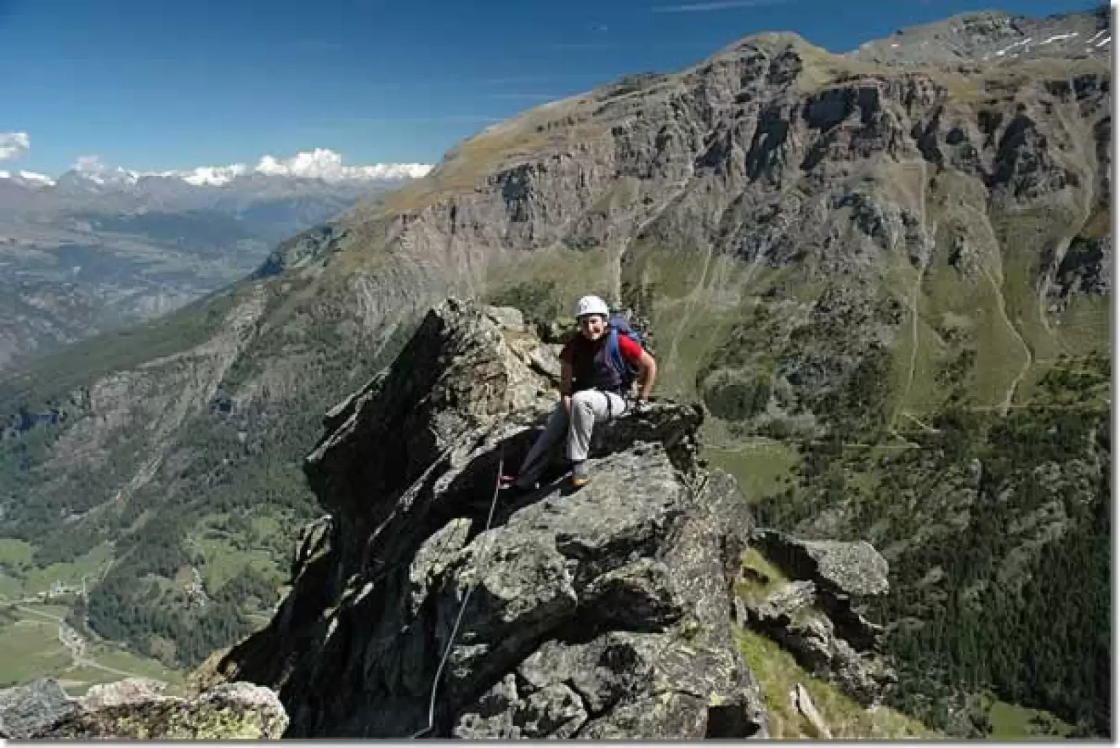
From the hostel, one continues following the signs for the fontina warehouse: having reached the warehouse, one encounters, shortly afterwards, a panel displaying all the information about the ferrata. After becoming acquainted with the existence of 1850 steps, we harness up and begin the route in a rather narrow corner. The first section of the ferrata has an altitude difference of around 250m. One immediately overcomes a short, slightly physical climb, after which the ascent proceeds quietly, quite vertical but not too steeply. After a long 'straight' section, you reach an overhanging roof, which you go round to the left. Continue with a few fairly athletic climbs, while slowly a splendid panoramic view opens up over the terminal part of Valgrisenche and the Beauregard lake below. and you finally reach the first exit point (1930m, 1h30'): if you have enough time, you can reach the starting point by following the path (17) that leads to Valgrisenche.
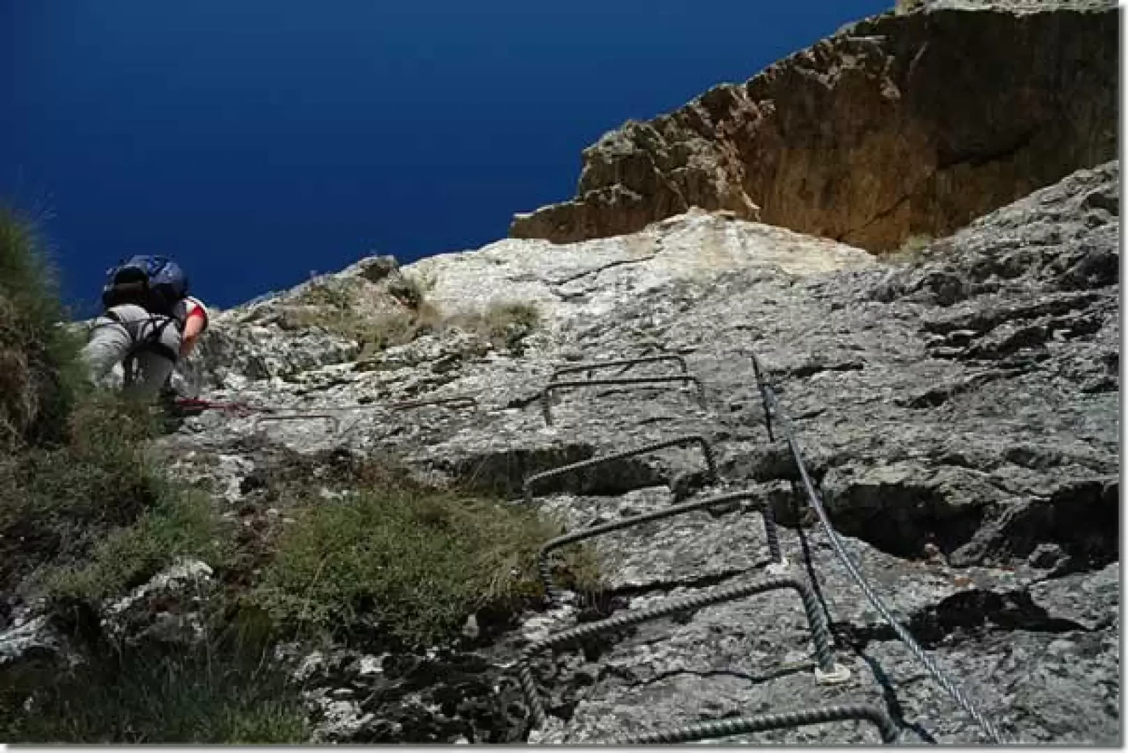
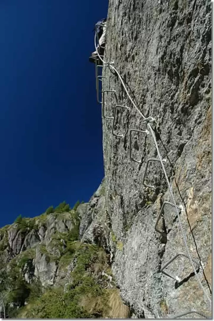
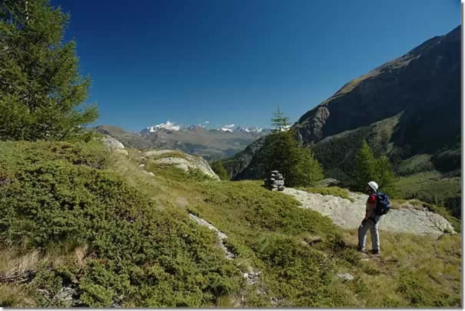
On reaching path (17), turn left following the ferrata indicator board until, after a few turns, you meet the rungs again. The ascent of the ferrata is resumed; this second part starts with a series of passages on sloping slabs alternating with small grassy stretches suspended between the rocks. You reach a small roof, which is also avoided by passing to the left; you cross a pass where you have to use your arms a little, and you come to a small 'plateau' at the foot of a spectacular, fairly vertical slab: the 'Yosemite' aesthetic of this section is worth the whole ferrata alone! The route continues with a succession of moderately easy passages without any particular exposure until reaching the Grandes Laures: a small plateau surrounded by rhododendrons, from which there is a beautiful panorama of the distant Pennine Alps. Shortly afterwards, you come to a signpost indicating the end of the second ferrata section (2180m, 2h30'): from here, you can descend to the path (17) via a steep track.
Continue northwards on a faint track that leads to the foot of an imposing rock; from here, descend slightly (be careful where you put your feet: the presence of weeds and some unstable stones makes the route delicate, especially on wet ground) and then climb back up to the start of the third part of the ferrata.
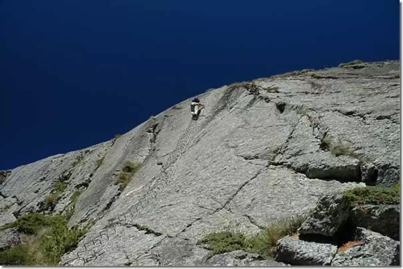
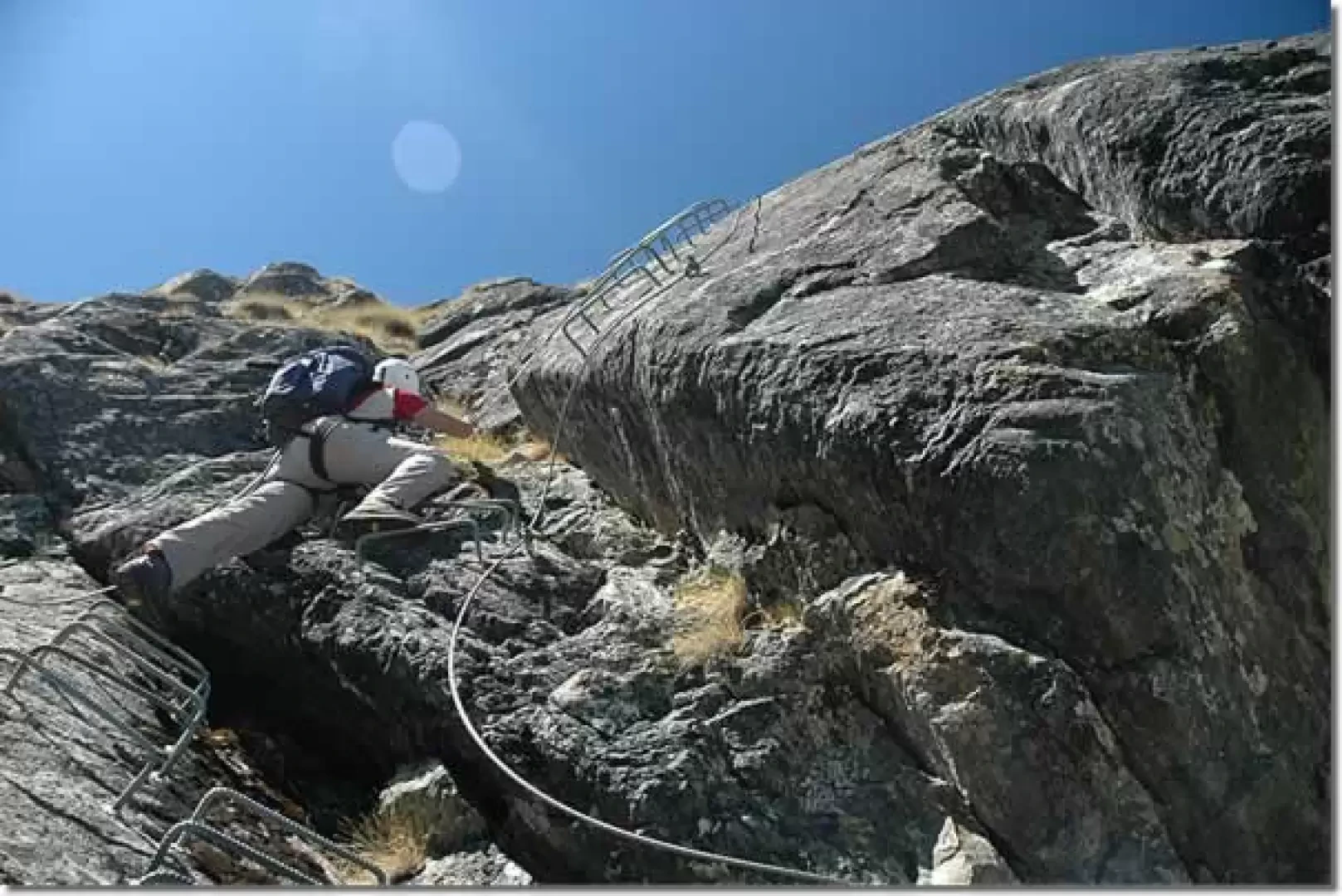
After about twenty minutes, you reach the base of a beautiful, practically vertical rock face, which must be walked all the way up. This part of the ferrata presents the feeling of emptiness - exposure as the greatest difficulty, but has no particular physical difficulties. Once past the long wall, turn right with some technical passages and then proceed slightly uphill to the start of the last section (2,350 m, 3h 20): here too there is an "escape route" down a path that leads into the valley below the Becca d'Aouille.
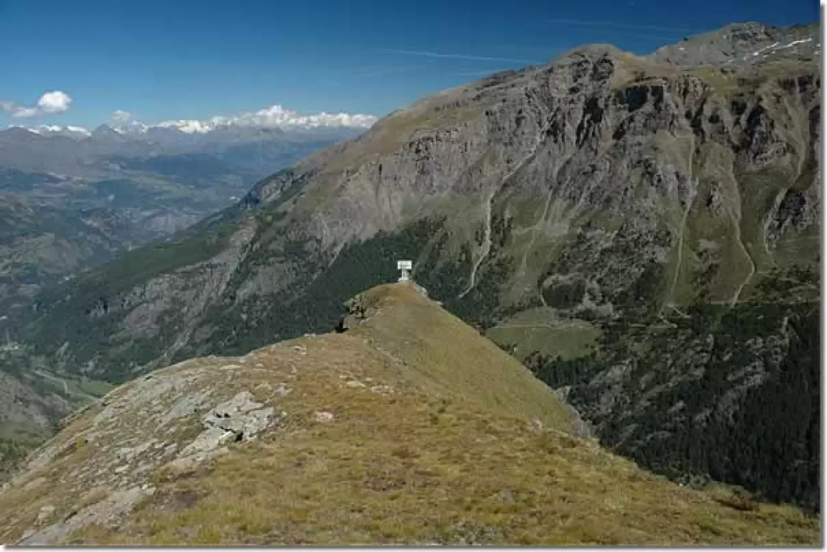
Now the destination is near, immediately climb up a sloping slab and then begin the ascent of the ridge that leads to the television repeater. This section is definitely fun as it is much more varied. The ridge has aerial stretches and some quite technical passages. Once this last asperity has been overcome, you reach the Becca's summit, recognisable by a wooden post set into a large stone cairn. A few more minutes of ascent on a track and you finally reach the television repeaters on the summit of the Becca d'Aouille (2605m, 4h00').
Retrace
Leaving the Becca d'Aouille, continue along a little path heading west up to a small col: from here, start the descent towards trail No. 18. The first part of the descent is quite steep - some steel cables facilitate the descent. Cross a scree slope until you come to a marker indicating that you should climb to the left: continue along the scree slope until you reach a col (2646m, 4h20'). From here, turn right and start descending the path (18). The descent takes place, in the first part, skirting a large rock, then, with a series of twists and turns, the descent proceeds to Miollet (1895m, 5h30'). On reaching a fork, we turn right and proceed along the famous cliffs of la Béthaz until we reach the village of the same name (1615m, 6h00'). You finally reach the regional road, which you will follow as far as Valgrisenche and, consequently, the car (1690m, 6h30').
Advises
Due to the length of the route, we recommend setting off around 8.00am: this way you will be able to enjoy the right light for photographs and the right warmth for the climb.
Bibliographical references
- L.Marchisio and M.Carena, Un Gancio in mezzo al Cielo, Grugliasco (To), 2001
- D.Gardiol, Le vie ferrate, Cuneo, 2003
- O. Pecchio, Excursioni e vie ferrate in Valle d'Aosta, Quart - Aosta, 2004
Due to the length of the route, we recommend departure at around 8.00 a.m.: in this way you will be able to enjoy the right light for photographs and the right warmth for the ascent. Photo gallery Ferrata Béthaz-Bovard (2605 m) - © 2004 Massimo Martini Ferrata Béthaz-Bovard (2605 m) - © 2004 Massimo Martini Ferrata Béthaz-Bovard (2605 m) - © 2004 Massimo Martini Ferrata Béthaz-Bovard (2605 m) - © 2004 Massimo Martini Ferrata Béthaz-Bovard (2605 m) - © 2004 Massimo Martini The start of the ferrata A little under a "roof" "athletic" strain Sloping slab A little bit of arm... Ferrata Béthaz-Bovard (2605 m) - © 2004 Massimo Martini Ferrata Béthaz-Bovard (2605 m) - © 2004 Massimo Martini Ferrata Béthaz-Bovard (2605 m) - © 2004 Massimo Martini Ferrata Béthaz-Bovard (2605 m) - © 2004 Massimo Martini Grandes Laures The start of the third section Technical passage The Becca d'Aouille area ridge Bibliography: * L.Marchisio and M.Carena, Un Gancio in mezzo al Cielo, Grugliasco (To), 2001 * D.Gardiol, Le vie ferrate, Cuneo, 2003 * O. Pecchio, Escursioni e vie ferrate in Valle d'Aosta, Quart - Aosta, 2004 Cartography: * Valgrisenche and Rhêmes Valley, Map of Trails 1:25000, Rimini, 2004 * IGC, Sheet 102 Valsavarenche Val di Rhêmes Valgrisenche, 1:25000, Turin
Photo gallery
Comments (0)
Sign in to leave a comment