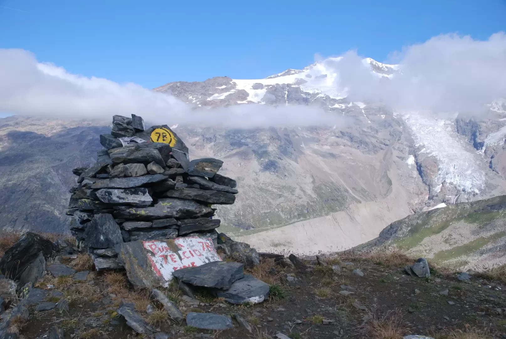
Punta Telcio, from Staffal

Access
Leave the motorway at the Pont-Saint-Martin exit. After about 100 metres, turn right, pass a traffic light and continue for about 600 metres until the crossroads for Gressoney. Enter the village of Pont-Saint-Martin and, after 1.2 kilometres, turn right onto the regional road in the direction of Valle di Gressoney.
Follow the road up the entire valley for about 38.4 kilometres, passing through the villages of Lillianes, Fontainemore, Issime, Gaby, Gressoney-Saint-Jean and Gressoney-La-Trinité. After passing the latter village, continue for a few more minutes until reaching Staffal and Tschaval. Opposite the Gabiet cable cars is a large car park 🅿️ where you can conveniently leave your car.
The place is served by public transport. To consult the timetable, please visit aosta.arriva.it
Distance and travel time
🕒Travel time: 52 minutes
📏 Distance: 38.4 km
GPS navigation
📍 How to get there with Google Maps
📍 How to get there with Apple Maps
ℹ️ Important note
The directions given were verified on the date of the route survey. Before departure, it is advisable to check for any changes to the route. For up-to-date and detailed directions, we recommend the use of Google Maps or Apple Maps.
Introduction
Punta Telcio (2833 m), easily recognisable by its obvious avalanche barriers, is located on the south-east side of the Moos valley, upstream of Gressoney-La-Trinité. It is that peak that constantly appears in the background of Gressoney Saint Jean when looking towards Monte Rosa: a seemingly secondary mountain, but in reality a large and panoramic one, with excellent views of Staffal, the sources of the Lys and the Rosa massif.
The itinerary follows the path , starting from Staffal, and touches on two alpine lakes of great interest: the Green Lake/Griensee (2,631m) and the more famous Blue Lake/Bloabesee (2,687m). From here the trail becomes less obvious and the progression requires good orientation skills and attention to the terrain, justifying the EE classification.
Description
0h00' 0.00km From the car park, cross the regional road and head towards the signpost with the Tour of Monte Rosa <TMR>g directions.
0h02' 0.04km <TMR>g Take the little road that leads to Hotel Nordend, then turn right along a level path through the pastures below Tschaval, until you reach the chapel dedicated to Saints Peter and Paul. After the chapel, turn left and cross a short ascent between pastures and larches. A little further on, continue along a rather steep track that quickly leads to the dirt road leading to the Moos valley. At the crossroads, keep to the left and climb up the dirt track to a marker post.
0h35' 1.30km Disregard the path that starts to the right and leads to the Gabiet hut via the path <TMR>g. Turn left and follow the dirt road to Mòos (1,988m), then take the path that climbs rapidly through the pastures, approaching the rock walls that descend from Punta Telcio. Having reached a small plateau, the track heads eastwards and begins a long, ascending traverse halfway up the rocky slope to then enter the Gavino pastures. Once past the steepest section, the trail softens and soon reaches the stone pastures of Welfsch Gaveno (2,455m). From there, a slight descent leads to Becksch Gaveno (2,424m) and a little further on to the junction with trails and coming from the Gabiet.
2h25' 4.18km Continue along the path alongside the Endrebach stream until you reach a new fork.
2h35' 4.83km Turn left, ignoring the path leading to Oreste's Hütte, and walk up the grassy slope, leaving a small reservoir on the right, until you reach a new fork.
2h50' 5.34km Ignore the path that goes straight on towards the Colle della Salza and turn left again, following the path that climbs up between rocky outcrops to Lago Verde (2,631m).
2h55' 5.40km Continue along the track between rocky outcrops and sparse pastureland until you reach the Blue Lake (2.687m)
3h10' 5.91km The path veers to the left skirting the Lavetz lakes (2,626m) and then, less and less clearly, climbs the slope to a small saddle. From here, in a westerly direction, continue along the final ridge until reaching the summit of Punta Telcio (2,833m) 4h05' [7.91km] (1027m D+) (23m D-), marked by a cairn. From the summit there is a wide 360° panorama of Monte Rosa, Col d'Olen, Stafal and the surrounding valleys.
The return follows the same route as the outward journey, retracing the path until returning to the starting point at the Staffal car park 2h40' 6.15km .
Points of Interest
- Staffal
- Tschaval Chapel
- Mòos
- Gaveno
- Green Lake
- Blue Lake
- Telcio Point
- Gressoney-la-Trinité