Punta di Medzove, from the Blanchet car park


Edited by:
Giancarlo Beretta
Updated at: 21/06/2025
Access
From the motorway junction at Verrès enter the roundabout and take the third exit and take the Strada Statale in the direction of Aosta.After 450m at the roundabout take the first exit and continue on the statale for a further 1.3km. Turn left onto the strada regionale with signs for Valle di Champdepraz - Parco del Mont Avic. Go up the for about 10km before meeting the panel with the signs for the resort's main car park: turn left following the signs for Blanchet and Fusse and, after about 200m, park your car in the convenient free car park 🅿️.
[0h22'] - [11.5km]
How to get there with GMaps
How to get there with Apple Maps
In the summer period, July/August, there is a shuttle service to Chevrère (Covarey).
These indications are based on direct verification carried out at the time of surveying the route so the information should be checked before setting off on the hike. We recommend using a GPS navigator or a map app on your smartphone to get up-to-date and detailed directions.
Introduction
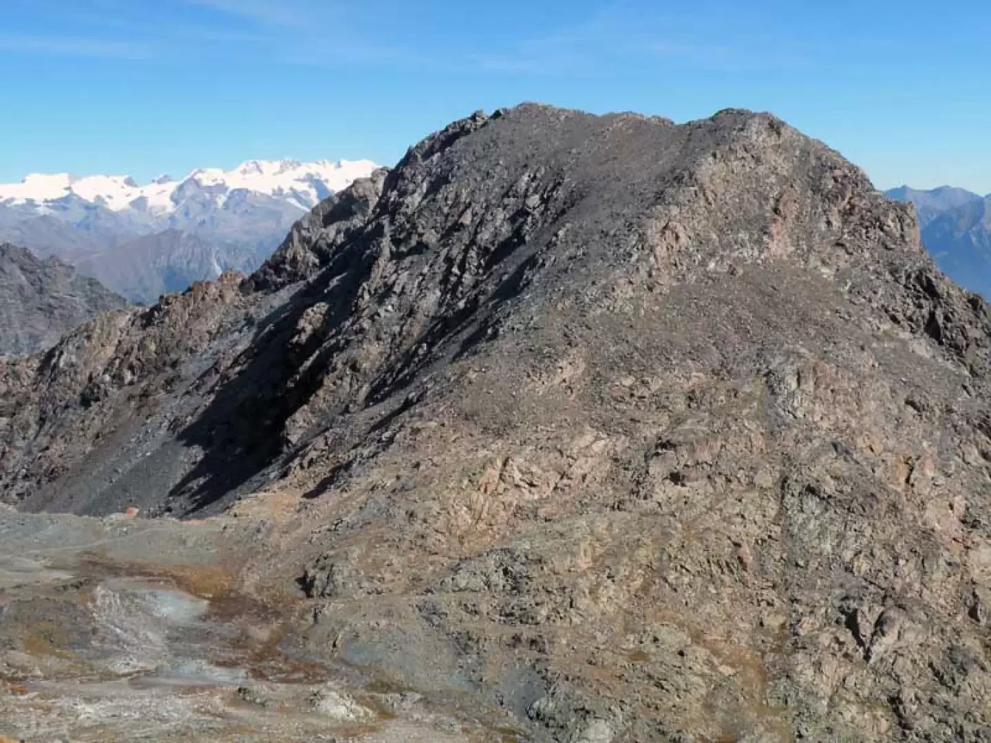
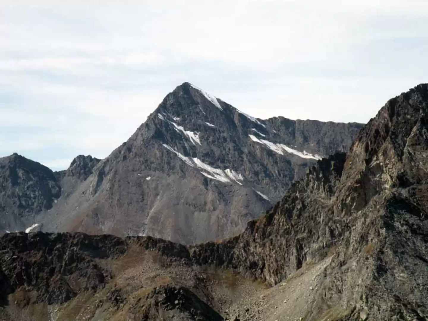
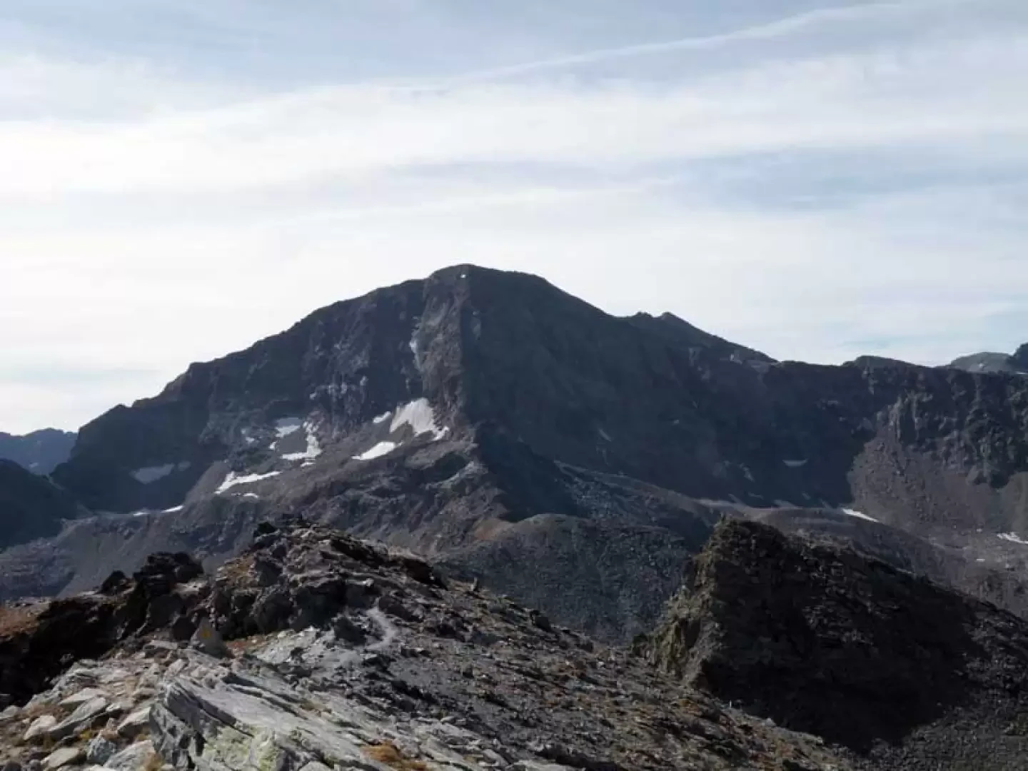
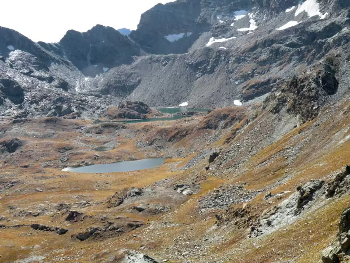
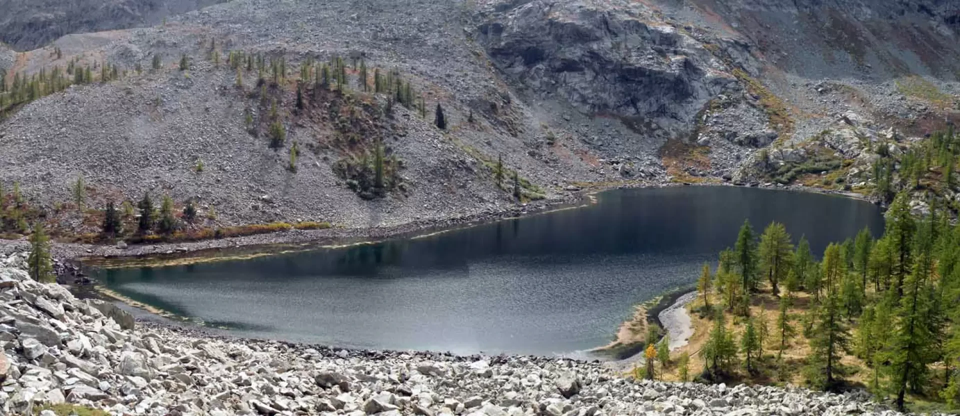
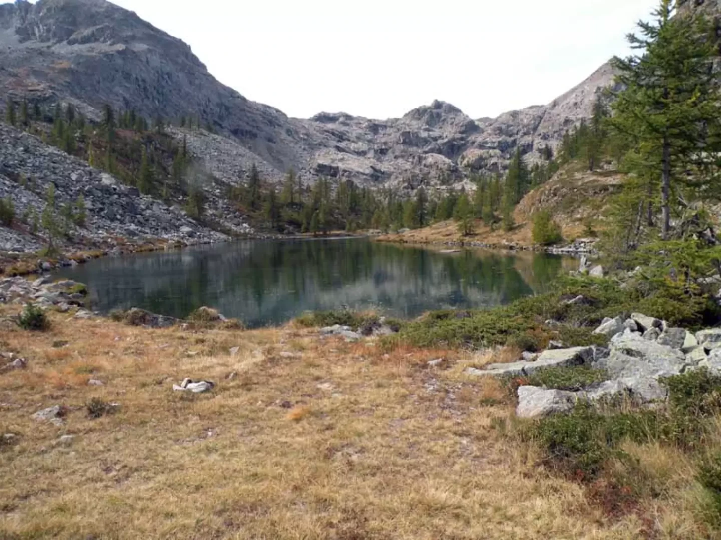
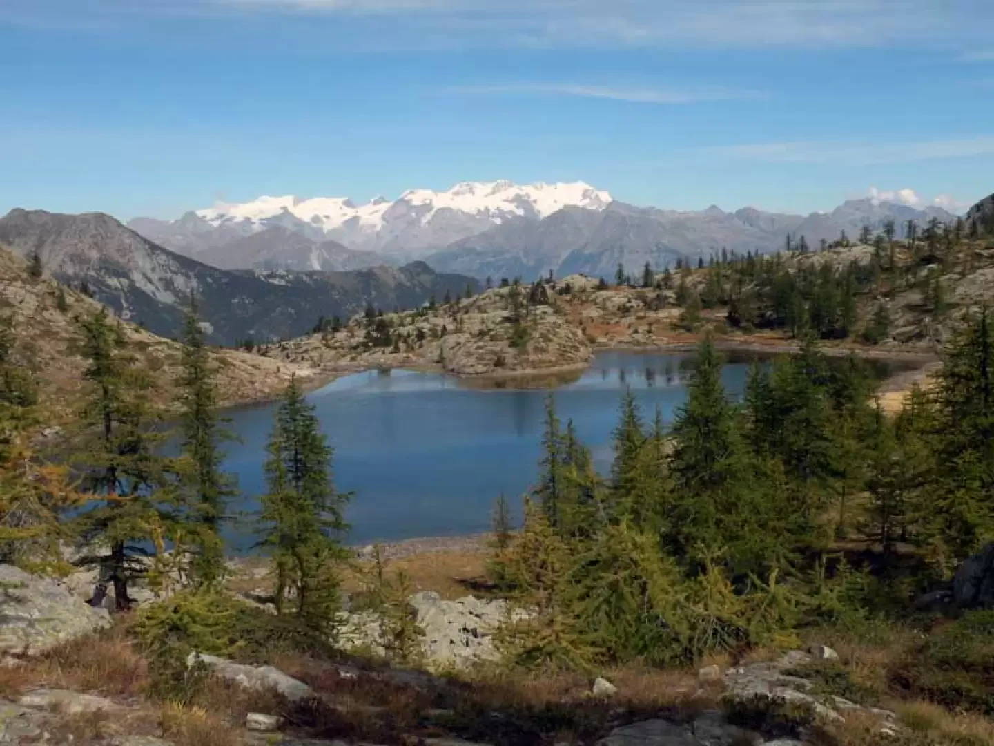
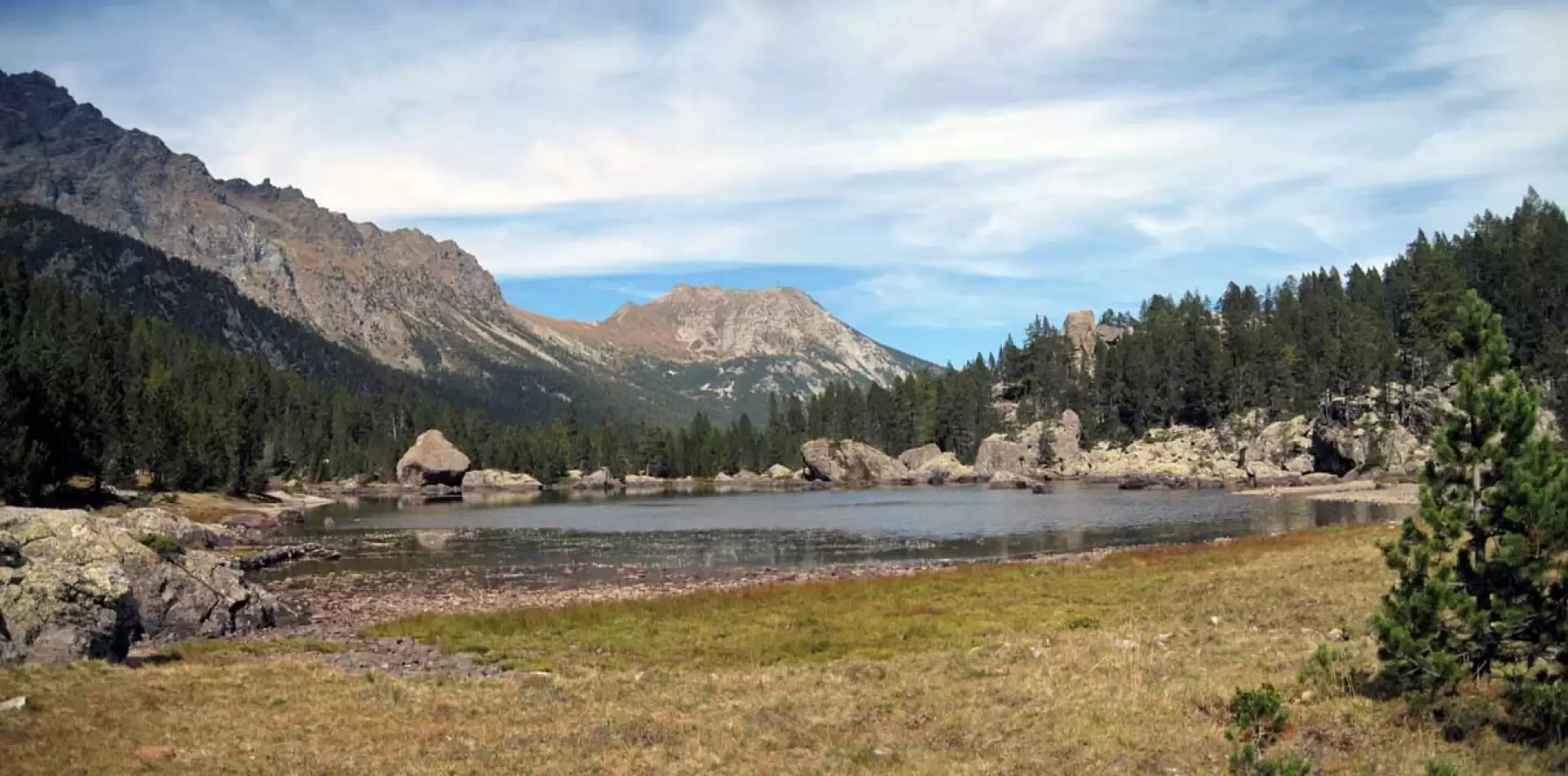
The true merit of this hike is to see no less than 9 lakes, including the Gran Lac, which is the largest high-altitude lake in the Valle d'Aosta, scattered in the valleys and basins of the Park of the Mont Avic and by reaching the Punta di Medzove one reaches the highest and most obligatory crossing point of the tour of the Park's lakes; on this long hike (just over 21 km) one crosses all the environments of the mountain: from the pastures to the forests and the typical high altitude scree slopes, enjoying wide views of the distant 4000-metre peaks of the Alpine chain and the nearby peaks such as Tersiva, Mont Glacier, Avic and the others of the adjacent territories. The itinerary is well marked (signposting was restored this year) and does not present great difficulty except for a short, somewhat exposed section on the ridge descending from the summit and, above all, for the height difference and length. The descent takes about the same amount of time as the ascent to the summit and, of course, the route can also be done in the opposite direction although, done in the sense of this description, the ascent to the summit is shorter and more direct and you have more time during the descent to stop at the many lakes.
Description
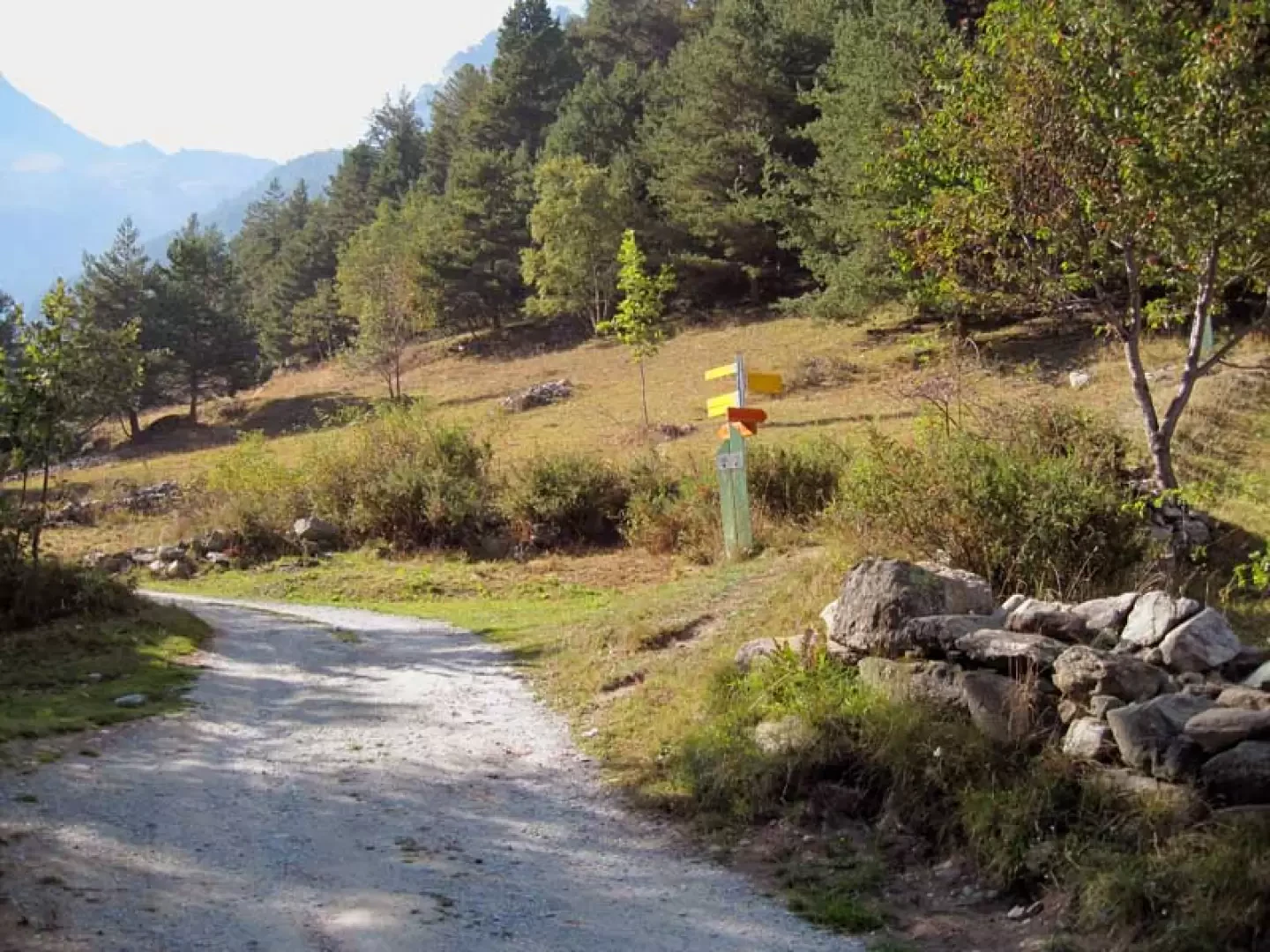
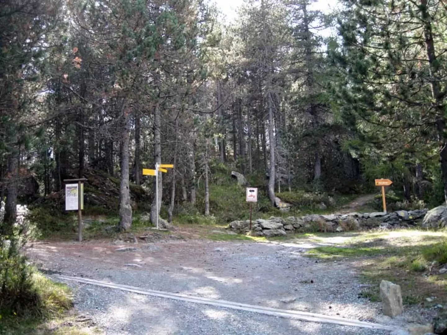
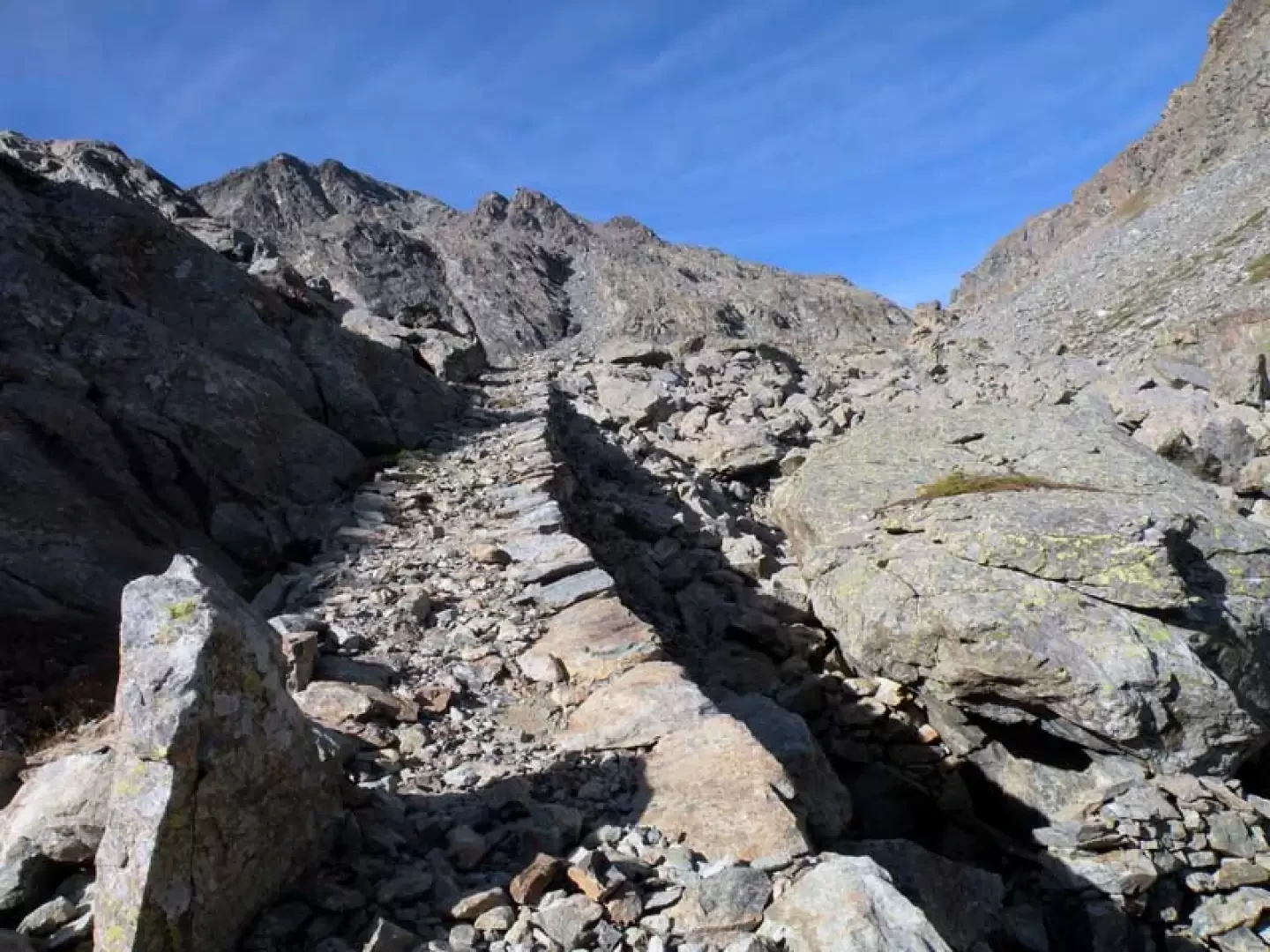
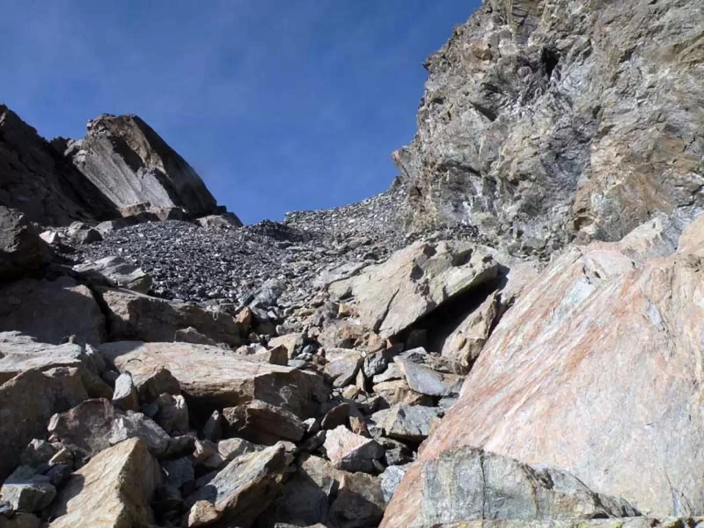
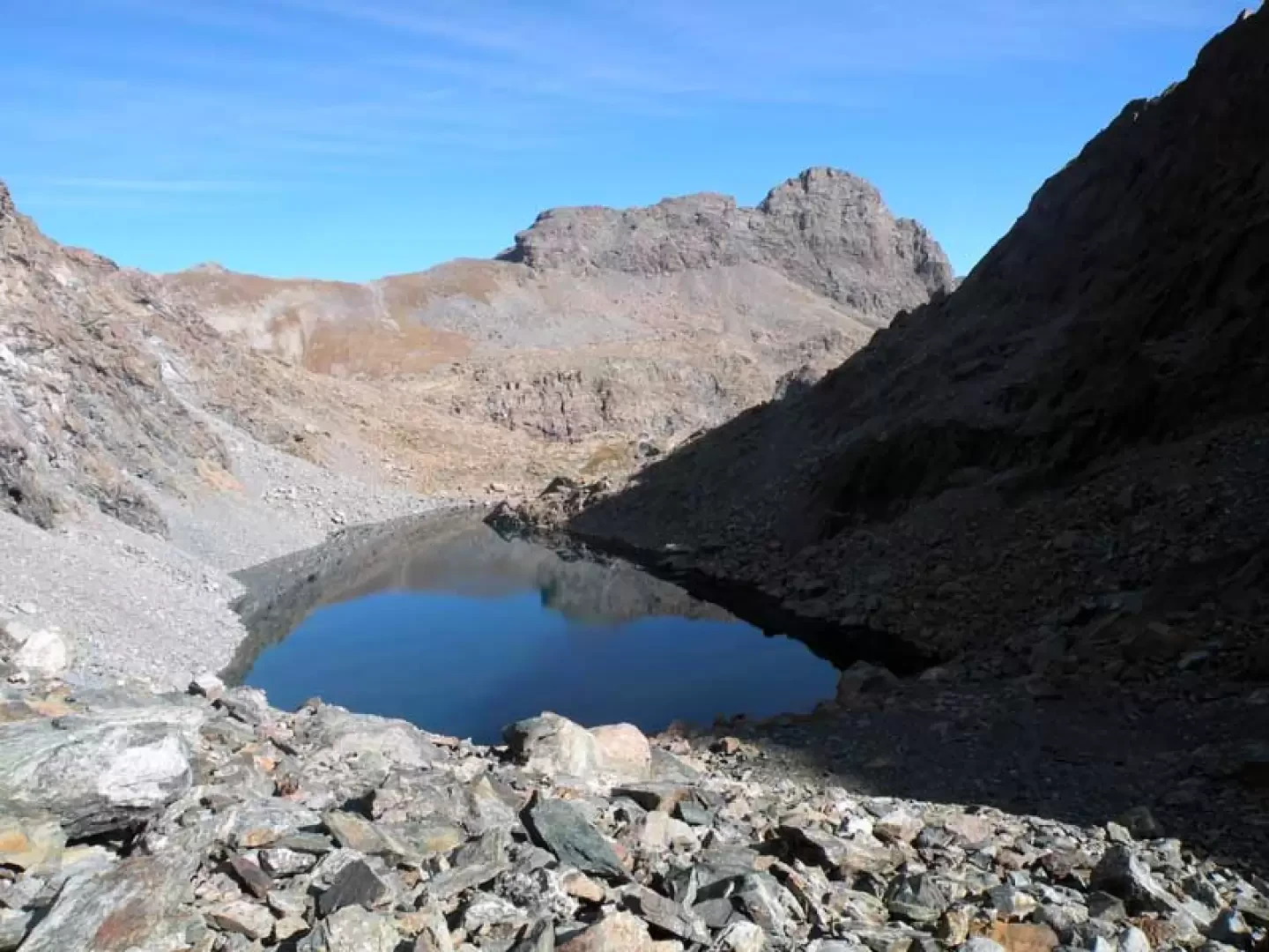
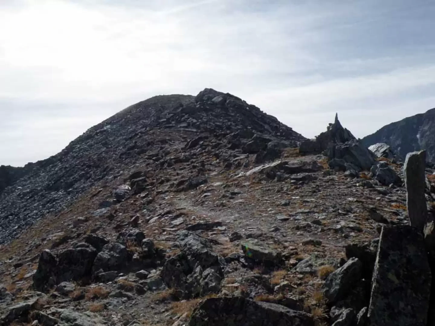
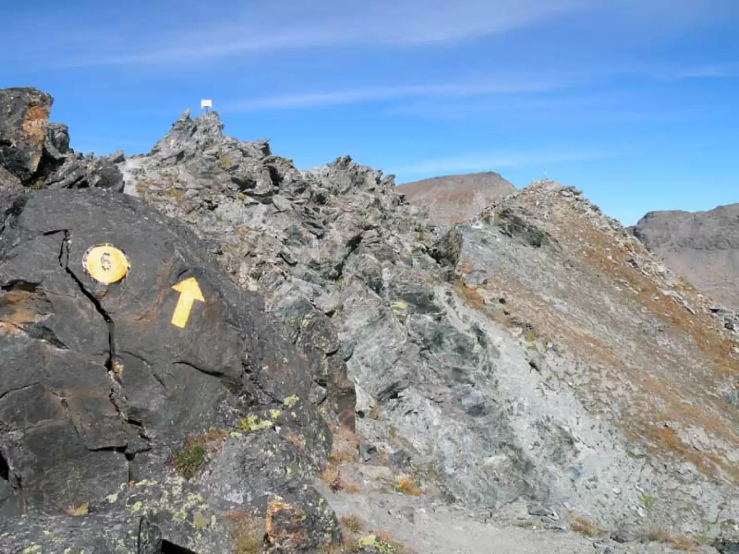
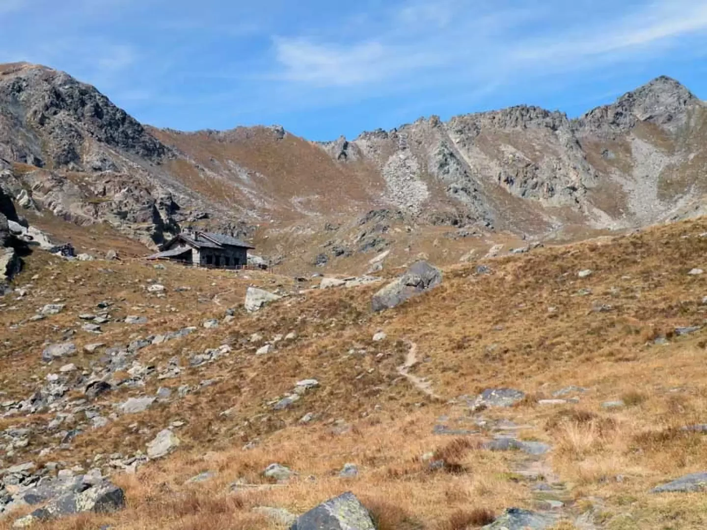
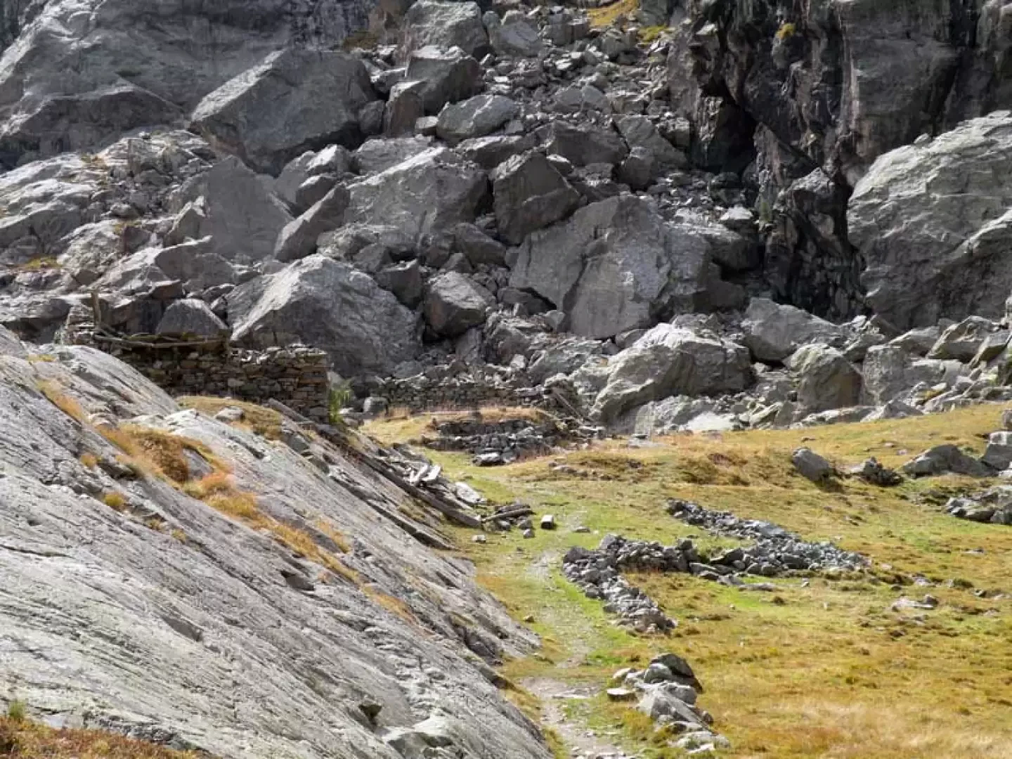
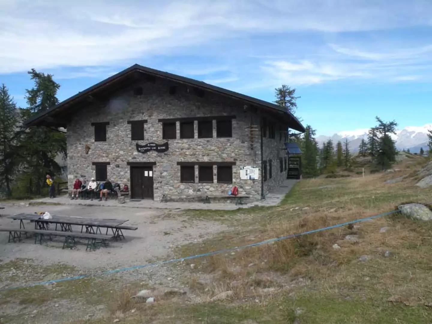
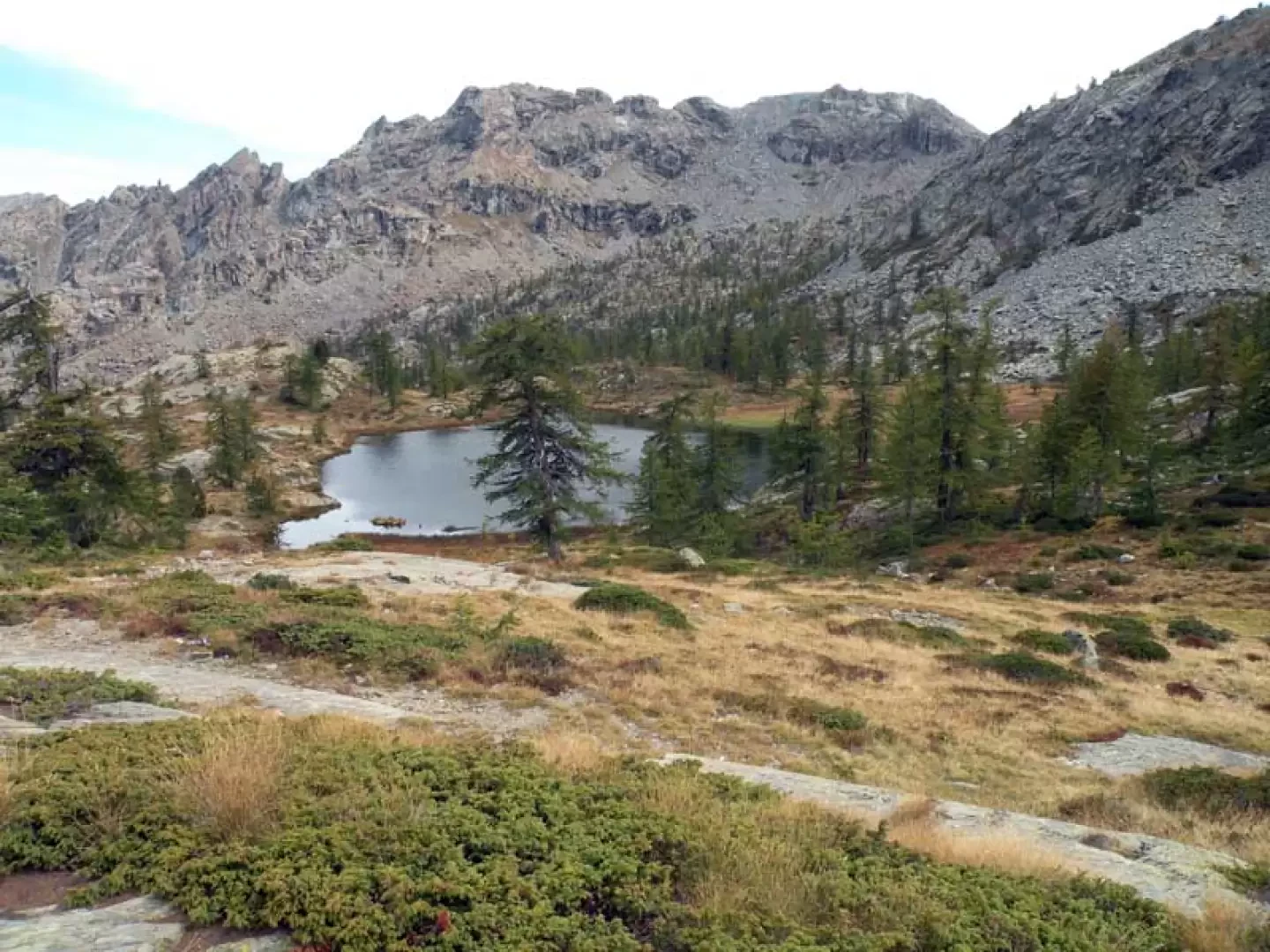
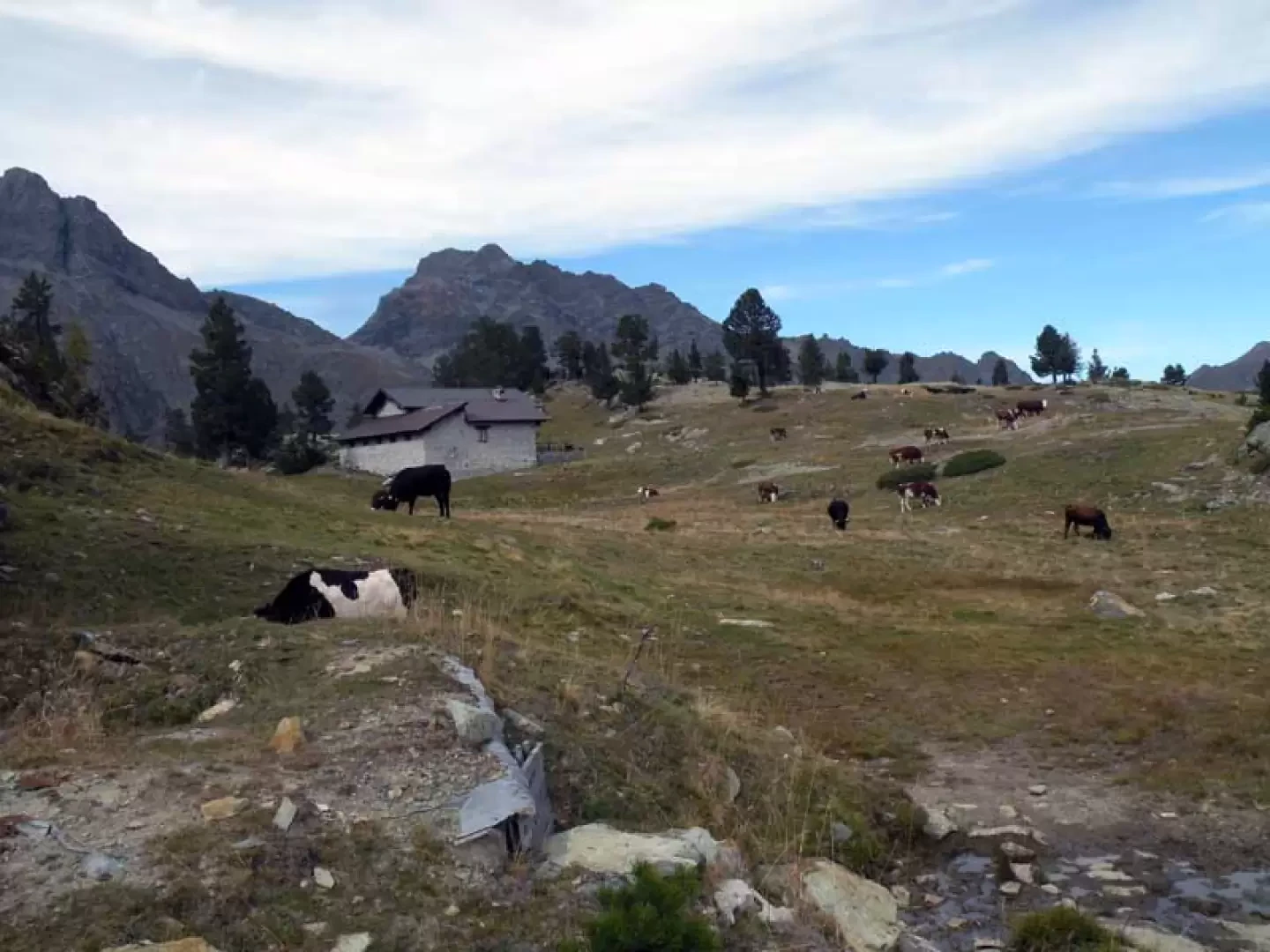
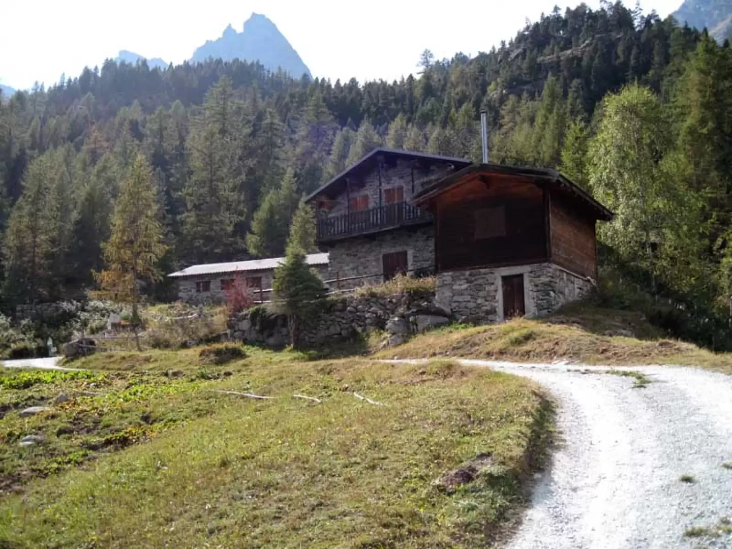
From the car park, go up a small paved road to the houses of Veulla, which you cross on the left, passing in front of the hotel and continuing on the asphalt road for a few dozen metres until you come to a square where only authorised or emergency vehicles are allowed to park. From this forecourt, take the paved road that rises to the right of the little church and enters the pastures, arriving almost immediately at a crossroads (1360 m) at which, ignoring the path that branches off to the right, we continue along the road that has now become a dirt track. The track follows the side of the mountain, entering a beautiful wood and passing a few torrents; this brings us to a large clearing called the "warehouse" where there are markers at a crossroads (1473 m). Having now left the dirt track, we continue on the path that continues ahead of us and that, with a more accentuated and continuous slope, rises with an almost straight path on the steep slopes of the mountain. At the exit of the forest, the path makes a few hairpin bends and heads towards an evident crevice, from which, taking a rest for a while, we come to a large scree slope; we cross it without any problems on an old but well-maintained stone mule track that, as we continue, moves to the left towards another col. After a few steep hairpin bends, climb up towards a high dry stone wall, beyond which you find the mule track that passes between the remains of the old mines; with a path that now becomes flat, continue for a few dozen metres, arriving at the shores of Lac Gelé (2600 m). From the shores of the lake, keep to the left to cross its emissary, following the path that, well marked also by stone cairns, surrounds it as it rises towards the bottom of the basin; now you have to climb up quite laboriously, which, among the many stones, comes out at a hill that leads to a large plateau. Cross this by following the path that heads towards the slope opposite the direction of travel and, ascending it with a few hairpin bends, arrives at a ridge that must be followed to the left, shortly reaching the summit of Punta di Medzove (2855 m). From here you begin the long descent, continuing on the opposite side of the ridge, which has a short exposed section, at the end of which you descend to a wide creek; the path now descends steeply and quickly loses altitude to reach a wide plateau at the bottom of which is a Park hut used as a guesthouse and, just beyond, you reach the shores of the Gran Lac (2501 m). Go around the lake on the left and, just before the outflow at a high stone retaining wall, the trail begins to descend again with narrow hairpin bends, passing by a ruin (2487 m) and continuing on mainly stony ground to reach the plateau below; pass a bridge and then cross the ruins of Pisonet (2310 m) to continue with a slight descent halfway down the hillside that enters a sparse forest. With a few ups and downs you pass above the Lac Cornu reservoir and then descend again, passing Lac Noir (2166 m) and Lac Blanc located on its side on the opposite side of the path. Cross a bridge and climb briefly to the left, leaving on the right the branch-off of another path (2197 m) almost immediately reaching the Barbustel hut (2208 m). Just behind the building you will find the posts at a crossroads, from where you can see the nearby Lac Vallette, at which point you turn left and follow the path which, on stony ground, descends quickly to the pastureland where the Coucy mountain pasture (2070 m) is situated; here too there is a crossroads marked by the posts, at which you keep to the left and pass by the hut, re-entering the wood immediately, which you cross for an initial stretch on level ground, passing through some small peat bogs. You come to a large stone cairn situated at the top of a fairly steep slope that descends in narrow hairpin bends over stony terrain at the bottom of which is the small basin where the Lac de Servaz (1820 m) is situated; go around it on the left and descend along the obvious path that re-enters the woods and, after many hairpin bends and passing a fork (1581 m) at which you keep to the left, reaches the Servaz desot huts (1560 m). From here take the road that descends with a few hairpin bends, arriving at the crossroads at an altitude of 1473 m found on the way up, and from this it is a short walk back to Veulla.
.Photo gallery


Comments (0)
Sign in to leave a comment