Tête de Cou, from Albard de Bard


Edited by:
Massimo Martini
Updated at: 03/06/2026
Access
Road Navigation
Exit the motorway at the Pont-Saint-Martin toll booth and, at the tollbooth exit, follow the signs for Donnas along the northwest for 2.4km (2.4km). Turn right onto Via Jan Brean and continue for 500m (2.9km), then turn right and continue for 240m (3.1km). Turn onto Artada Street and continue for 1.2m (4.3km). Turn left and continue for 1.3km (5.6km) until you reach the chapel of San Grato in Albard de Donnas. Continue straight on along the small communal road until you come to a fork in the road at the Crous hamlets: keep right on the small road, which climbs up a few hairpin bends for a further 400m (7.2km) to the car park.
Parking
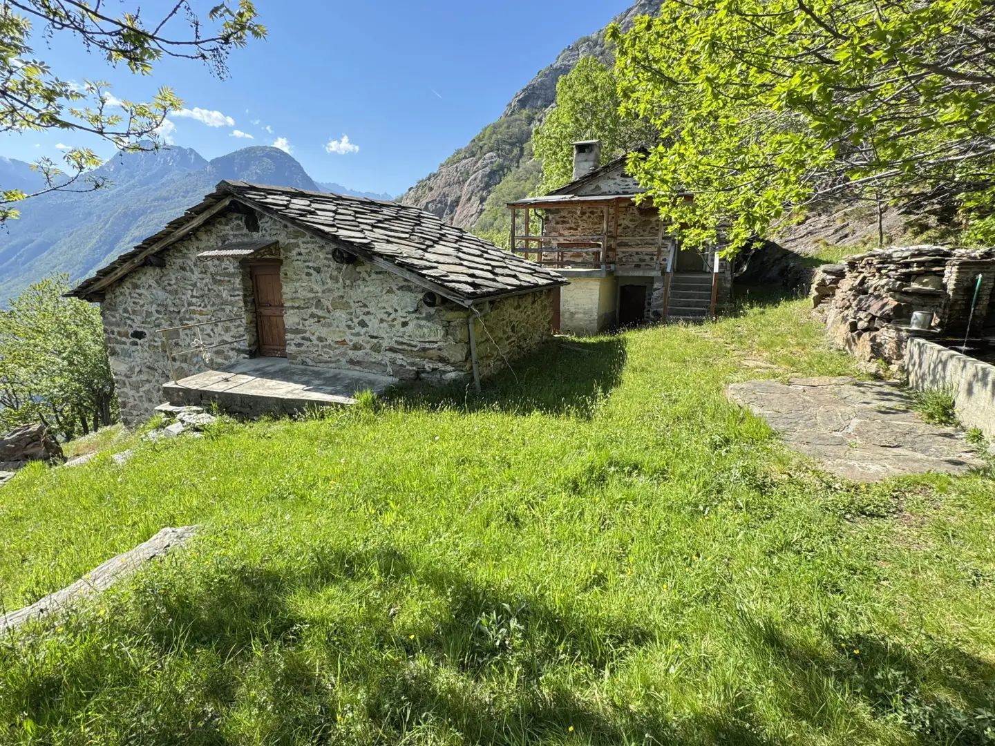
The 🅿️ car park is at the end of the small road opposite the village of Albard de Bard.
Access by public transport
Private transport is required to reach the starting point of the itinerary, as the village is not served by public transport.
Distance and travel time
🕒 travel time: 15 minutes
📏 distance: 7.2km
GPS navigation
Information note
The information provided has been verified as of the date of the survey of the itinerary. Before departure, it is recommended to check possible changes in the route or road conditions. Please consult Google Maps or Apple Maps for the latest information.
.Introduction
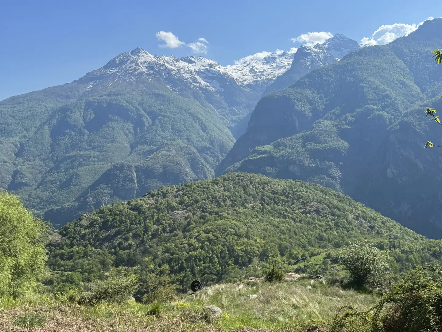
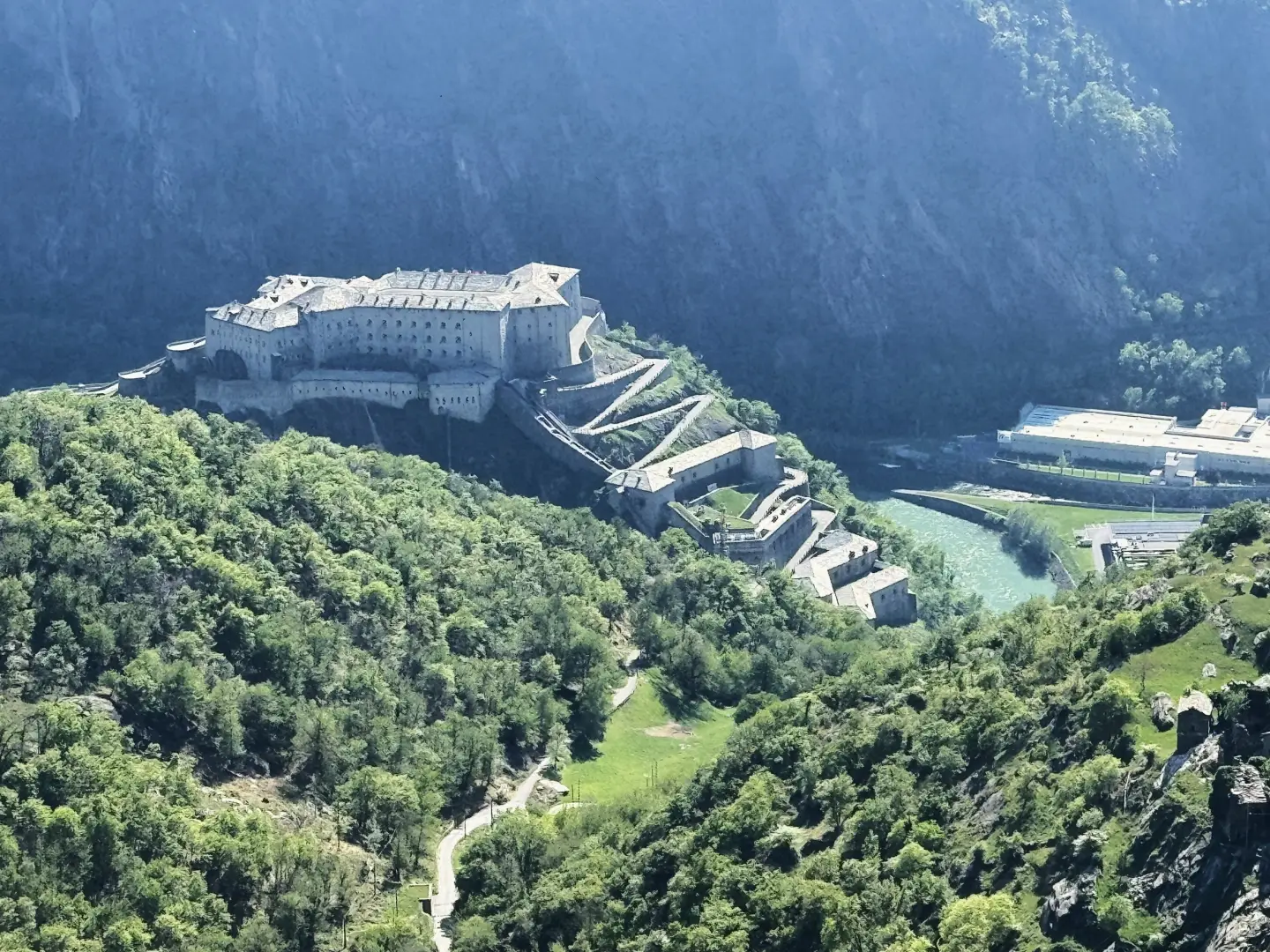
Round-trip itinerary from Albard di Bard to the Tête de Cou (1,410 m), which follows a long paved mule track through mixed chestnut (Castanea sativa) and downy oak (Quercus pubescens) forests, passing through the abandoned village of Bossou, the hamlet of Verale and the Col de Cou. The trail opens with two unusual elements for a hiking itinerary: the Chestnut Ecomuseum - currently closed, but visible in the building perched on an erratic boulder - and the attack zone of the long routes of Mont Coudrey, frequented by climbers. The mule track then enters the forest and climbs at a sustained gradient, offering at times glimpses of the Fortress of Bard and the Truc Chaveran hillock. Bossou, an abandoned village at an altitude of 943m, suddenly appears along the way, evoking a real ghost town. Further up, the village of Verale preserves its bread oven and a chapel; beyond the Col de Cou, the ruins of the Ricovero Capitano Muttoni mark the entrance to the grassy summit ridge that leads to the peak, with a view over the Alto Canavese and the lower valley.
The itinerary is practicable from spring to late autumn. The height difference (827m D+) requires good physical preparation, but the route is always clear and has no exposed sections.
Description
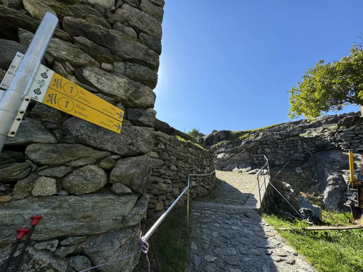
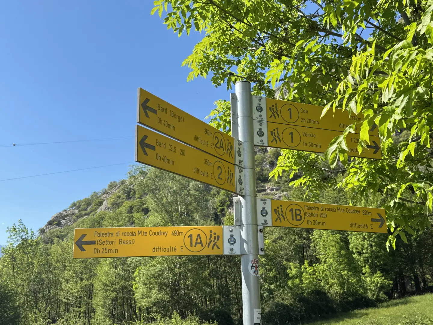
0h00' 0.00km From the car park, walk past a fountain 💧 and, after having had a look at the village chapel dedicated to the Blessed Virgin Mary, take the mule track lined with fine drystone masonry until you come to an isolated hamlet perched on an enormous boulder, the ecomuseum Castagna (currently closed) and a second car park normally used by climbers preparing to tackle the classic long routes in the area;ecomuseum of the Chestnut (currently closed), and a second car park normally used by climbers preparing to tackle the classic long routes in the area. A signpost indicates the access routes to the climbing routes of Mount Coudrey.
0h04' 0.20km Follow the signs for Verale and Cou and continue along the road, which soon becomes a dirt track until you come to the junction (650m), path , for the routes of the high sector of Mount Coudrey.
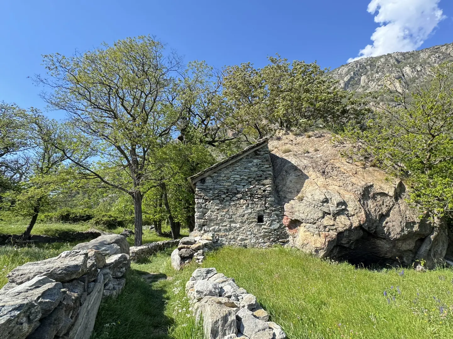
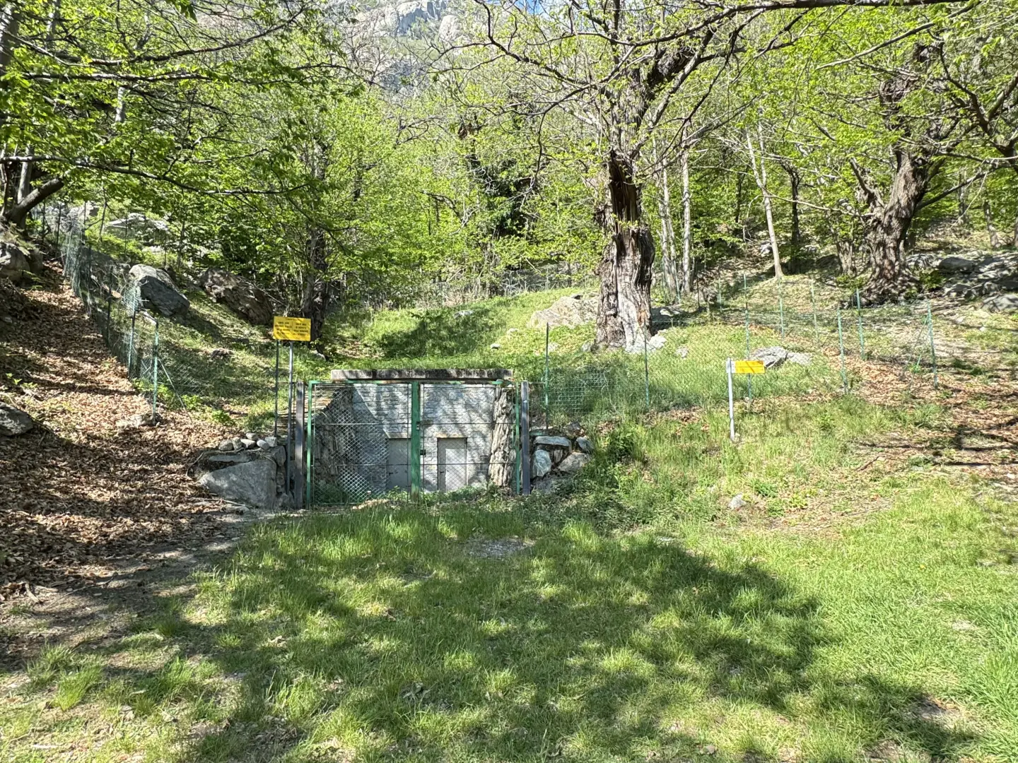
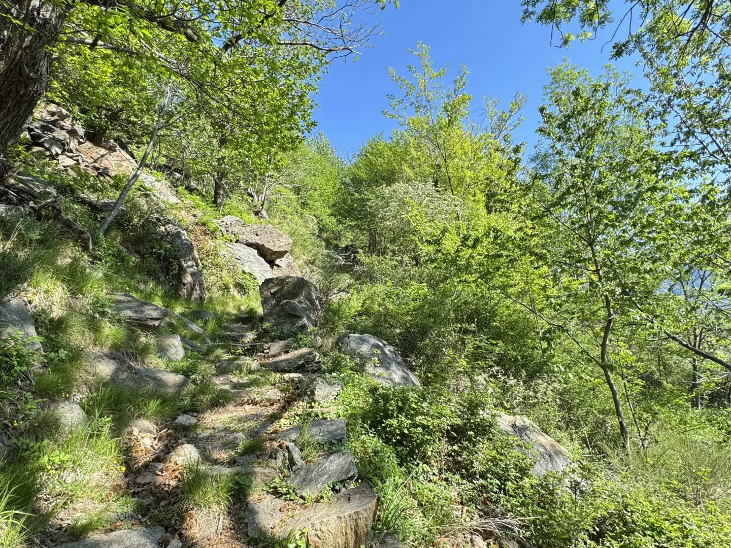
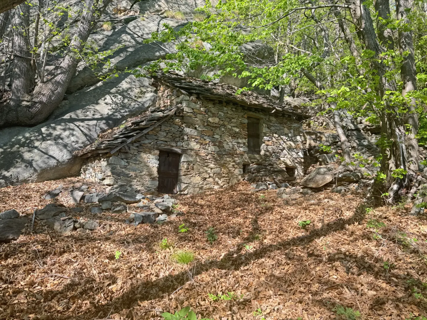
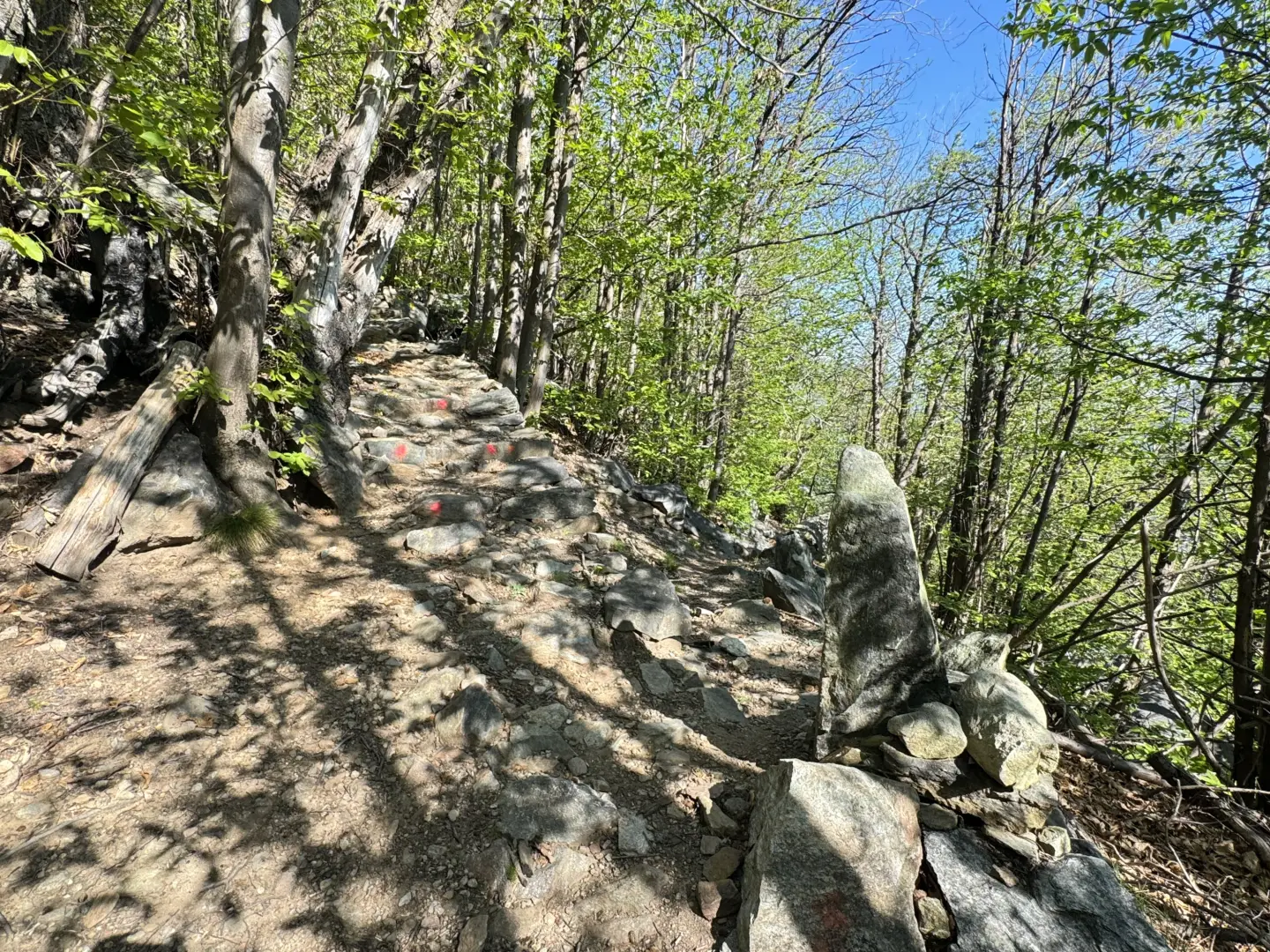
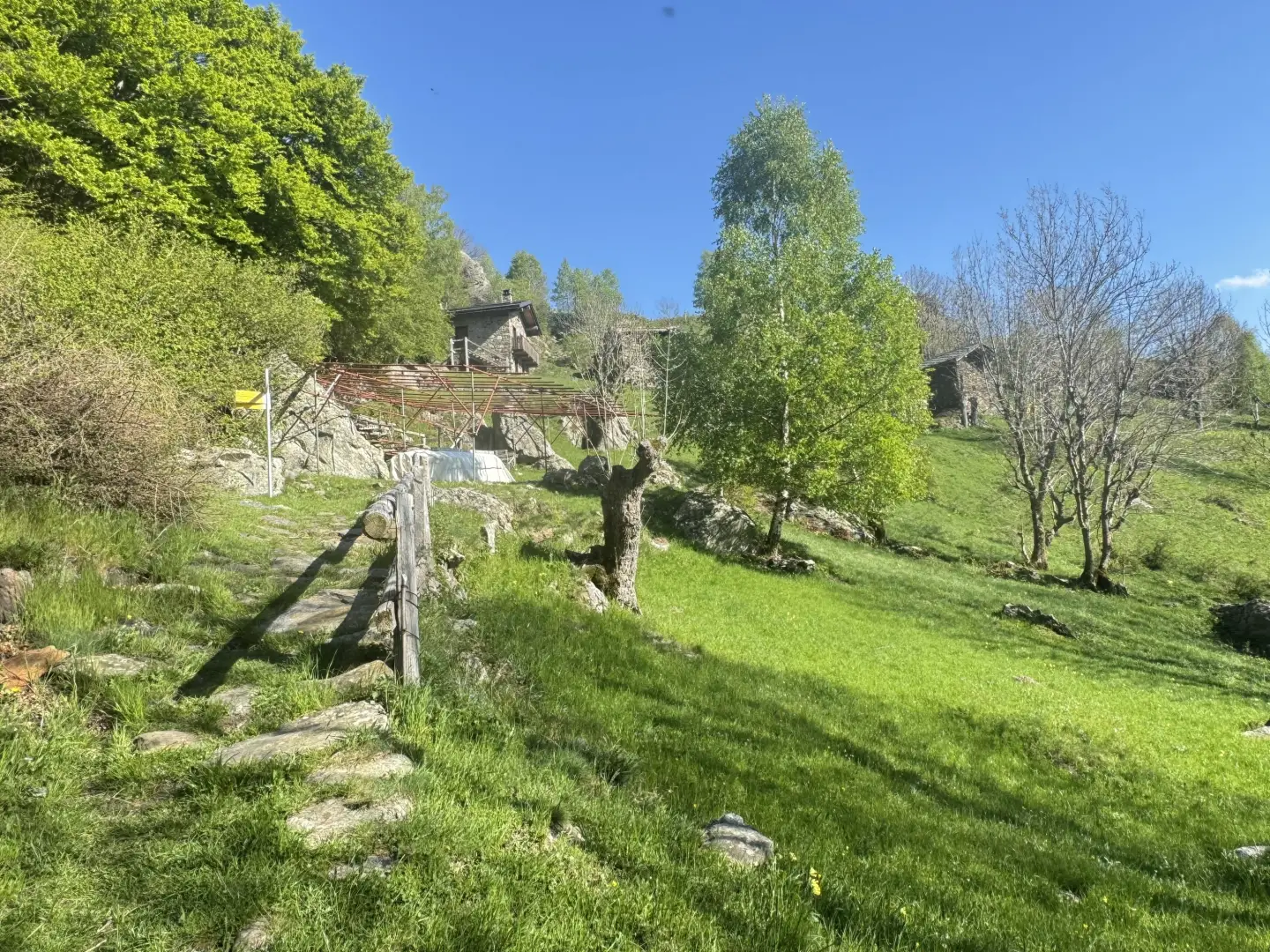
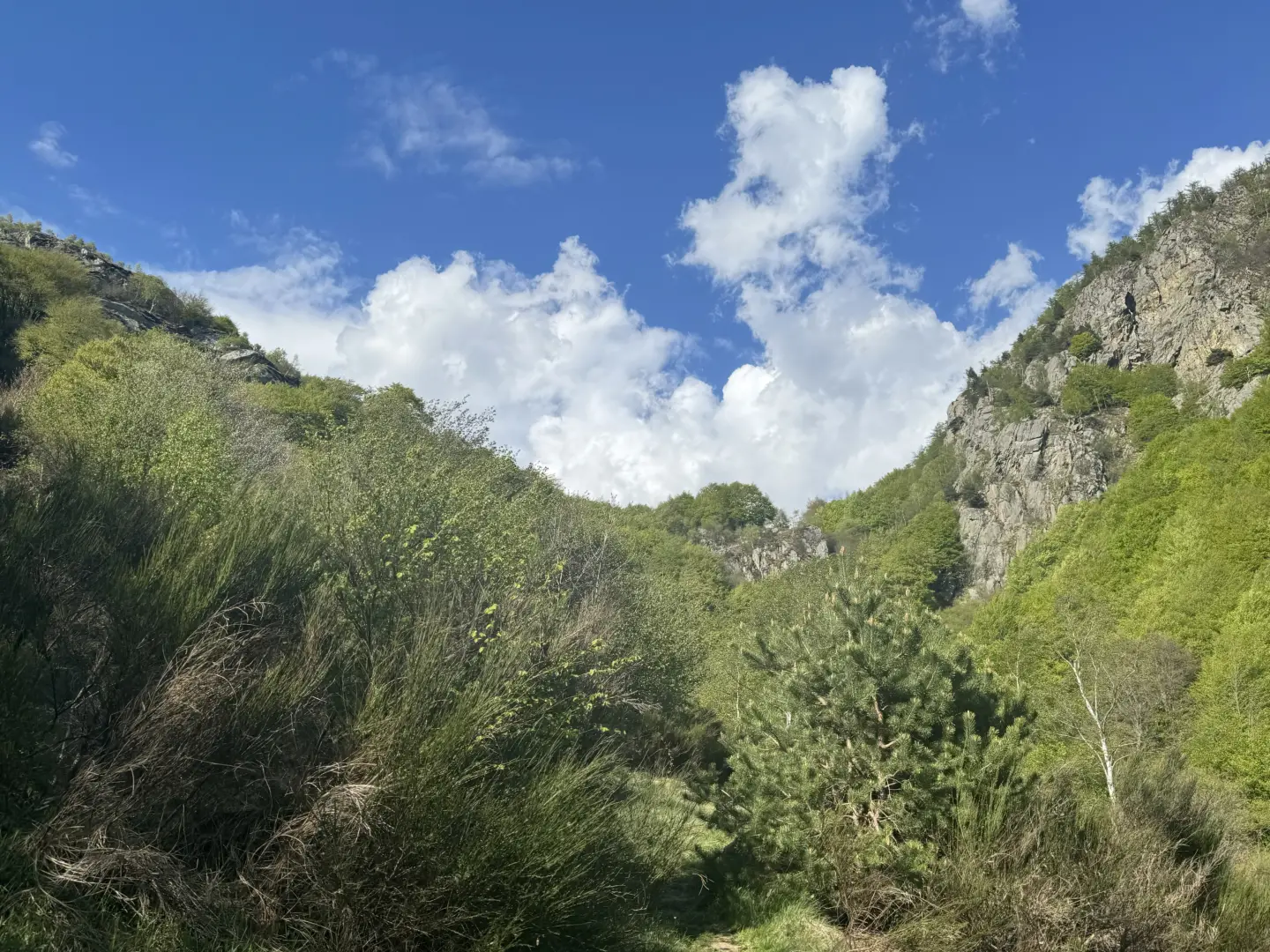
0h08' 0.24km Neglect the small road to the left and continue straight ahead until reaching the waterworks hut and a new signpost. Take the paved mule track that climbs into the forest of chestnut trees (Castanea sativa) and downy oaks (Quercus pubescens), alternating between less steep sections and short breaks on stepped sections. At certain points, the forest thins out, giving way to panoramic views of the valley below, the wooded hillock of Truc Chaveran, the Fortress of Bard and the village of Albard de Bard. Continue along the mule track, now with a steeper incline, until you reach the hamlet of Chesal (847m), consisting of two isolated huts with a fountain 💧. The path veers to the right and continues at a moderate incline until it meets the abandoned village of Bossou (943m); watch out for falling slates from dilapidated roofs. A little further on, you reach the junction (969m) with path unable to parse coming from Albard de Donnas.
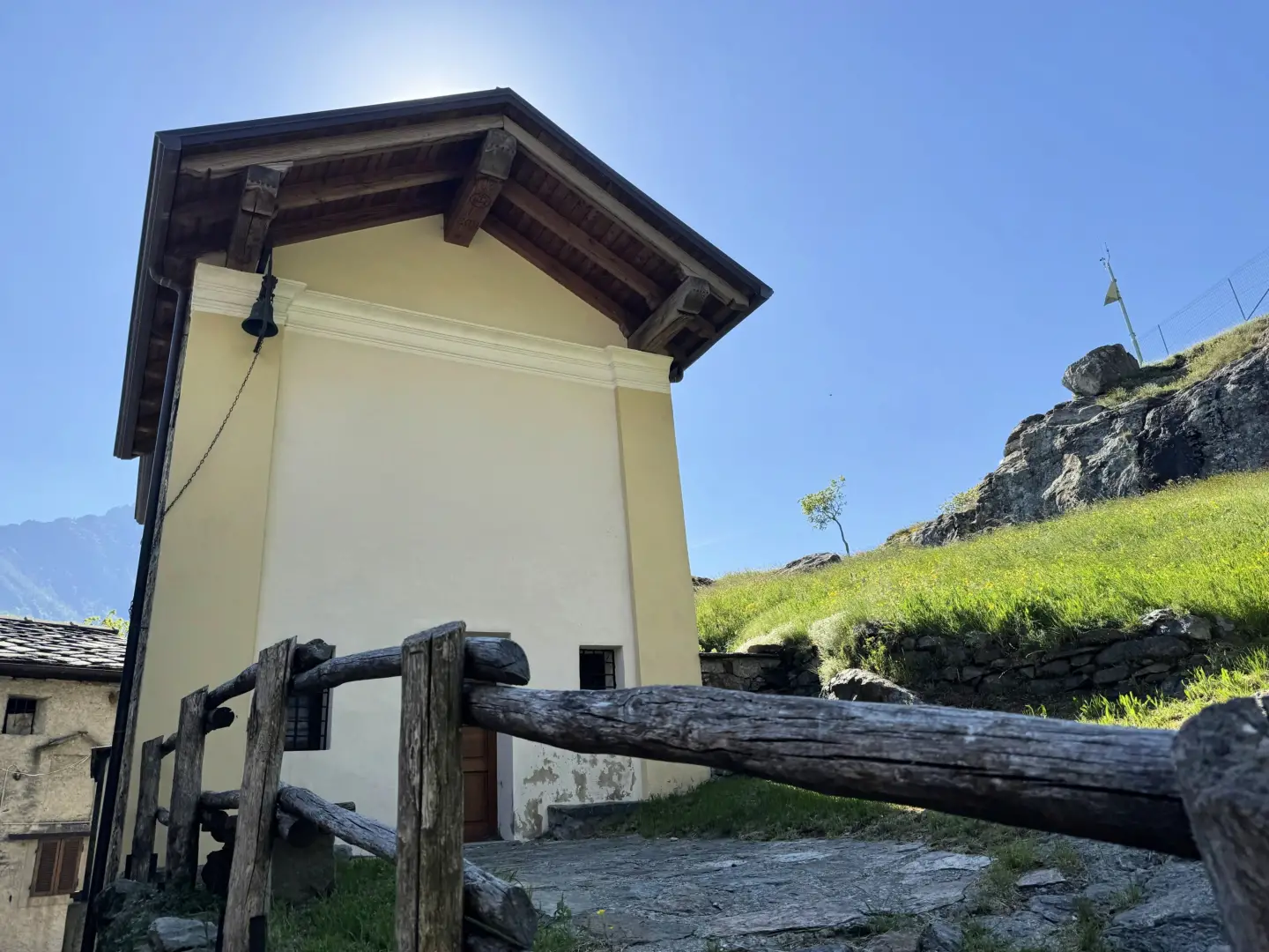
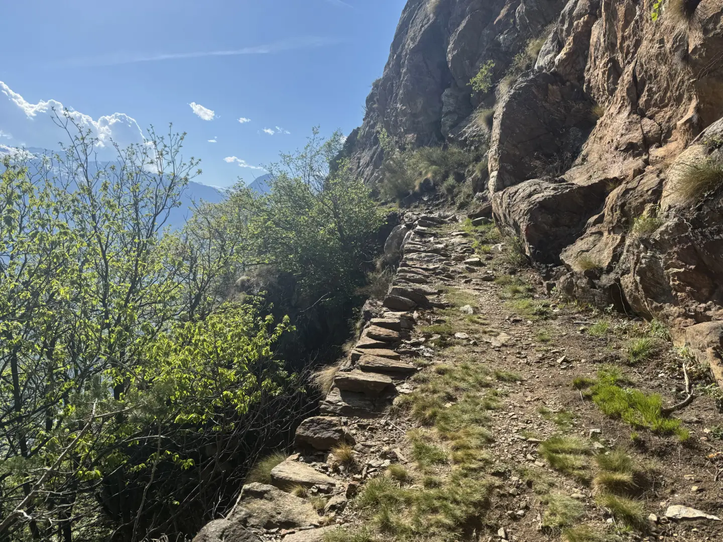
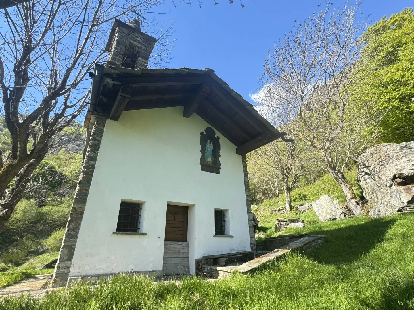
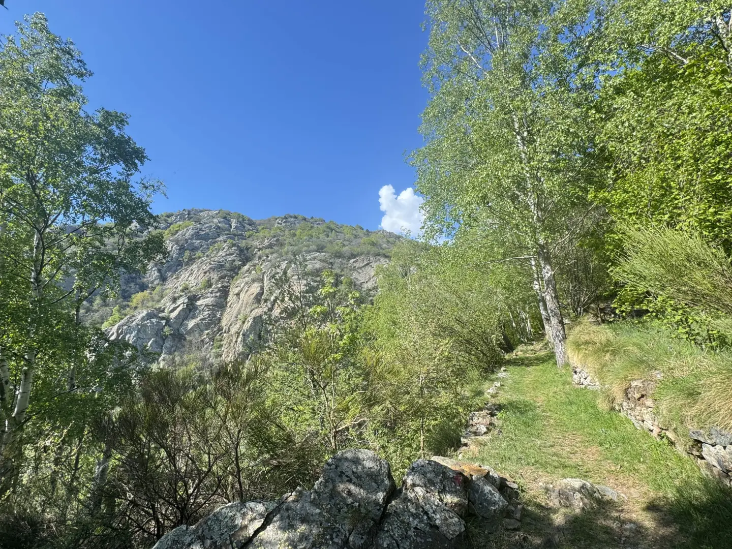
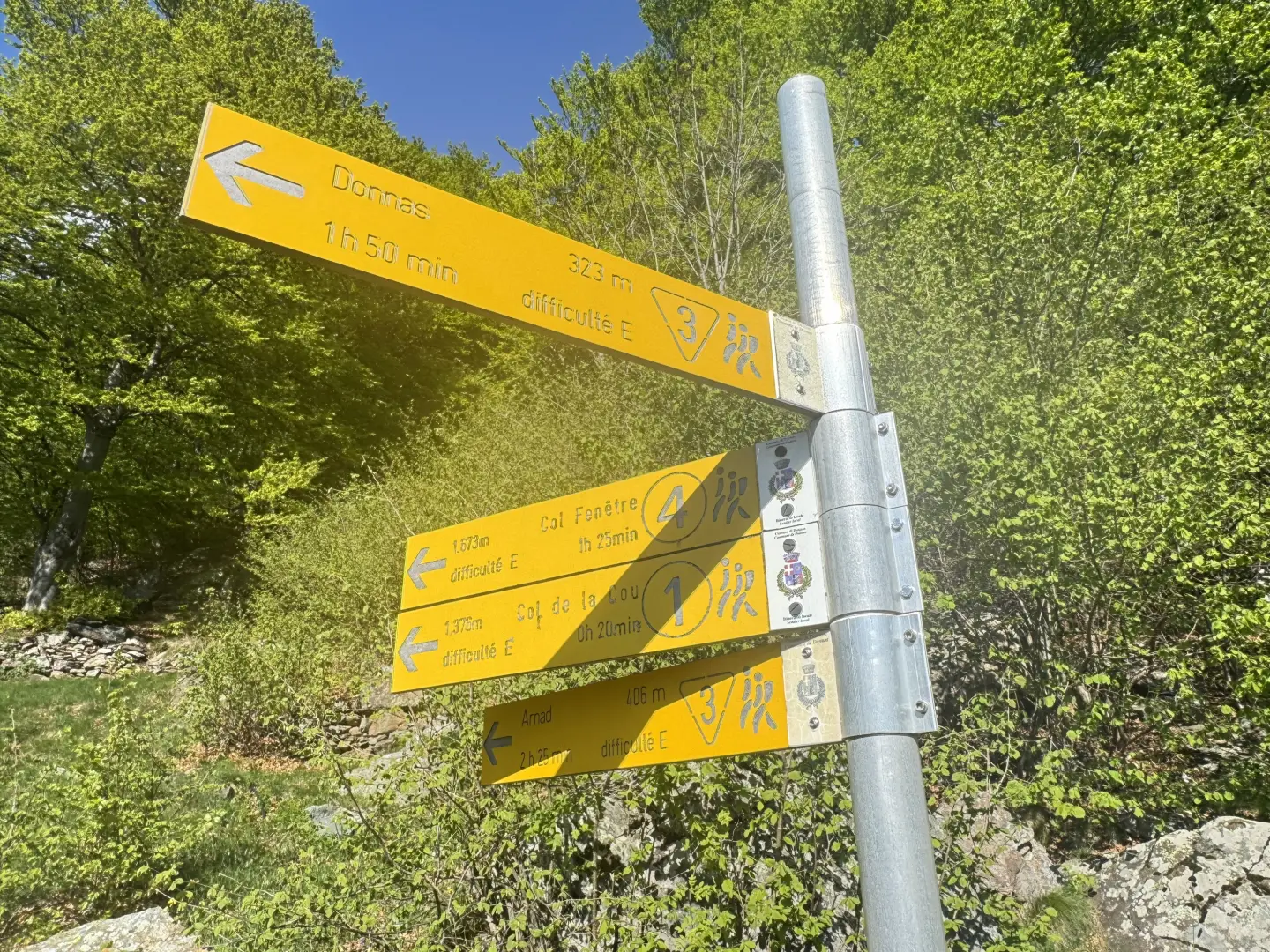
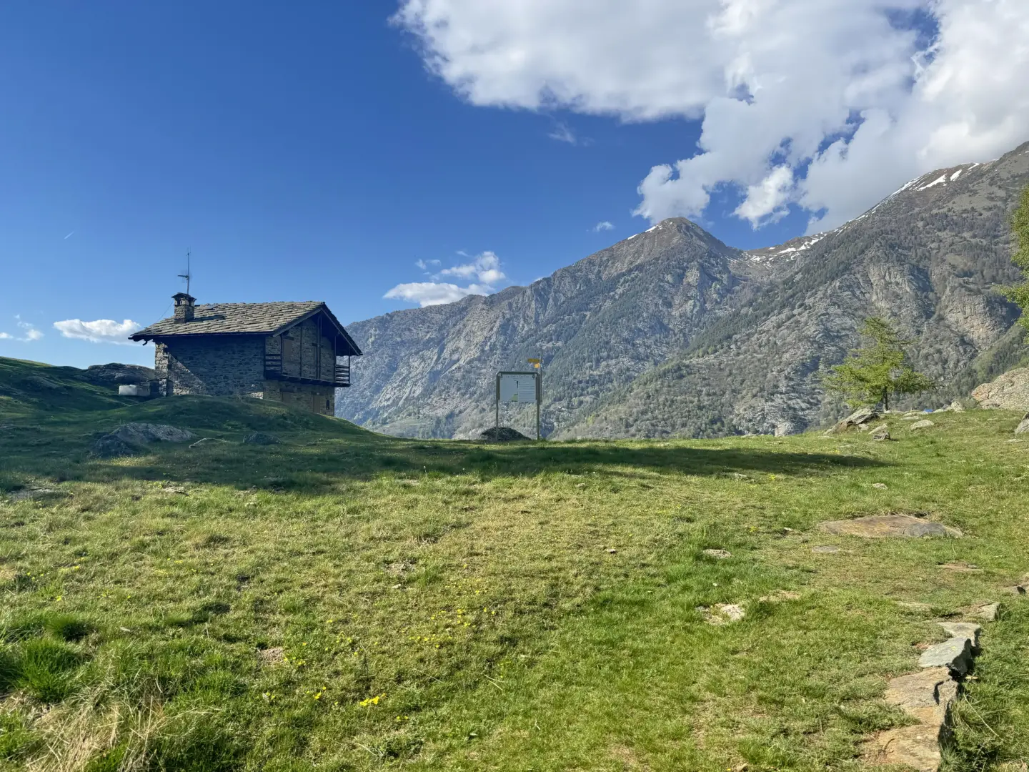
1h05' 1.59km unable to parse Continue straight on, proceeding along the edge of an overhanging rock face that runs alongside the path until a hairpin bend to the left, which soon leads to a panoramic section with a remarkable view of the Fortress of Bard below. After another hairpin bend to the right, you re-enter the forest, left temporarily in the panoramic section, until a subsequent left turn preceding a flat and panoramic section. The destination is not far away: you start climbing again, making a wide bend to the right and entering the hollow before Verale. The wide rocky panettone of the Tête de Cou appears before your eyes. With an even slope, you leave the last wooded patches and enter the pastures that precede the village. The mule track now becomes paved and makes a suggestive bend to the right, first reaching a fountain 💧 and, a little further on, the pretty chapel of Verale (1,238m). Continue past the chapel in the direction of the cottages until you come to the junction for Col de Cou.
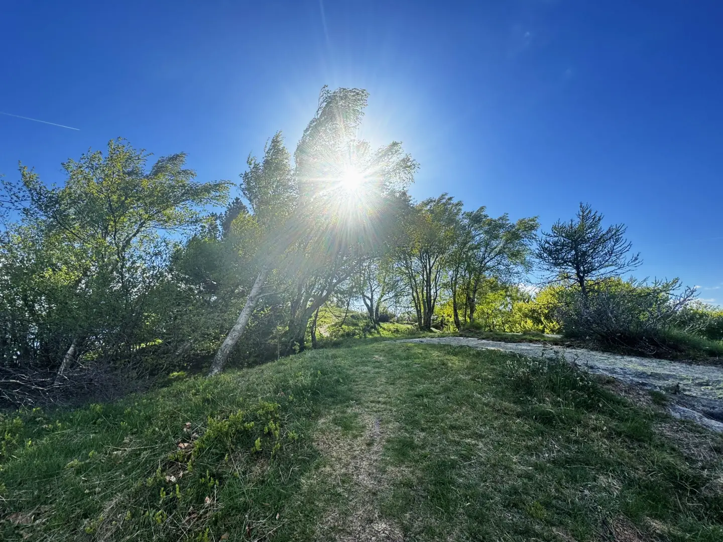
1h55' 2.76km unable to parse Turn left along a stretch of path with a moderate incline. Proceed towards the centre of the depression descending from the pass, then keep to the left at the edge of the slope sloping down from the Tête de Cou. Go back into the forest and, with a few turns, reach a vantage point from which a military building is visible. The trail veers northwards and, after leaving the forest, reaches the wide grassy saddle of the Col de Cou (1,372m), where there is an isolated hamlet.
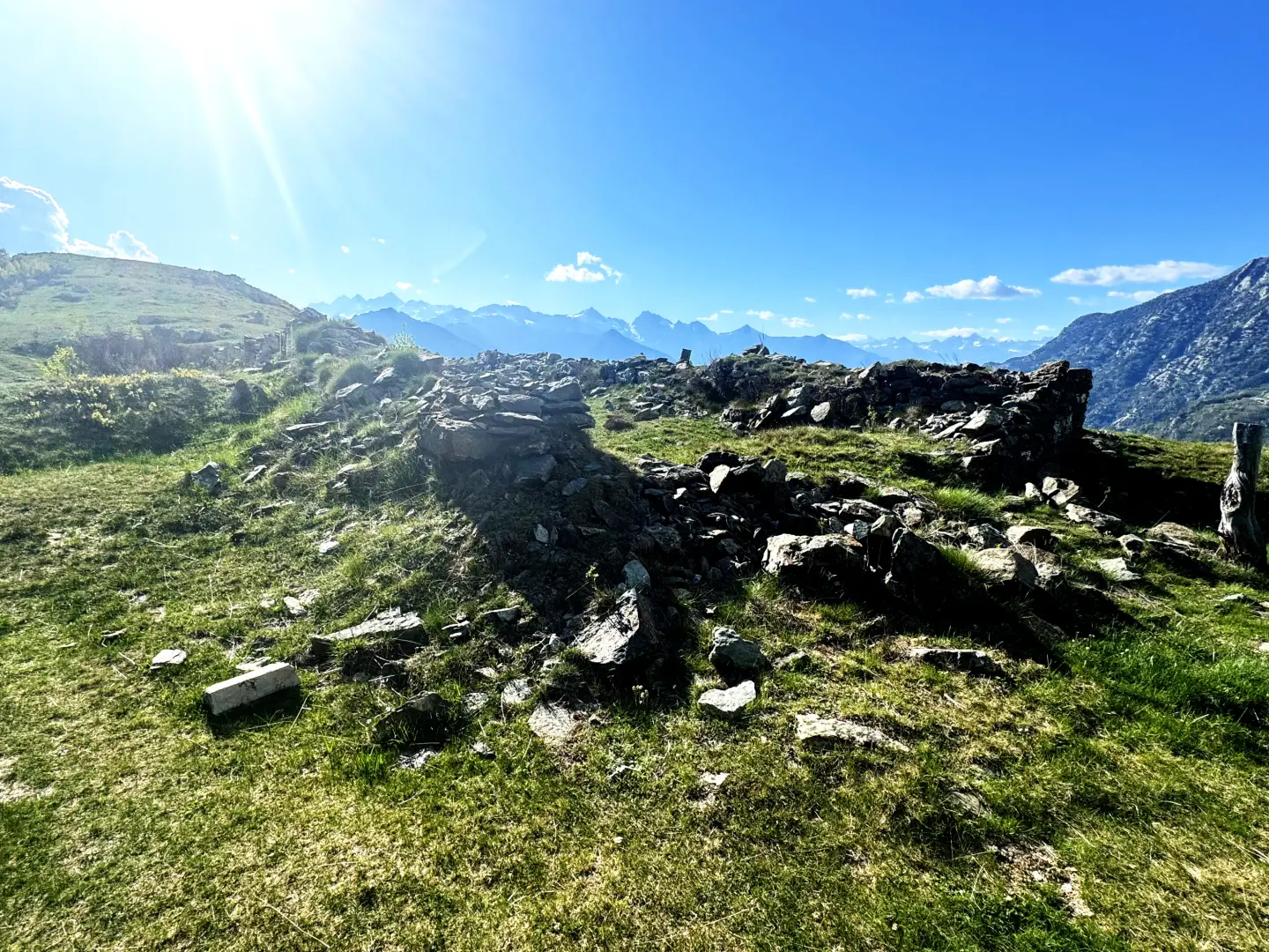
2h15' 2.96km Turn left to first reach the ruins of the Ricovero Capitano Muttoni (Captain Muttoni Shelter), then continue along the track of a path that runs along the grassy summit ridge towards the peak, with some ups and downs. After a final ascent, you reach the summit of the Tête de Cou (1,410m), surmounted by a stone memorial. 2h30' 3.84km
The return is along the same route followed during the ascent. 1h30' 3.84km
Points of Interest
Albard de Bard Chapel
Verale Chapel
Collections
Photo gallery


Comments (0)
Sign in to leave a comment