Punta Ouillette, from Vens

Edited by:
Maria Grazia Schiapparelli
Updated at: 30/06/2026
Access
Navigazione stradale
Lasciare l'autostrada allo svincolo di Aosta Ovest e immettersi sulla strada regionale , seguendola per 950m (0,95km). Alla rotonda, svoltare a sinistra in direzione Courmayeur sulla strada statale e attraversare l'abitato di Saint-Pierre per 2,6km (3,55km). Tenere la destra su Rue Corrado Gex, proseguendo sulla strada regionale per 330m (3,88km), quindi svoltare a destra in Località Pommier continuando sulla per 3,5km (7,38km). Svoltare a sinistra rimanendo sulla per altri 4,6km (11,98km) sino al bivio di Vens. Svoltare a sinistra imboccando la strada regionale di Cerellaz e risalire per 7,95km (19,93km), attraversando i villaggi di Chez Louvitoz, Clavel e Cerlogne. Lasciare la e immettersi su strada comunale, proseguendo per 84m (20,01km) fino al tornante, poco oltre l'abitato di Vens, dove si trova il parcheggio.
Parcheggio
Poco oltre l'abitato di Vens, in corrispondenza di un tornante, si trova un parcheggio 🅿️ gratuito con una dozzina di posti.
Accesso con mezzi pubblici
Per raggiungere il punto di partenza dell'itinerario è necessario un mezzo privato, poiché Vens non è servita da trasporti pubblici.
Distanza e tempo di percorrenza
🕒 Tempo di percorrenza: 30 minuti
📏 Distanza: 20,1km
Navigazione GPS
Nota informativa
Le indicazioni fornite sono state verificate alla data del rilievo dell'itinerario. Prima della partenza si consiglia di verificare possibili variazioni del percorso o delle condizioni stradali. Per informazioni aggiornate si raccomanda di consultare Google Maps o Apple Maps.
Introduction
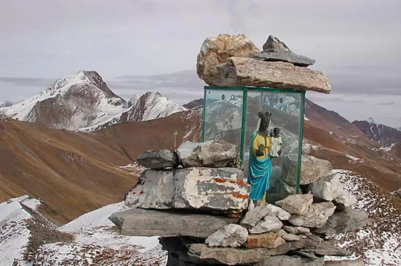
The trip to Aouillette is easy and very scenic; already on the way up after the crossroads beyond Saint-Nicolas, it is interesting to stop on the left, before a small bridge, in a widening marked by a sign, to admire the gullies below, an interesting erosion phenomenon. At Joux there is a beautiful chapel where Pope Wojtila had stopped during one of his Aosta Valley holidays. On the summit we find a glass shrine with the Black Madonna of Oropa inside. Devotion to this 'Biellese' Madonna is widespread in both the Aosta Valley and nearby Savoy. This peak, which is easy to reach, offers a beautiful panorama of the nearby Mont Blanc group and many other Aosta Valley mountains.
.Description
Leaving the car in the small car park in front of the lake (1894m), there is an arrow on the right indicating the ascent path; the route is elementary, steep, at first among larch trees, then outside, in the midst of clearings, while the panorama around it widens as it climbs, until the Mont Blanc group appears in all its beauty; you climb for certain stretches into small valleys, and then also on the ridges that descend from the summit. At a certain point on the route, a diversion to the right, which should be omitted, leads to Lake Leysser. Continue up the fairly steep slope and gain the summit, marked by a shrine with the little black Madonna di Oropa (2616m, 2h00'). Around the Red of Vertosan the Fallère, the Leysser, the Vetan basin, the Vertosan comba with the Dzioule lakes, the entire Mont Blanc range and all the peaks of the valleys overlooking the Ferret and Veny valleys. Descent, by the same route as the ascent, in an hour and a quarter. On the way back, an interesting short stop to visit Vens, with its beautiful houses full of flowers.
Comments (0)
Sign in to leave a comment