Mount Faroma, from Lignan


Edited by:
Ermanno Panara
Updated at: 16/02/2026
Access
Navigazione stradale
All’uscita dello svincolo autostradale di Nus procedere in direzione nord-est per 220m (0,22km). Alla rotonda prendere la prima uscita e imboccare la Strada Regionale di Fénis, proseguendo per 600m (0,82km). Alla rotatoria successiva prendere la terza uscita e, dopo 97m (0,92km), immettersi sulla strada statale della Valle d’Aosta in direzione Aosta. Proseguire sulla per 900m (1,82km) fino a individuare sulla destra l’imbocco per la Valle di Saint-Barthélemy.
Svoltare a destra su Via Champagne e dopo 71m (1,89km) svoltare nuovamente a destra imboccando Via Aosta/. Dopo 160m (2,05km) svoltare a sinistra e seguire le indicazioni per Saint-Barthélemy, proseguendo sulla strada regionale . Risalire la per 15,7km (17,75km), superando i villaggi di Petit-Fénis e Blavy e proseguendo in direzione Lignan. Al bivio in corrispondenza di una curva svoltare a sinistra seguendo le indicazioni per Lignan e continuare per 190m (17,94km). Svoltare a destra e, dopo 30m (17,97km), raggiungere il piazzale di Lignan, termine della navigazione stradale.
Descrizione del parcheggio
A Lignan si trova un parcheggio 🅿️ gratuito situato nei pressi della chiesa parrocchiale e dell’Osservatorio Astronomico della Valle d’Aosta. Il parcheggio costituisce il punto di partenza dell’itinerario. In caso di posti esauriti, tornare indietro di circa 100m dove, sul lato sinistro della strada, è presente un ulteriore parcheggio 🅿️ gratuito. Nei pressi dell’abitato è presente un fontanile 💧 utile per l’approvvigionamento idrico.
Accesso con mezzi pubblici
La località di Lignan è servita da autobus di linea gestiti da Arriva Valle d’Aosta con collegamenti da Nus. Consultare gli orari aggiornati al seguente link ufficiale: https://aosta.arriva.it
La frequenza delle corse può risultare ridotta nei giorni festivi e nel periodo invernale; verificare sempre gli orari prima della partenza.
Distanza e tempo di percorrenza
🕒 Tempo di percorrenza: 27 minuti
📏 Distanza: 18 km
Navigazione GPS
📍 Come arrivare con Google Maps
📍 Come arrivare con Apple Maps
Nota importante
Le indicazioni fornite sono state verificate alla data del rilievo dell’itinerario. Prima della partenza, è consigliabile verificare eventuali variazioni del percorso. Per ottenere indicazioni aggiornate e dettagliate, si consiglia l’uso di Google Maps o Apple Maps.
Introduction
The hike to Monte Faroma is neither very long nor very difficult, but it is more mentally demanding than physically demanding. In fact, due care is always required, both for orientation when losing track of the path, which is often missing, and for progression on rock that is not always stable. The cairns on the mountaineering part are sometimes not very visible, but by looking for them one realises that they point the right way to follow.
Description
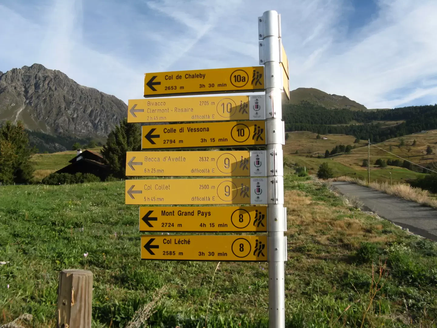
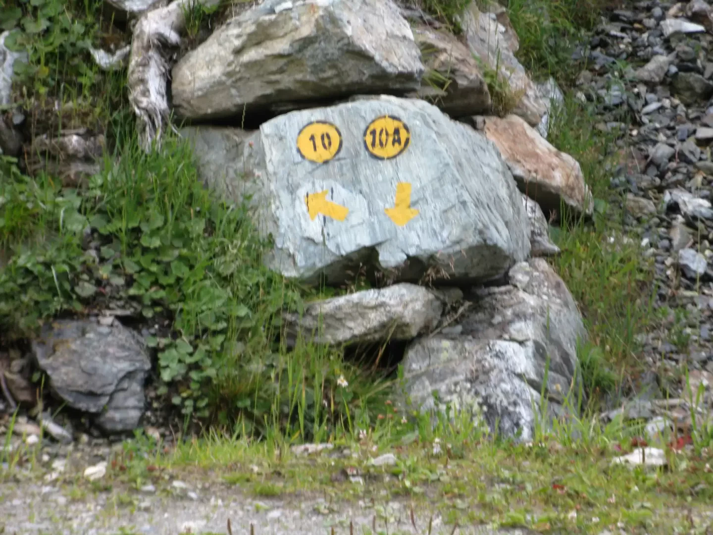
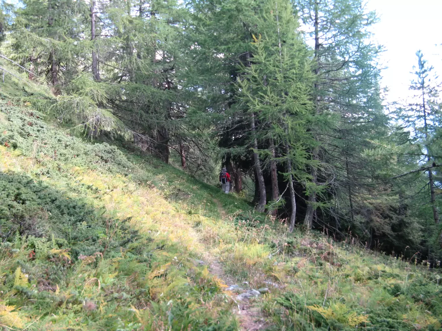
From the Lignan car park, take the road leading to the high villages of Venoz, Larset and Porliod. After passing the astronomical observatory, you will cross a signpost indicating several paths. Immediately turn left onto trail No. 10, taking a wide cart track that enters the forest and skirts the Ru de Saint-Barthélémy in a north-westerly direction. Continue on the dirt track that, after about twenty minutes, crosses the stream and climbs the other side of the mountain in the opposite direction (south-east). Shortly afterwards, turn right, finding the stream again further on. Do not continue along the dirt track, but pay attention to the marker placed on a small rock and indicating path no. 10 on the left.
The path is totally lost, but yellow arrows indicate the direction to follow (North North-East). After passing a hump, the arrows also fail, so keep heading north up the meadows until you reach the dirt track just before the Champanement pasture (2327 m, 1:45 hrs.).
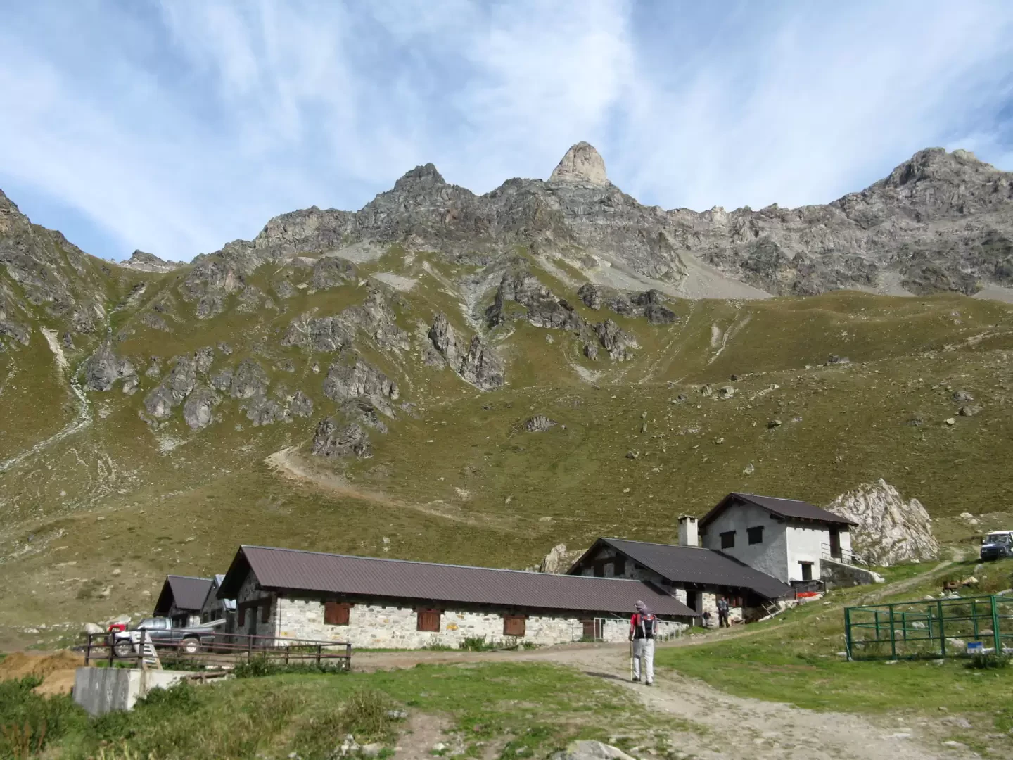
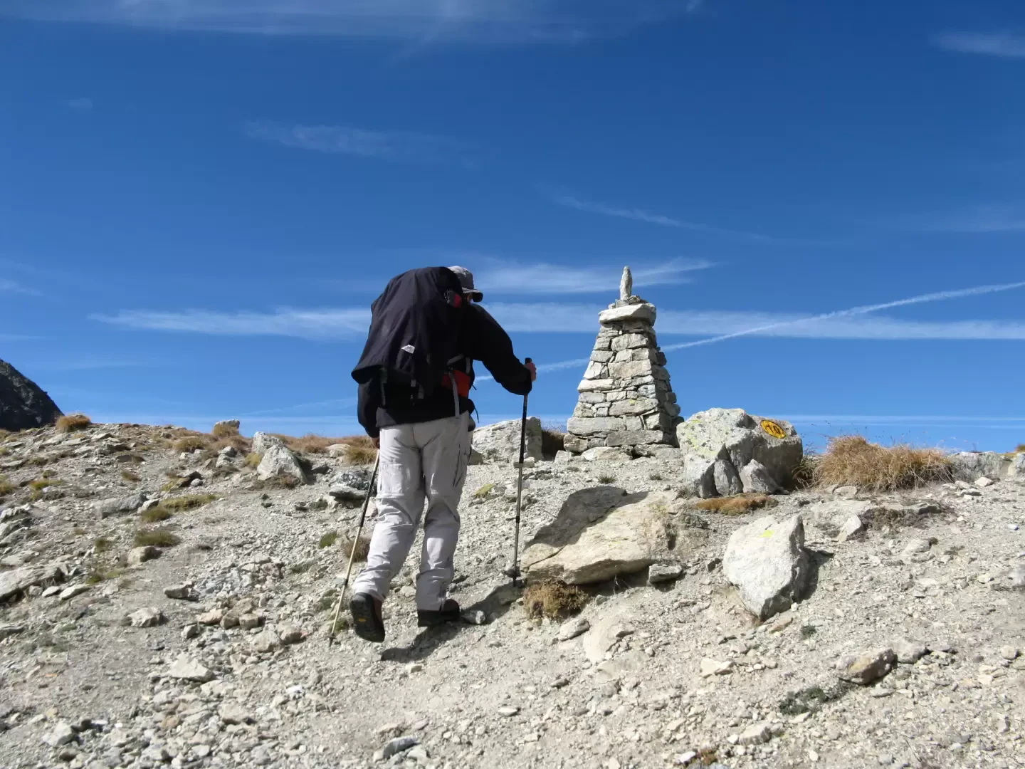
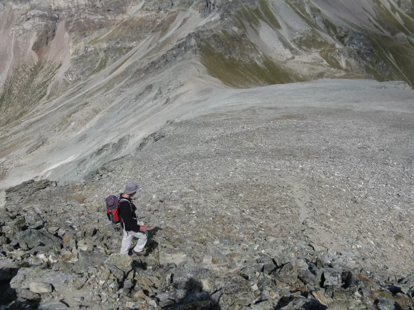
Just after the huts, on a water collection basin, an arrow indicates to go right on a path to retrace the Alta Via No. 1. There are several uphill alternatives. Take the first path that you see on the left and, through meadows without a real trace but with the help of a few cairns, go up the Plan Piscina until you intercept the Alta Via path.
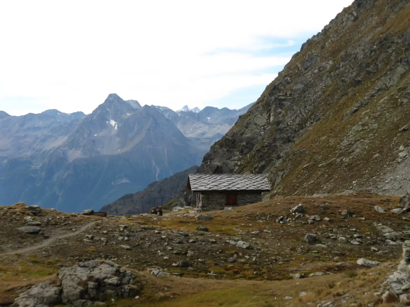
Take it to the left at an altitude of about 2600 m and cross the south side of the Denti di Vessona. After crossing a landslide area and a couple of hills, you come to the Rosaire and Clermon bivouac on the left, located on a hollow near a nice little lake. We now continue uphill and after a couple of twists and turns we reach Col Vessona (2788 m, 3 hours).
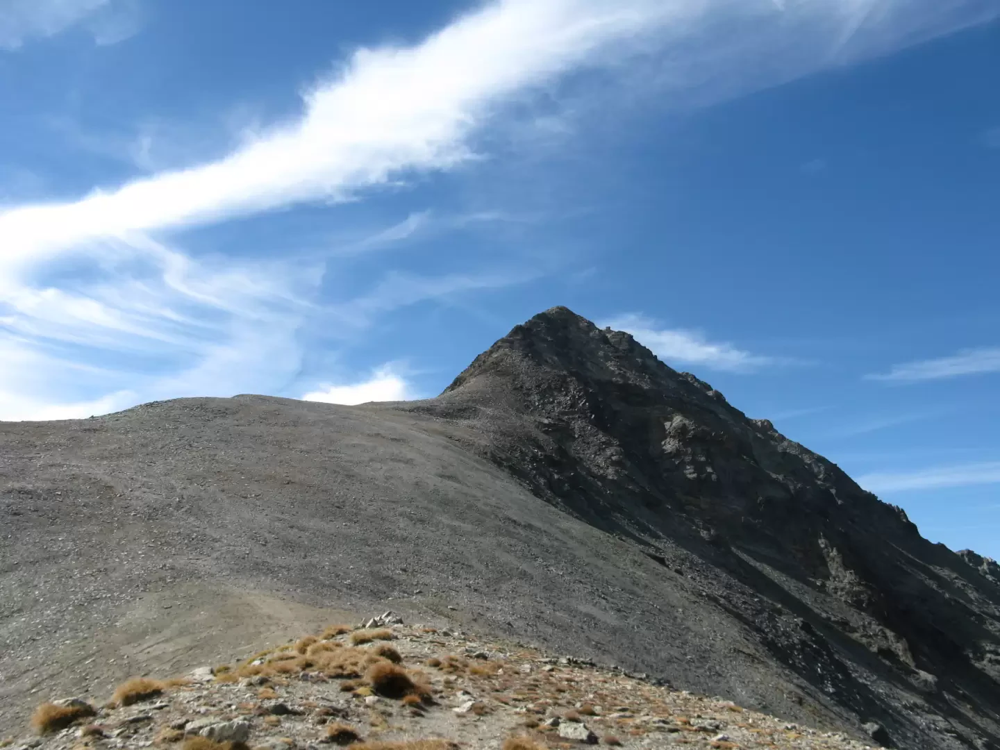
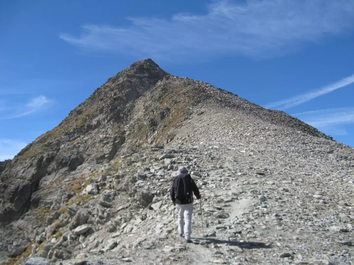
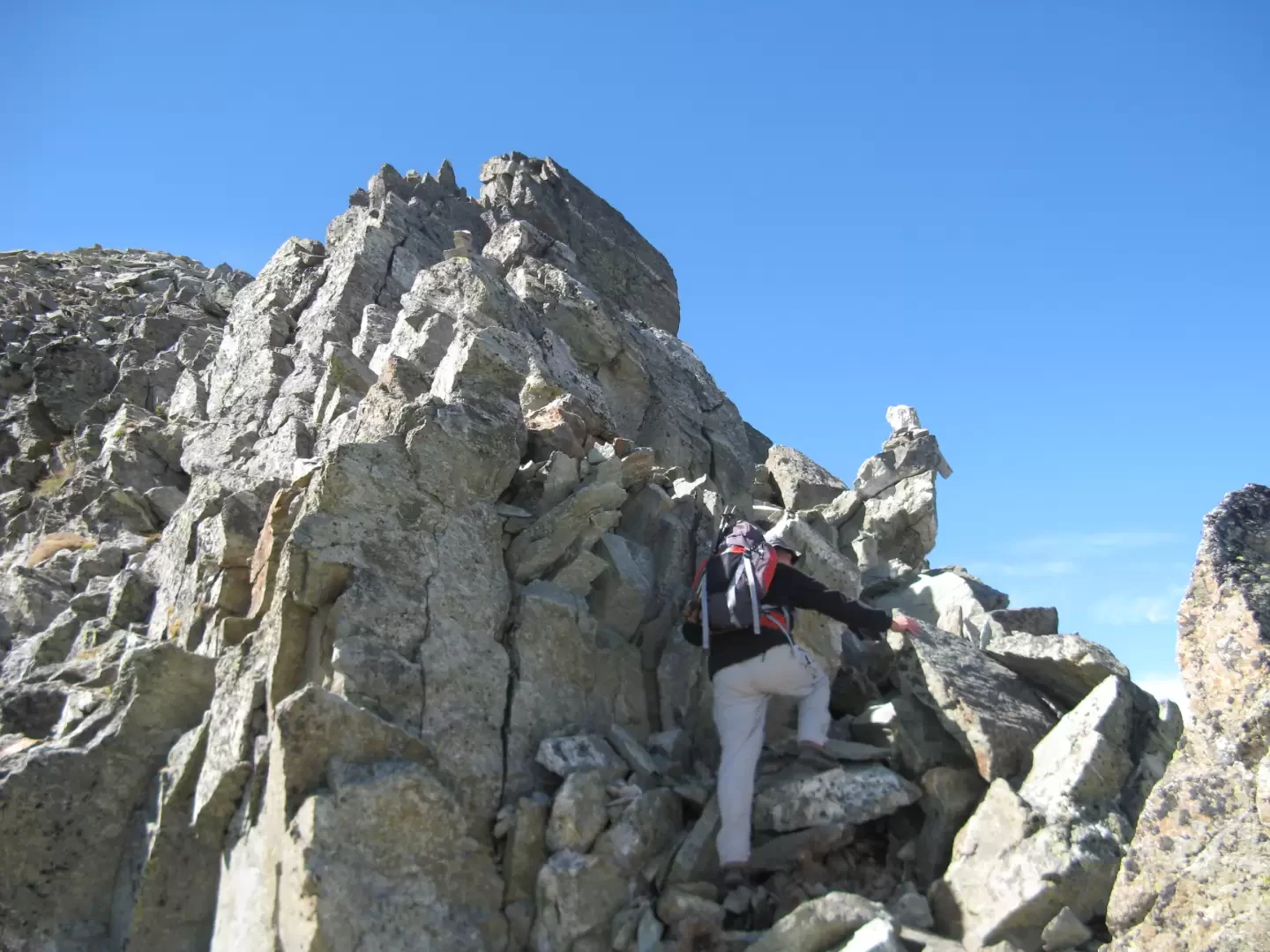
From the pass, we go left onto the wide hump that forms the base of the north-east ridge of Mount Faroma. A faint trail up the scree bank is visible, and large cairns help to keep the right direction. The path gradually becomes rockier and steeper, and for progression one starts to use one's hands until one finds oneself in front of a large rock that invites one to climb, but which must be bypassed on the left on the Saint-Barthélemy side.
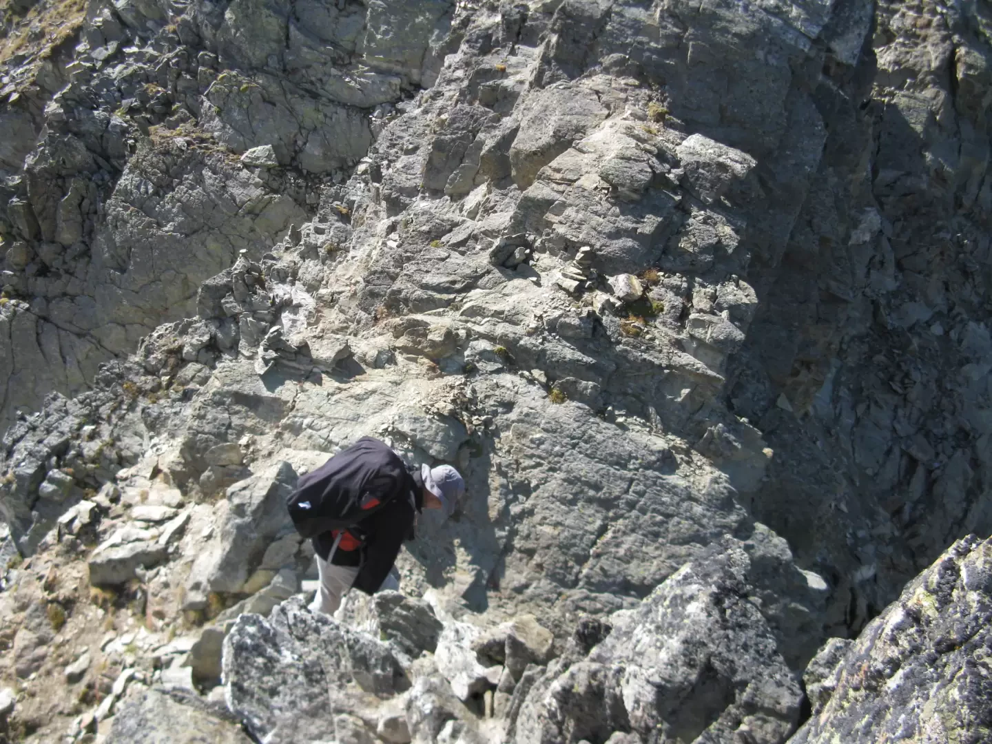
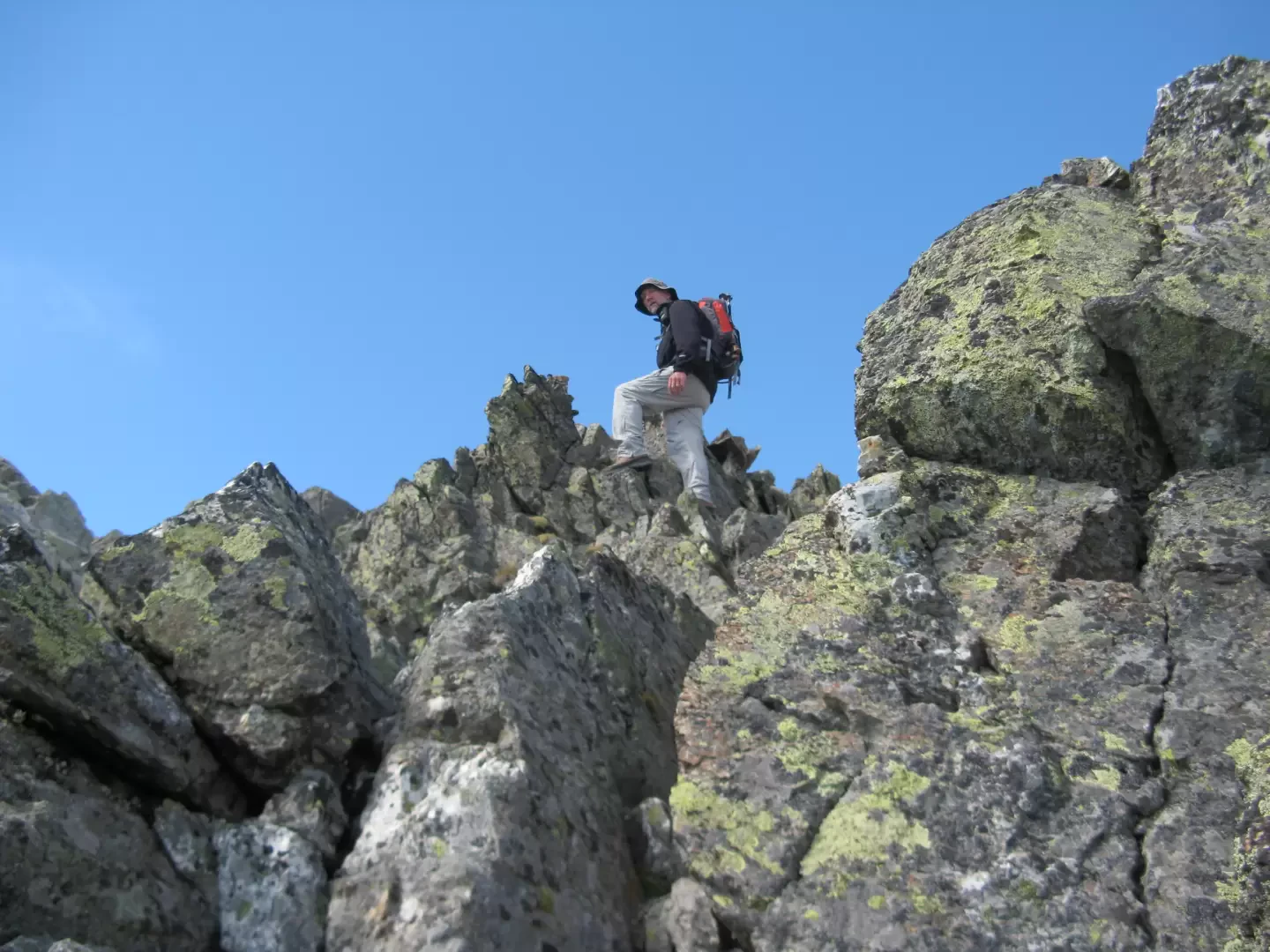
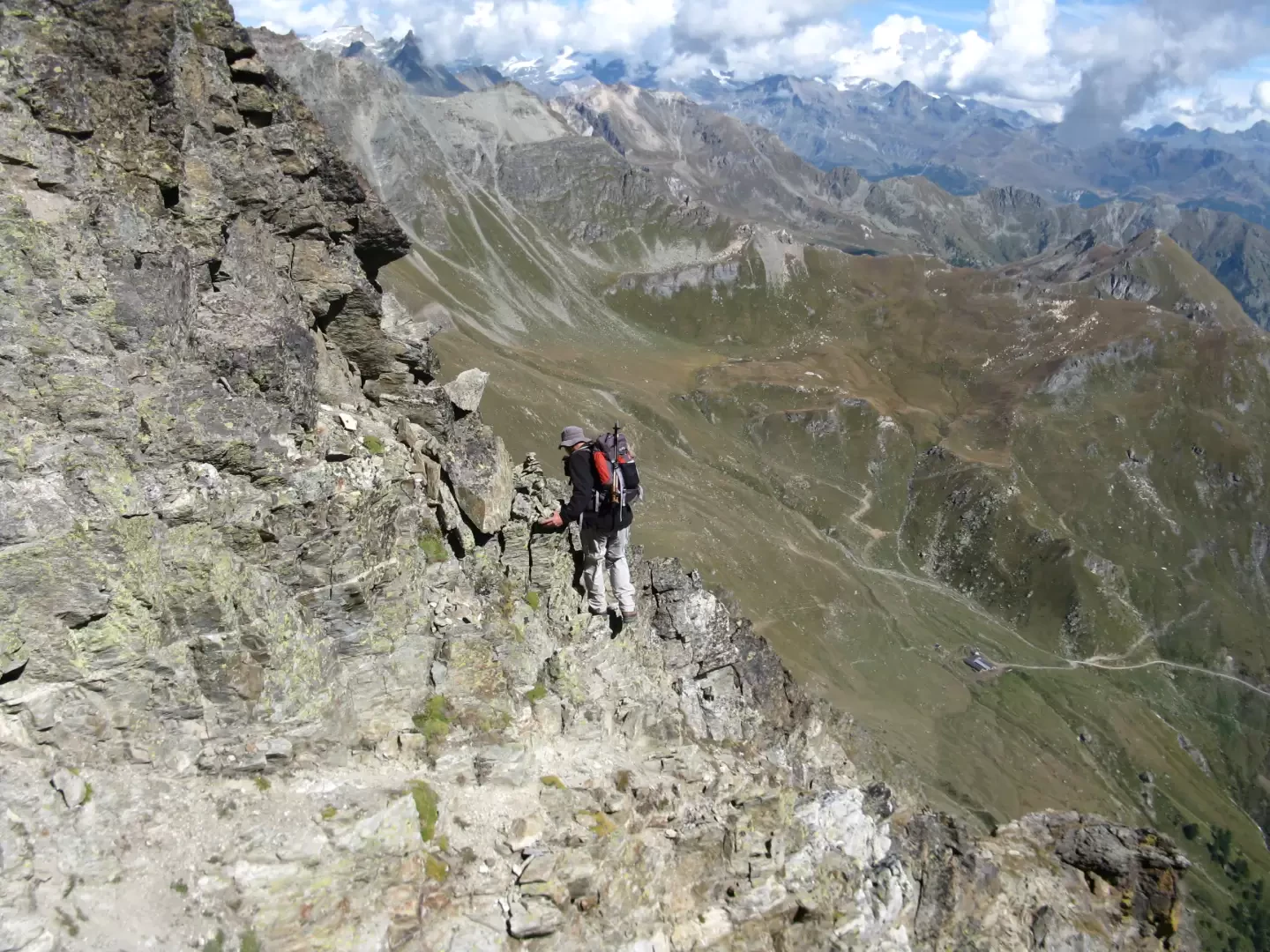
After the large rock, one briefly unclimbs and crosses a scree gully, beyond which one ascends the rock, always trying to follow the cairns. Continue up and down between rocks, steep gullies and more or less exposed ledges.
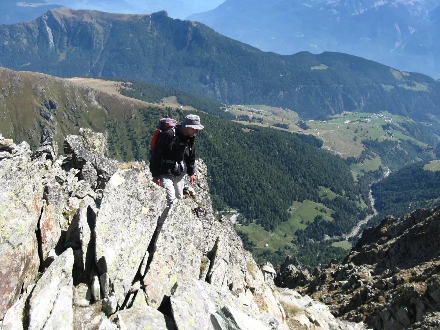
From the crossing of the first gully, continue along rocks to the next gully, which you cross by climbing it for a few metres to reach the opposite slope. Proceed by traverse until you find the third gully, after which you must continue on a delicate ledge because it is exposed and quite slippery. Climb up towards a conspicuous cairn on an edge, after which you can see the summit cross in the upper right-hand corner.
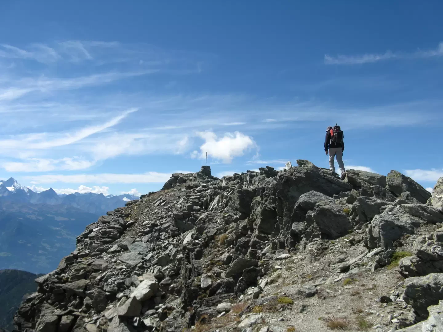
You now climb straight up over rocks and steep sections of path until you reach the summit. The cross is located on a wide panoramic terrace.
Photo gallery
Comments (0)
Sign in to leave a comment