Montandayné, from Pravieux


Edited by:
Massimo Martini
Updated at: 11/10/2025
Access
Leave the motorway at the Aosta West barrier and keep to the left, following the signs for Aosta - Saint-Pierre. After about 1 kilometre, at the roundabout, take the second exit to join the national road . Continue on the state road for 4.3 kilometres, passing the centre of Saint-Pierre until you reach a roundabout recognisable by the presence of the Gran Paradiso National Park effigy. Take the first exit, continue on the for a further 1.4 kilometres and locate the junction for Introd / Rhêmes-Saint-Georges / Rhêmes-Notre-Dame / Valsavarenche. Take the junction and, after 700 metres, at the next roundabout, take the first exit onto Regional Road in the direction of Valsavarenche. Follow the regional road for 3.9 kilometres, pass the village of Introd and climb up the hairpin bends to the crossroads for Val di Rhêmes (). Keep to the left and continue along the as you enter Valsavarenche: after about 22 kilometres and after passing through the villages of Bien, the main town Dégioz, the villages of Tignet, Bois de Clin, Eaux Rousses, and a few hairpin bends, you will reach the Pravieux esplanade. Here, to the left of the direction of travel, there is a free car park (🅿️) reserved for hikers and mountaineers on their way to the Chabod Refuge and Gran Paradiso.
The resort is served by regular buses run by the Arriva company, departing from Villeneuve and with average journey times of around 45 minutes. Regular scheduled services are available, as well as the Allôbus Grand-Paradis dial-a-ride service on weekday mornings (8:30-11:30 a.m.), which provides additional connections between Villeneuve and Valsavarenche. Updated timetables and details can be found on the regional public transport portal aosta.arriva.it.
Distance and travel time
🕒Travel time: 43 minutes
📏 Distance: 30.6 km
GPS navigation
📍 How to get there with Google Maps
📍 How to get there with Apple Maps
ℹ️ Important note
The information provided was checked on the date of the route survey. Before departure, it is advisable to check for any changes to the route. For up-to-date and detailed directions, we recommend the use of Google Maps or Apple Maps.
Introduction
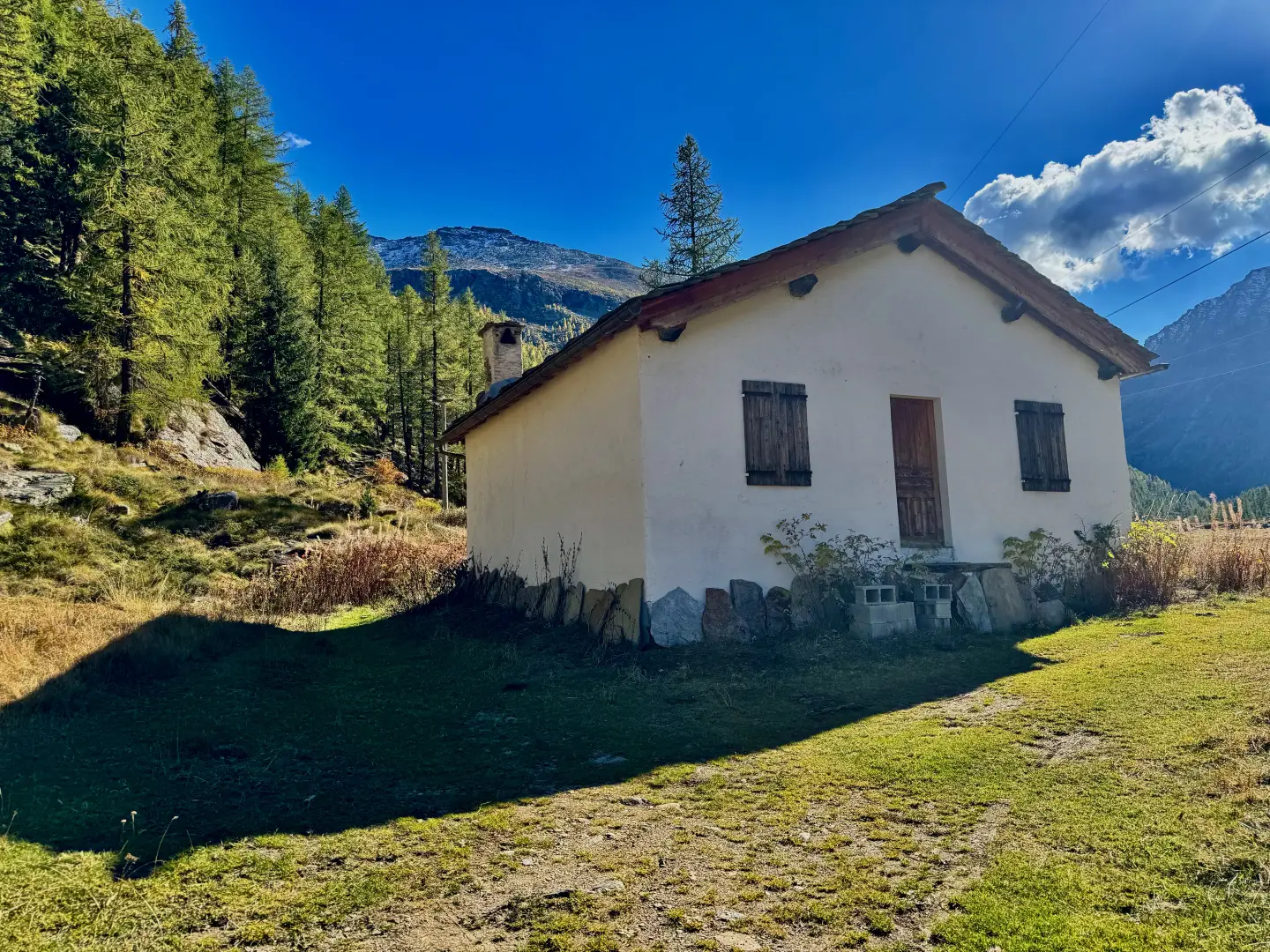
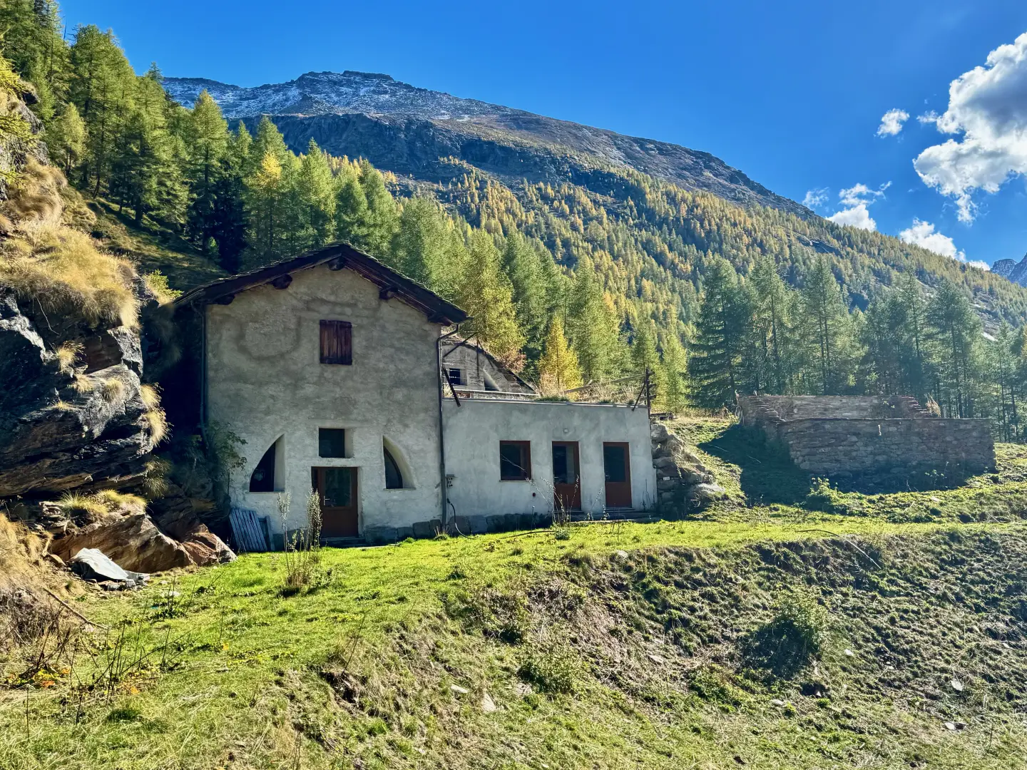
Located in the heart of Valsavarenche, in the Gran Paradiso National Park, the mountain pasture of Montandayné is reached at the end of an evocative route through pastures and larch woods above Pravieux. The toponym preserves the memory of an ancient local family, the Dayné, while the term 'mountains' recalls the Valle d'Aosta tradition of mountain pastures, once the fulcrum of the valley's pastoral economy. Even today, despite a few seasons of neglect, the alpine pastureland retains its charm intact, immersed in a natural environment of extraordinary beauty, dominated by the peaks and glaciers of the Gran Paradiso.
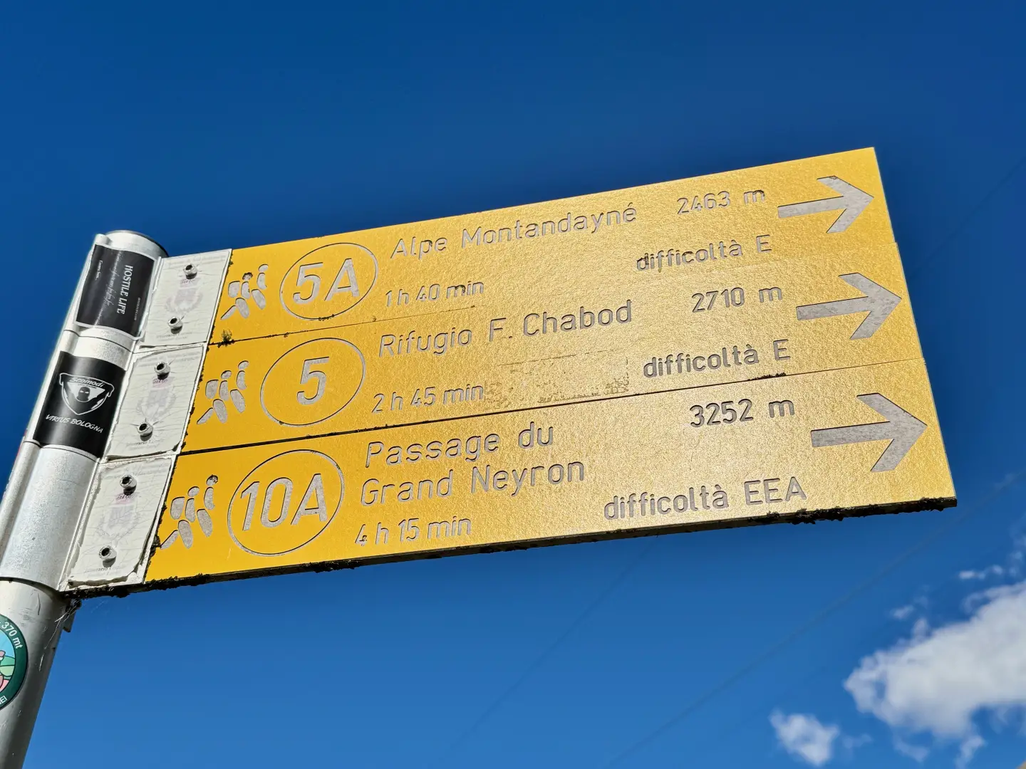
The itinerary leading to Montandayné follows one of the historic Royal Hunting Roads, laid out in the 19th century at the behest of Victor Emmanuel II. The ascent initially winds its way through shady woods and paved mule tracks, then opens out onto the wide high-altitude pastures, offering ever-widening views of the valley and the walls that frame it. The arrival at the mountain pasture evokes atmospheres of times gone by: stone huts, streams of clear water and the silence of alpine basins, where the mountain reveals itself in its most authentic form.
Description
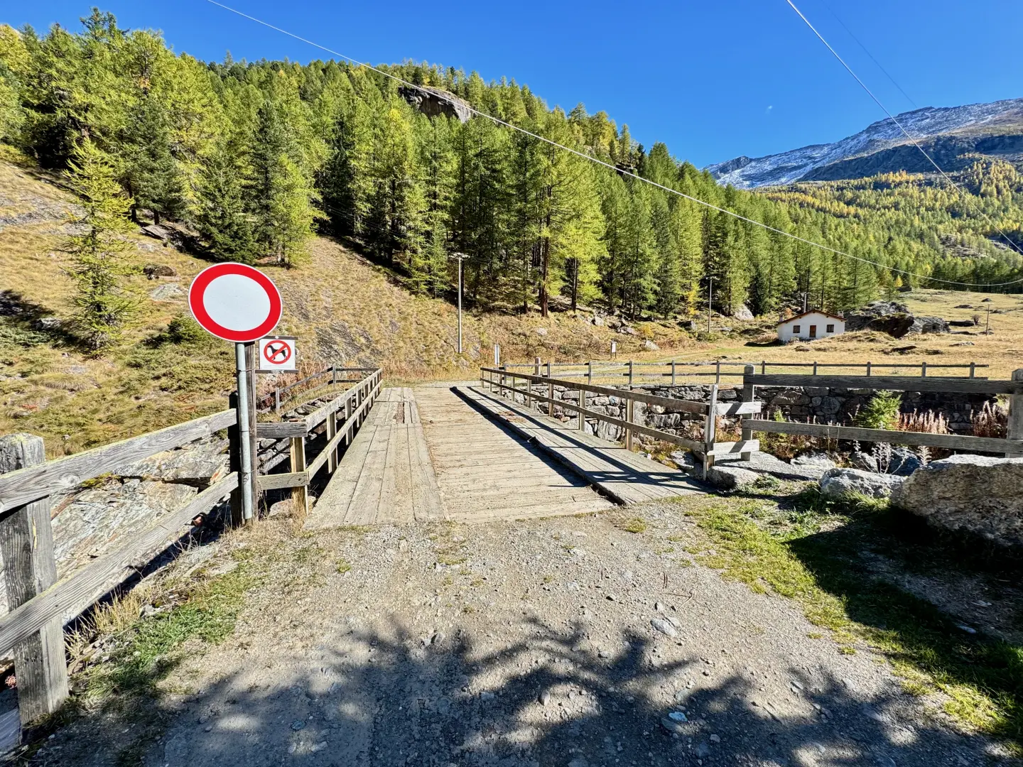
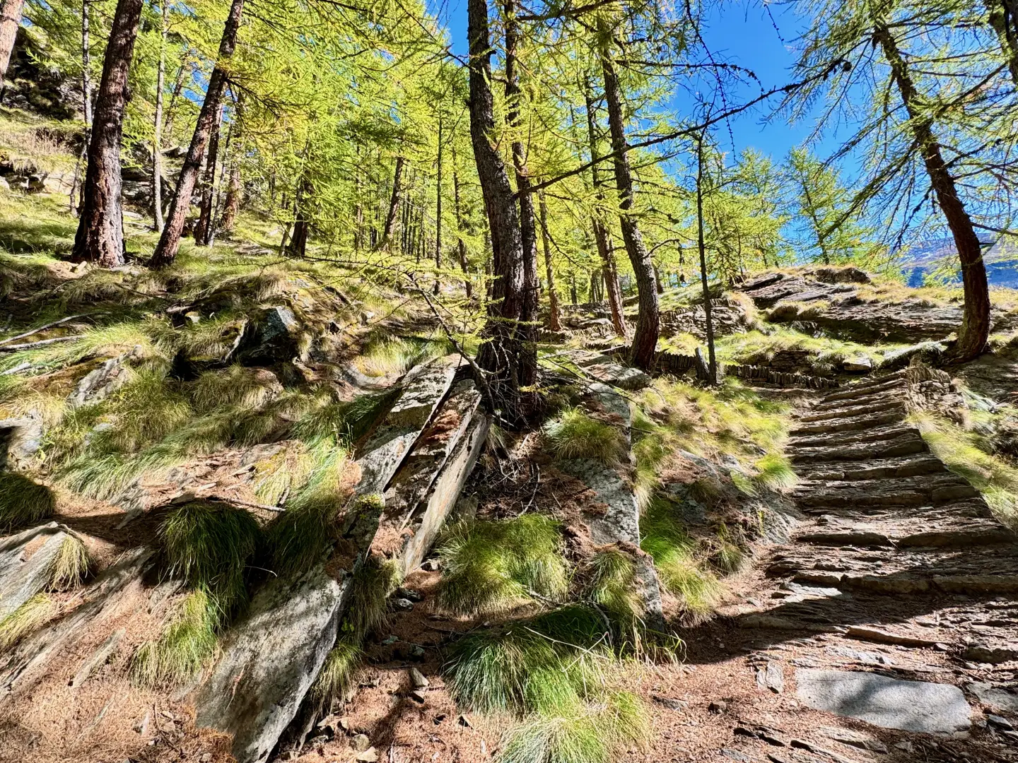
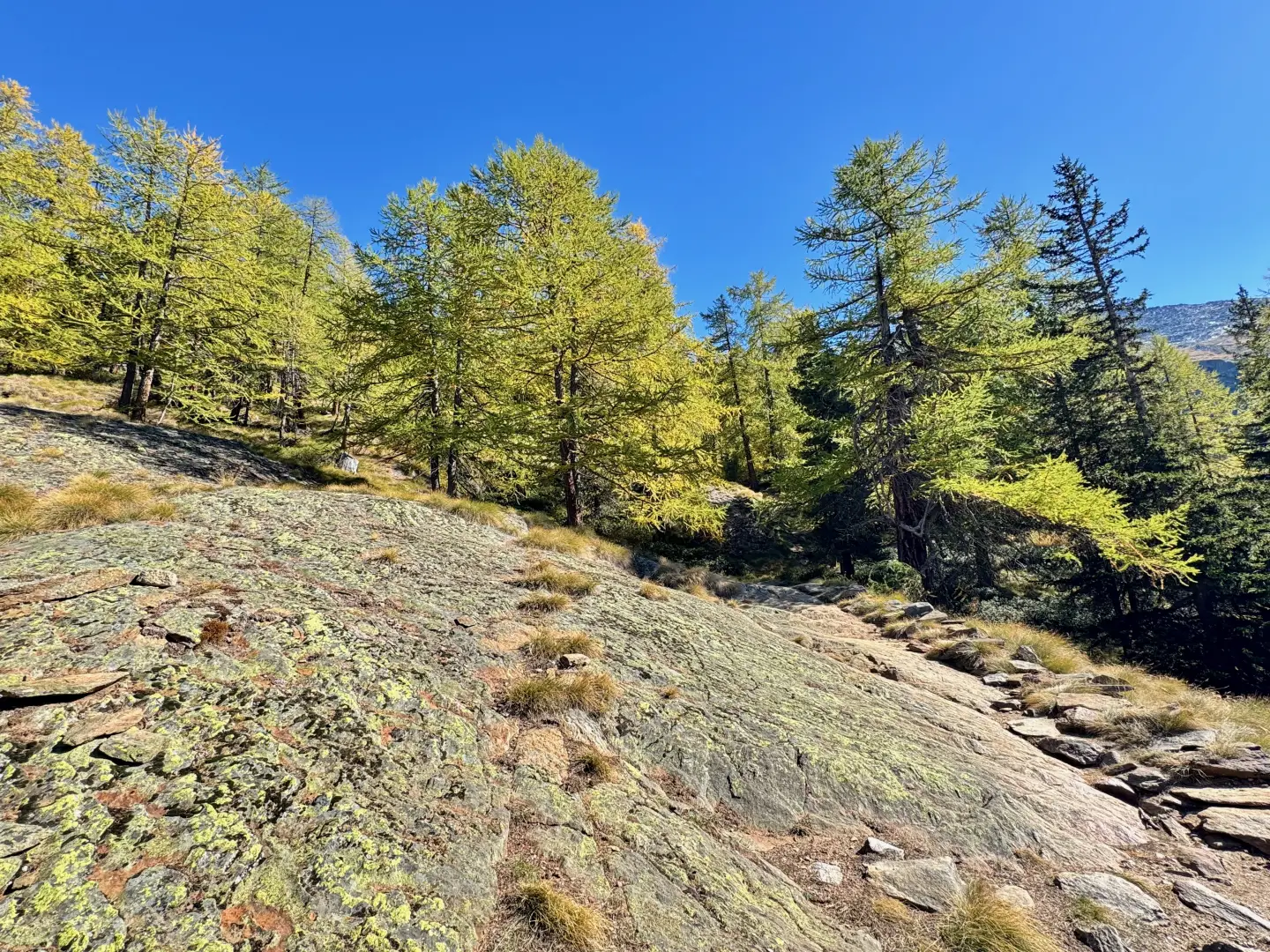
0h00' 0.00km Leave the car park and head towards the signpost indicating the start of the route. Cross the Savara stream on a wooden bridge, then turn slightly to the right towards the hamlet of Pravieux Dessous (1,835m), near which the little road turns into a path. Continue slightly uphill towards the Pravieux Dessus alp (1,869m). The track becomes a beautiful paved mule track, one of the ancient Real Hunting Roads wanted by King Victor Emmanuel II for his hunting trips in the Gran Paradiso Park. With a long series of regular hairpin bends, the mule track gains height among the larch trees (Larix decidua), occasionally opening up panoramic views of the valley. Around an altitude of 2,000m, the path bends to the left, making a long traverse halfway up the slope, then turns right until reaching a rocky slab and a viewpoint. Continue with another hairpin bend to the left, gradually leaving the forest to enter the meagre pastureland that precedes the characteristic Lavassey mountain pasture (2,194m) with a fountain (💧).
1h00' 2.00km Shortly after the fountain, a large boulder is encountered, on which the yellow mark of the trail is visible. Turn left and enter the forest. Proceed slightly uphill in a north-easterly direction, alternating between short stretches of meadowland and sparse woodland. At an altitude of 2,250m, turn right and start walking along the remains of a beautiful mule track that wedges into the small valley, accompanied by a few remaining larch trees. At an altitude of about 2,400m, the trail bends to the left and heads into the wide Montandayné valley. From here, the trail advances towards the centre of the wide meadow basin, passing a first stream and then a torrent fed by glacial meltwater. Proceeding diagonally upwards, we continue in the direction of the now visible mountain pasture, dazzled by the beauty of the surrounding mountain cirque. After a few minutes, we finally reach the beautiful mountain pasture of Montandayné (2,364m) 1h40' 3.40km .
The return trip is made by following the same route back to the car park in Pravieux (1,829m) 1h00' 3.40km .
Points of Interest
Collections
Galleria fotografica