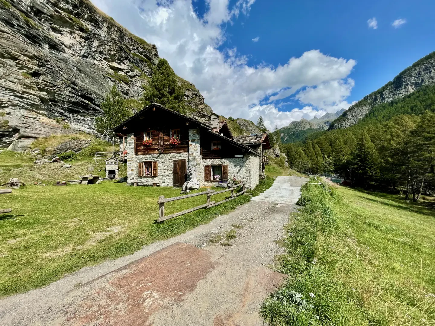
Goilles dessous, from Lillaz

Access
At the motorway junction of Aosta West, turn right and take the regional road for the Cogne valley. Drive through the village of Aymavilles and, after 1.3 kilometres, take the second exit at the roundabout. Go up the regional road for 19 kilometres, passing the villages of Vieyes, Epinel and Crétaz, until you reach a roundabout: take the second exit, following the signs for Lillaz. Continue on the communal road for about one kilometre until you reach another roundabout; continue straight on for another 1.8 kilometres until you reach the large free car park 🅿️ in Lillaz.
[0h32'] - [24.0km]
How to get there with GMAPS
How to get there with Apple Maps
The directions provided have been carefully checked at the time of the route survey. However, it is highly recommended to check for any changes that may have occurred since then, especially regarding the route to the starting point. Before embarking on your journey, it is advisable to consult up-to-date navigation tools for accurate and up-to-date directions. We recommend the use of satellite navigation apps, such as Google Maps or Apple Maps, to ensure the most accurate and safe route.
Description
0h00' 0.00km From the car park, head towards the shelter where the main paths in the area are indicated. Continue straight ahead on the small road that runs alongside the Urtier stream and passes the CVA power station, before reaching a fork and the no-transit sign. Keep to the left and, after meeting another signpost, take the path. Begin the ascent into the larch forest (Larix decidua), leaving the last houses of the village behind. The path, with a series of hairpin bends, rapidly gains height until it reaches the junction for the Lillaz waterfalls .
0h12' 0.41km Continue straight ahead, soon reaching a small road, turn left and then, after a few metres, right, following the signs for the climbing hall. Continue along an open section, meeting the fork for the climbing hall (on the right).
0h12' 0.61km Continue towards a rocky buttress. The path tends to the right, cross the penstocks of the Lillaz CVA power station and reach a votive shrine located above the waterfalls (1,726m, 0h20').
0h12' 0.41km Here the path descends slightly until it reaches below some pastures where it begins to climb, crossing them, until reaching Goilles Desot (1,834m, 0h35').
Points of Interest
- Lillaz
- Lillaz Waterfalls
- Lillaz Rock Gymnasium
Collections
- hikes departing from Lillaz - on the map
- hiking in the Cogne Valley - on the map
- hiking in the Gran Paradiso National Park - on the map
- hiking in the Aosta Valley - on the map