Fenêtre d'Ersaz, from Etirol


Edited by:
Massimo Martini
Updated at: 21/10/2025
Access
Leave the motorway junction at Châtillon-Saint-Vincent, turn left and continue for 300 metres to the roundabout. Take the third exit onto Via Émile Chanoux and follow it for 600 metres through the historic centre of Châtillon. Turn slightly right onto Via Menabreaz and continue for 450 metres to the roundabout with the Matterhorn monument in the centre. Take the second exit and enter the Regional Road in the direction of Valtournenche. Continue on for 7.8 km until Antey-Saint-André, where you will come to the junction with Regional Road for Torgnon. Turn left and climb up the road for 6.4 km until you reach the main town of Mognod. Continue straight on, following the signs for the ski lifts. After 400 metres, at a hairpin bend to the left, turn right onto the municipal road, following the signs for Petit Monde, Triatel and Etirol. Continue along the narrow road until you reach the village of Triatel and finally that of Etirol, where there is a small car park 🅿️ near the village. If the car park is full, it is possible to turn around and park in some of the open spaces along the road.
To reach the starting point of the route, private transport is indispensable, as it is not served by public transport.
Distance and travel time
🕒Travel time: 33 minutes
📏 Distance: 19.6 kilometres
GPS navigation
📍 How to get there with Google Maps
📍How to get there with Apple Maps
ℹ️ Important note
The information provided was checked on the date of the route survey. Before departure, it is advisable to check for any changes to the route. For up-to-date and detailed directions, we recommend the use of Google Maps or Apple Maps.
Introduction
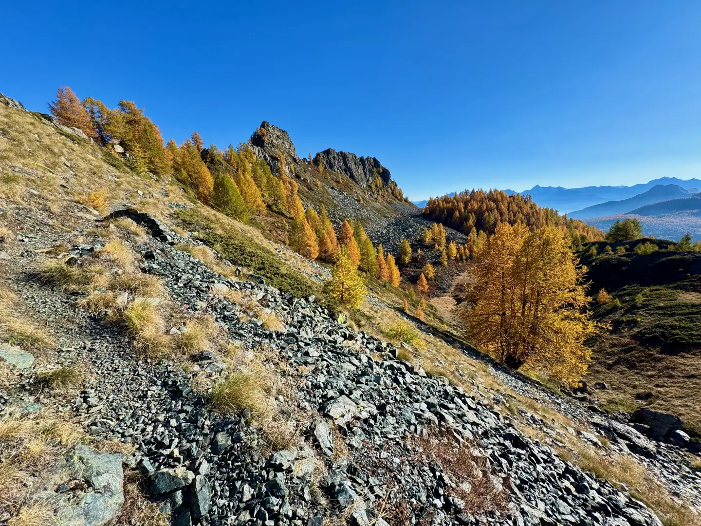
La Fenêtre d'Ersaz (2,290m) is one of the most interesting excursion destinations in Valtournenche, located in the municipality of Torgnon, along the ridge that separates the basin of the same name from the upper valleys of the main valley. The proposed itinerary starts from the village of Etirol (1,598m) and follows ancient mule tracks and mountain paths, crossing larch forests, pastures and evidence of the local rural past. The route does not present significant technical difficulties - T2 - (E according to the CAI scale), but does require a fair amount of training to tackle some steep gradients.
Along the way, you will encounter historic rascards, abandoned alpine pastures, fountains and marker stones, which restore the authentic atmosphere of the Valle d'Aosta alpine environment. October is a particularly good time to tackle this hike: the larch trees offer a suggestive spectacle of foliage, with warm hues accompanying much of the route. The ascent is enriched by several vantage points, offering sweeping views of Punta Tsan and the peaks of the mid Valtournenche.
Description
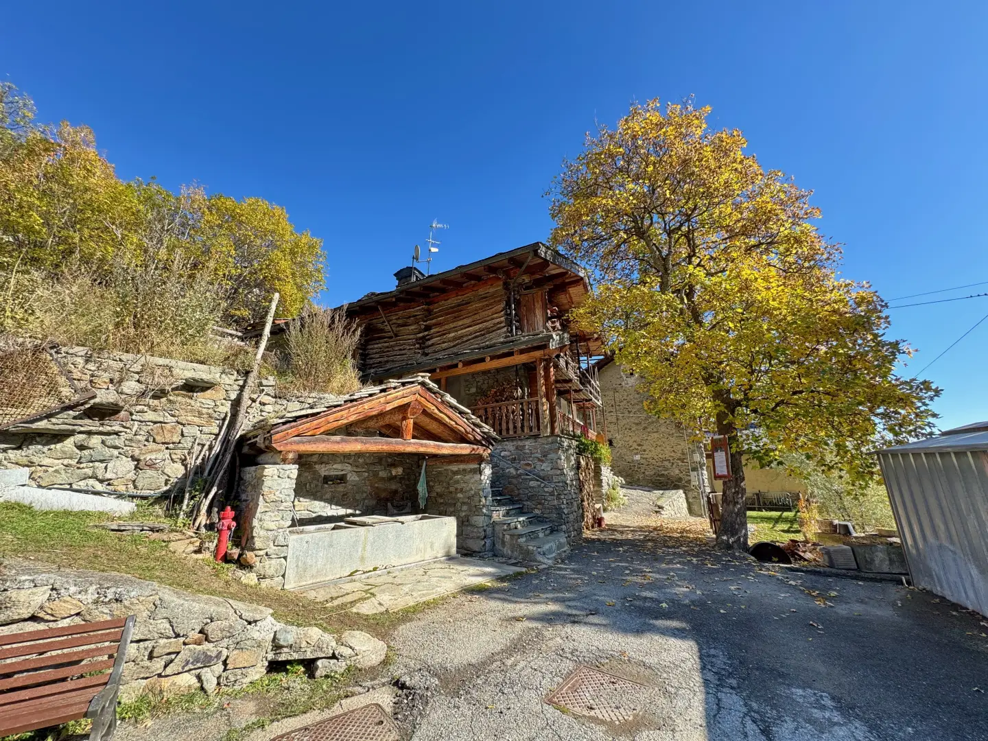
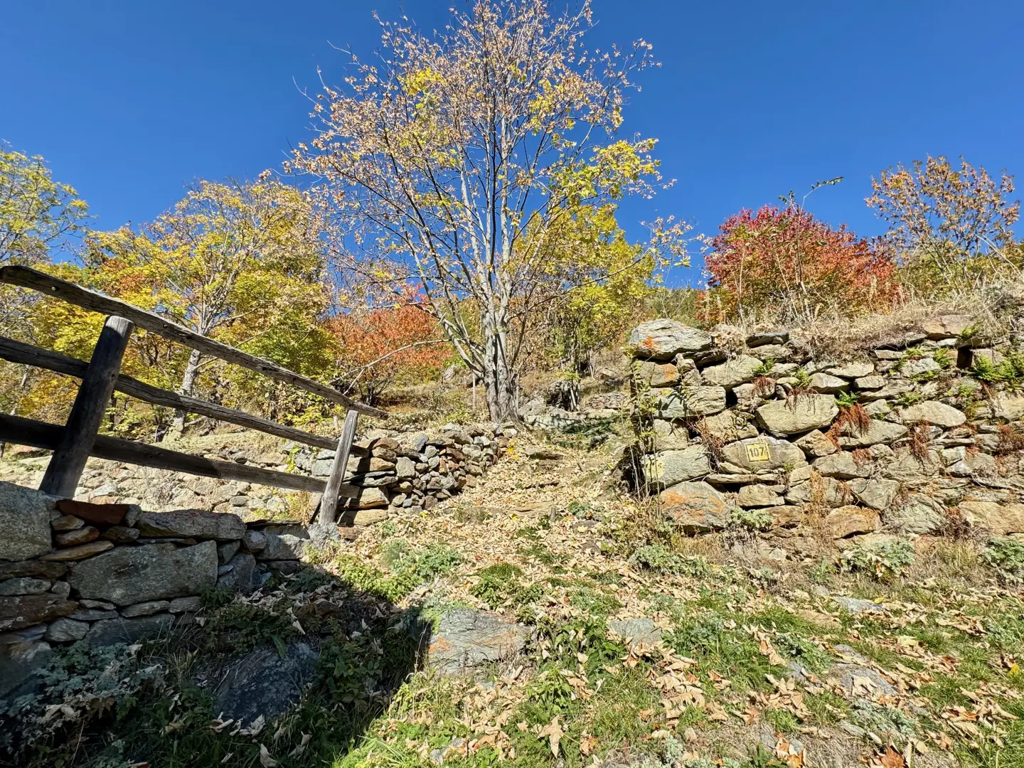
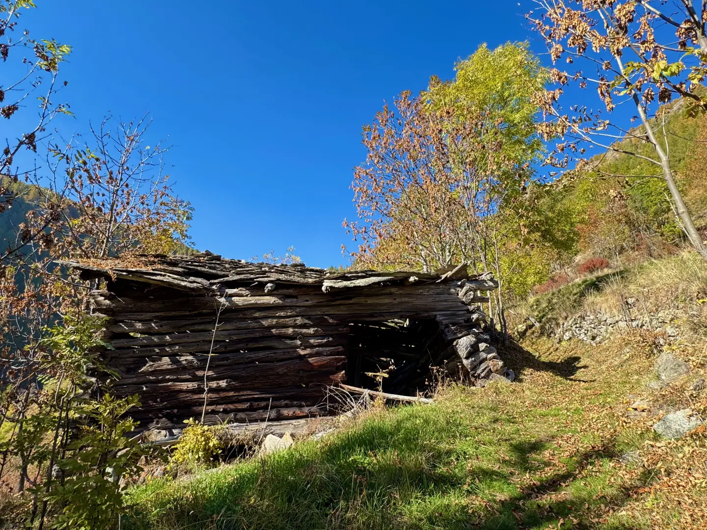
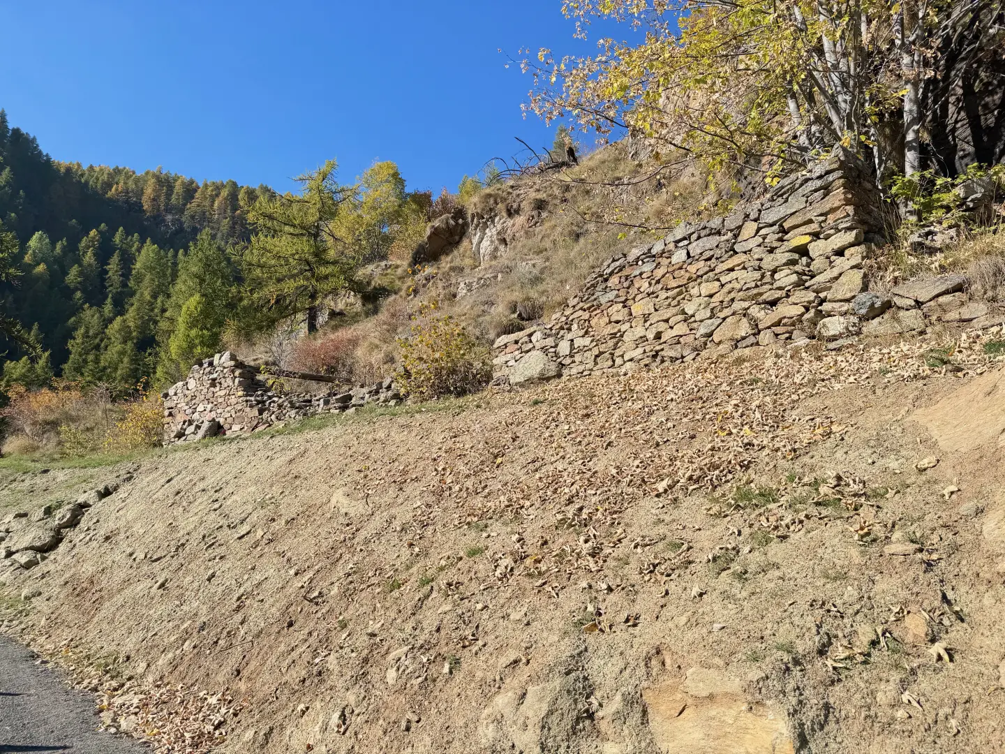
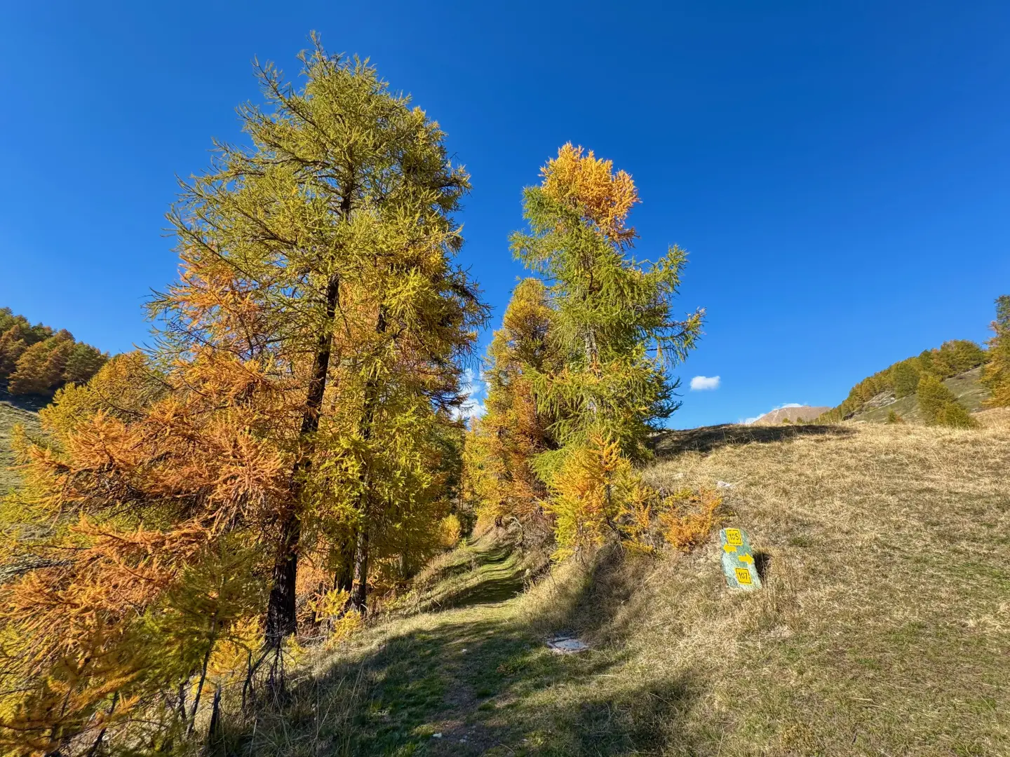
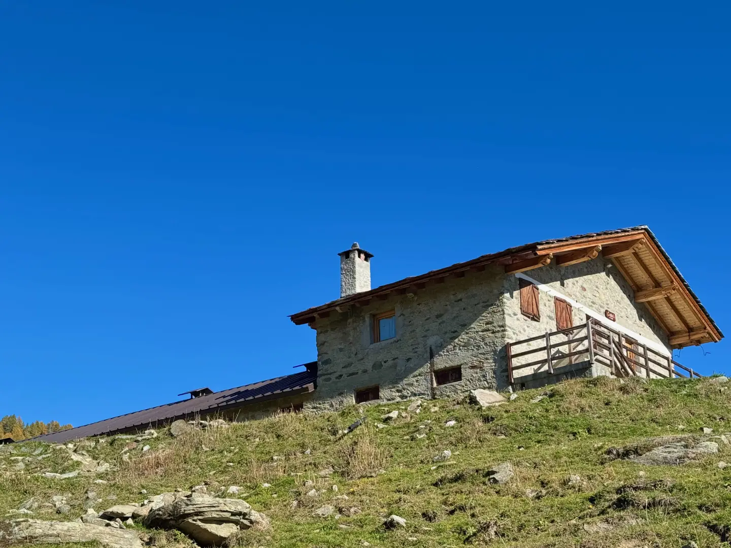
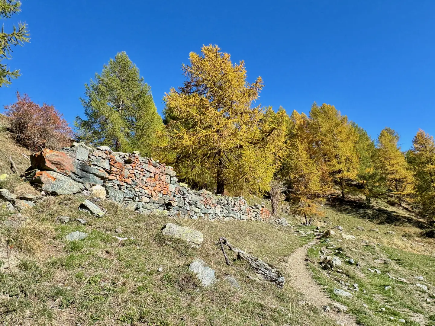
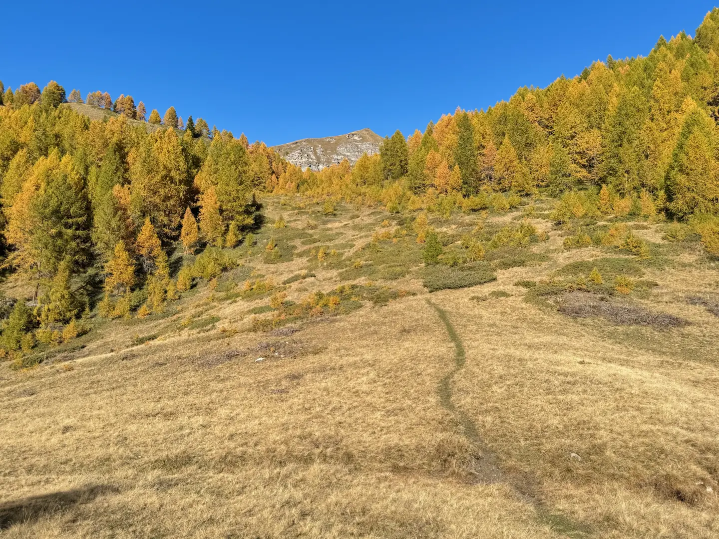
0h00' 0.00km 0h00' From the car park, near which there is a drinking fountain (💧), go straight on in a south-easterly direction towards Etirol (1,598m) and a beautiful maple tree (Acer platanoides). When you reach the first houses, turn left, then right and left again through the village. Past the last house, cross the farm road and continue along the old paved mule track that enters the forest in a north-westerly direction. After a few minutes' walk, an old collapsed rascard is encountered. Continue slightly uphill into the forest, which is coloured in autumn with beautiful yellow hues. The path then crosses a small stream and becomes slightly steeper until it meets the farm road again. Follow it as far as the ruins of the old Levaz Dessous pastureland (1,677m), where the road ends and the trail picks up again. Continue almost level along the path, which bends slightly to the right as it enters the Petit Monde valley. At an altitude of 1,690m, you will come to the junction of the path .
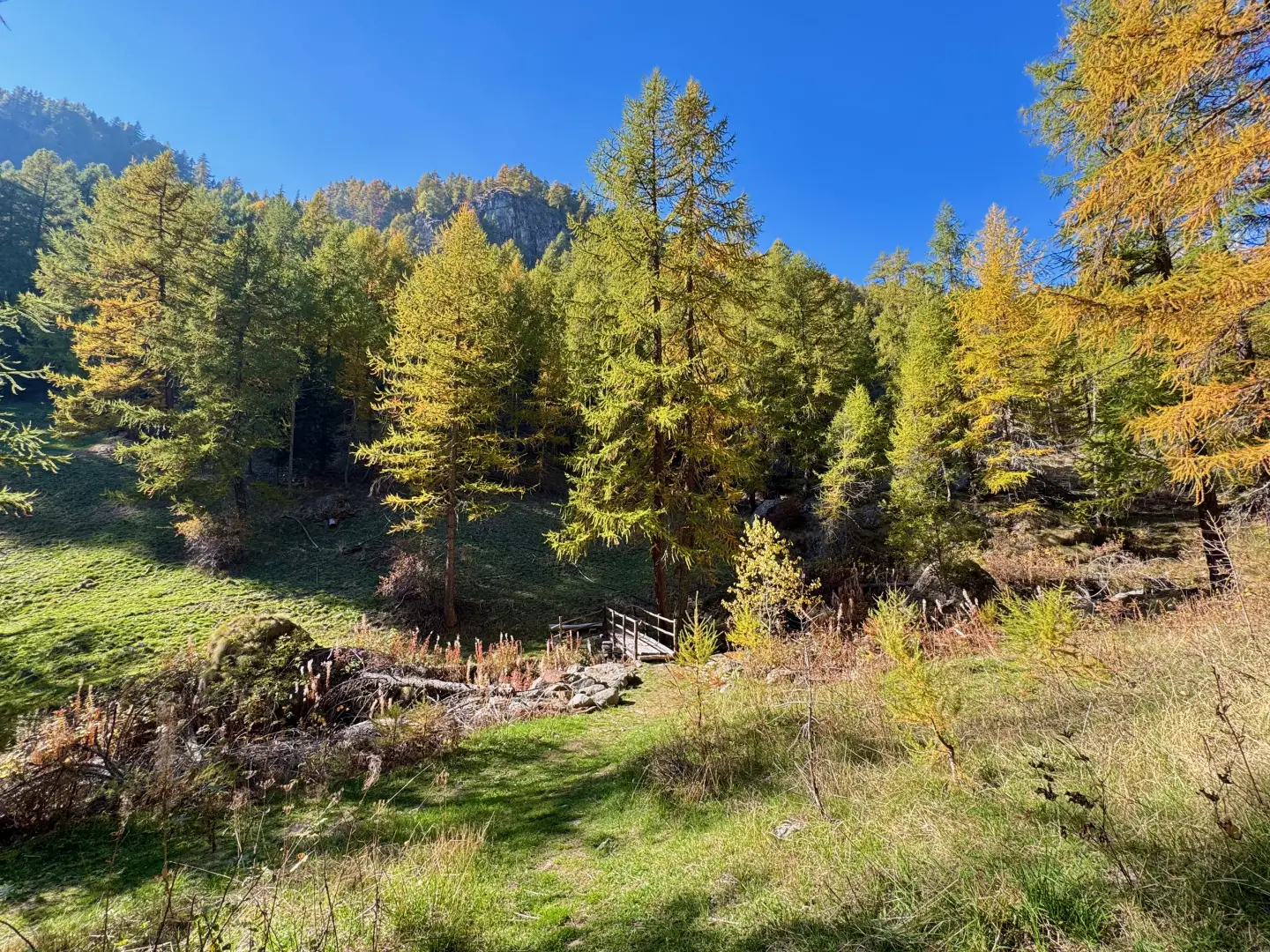
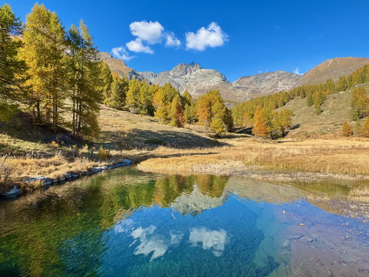
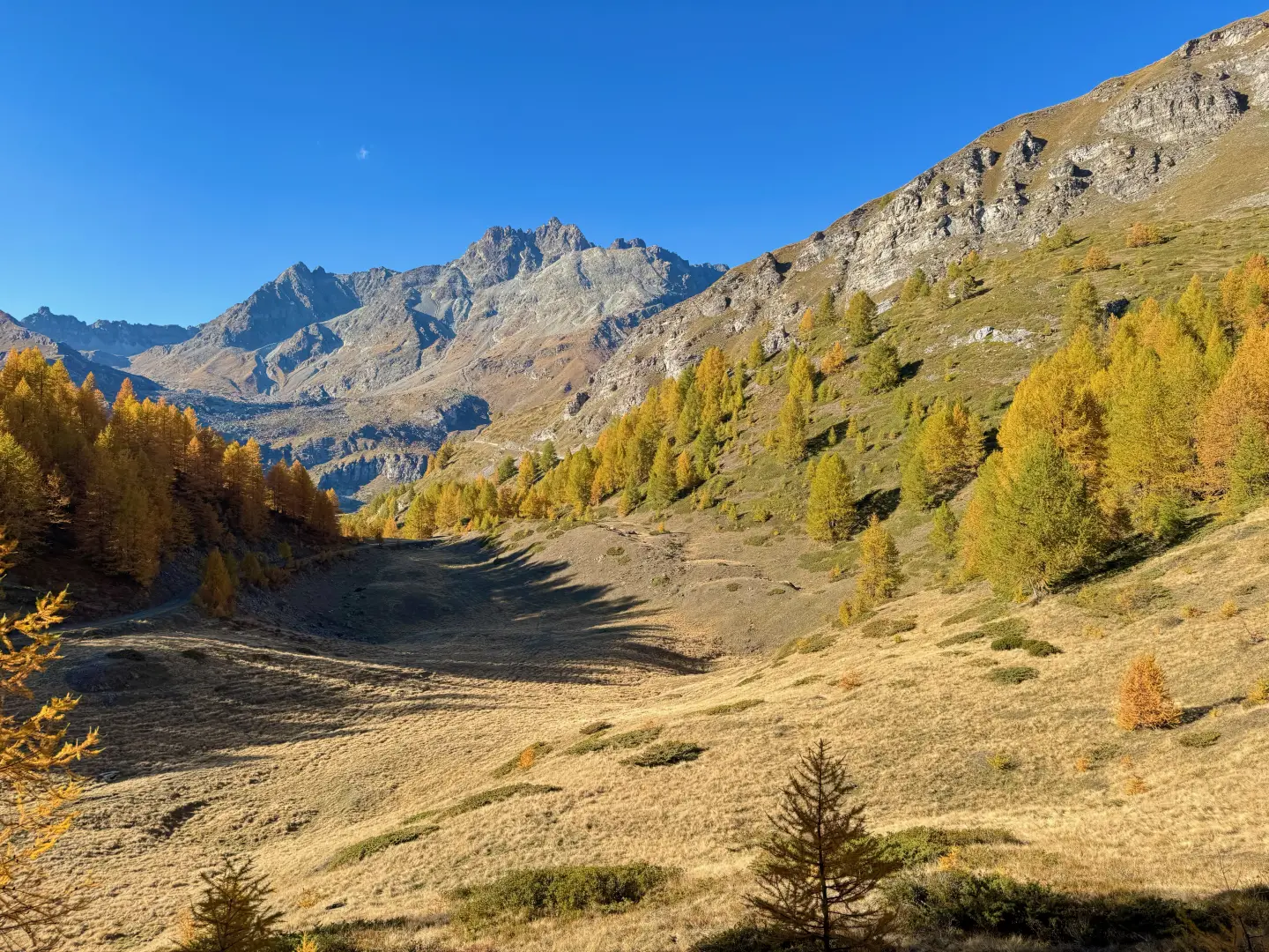
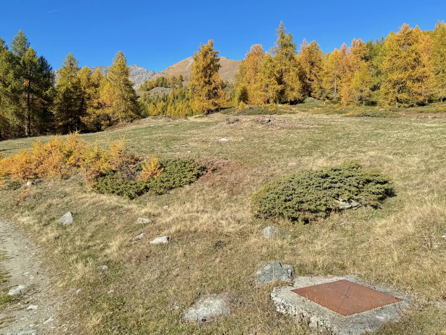
0h20' 0.76km Neglect the path on the left and continue straight on along the marked incline, keeping the stream on your left and crossing the cool larch forest (Larix decidua). The slope increases as the stream forms a small but lush waterfall, visible among the branches of the larches. Almost at the end of the ascent, cross a stream; a little further on, the slope eases, the forest thins out and makes way for the Tsantsevellà pastures. The path bends slightly to the left, offering a view to the right of the ruins of the old Tsantsevellà pastureland (a little further up is a modern stable, used for cattle during the summer). After passing another small stream, you will come across a boundary stone with markers relating to the stretch travelled. Continue straight on towards the Petit Monde stream's impluvium: the path, which is quite wide, runs alongside the stream and is flanked by imposing larches, until it joins the pleasant basin at the foot of Betsoloz, embellished by a small pond reflecting the Punta Tsan (1.861m).
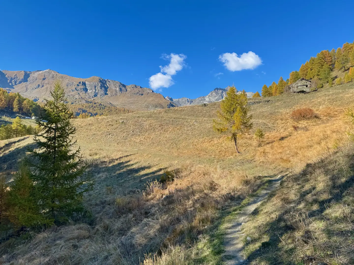
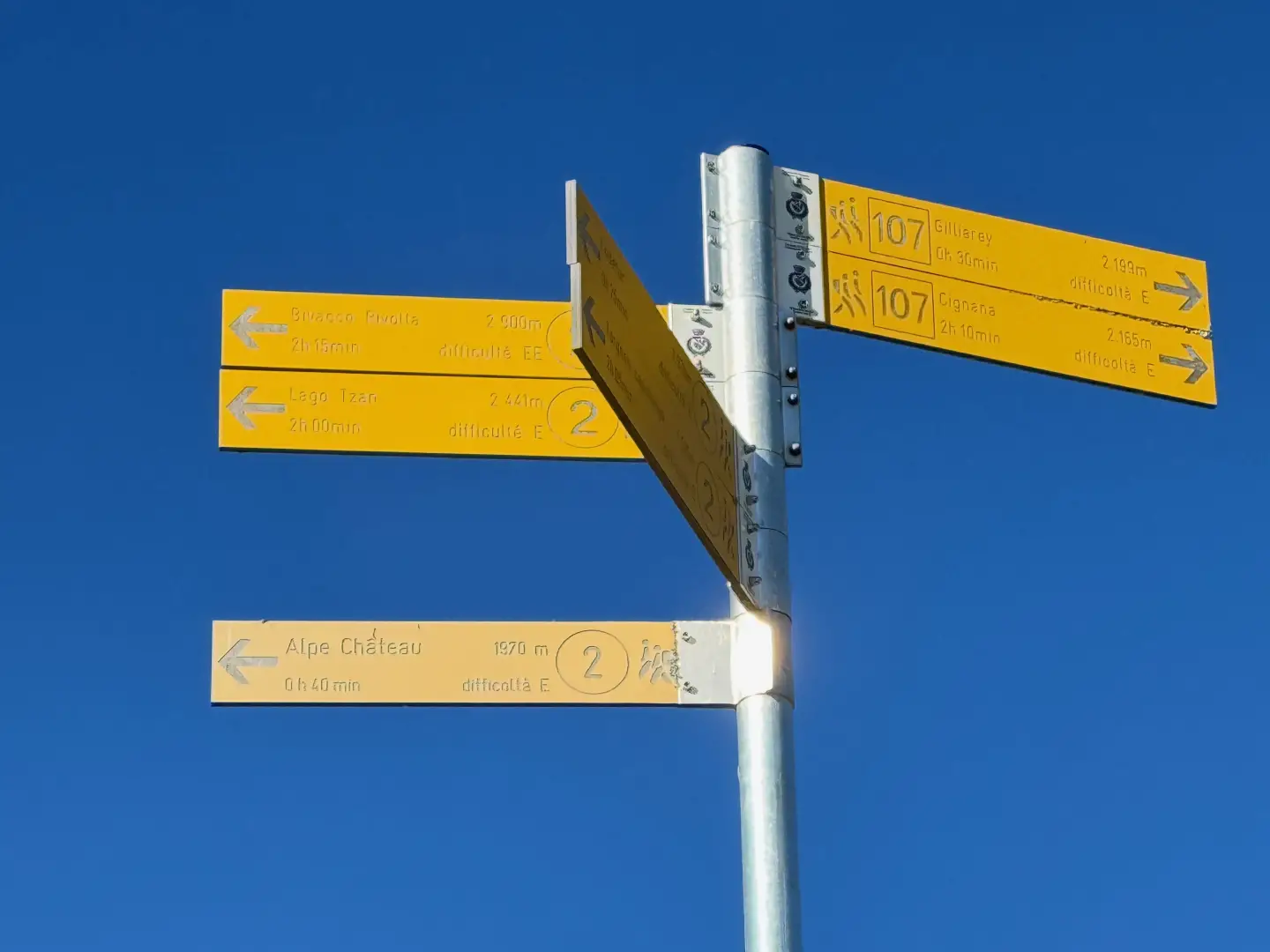
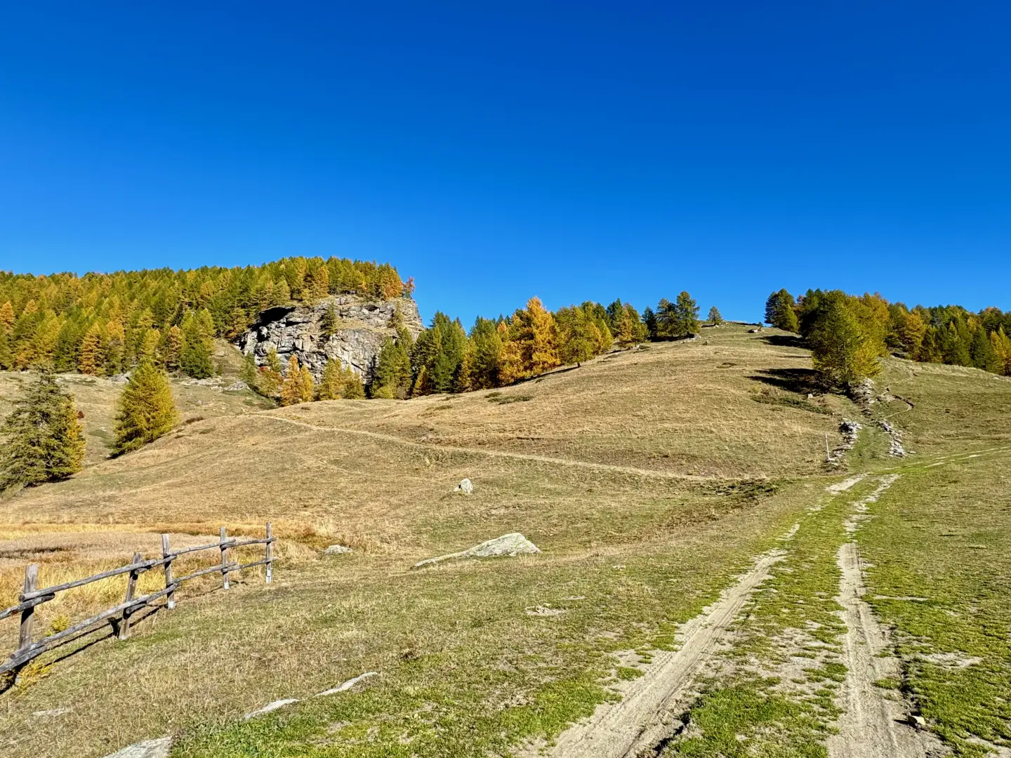
0h50' 1.91km Turn right and walk along a short flat stretch until you reach an old signpost. Then begin an ascent framed by stone walls and larch trees. The section is rather steep, but allows you to quickly gain height, until you reach a stone wall, beyond which you turn left. Continue along a section halfway up the hillside, with a gentle slope, and then enter the little valley that leads in a few minutes to Crêt (1,997m), a very scenic spot with a drinking fountain (💧). Bring yourself to the bottom of the mountain pasture and take a little path that is not particularly evident, which climbs the ridge and then bends slightly to the left, as the slope diminishes and Punta Tsan appears before your eyes in all its splendour. Shortly afterwards, turn right, heading for a solitary tree and a large rock that serves as a cairn. When you reach the cairn, continue to the right along the farm track for about 50 metres until you reach a new marker post.
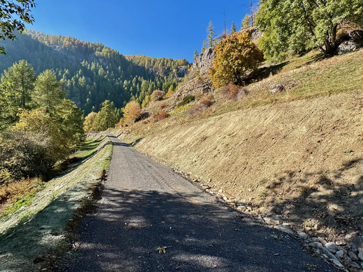
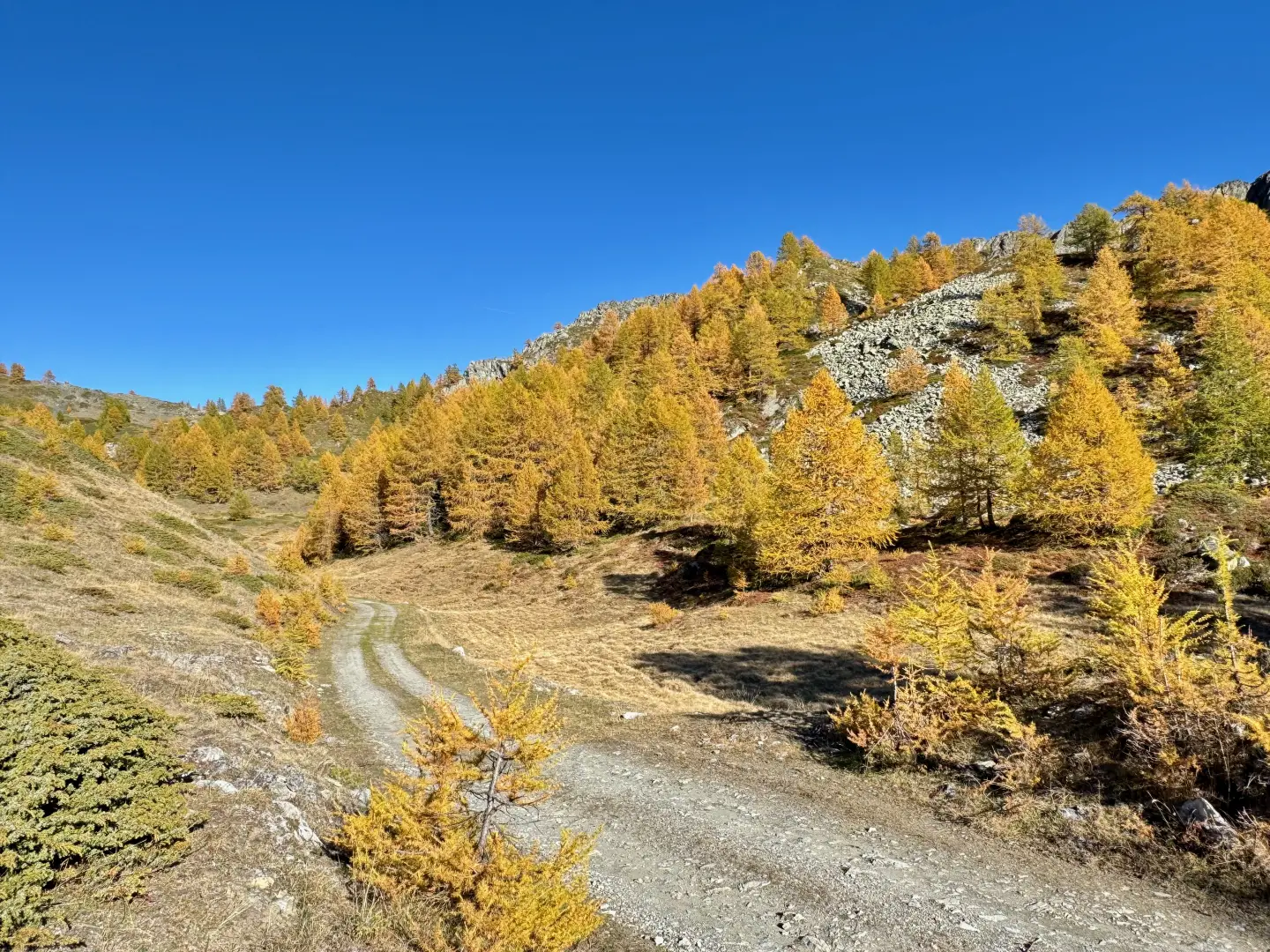
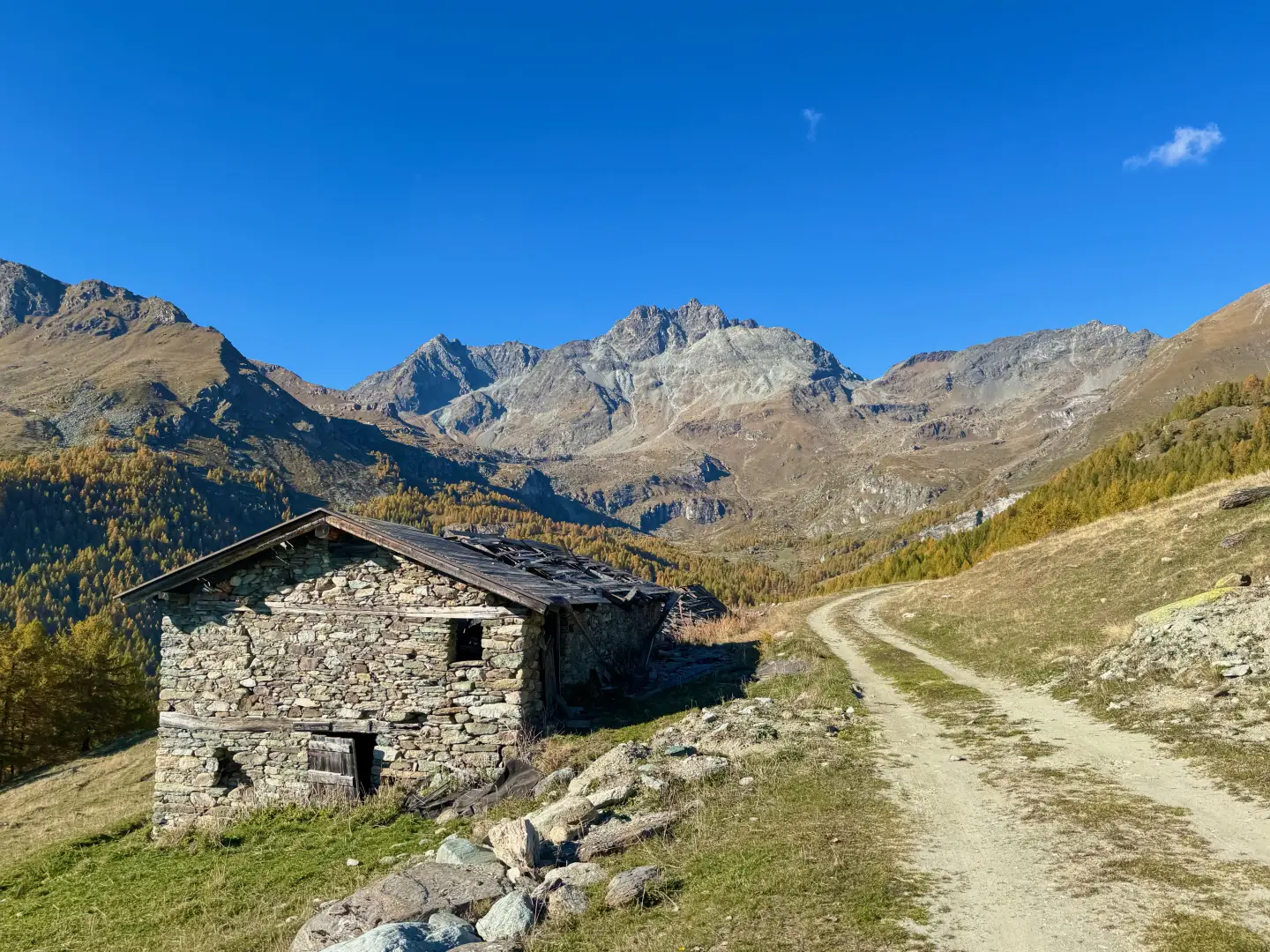
1h20' 2.81km Turn left and walk along the level farm track, leaving the hamlet of La Nouva di Tellinod (2,056m) to your left. After a wide bend to the left, enter the wood, which you cross to the next exit point, where you come to a drainage ditch.
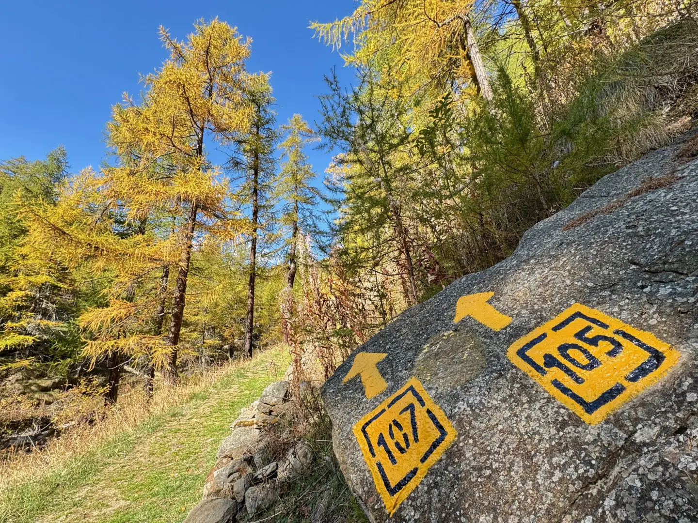
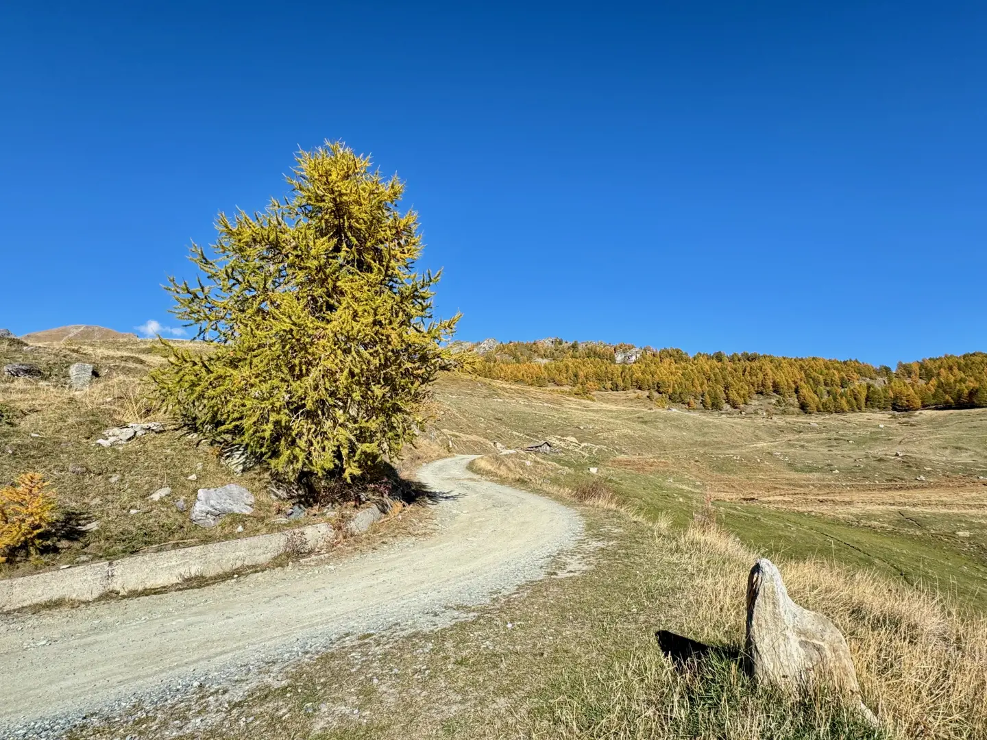
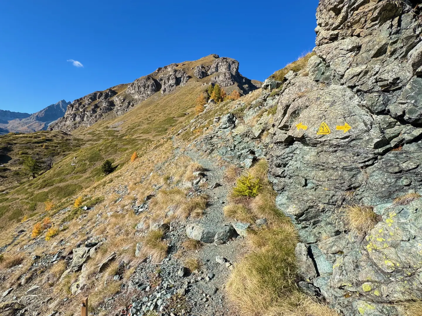
1h20' 3.30km Take a faint track heading towards a large, lonely larch tree. A little further on, the track becomes slightly more marked and follow it straight ahead until you reach a sort of hollow. Here, on the right, is a small ephemeral lake - often dry towards the end of the summer - while on the left, the ruined alpine pastures of Palud (2,071m) can be glimpsed further down. At this point, more attention must be paid to finding the correct path. After passing some juniper bushes, keep to the right, leaving the more obvious track to the left. The grassy path climbs up the slope covered with junipers and rhododendrons; a little further on it becomes more evident and climbs into the larch forest, where some yellow markings also begin to appear. After a short series of turns, a dirt road is reached again. Follow it for about fifty metres until you reach a hairpin bend to the left, where you leave the dirt road to follow a path halfway up the hillside, crossing a hollow. At this point, the destination is almost in sight: go up the path until you reach a small saddle, then turn slightly to the left, making a wide bend to the right that leads to the junction with the Alta Via trail, coinciding with the Tor des Géants route.
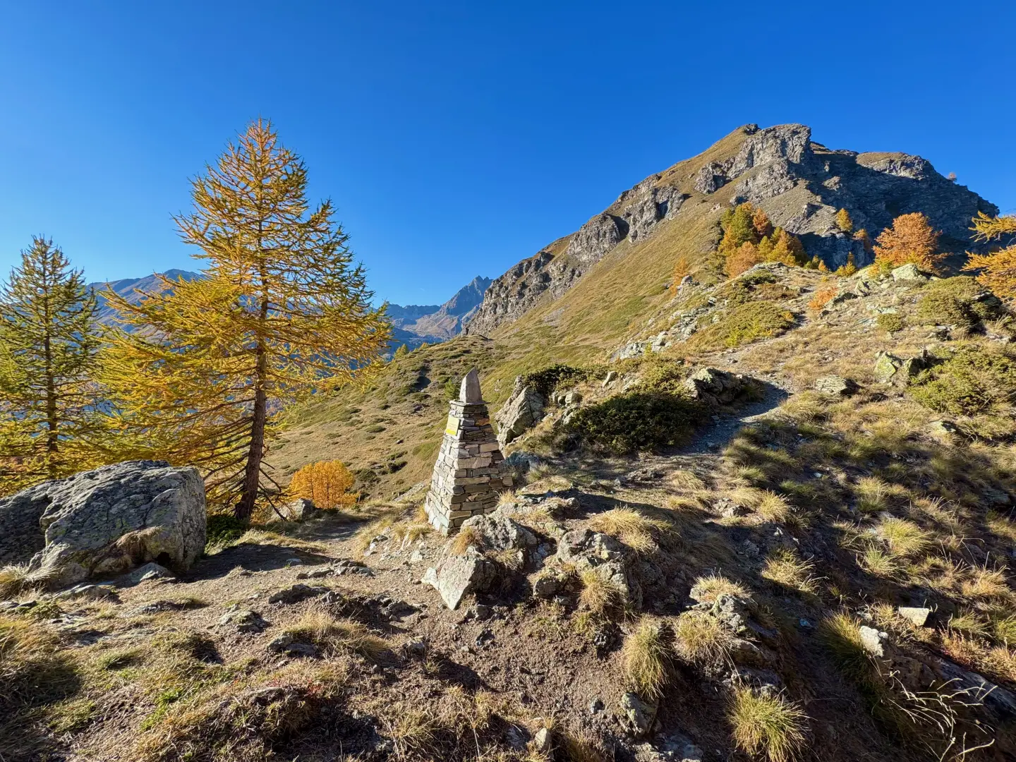
2h08' 4.85km Continue straight on for a few metres until reaching the characteristic Fenêtre d'Ersaz (2,290m), a particularly scenic spot, especially in autumn. A milestone with a marker and altitude indication clearly marks the pass point 2h10' 4.86km .
The return is along the same route as the outward journey: from the Fenêtre d'Ersaz, follow the path to the Crêt alpine pasture, then continue along the interval to Etirol 1h20' 4.86km .
Points of Interest
Collections
Photo gallery
Comments (0)
Sign in to leave a comment