Blavy

Edited by:
Maria Grazia Schiapparelli
Updated at: 04/10/2025
Access
Uscire dall'autostrada ad Aosta Est, proseguire per la strada statale direzione Aosta, facendo attenzione alla freccia a destra che dopo qualche centinaio di metri indica Saint-Christophe; la successiva indicazione da seguire è Sorreley; prima di Sorreley, a sinistra, una stradina ci porta a Veynes. Attraversate lentamente il villaggio, e vicino alle ultime case noterete a sinistra della strada le frecce gialle di inizio itinerario. L'auto può essere parcheggiata lungo la strada facendo attenzione ai cartelli di divieto di sosta.
Introduction
This itinerary takes place on the slopes below the classic route to the Becca di Viou, and is especially recommended when you want to walk, but the high altitude routes are impassable due to snow. Above Saint-Christophe there is a whole network of paths and farm roads. The mule tracks we followed are in excellent condition and well marked, in places still paved, and very scenic. We ascended from the path most exposed to the morning sun, choosing for the descent the one facing further west, but the tour can also be done in the opposite direction. The route indicated here is rather steep on the ascent, but has a very gentle descent, on the path, the interval that goes all the way to Aosta; actually in Blavy an indication gives as the time to reach the cathedral of Aosta 50 minutes That's about 1000 metres of difference in altitude, and it seems a rather optimistic sign... especially since the descent path is not very steep and has endless twists and turns. Blavy is an almost entirely renovated village, but we were told that it is no longer inhabited all year round, and Perleaz, the other village we encounter along the way, has houses being renovated and in late autumn it too seemed uninhabited.
Description
Leaving the car behind, we walk up the steep slope between the houses, leaving the yellow signs with the trail numbers
behind us. Almost immediately we find a beautiful fountain on the left overlooking the vegetable gardens. The mule track climbs steeply, and below us the view widens to Aosta and the surrounding mountains. We soon reach a farm road, which we will use on the return journey, cross it and begin to climb in twists and turns on the wide, steep mule track. At first the forest is chestnut, then oak; higher up we find larch and fir trees, as well as hedges of dog roses. We encounter two detours: there are no signs indicating destinations, only trail numbers; always follow the main trail that climbs steeply, ignoring the others. After about an hour, a small chapel appears in the coniferous forest, reached by a small path from above. A little further on, we leave the forest, and after skirting a meadow thick with dog-rose bushes, dotted with red berries, we tackle the last steep slope that brings us to the asphalt road that we drive along to get to Blavy. Here, too, yellow signposts abound. Around us are the snow-capped peaks of Emilius, Becca di Nona and the Pila basin, and beyond the valley of the Great St. Bernard the beautiful slopes below the Pointe Chaligne; below, vineyards, higher up autumn-coloured forests (the tour was carried out on 9 November). We take the road to the left and follow it (a couple of springs to the right along the way) until we reach the village of Parleyaz, which we see beyond a small valley (1275m, 1h30').
The village is exposed to the sun, clinging to the mountain. Still following the yellow signs, we climb between the houses (some are being renovated) to the little frescoed church. The mule track beyond the church becomes flat and heads towards the small stream that descends into the valley and which we easily cross over a beautiful wooden bridge; here the path becomes steep and climbs broadly through the splendid coniferous forest with continuous hairpin bends, without giving us time to rest. The height difference to cover is still 200 metres, 200 sweaty metres! To the right we overlook wide meadows with a now destroyed hut. We climb further until, after a final left turn, there are no more trees above us. When we reach the ridge, we look out over the valley of the Great St. Bernard and the meadows of Blavy, now less than 100 metres from us, overlooked by the Becca di Viou.
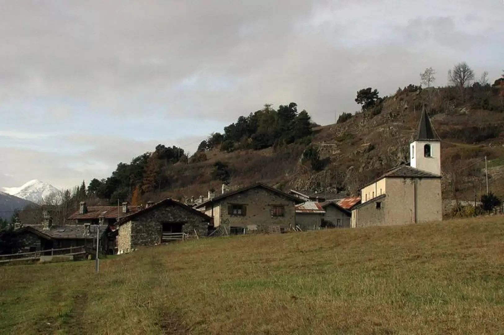
The path enters between the houses, some beautifully restored; in front of the little church there is a beautiful fountain, and around the village many benches (1474m, 2h15').
We take a little stroll, stop for a sandwich, and then set off on our descent; near the church is the famous sign 105 with the optimistic direction to the cathedral of Aosta.
We descend along the asphalt road, once again admiring the mountain ranges around us, and at the end of the village we leave it to take a steep, initially cobbled mule track, which descends between two low walls; after the first section with a good gradient, the route becomes little more than flat, and winds its way in long traverses through the forest. At times, slopes appear between the now bare trees above Aosta and along the Salassi road from Buthier to Meod. The path seems interminable because it is not very steep, but it does not require much concentration, so you have plenty of time to admire the beautiful forest of gradually different essences that we are passing through. Finally, the dirt strip of the farm road unravels below us, to be followed to the left. It enters the little valley that descends from Parleyaz and continues absolutely flat until it reaches a hundred-metre-long, dripping, dark tunnel... In the section before the tunnel, don't walk on the outer edge of the road, which has collapsed in several places and is empty underneath... We continue on our way, twice encountering paths going up from below towards Blavy: this area must have been very busy in the past... After a few kilometres (at least 5 or 6...) we find the crossroads we passed in the morning, and above all the sign for Veynes, 10 minutes...
We take the mule track downhill on the left and return to our starting point (1h 30' from Blavy).