Aiguille d'Artanavaz, from Planaval via Rantin


Edited by:
Benedetto Lorusso
Updated at: 06/04/2026
Access
Navigazione stradale
Lasciare lo svincolo autostradale di La Salle. Immettersi sulla strada statale in direzione Courmayeur e percorrerla per 1,1km (1,1km) fino al bivio con Via Corrado Gex. Svoltare a sinistra e imboccare Via Corrado Gex in direzione Planaval. Seguire la strada comunale in salita, attraversando la frazione Chaffieron, per 11,2km (12,3km) fino a raggiungere la frazione Planaval.
Parcheggio
In frazione Planaval si trova un parcheggio 🅿️ gratuito, punto di partenza dell'itinerario.
Accesso con mezzi pubblici
Per raggiungere il punto di partenza dell'itinerario è necessario un mezzo privato, poiché Planaval non è servita da trasporti pubblici.
Distanza e tempo di percorrenza
🕒 Tempo di percorrenza: 19 minuti
📏 Distanza: 12,3km
Navigazione GPS
Nota informativa
Le indicazioni fornite sono state verificate alla data del rilievo dell'itinerario. Prima della partenza si consiglia di verificare possibili variazioni del percorso o delle condizioni stradali. Per informazioni aggiornate si raccomanda di consultare Google Maps o Apple Maps.
Introduction
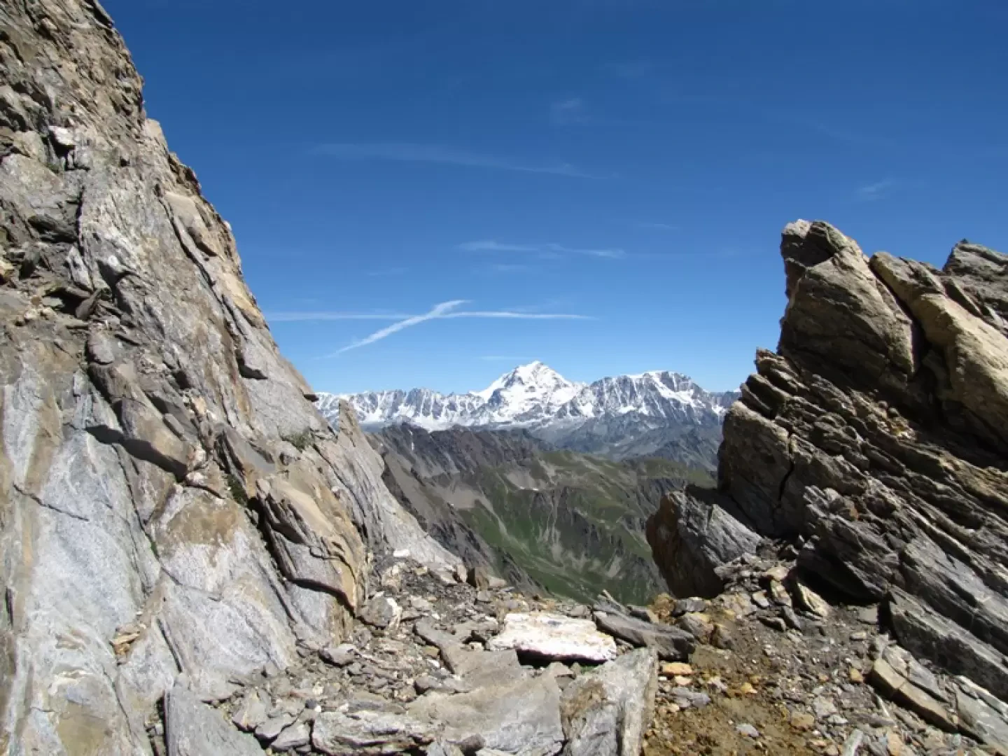
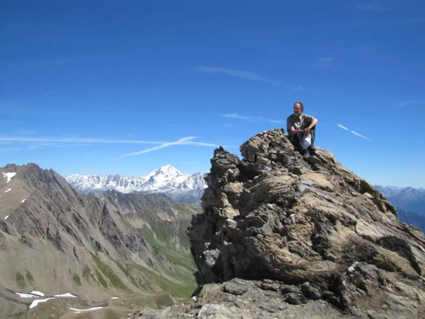
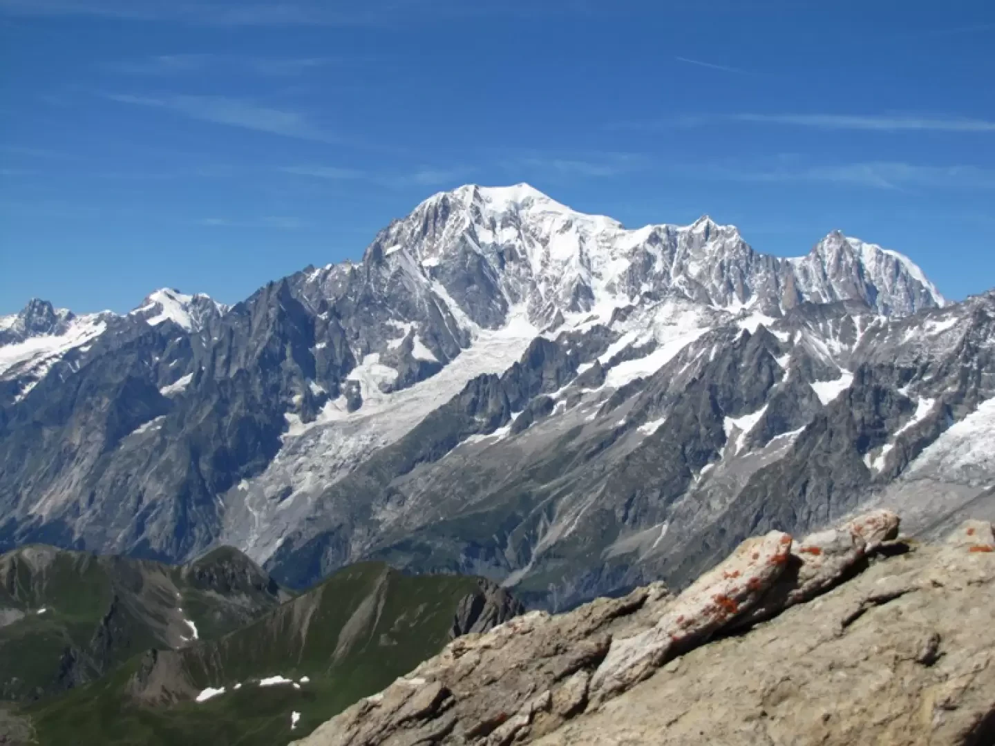
Final destination with an extraordinary view: almost within reach are Mont Blanc and the Grandes Jorasses, while the horizon stretches from Combin to the Matterhorn, via Monte Rosa and the Gran Paradiso massif, with the Ciarforon and the mountains of the valleys to the south.
Description
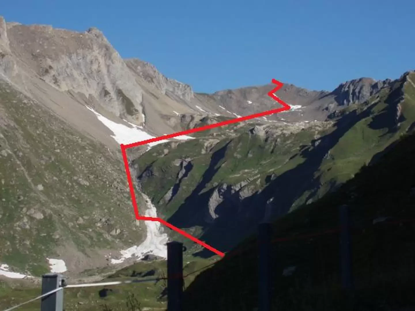
From Planaval you can reach Capanna Bonalè (an alpine hut) either by taking the road (longer, but more comfortable) that passes through Rantin or by taking the path at the bottom of the valley that leads over a steep valley.
From the alpine hut, follow the tracks and cairns that lead to a grassy slope on the right and a scree slope on the left.
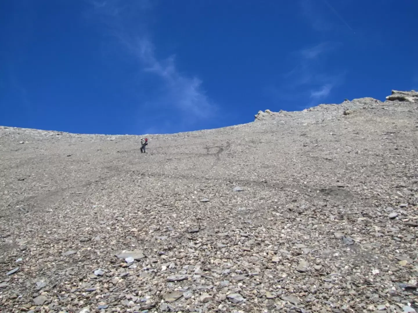
Leave the grassy slope and as soon as possible pass over the scree slope where you will find the cairns leading to the upper comba.
Continue northwards over grassy bumps from the last of which you can see the remaining path.
Further down on the right is the Bonalè lake.
Continue towards the summit, following the cairns that lead to a ridge on which the tracks are more evident, until the very clear track (which can be seen from afar) that shortly leads to the airy summit.
Just a stone's throw from Mont Blanc and the Grandes Jorasses, the view sweeps from Combin, to Velan, to the Matterhorn, to Rosa.
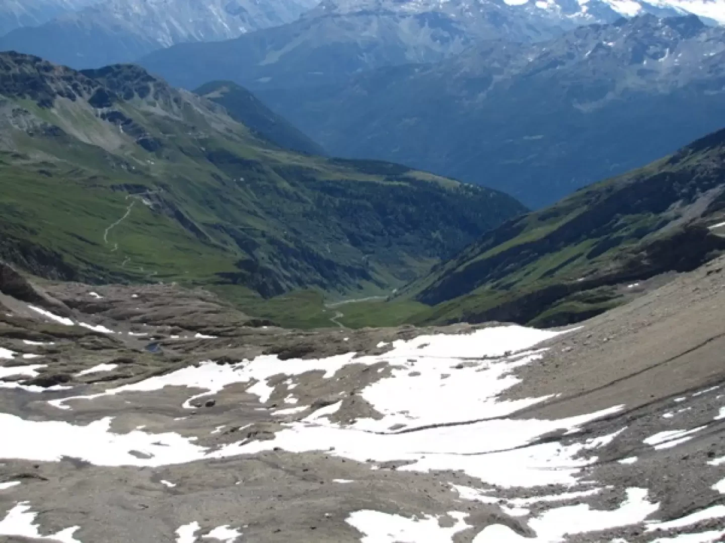
To the south, the north of Gran Paradiso, the Ciarforon and the mountains of the southern valleys.
Attend for four to five hours.
Punti di Interesse
Collections
Photo gallery
Comments (0)
Sign in to leave a comment