From the Aosta Est motorway exit on the , join the heading west towards Aosta Centro and follow it for 2.3 km (2.3 km). At the roundabout, take the second exit and continue on the for a further 3.3 km (5.6 km). At the next roundabout, take the first exit onto Viale del Gran San Bernardo and follow it for 3.5 km (9.1 km) until it joins the . Follow the towards Saint-Rhémy-en-Bosses for 16.3 km (25.4 km). Near the entrance to the Great St Bernard Tunnel, on the Dardanelli Viaduct, keep to the right and continue for a further 2.6 km (28.0 km). At the junction with Via per Crévacol, turn right and continue for 1.5 km (29.5 km) to the end of the road, where the car park is located. The route includes the toll section of the .
Warning: the (E27) is subject to closure for roadworks until June 2027. Before setting off, check that the section towards Saint-Rhémy-en-Bosses is open and be aware of any diversions in place.
Car park
The free 🅿️ car park at Crévacol is located at Via per Crévacol 15, in Saint-Rhémy-en-Bosses, at an altitude of 1,673 m. This is the starting point of the route.
Access by public transport
The Crévacol car park cannot be reached by public transport. The bus service [to be completed — route and operator] stops at Saint-Rhémy-en-Bosses, from where the car park is approximately 1.5 km uphill, a distance not covered by public transport. A private vehicle is required to reach the starting point.
The directions provided were verified on the date the route was mapped. Before setting off, we recommend checking for any changes to the route or road conditions. For up-to-date information, please consult Google Maps or Apple Maps.
Introduction
The route follows the entire valley, passing through a series of traditional mountain pastures — Devies, Merdeux desot, Côtes, Moindaz, Tsa de Merdeux — before reaching the upper reaches, where the small lake of Merdeux and the Pier Giorgio Frassati Mountain Hut (2,551 m) are situated. The refuge, built by volunteers from Operazione Mato Grosso, is situated on the Aosta Valley Alta Via No. 1, on the section linking Val Ferret to the Letey Refuge.
From the pass, the view opens out onto the Mont Blanc massif, including the Grandes Jorasses, and to the north towards the Grand Combin. The Col de Malatra is a mandatory crossing for participants in the Tor des Géants and the Alta Via No. 1: the customary photo in front of Mont Blanc remains an iconic moment, marking the final effort before the descent to Courmayeur.
Visits are recommended from mid-July to September, when the route is free of snow. The difficulty rating is T3 due to a final section equipped with iron steps and a fixed rope on partially unstable ground; the section along the hillside in the Comba di Merdeux includes exposed sections. The total elevation gain exceeds 1,000m.
Description
0h00'0.00km From the Crévacol car park (1,673m), head up the tarmac road towards the Great St Bernard Tunnel viaduct, passing underneath it. Once you reach the ‘no entry’ sign, continue along the farm track which, after a bend, passes in front of the Devies hut (1,734m). Immediately beyond this, on the right, a junction marked by a signpost indicates the path: take it to the right, leaving the farm track. Follow the path uphill through pastures towards the Merdeux dessous huts (1,921m). Pass through them, going under two stone huts. A little further on, you’ll cross the farm track again at a junction (1,946 m): take the dirt track to the left, which descends slightly, passing over the Côtes mountain pasture (1,939 m), where it ends. Continue now along the path, skirting a grassy promontory, beyond which you enter the Comba di Merdeux. Follow the track as it climbs gently, cutting across the grassy slopes at mid-slope, with a few exposed sections. When you reach a gully, cross the stream via a wooden bridge and head up to the ruined huts of Moindaz (1,984m). Pass the huts and continue along the grassy ledges, traversing the hillside diagonally until you come to a mule track (2,159m). The path continues on the opposite side: climb through a wide pasture, skirting a hairpin bend in the farm track, beyond which you reach the Tsa de Merdeux mountain pasture (2,273m), to the left of which you’ll find the signposts. Once past the mountain pasture, enter the upper part of the valley, climbing up gentle grassy slopes towards the head of the valley where there are a few hummocks. Climb up the hummocks along a steeper section, making a few hairpin bends, then ascend more directly to the junction marked by signposts (2,503 m): take the path on the right. After a few minutes’ walk amongst the grassy hummocks, you’ll reach the small cirque where the Merdeux lake lies, above which stands the Pier Giorgio Frassati Mountain Hut (2,551m), visible only at the very last moment.
2h45'6.51km (851 m ascent) (27 m descent)
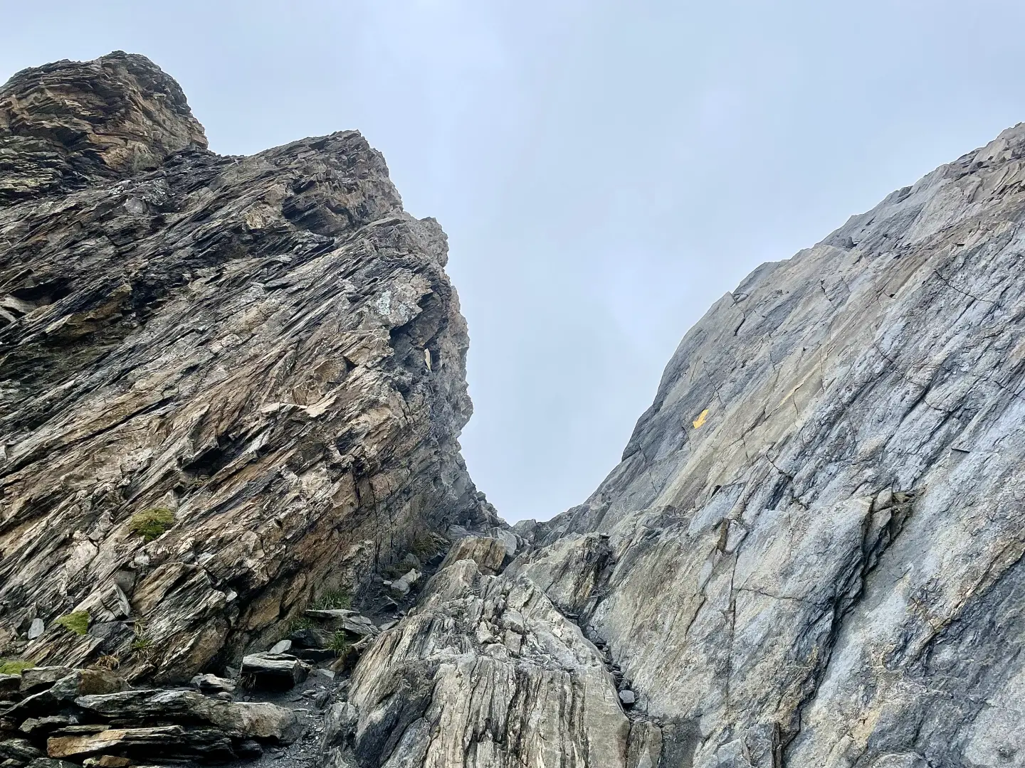
Continue past the refuge and, traversing to the left, rejoin the main path heading towards the pass. Cross the final, rocky and vegetation-free cirque leading up to the pass, then follow a long diagonal path to the left and a steep section over unstable ground. The final section, equipped with iron steps and a fixed rope, leads to the narrow pass of Col de Malatra (2,930m) 4h30'8.50km .
The return journey follows the same route downwards 3h30'8.50km .

Comments (0)
Sign in to leave a comment