Lillianes

Edited by:
Maurizio Bergamini
Introduction
A mid-mountain commune in the Lys valley, located 7 kilometres from its entrance at Pont-Saint-Martin. Its place name derives from a Latin proper name Laelius, probably an ancient landowner.Description
The history of the village is linked, as for all the others in the valley, to the vicissitudes of the Vallaise family, the powerful lineage that held feudal rights over much of the lower Aosta Valley until the 18th century. Originally, Lillianes was united with Perloz for both civil and religious administration. In 1614, an independent parish, dedicated to Saint Roch, was established, while it was not until 1762 that the municipality was created.
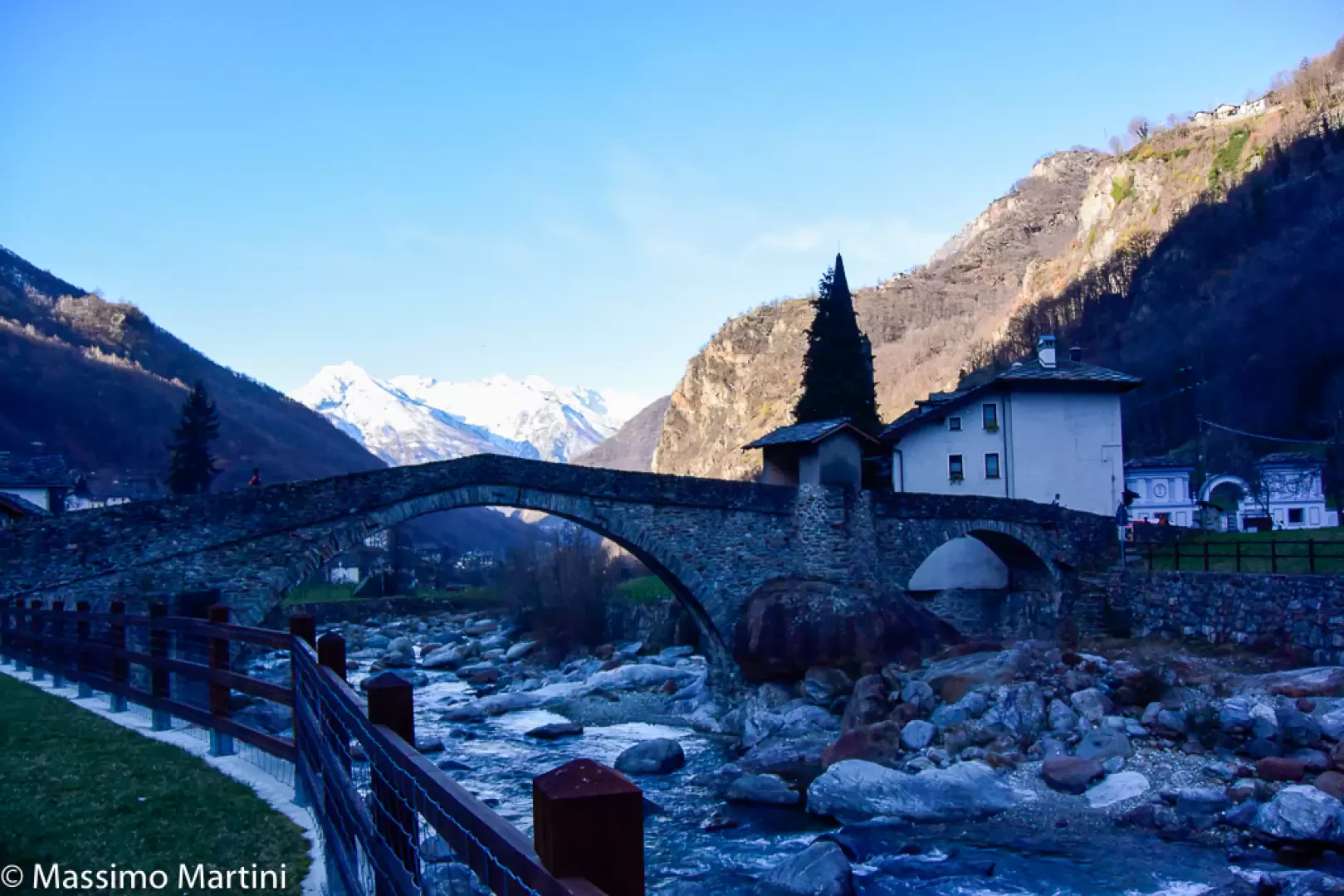
A traditionally agricultural municipality, particularly devoted to goat and cattle breeding and chestnut production, it also offers reasons of interest to tourists: the parish church preserves splendid Baroque works, while a centuries-old, evocative stone bridge crosses the stream, joining the old village to the cemetery. Finally, the mountain above offers the opportunity for beautiful hikes to the sanctuary of Santa Margherita, from where one can enter the Biellese area along the traditional path to Oropa.
Information
Area: 18.55 square km
Altitude: 655m
Maximum elevation: Mont du Prial (2411m)
Number of inhabitants: 480
Name in dialect: Elljini (in Töitschu)
Inhabitant name: lilinois
Patron Saint: Saint Roch (16 August)
Website: www.comune.lillianes.ao.en
Webcam:
Bordering municipalities: Carema, Fontainemore, Graglia, Issime, Perloz, Pollone, Settimo Vittone, Sordevolo
Villages and hamlets: Chessun, Chessun Vieux, Chichal, Praz, Rouby, Fey, They, Court, Foby, Tournoun, Suc, Lazé, Bonnesheures, Barmetta, Barbiaz, Salé, Las, Toux, Coeurtes, Fangeas, Vérigoz, Mattet, Costey, Parte-Joux, Grange, Choulére, Moler, Tetoun, Sassa, Moliné, Pines, Sénéchaz, Russy, Vallomy, Montcervier, Rive, Piatta, Pérapianaz, Traversagn, Duzeré, Mirioux, Verfey, Riasseu, Berlechuz, Couleura
Alpeggiations: