Chamois

Introduction
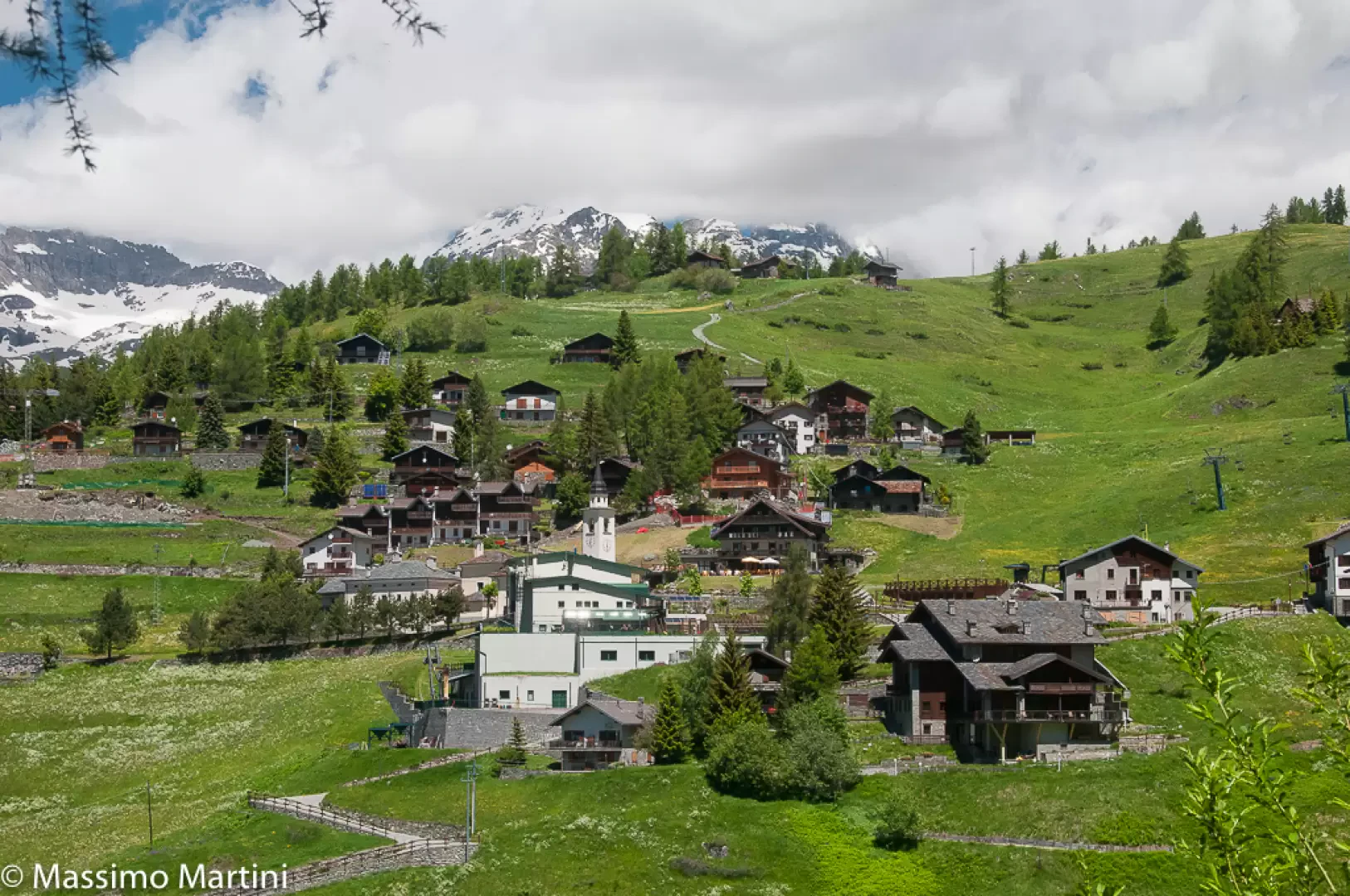
Chamois, a small jewel nestled in the Valtournenche, in the Aosta Valley, fascinates with its peculiarities. Located at an altitude of 1,815 metres, it is the highest municipality in the region and among the highest in Italy. It has just over one hundred inhabitants, but its main peculiarity is the choice, made with determination by the inhabitants, not to be reached by car. This decision has made it possible to preserve its authentic character and the tranquillity of the mountain landscape, without the influx of vehicles. To reach Chamois, a cable car has been in operation since 1955, connecting the village of Buisson, located along the road leading to Breuil-Cervinia, with the chief town. This installation marked an important change for the village's economy, allowing it to open up to tourism while maintaining the traditions linked to agriculture and animal husbandry.
Description
Today Chamois offers hospitality to those who want a peaceful holiday immersed in nature. The accommodation facilities are ideal for a relaxing and quiet stay away from hectic mass tourism. In recent years, a small but popular ski resort has developed, which, thanks to its favourable exposure to the sun and a relatively temperate microclimate compared to other resorts in the valley, attracts ski enthusiasts and families. During the summer, Chamois becomes a base for hikes to alpine pastures, scenic trails and bivouacs, such as the Canavari-Letey Bivouac, dedicated to two mountain lovers who lost their lives during a hike.
The municipality still retains strong agro-pastoral roots, visible in the pastures surrounding the village and in the typical products. For visitors, Chamois represents a unique opportunity to discover a community that has been able to preserve its identity and unspoilt nature. Life here follows the rhythm of the seasons, offering authentic experiences, including the simple pleasure of walking in the woods and admiring the breathtaking views of the surrounding peaks.
Visiting Chamois means living an experience of immersion in a unique natural and cultural context, where time seems to pass more slowly and the tranquillity of the mountains envelops the visitor in a rare and precious dimension.
Information
Area: 14.53 sq. km
Altitude: 1,815 m
Maximum elevation: Becca Trécare (3032m)
Number of inhabitants:107 (as of 31.05.23)
Name in dialect: Tsamoué
Inhabitant name: chamoisiens
Patron Saint: Saint-Pantaléon (27 June)
Internet site: www.comune.chamois.ao.it
Webcam: www.comune.chamois.ao.it/Webcam
Neighbouring municipalities: Antey-Saint-André, Ayas, La Magdeleine, Valtournenche
Points-of-interest
Territory
Itineraries
- hiking - map
- snowshoeing - map
- snowshoeing - map