Weissmies, crossing from Saas-Almagell


Edited by:
Giancarlo Beretta
Updated at: 16/11/2025
Access
From Italy you reach Switzerland via the Simplon or Great St. Bernard Pass and, continuing on the Valais valley road, follow the signs for Visp, where you will find the junction for Zermatt and Saas Fee. When you reach Stalden, there is a roundabout at which you turn left into the Saas Valley. Continue for a few kilometres until you reach the village of Sass Grunde, where you turn left to reach the visible cable car station next to which there is a car park (for a fee) where you can leave your car. Returning on foot to the main road, turn left to the square where, on the right, there is a post bus stop; here take the bus for Saas Almagell, getting off at the Sportplatze terminus, and go back a few dozen metres, turning onto a small road on the right where you can see the start of the chairlift.
- How to get there with GMAPS
- How to get there with Apple Maps
Introduction
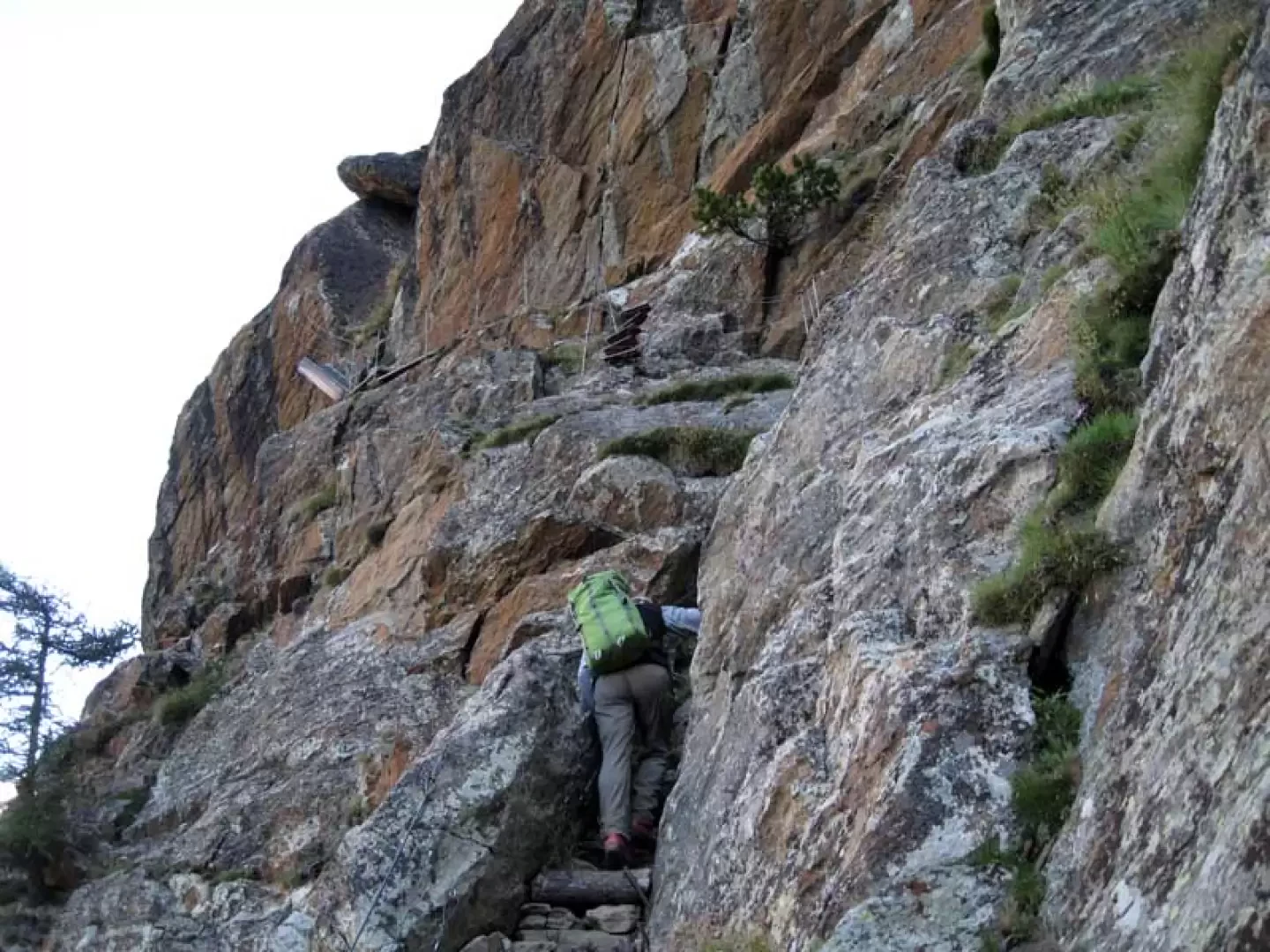
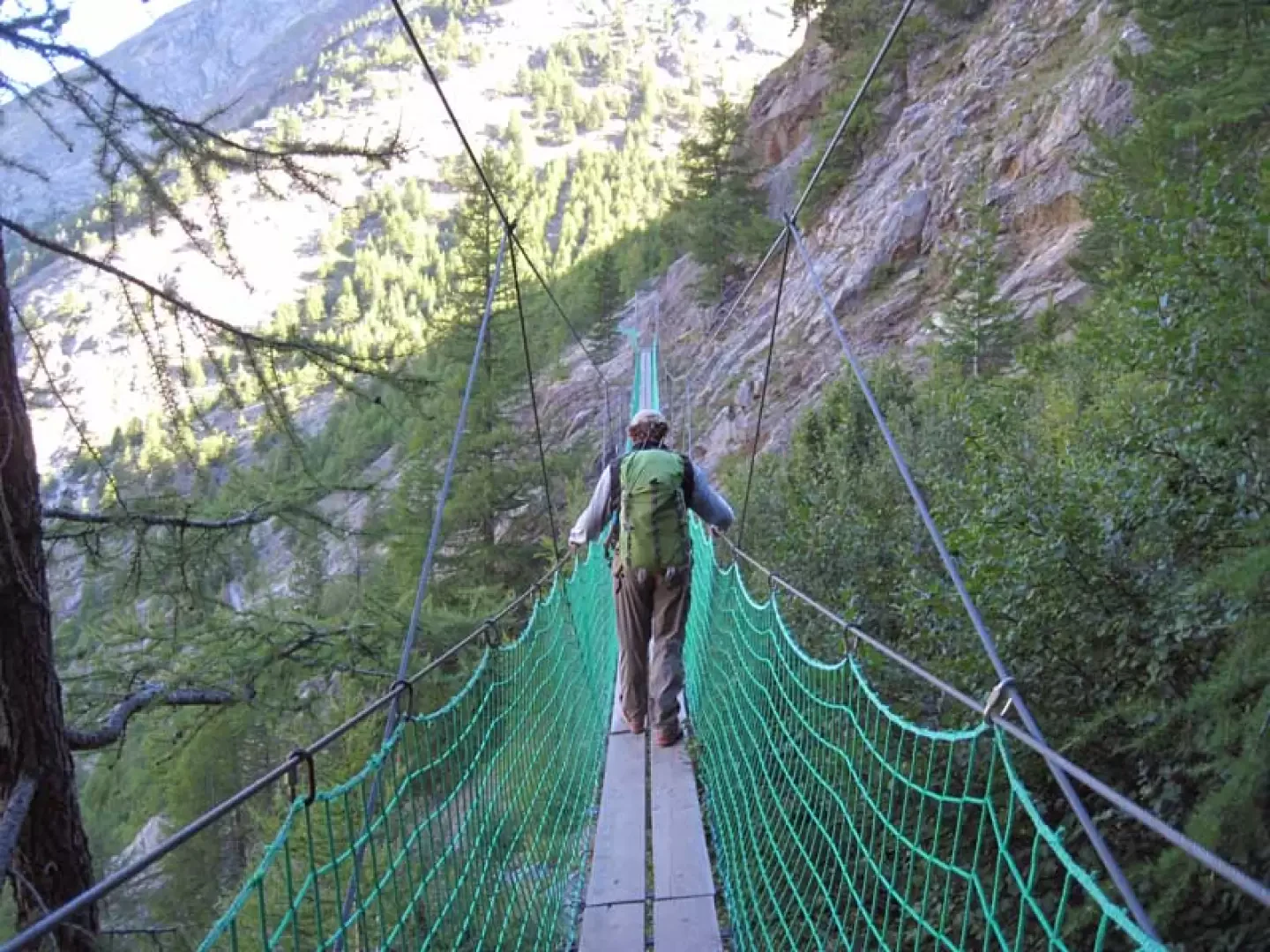
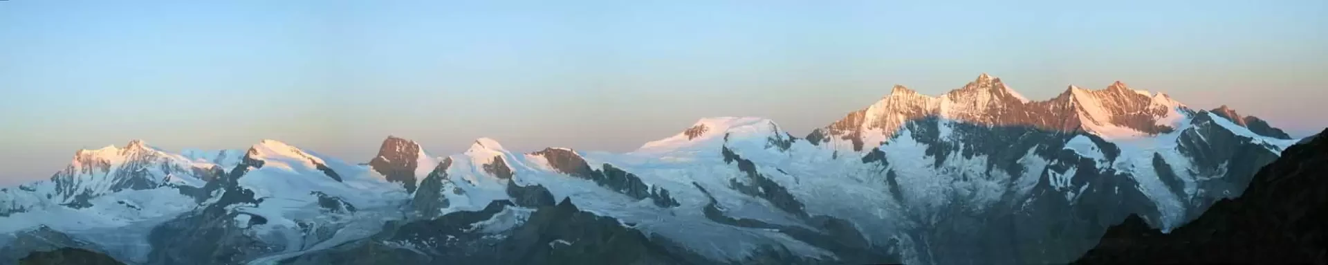
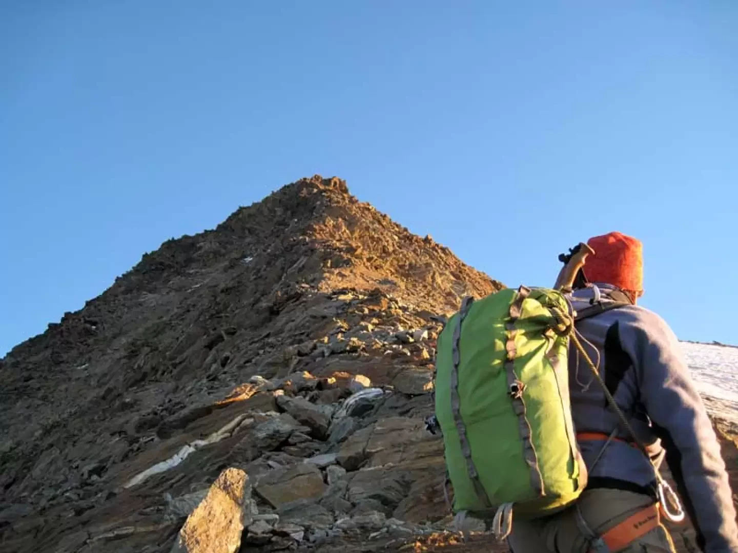
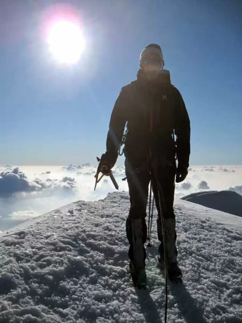
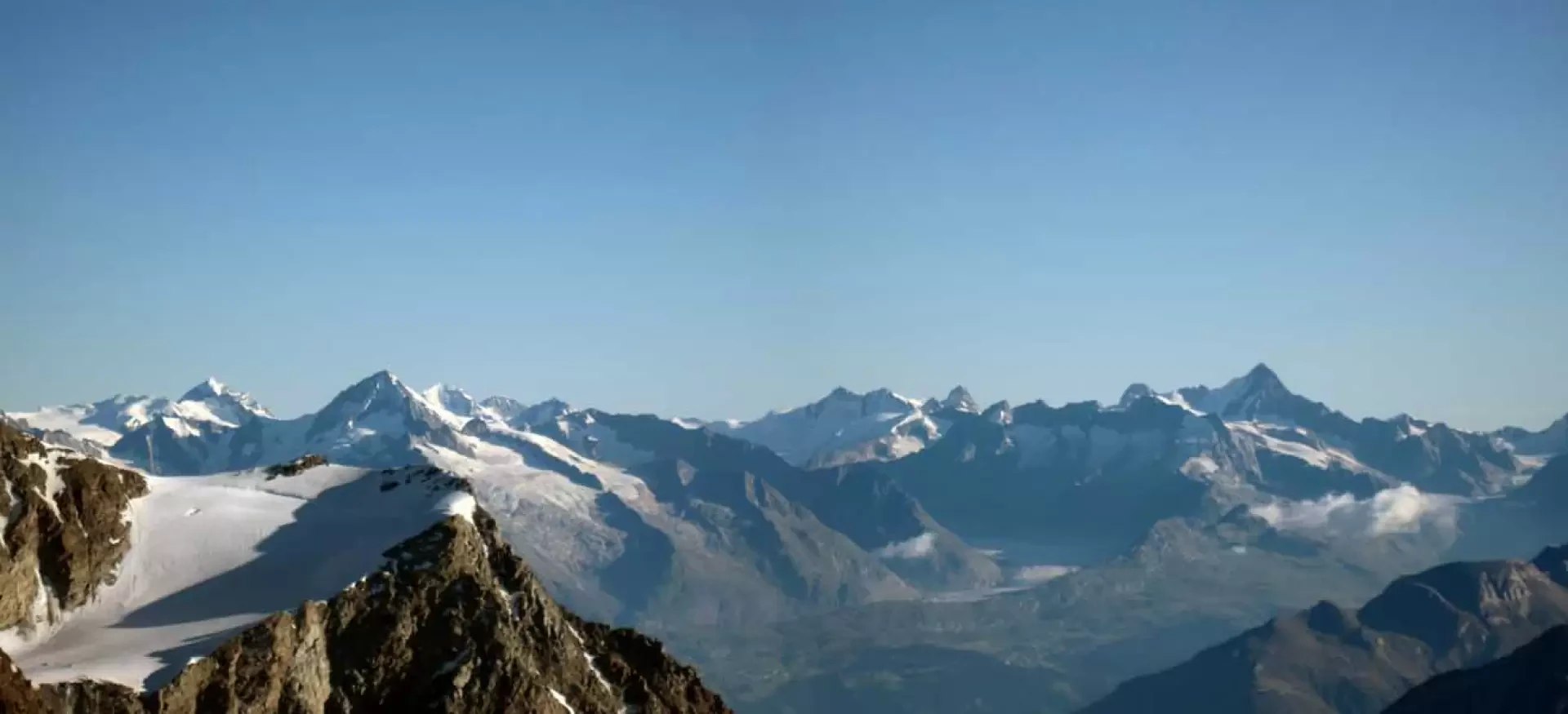
This ascent is a beautiful traverse of an equally beautiful 4000m, climbing the rocky south-south-east ridge and descending the large glacier on the north-west side. Therefore, for the logistics of recovering the car on the return journey, it is advisable to do as written on the approach so that you are already ready at the car as soon as you get off the cable car; obviously if you prefer you can do it the other way round, leaving the car in Saas Almagell and returning to pick it up with the postal bus the following day. The ascent to the hut is via a path that, at the beginning, offers fun passages on a via ferrata and then continues into a wild valley; the next day, you follow a beautiful track up to the Zwischerbergenpass and then climb up scree until you reach the beautiful and easy ridge, all in an absolutely "wilderness" environment. The ridge, which is walkable for short stretches, never offers any difficult passages, but all to be guessed by following, in addition to the usual traces of passage on the topsoil, the crampon marks on the rocks; a few slightly more athletic passages offer an enjoyable and never boring ascent that in any case offers stupendous views from both sides. The descent from the other side via the normal route takes place entirely on glacier and is a little delicate due to the crossing of some large seracs that, for a hundred metres or so in length, require attention and above all speed. The breathtaking 360° panorama sweeps over the numerous 4000-metre peaks that surround it, from the closest ones in Saas Fee and Zermatt to the most distant ones in the Oberland, without neglecting the endless carpet of other valleys and minor peaks.
Description
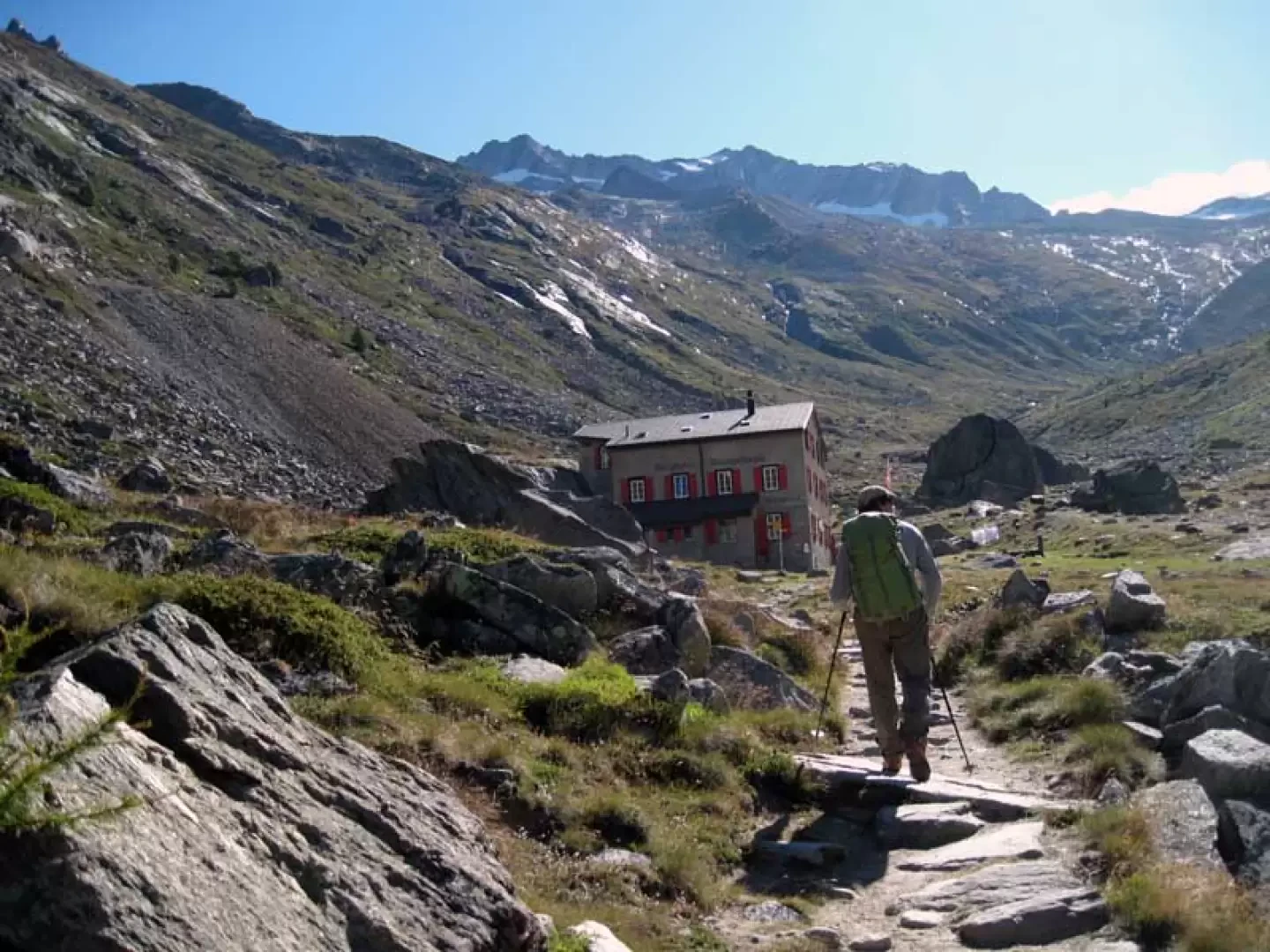
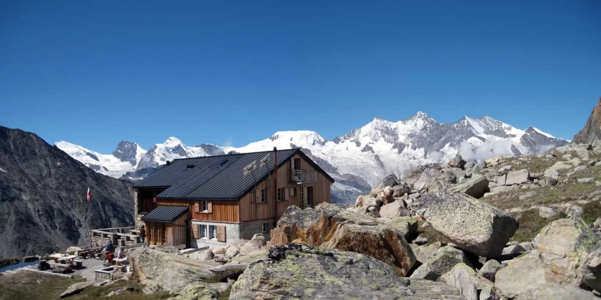
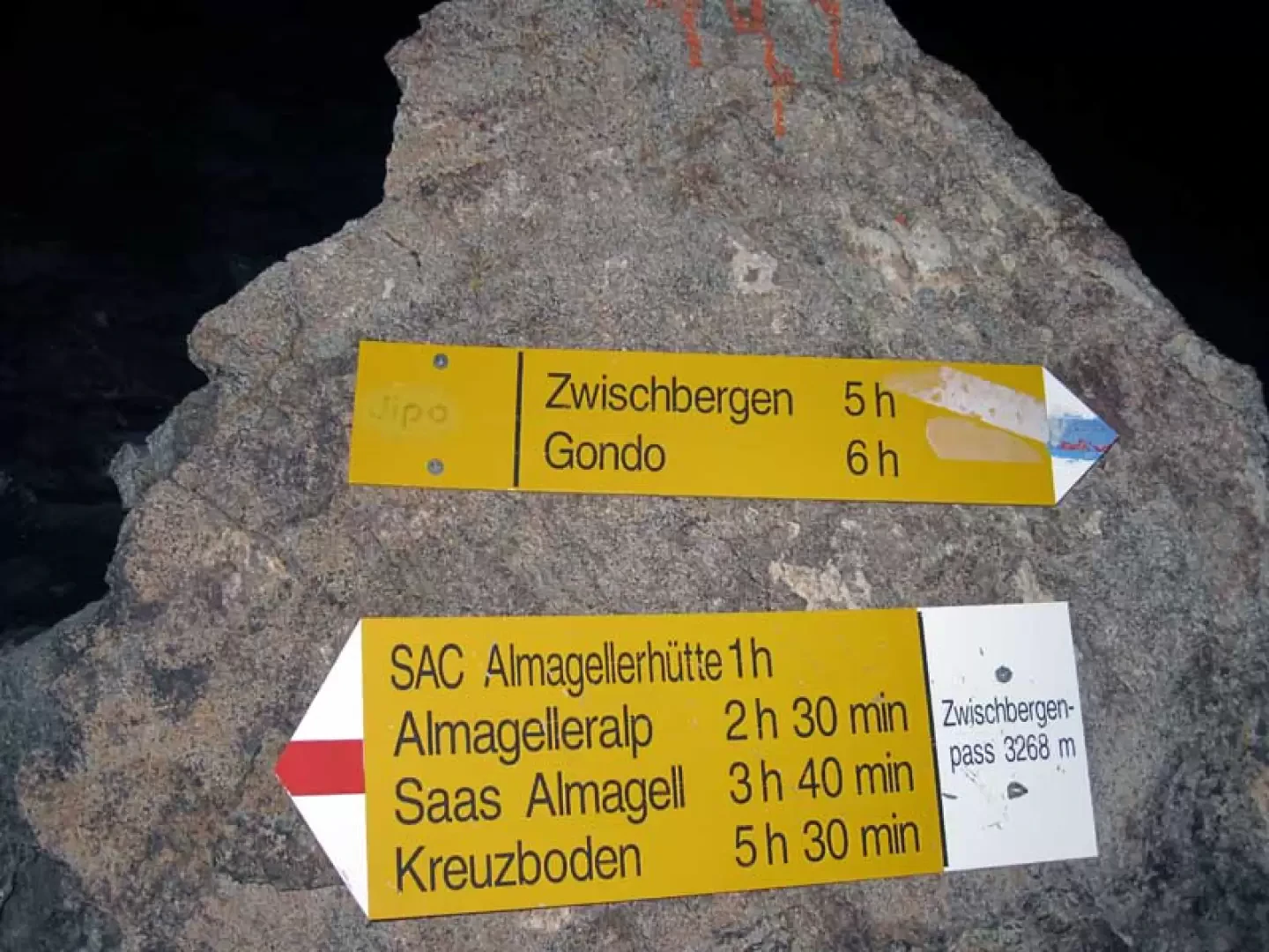
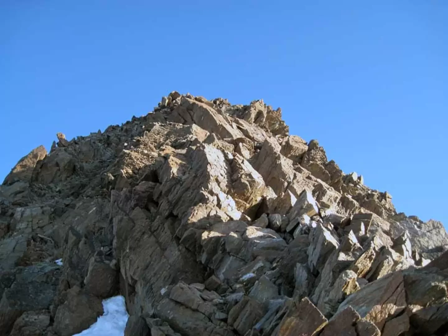
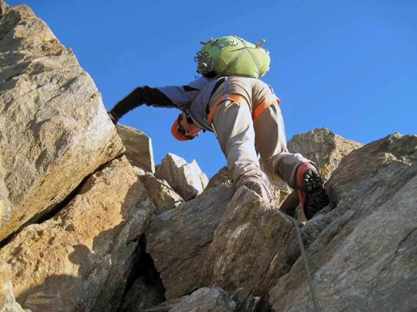
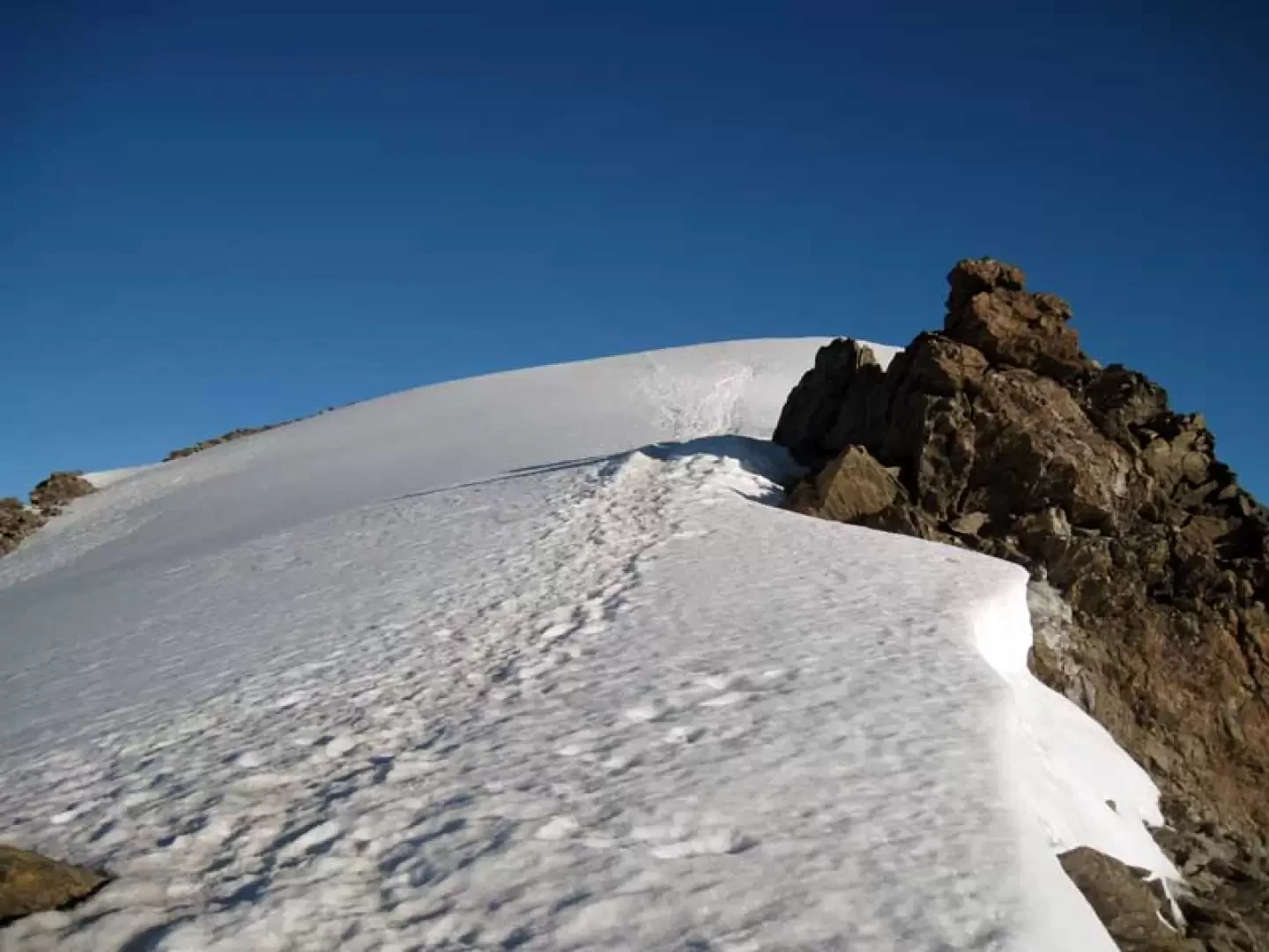
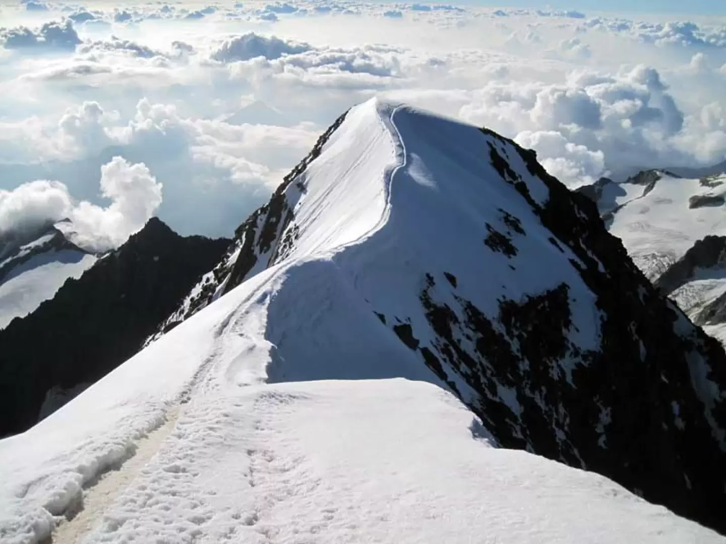
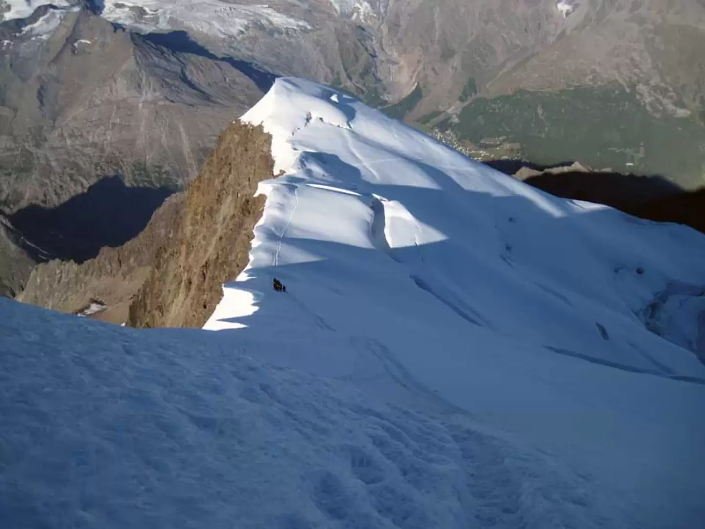
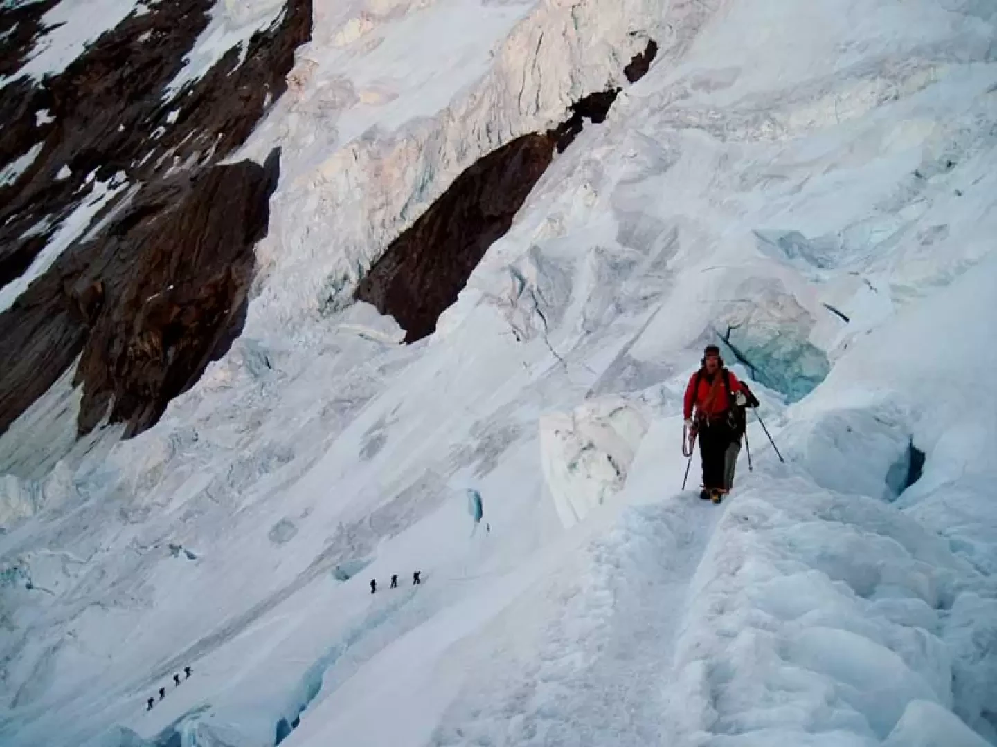
From the arrival point of the chair lift (1811m), head towards the houses, arriving at a crossroads that you follow for a short distance until you find a fork in the road, near a bend, where you can see the route markers (1939m). After a short stretch of the path, the ferrata begins, climbing up the side of a rocky rampart and then, decreasing in gradient, moving towards a wide gully that is crossed on a long suspension bridge; the path then crosses a wide col and then crosses a first gully on a metal footbridge and, shortly afterwards, a second gully with a second suspension bridge shorter than the previous one. At the end of the equipped section, continue along a good path, staying to the right at a first fork (2051m) and then, after crossing a small wooden bridge, also at a second one (2067m), which is reached after a few minutes; now the trail climbs up the long valley on its orographic right, passing below a ruined barn beyond which, a short distance away, is the Almagelleralp hut (2202m). Go past the hut and continue along a good path into the valley, heading towards the head of the valley until you come to a fork in the road (2385m), where you turn left and begin to climb a wide ridge, making numerous hairpin bends and ignoring some of the paths that branch off to the right and left; after the last fork (2785m), the route becomes almost straight, climbing the grass and stone slope more decisively, arriving at the destination of our excursion above. A few more minutes and, having crossed the stream, we reach the panoramic Almagellerhütte (2894m). From the hut, take the path that climbs gently to the north-east towards a moraine, which we climb up with a steeper section, then moving to the left to continue on a long, smooth stone; the well-marked path continues to bend to the left and reaches a col (3248m) from where we continue on the ridge to the left and shortly reach the Zwischbergenpass (3273m). From the pass, do not immediately take the ridge but, traversing downhill a little to the right, you reach a low moraine ridge, which you first traverse on the flank and then climb up it, walking on loose stones and crumbly loam, following a few traces of passage and a few stone cairns. Continue the ascent, perhaps taking advantage of a few tongues of snow on the same type of terrain, gradually approaching, on the left, the rocky ridge that can be reached comfortably in several places, but in any case at around 3500m altitude. From the crest, at first you remain mainly on the edge or to the right of the ridge, guessing the best but never difficult passages; as you proceed, you go along a stretch on the left of the ridge, approaching the final part, which is a little steeper; this can be done by moving a little away from the edge both to the right and to the left and, with a few brief passages that are a little more difficult, you reach a point where the slope decreases, reaching the end of the rocks (around 3953m). This is where the snowy part of the crest begins, and you walk up a small hump to reach a somewhat airy ridge that reaches an antecedent; along the short ridge you reach the broken rocks of the antecedent that you easily pass, reaching the crest that reaches the summit. This, which is a little more exposed than the previous one, is at first horizontal and then, with a final, slightly steeper climb, leads to the summit's icy cap. On the descent, take the ever-present traces of the normal route and begin the descent on the glacier, which is a little steep at first and then, with wide and aesthetic hairpin bends on the ridge, with gentler slopes, you arrive at some small rocks; from here the track turns right, descending towards the most delicate part of the route as you have to cross large seracs and crevasses with jumps and snow bridges to be assessed on the spot, also because, if you are slow on the ascent, you risk arriving at this point in the presence of the sun, which makes the snow more unstable. Having passed this stretch, a little more than a hundred metres long, you cross a plateau under large, looming seracs, arriving in the lower part of the glacier, the crevasses of which you pass at first with a slight diversions to the left and then descend more decisively, still to the left, towards the rocky flank on the right; When you reach the stones at its base, you will find a small opening from which a short path climbs up, above which is the Hohsaas hut and the cable car station, which you must take on arriving at the square where you left your car the previous day.
Photo gallery


Comments (0)
Sign in to leave a comment