Cima Pomodoro, from Passo di Giovo


Edited by:
Marco Bonati
Updated at: 04/05/2025
Access
From Lecco or Como take the "Regina" state road to Dongo; from here take the provincial road to Garzeno. When you reach the small village, near an Alpine soldier's monument, turn right in the direction of "Il Giovo": the road is very long and goes up the mountainside through a chestnut grove with numerous inhabited hamlets. The last few kilometres are on a fairly bumpy dirt road, but easily passable with caution. Ample parking is available on the pastures near the refuge.
Introduction
A wide hiking tour along the border line on tracks now frequented only by sheep: until a few decades ago, it was a border guards' path that crossed numerous passes used by smugglers. Grandiose panorama on the Italian side, more limited - only the head of the Morobbia Valley - on the Swiss side.
Description
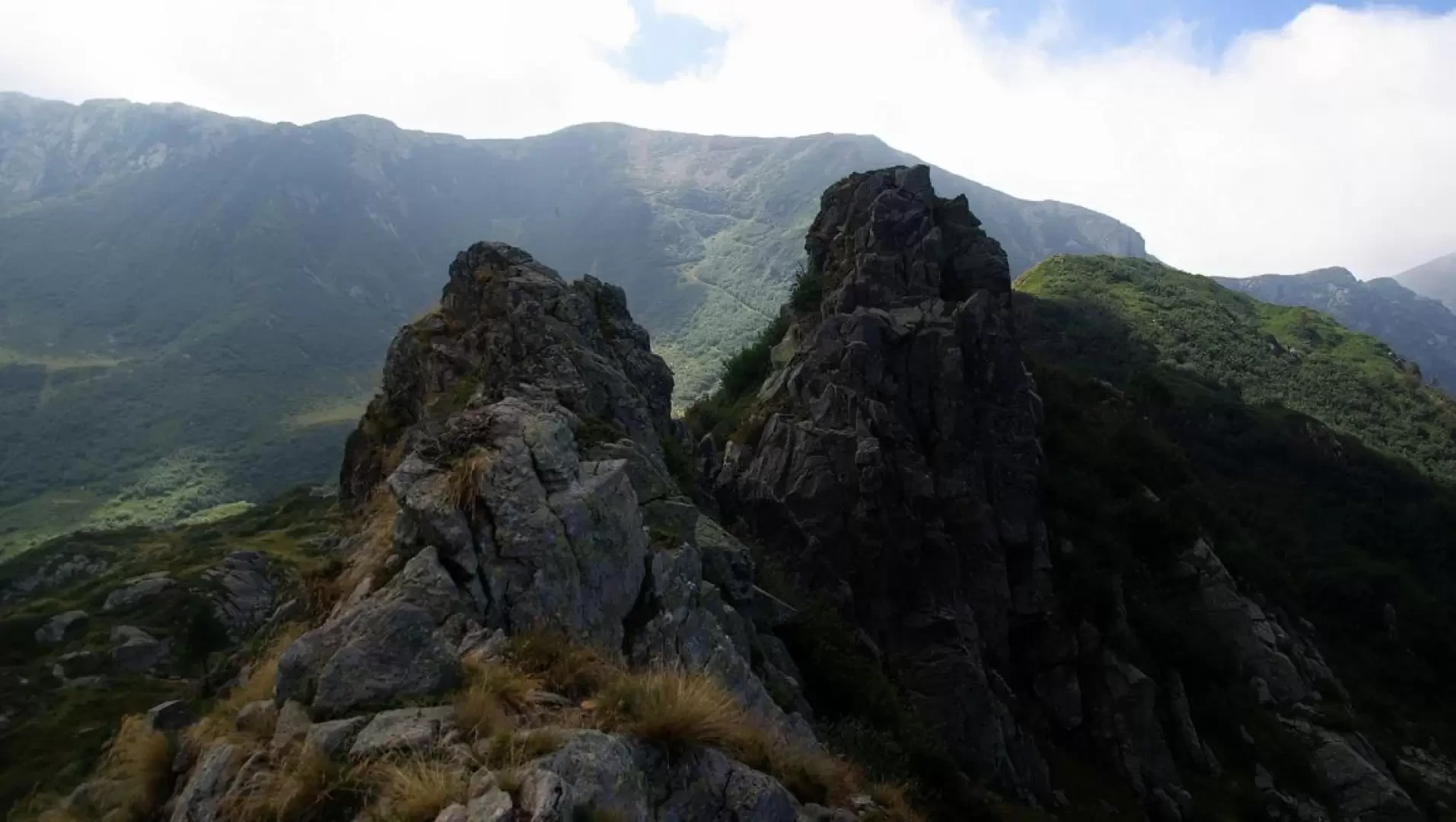
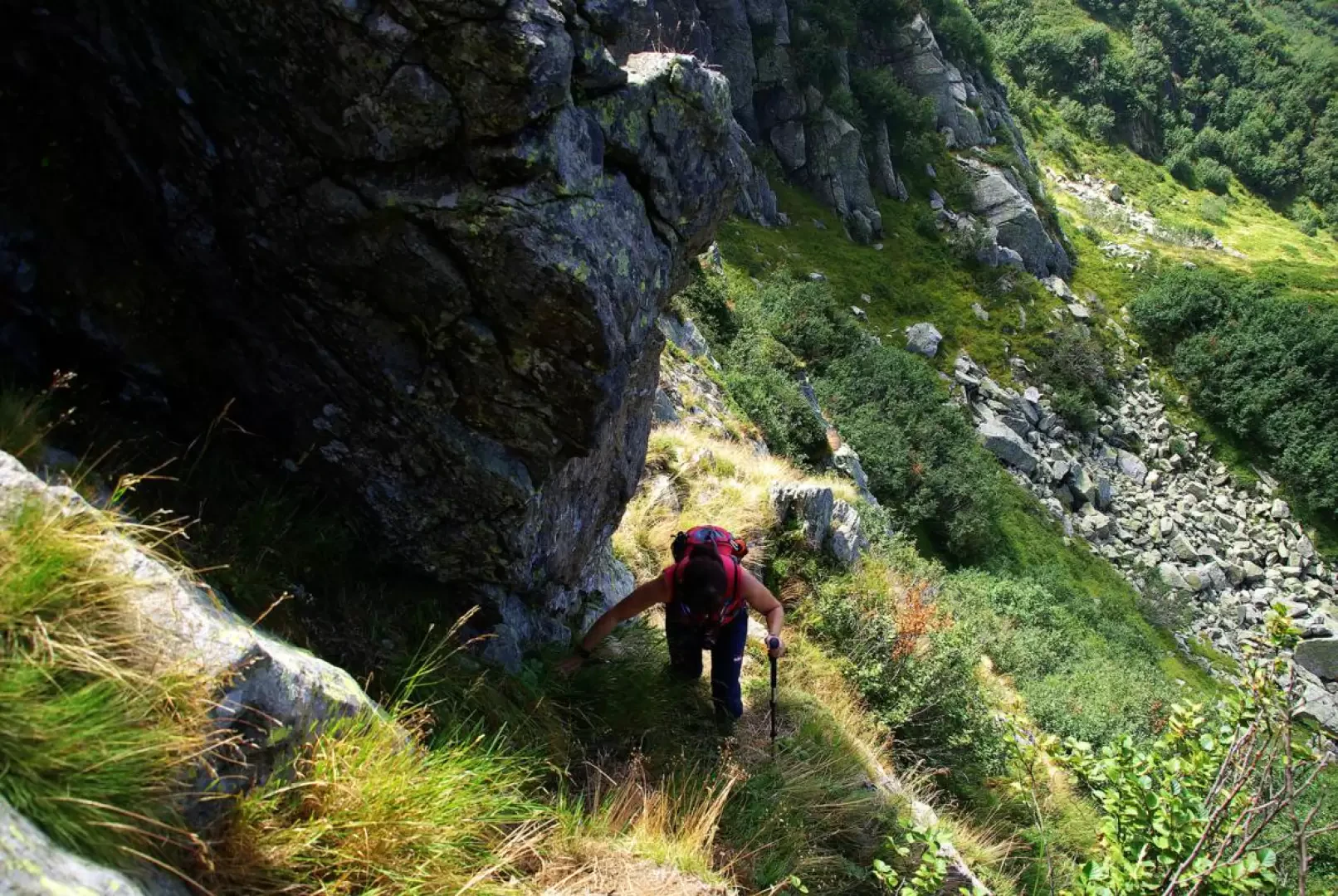
From the 1705m car park, continue along the ridge to the fork near a watering place: choose the left direction towards the Sommafiume Refuge. Follow a mule track with gentle ups and downs that, following the contours of the valley, crosses steep pastures (memorial stones commemorating financiers who perished in the line of duty under the avalanches on these slopes) to the Alpe Albano huts at 1756m; from here the track begins to descend until, not far from the Sommafiume refuge at 1784m near a stream, you find the fork for Cima Verta (CNS stage motto). Continue along the military road - here it becomes grassy and flanked by dense alders - to a new fork: following the Swiss signs, turn right and in a few steps you reach Bocchetta di Sommafiume 1925m. This is actually a grazing hollow on the very wide ridge overlooking the terminal cirque of the Val Morobbia. From here, the summit of the Cima Pomodoro is very evident. From the pass, following the south-west ridge on a thin track, you reach the Q1960m shoulder: a dome covered with creeping junipers among the scattered rocks. The track leads to a second, less evident shoulder and then descends to the base of a rocky gendarme that is best bypassed on the Italian side (a few metres further down, a small seasonal pond). [Easily climbed on the ascent, it is more difficult on the descent: about III°]. One finds oneself at a rocky saddle characterised by a sharp rock, at the base of a second, apparently more difficult gendarme: the little path - very exposed - turns onto the Swiss side under a jutting rock and leads to a comfortable grassy col opposite the summit wall. At one time (at least until 1997) there was a large metal cable here that facilitated the passage of the guards: this has now fallen among the boulders on the summit, having probably been dislodged from its anchorage upstream by a small landslide. A few short climbing steps over unstable rocks and many tufts of grass and you reach the narrow grassy dome of Cima Pomodoro 1973m. Descend comfortably on the other ridge on steep tracks through the usual arid vegetation to a grassy hollow; the track tends to disappear as it ascends Q1941, from which it then descends to the wide Bocchetta di Albano 1900m. Continue on the comfortable but increasingly steep ridge to the grassy dome of Monte Albano 2027m (Poncione di Giumello CNS): on the other side, continue without problems on one of the many animal trails on the Swiss side halfway up the Q 1988m; disentangling yourself among the numerous alders, you reach with difficulty the limited opening of the Bocchetta di Nembruno 1878m. Carrying on the Italian side, without a trail, you descend on sight for a few dozen metres towards the initial mule track, about half an hour from Rifugio Il Giovo.
General information
Route: from Rifugio Il Giovo
Trail signposts: red/white/red
Maximum height reached: 2027m
Type of route:circular
Recommended period: May, June, July, August, September, October, November
Mountaineering grade: II-
Sun exposure:southeast
Exposed sections:thin ridge
Photo gallery
Comments (0)
Sign in to leave a comment