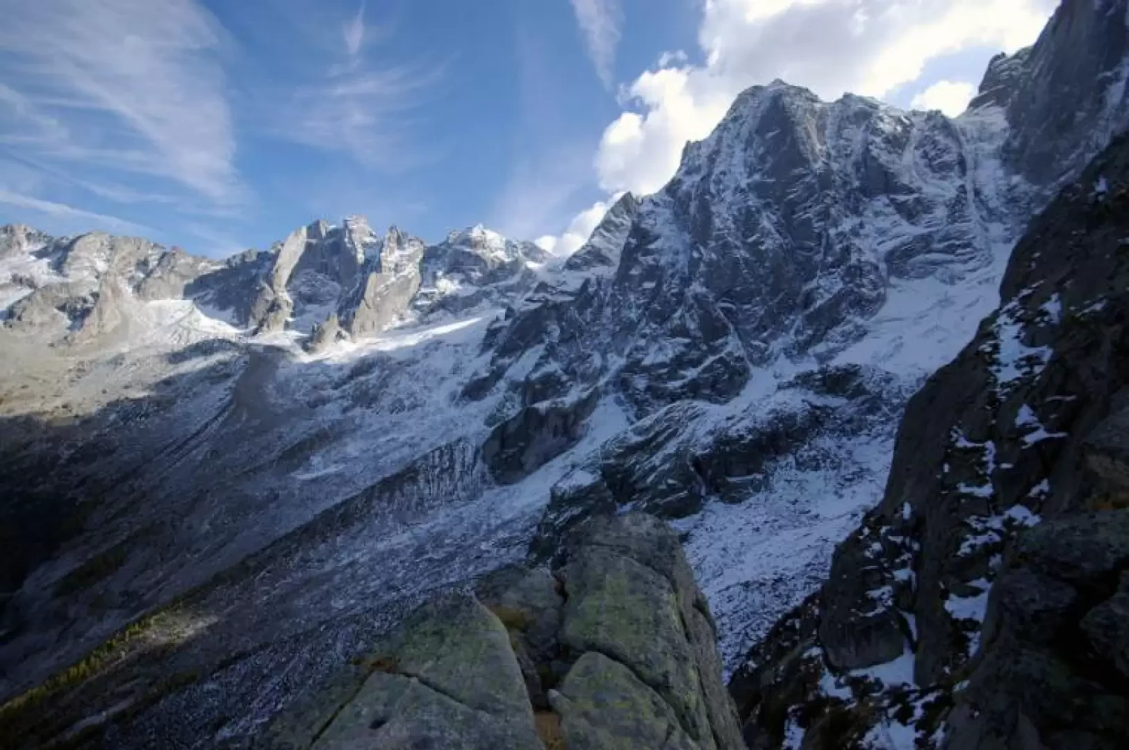
The Viale, from the Val Bondasca car park

Access
From Milan to Chiavenna along the SS36; at the main crossroads take Viale Maloggia (SS37) and continue to the state border. After crossing into Switzerland, in 3km you reach the village of Bondo and following the signs you arrive at the Val Bondasca car park: by paying a toll (13 CHF 0.9 Euro in coins at the ticket machine) you can continue - very advisable - up to Q 1300 m or so. This stretch on foot would cost 1h 30' both outward and return.
.Introduction
A very famous excursion, a must for getting to know the region: suffice it to say that you pass in a semicircle under the north faces of Pizzo Badile and Pizzo Cengalo on a demanding route in a very severe and tiring environment. Also not to be overlooked is the view of the Sciore group at sunset. Technical notes: the section known as "il Viale" - a track on a rather narrow and very exposed ledge - becomes impassable with ice or snow; some modest equipment helps in a medium climbing section; the route is certainly easier in the opposite direction to that described.
.Description
From the end of the road, continue along the track that has become a mule track and in about ten minutes you will reach the Alpe Larèt 1368m junction; descend to the right (from the left you will return) until you cross the Bondasca stream on a beautiful wooden bridge. From here begins a very steep ascent - always on a well-marked path - that leaves no respite until the hut; we climb a seemingly inaccessible rock face using ledges (natural or artificial), gullies and very thin ridges at the top of the latter. There are only a few steps to be taken outside of rocky steps and almost spiralling timber structures. Having passed the sheer wall between sparse, centuries-old larches, we come out into the clearing of Alpe Sass Furà 1904m with the refuge of the same name. Already from here, the summit of Pizzo Badile 3305m appears, in the form of a spire among the fir trees. Behind the refuge, at the brand new winter bivouac structure, we begin to follow the white/blue signs that lead to the Viale and then to the Capanna Sciora. The first few hundred metres are in a beautiful wood of larch and stone pine, with a background of blueberries, rhododendrons and junipers; the track is deep in the soft ground like a trench dug by rainwater. Suddenly, once the vegetation is over, we begin to walk on the northern edge of the Badile: certainly not on the famous alpine route (19 lengths of IV/IV+), but on its northern offshoots, along slabs of granite at the limit of boot-holding capacity. In this section, the signposts to be taken into consideration are always those in paint: the numerous and sometimes artistic stone cairns are dedicated to mountaineers who, still in the dark, head for the edge. Moving to the left on the last slabs, we reach the narrow notch that allows us to enter the narrow ledge of the Viale. The first few metres are a steep descent with maximum exposure: the path is gravel and great care must be taken. Alternating between flat stretches and uneven descents - sometimes under overhanging roof rocks - one arrives at the only equipped section: a small wall of about 15 metres (grade III) assisted by a chain poorly secured with solid bolts. At this point, the technical section is finished and the interminable traverse of the glacial valleys coming from the walls upstream begins: there are four grooves to be overcome, separated by sharp moraines to be ascended and descended each time. The progression is tiring due to the absence of a real track: it is necessary to disentangle yourself between the large boulders by jumping from one to the other or climbing up the sides. After a couple of hours in this environment, a few blades of grass begin to reappear and - in a short time - you arrive at Capanna Sciora 2120m. Justifiably famous panorama. From the hut, the path, which is always rather uneven, descends rapidly among loose stones and slabs equipped with artificial steps; then we reach a strip of mountain pines and proceed on their roots polished by the passage: it is not unusual to use them as handholds in the steepest points. At this point we have arrived at the suspended esplanade of the abandoned Naravedar alpine pasture 1843m; from here the descent starts again, which - flanked by a waterfall embedded in the forest - is another example of the interlocking wooden steps. At its end, with a much diminished gradient, the valley floor transfer begins towards the two Larèt huts, a few metres above the initial fork. From here, it is only a few steps to the car park.
.