Rifugio Noaschetta, from Noasca


Edited by:
Ivano Ruffoni
Updated at: 10/05/2025
Access
At the motorway exit in Ivrea, take the Pedemontana road, , and at Castellamonte the Ceresole Reale road. Continue into the Orco Valley as far as Noasca, pass the next four hairpin bends above the town and, just before the tunnel, turn right towards Balmarossa. Now go up the numerous hairpin bends to the small car park at the end of the tarmac road.
Introduction
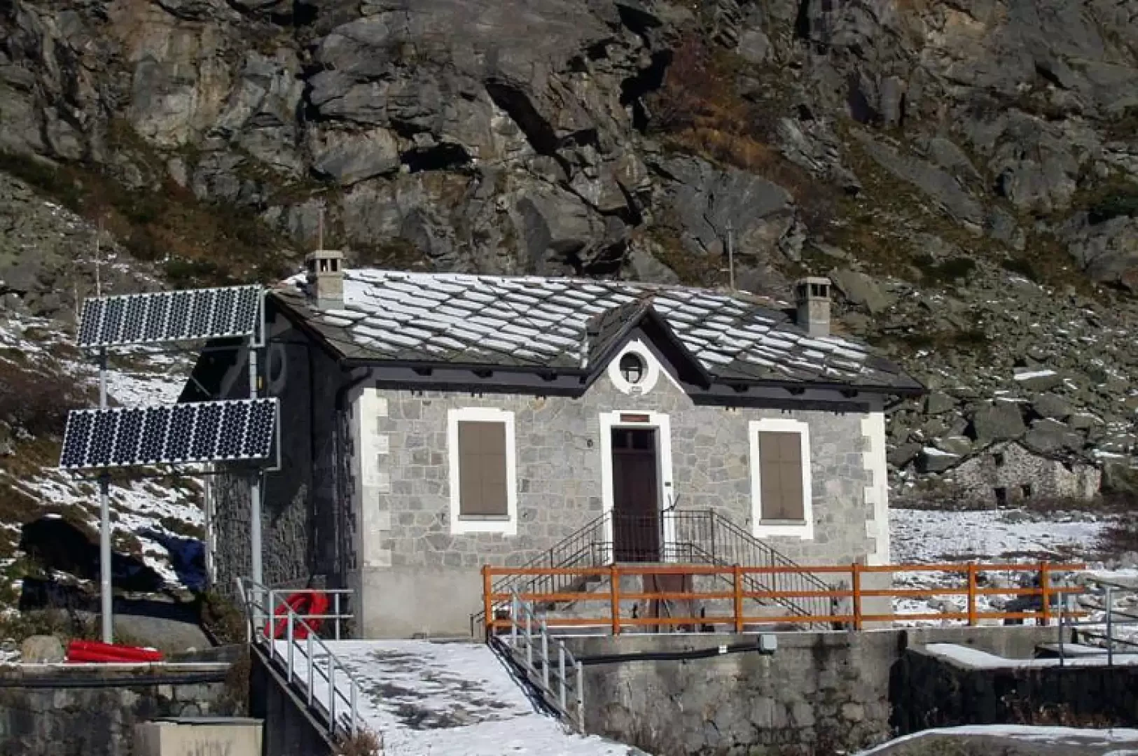
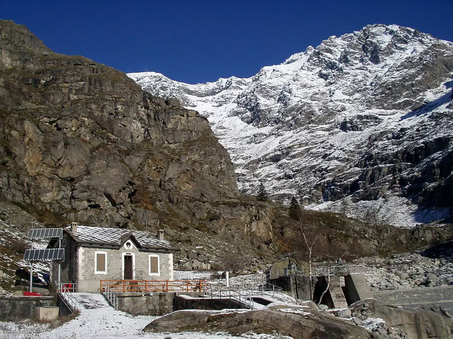
Easy itinerary in the Gran Paradiso National Park. The Noaschetta Refuge is located after the rocky bastion that closes, to the north, the meadows of the hamlet of Sassa, just above Pian Sengio. The building, lapped by the Noaschetta stream that descends from the valley of the same name, derives from a building used in the past by the keepers of the underground canal that descends from Lake Ceresole to the Rosone hydroelectric power station. Near the refuge, part of the waters of the Noaschetta stream are also channelled into the same canal. The refuge is closed all year round but keys can be collected from the Gran Paradiso Ristobar in Noasca.
The Rifugio Noaschetta is a small, unmanaged and locked refuge. For retrieval of keys contact:
Trattoria Caccia Reale
Via Roma, 14
10080 Noasca (TO)
Tel. 349 23 18 586 and 340 25 26 735
(trattoria closed on Thursdays)
Description
0h00' From the clearing, descend for a few tens of metres along the asphalted road and take the beautiful mule track
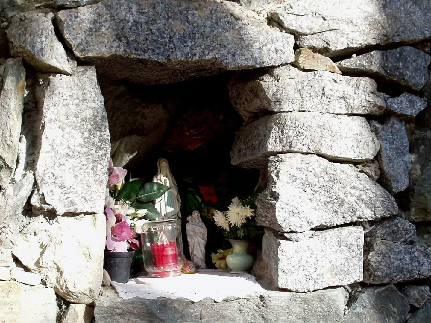
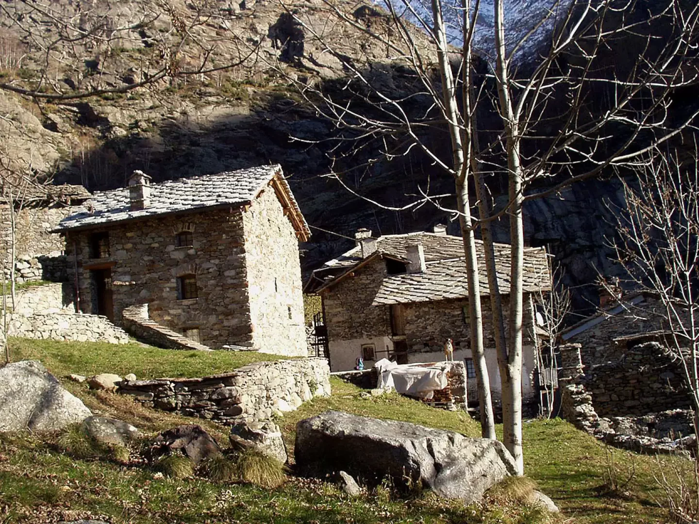
on the left, which climbs gently into the wood. The mule track proceeds in hairpin bends at regular intervals, passes a beautiful niche with a Madonnina, and through the well-maintained forest, along the steep larch ridge to the orographic left of the Vallone di Ciamouseretto, leads to a grassy shelf. Halfway up the hillside, you reach the small hamlet of Sassa (1353m).
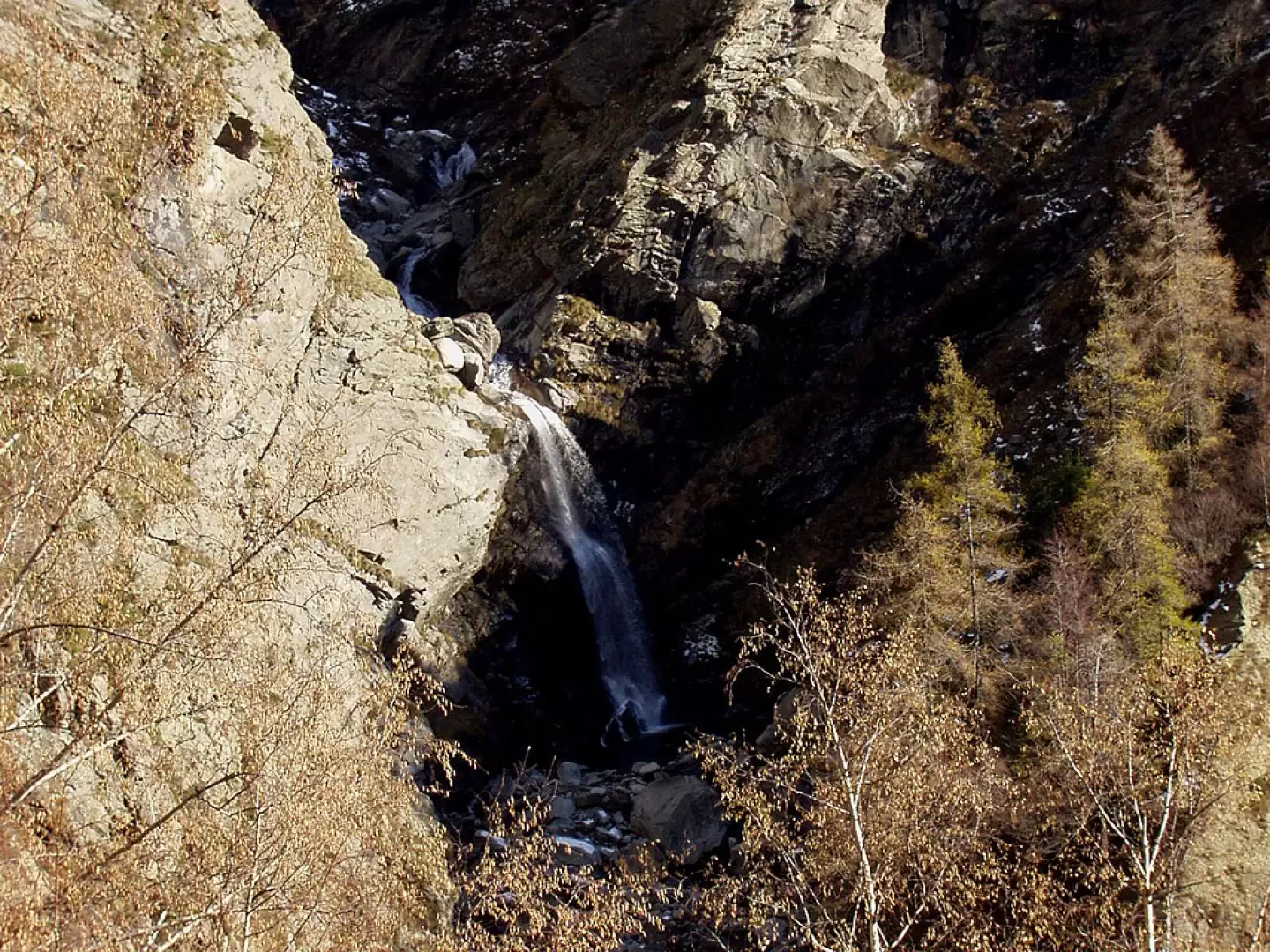
The trail goes around the hamlet to the left and points north towards the rocky rampart bordering Pian Sengio. To the right, the Noaschetta stream cascades in a thunderous waterfall.
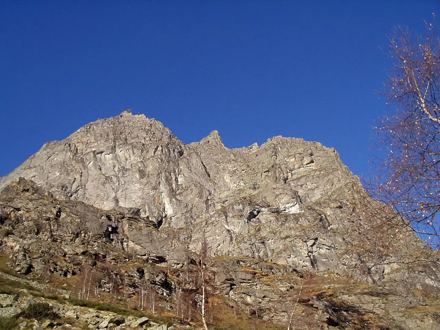
Near the rampart, the path bends to the left, to the west, between the rocks of a landslide. Shortly afterwards, a path crosses to the right that, if followed, would lead to the rock gymnasium. Instead, continue along the main track (wooden signpost indicating Rifugio Noaschetta - Sentiero Facile) with beautiful views, south-westwards, over the Levanne. Shortly after, on the left, you cross a track that descends into the Vallone di Ciamouseretto, but do not follow it. Instead, continue along the main winding path through the woods.
After crossing a stream, leave the
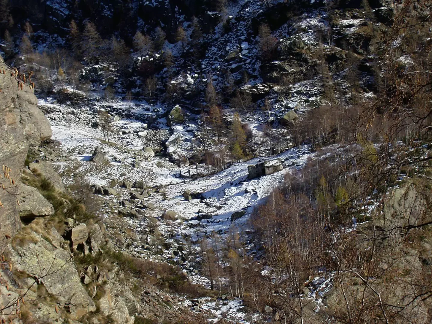
sign on the left for Alpe Gran Piano, at about 1640 m, the highest point of this excursion, and walk along the hillside, sometimes downhill, past Pian Sengio, visible on the right, while the severe walls of Monte Castello dominate above. Shortly afterwards, on the right, follow a track indicated by a wooden sign (altitude 1600m). We descend between rare red and white notches and cairns, pass to the right of a ruin, and turn left, descending further and further into the valley. Near the stream rises the Noaschetta Refuge (1520m): in the vicinity are a number of dams, winches and bulkheads governing both the underground canal coming from Lake Ceresole and the waters of the Noaschetta stream that are channelled there.
The return journey follows the same itinerary.
Punti di Interesse
- Noasca
- Sassa
- Rifugio Noaschetta
Collections
Photo gallery
Comments (0)
Sign in to leave a comment