Bocchetta di Valsoera, from the Teleccio dam car park


Edited by:
Ivano Ruffoni
Updated at: 04/05/2025
Access
At the motorway exit in Ivrea take the Pedemontana, State Road 565, and at the height of Castellamonte the State Road of Ceresole Reale: continue into the Orco Valley as far as Rosone.
Take the narrow asphalt road to the right into the Piantonetto valley. Shortly after San Giacomo the road is closed to unauthorised traffic but, in reality, transit is tolerated. Afterwards, the road becomes unpaved and with a slightly wider carriageway. The last 800 metres before the Teleccio dam are again on asphalt road. Parking is provided in the vicinity of the dam.
Introduction
Itinerary, in the lonely and somewhat exposed final part, leading along the watershed between the Piantonetto and Valsoera valleys. Magnificent views of the Telessio and Valsoera lakes.
Description
Take the dirt road, marker
, which starts from the dam car park. When you arrive at the concrete construction, a sign illustrates the two paths leading to the Pontese Refuge: the first, the old one, which is the subject of this description, leads to the refuge by crossing an area potentially subject to landslides and rock discharges; the second, which is newly marked, runs along the dam and climbs up the opposite orographic side.
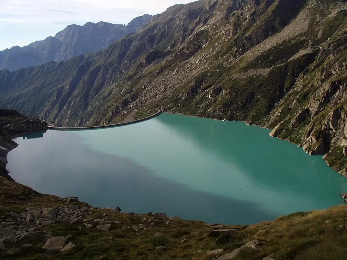
We proceed on the mule track that runs along the orographic left side of Lake Telessio, bypassing a first landslide of unstable rocks and a second, more modest one.
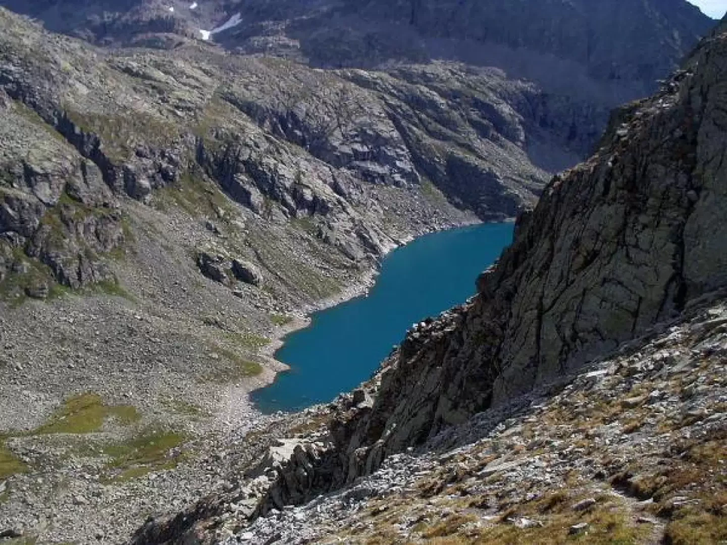
At about 3/4 of the lake, the mule track ends. We now follow a steep path, paying attention to the suspended loads moved by the refuge's cable car, enter a small, sparse grove and then, with numerous hairpin bends between slabs of rock deposited in the form of steps, climb to the southern edge of the Piana delle Muande. The view of the Telessio lake below is magnificent.
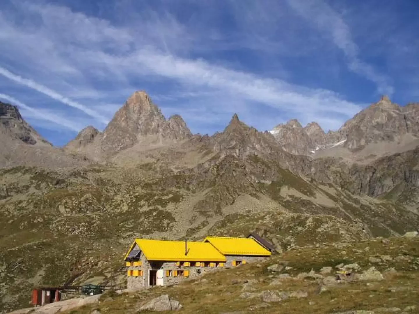
We turn slightly to the left and, with a modest slope, arrive at the Pontese hut (2193m), with its characteristic yellow-coloured roof.
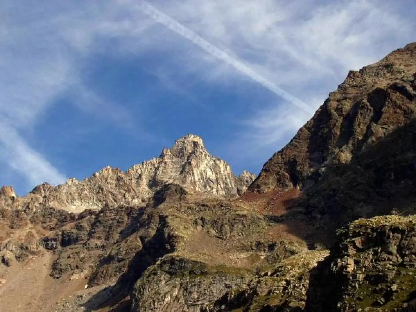
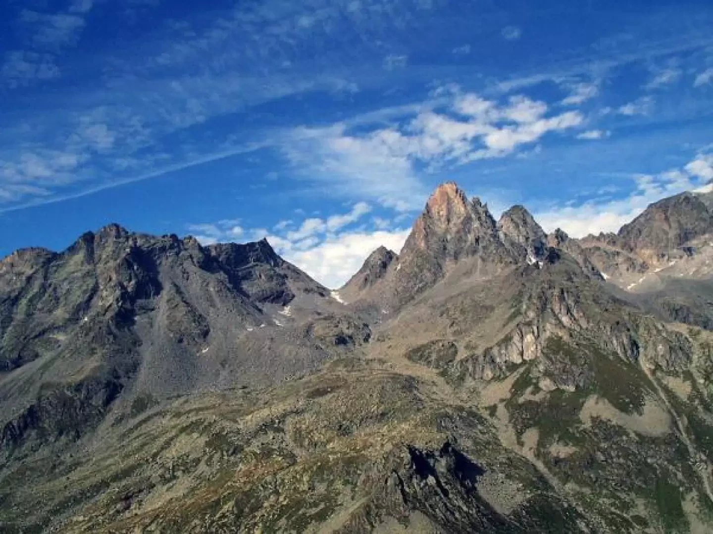
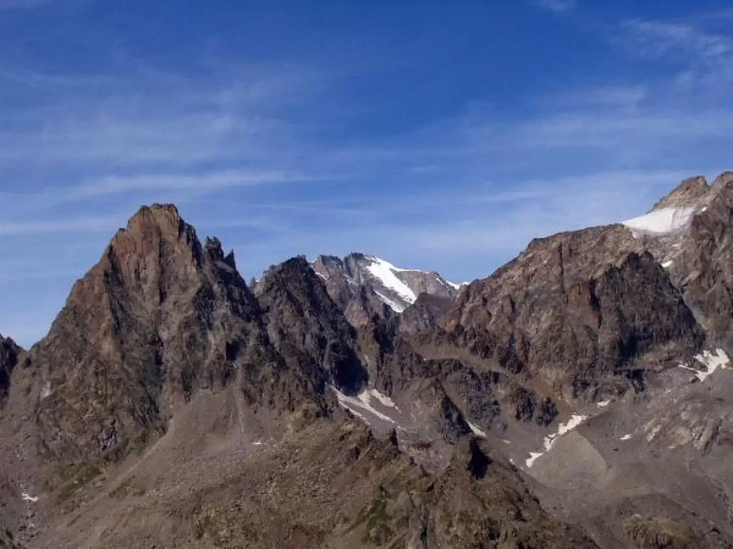
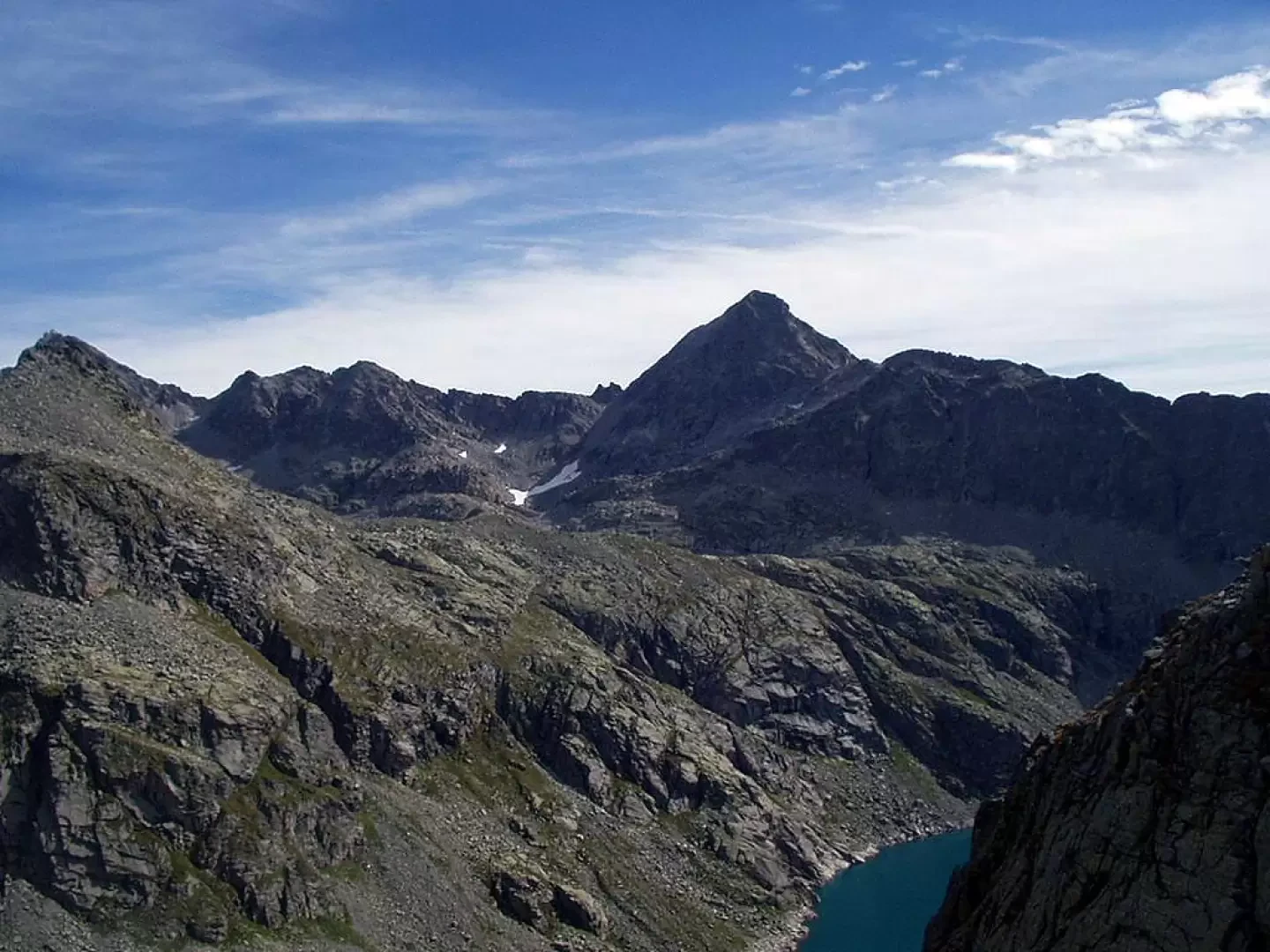
From the hut, to the north, the Torre del Gran San Pietro and the Becco di Valsoera are clearly visible; to the east, the Becchi della Tribolazione and Blanc Giuir are noticeable.
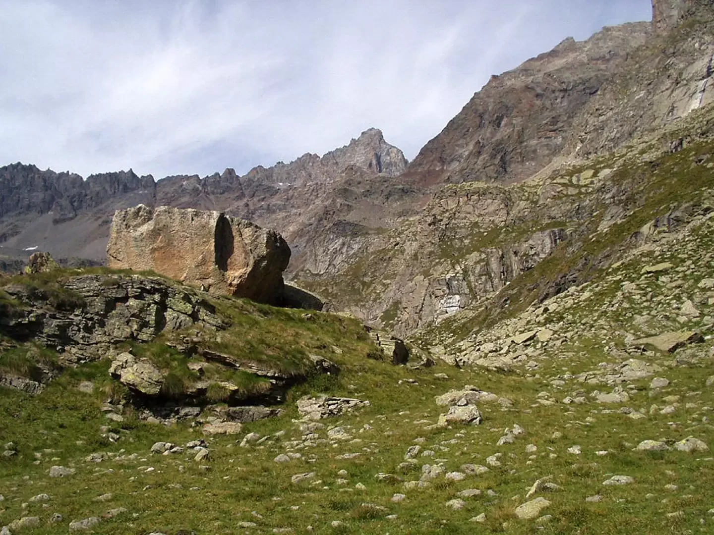
North-eastwards, follow the water pipes until you reach a small flat basin, then go around a modest hillock on the right, on the top of which there is a large boulder, and you will find the traces of the path, signposted AVC.
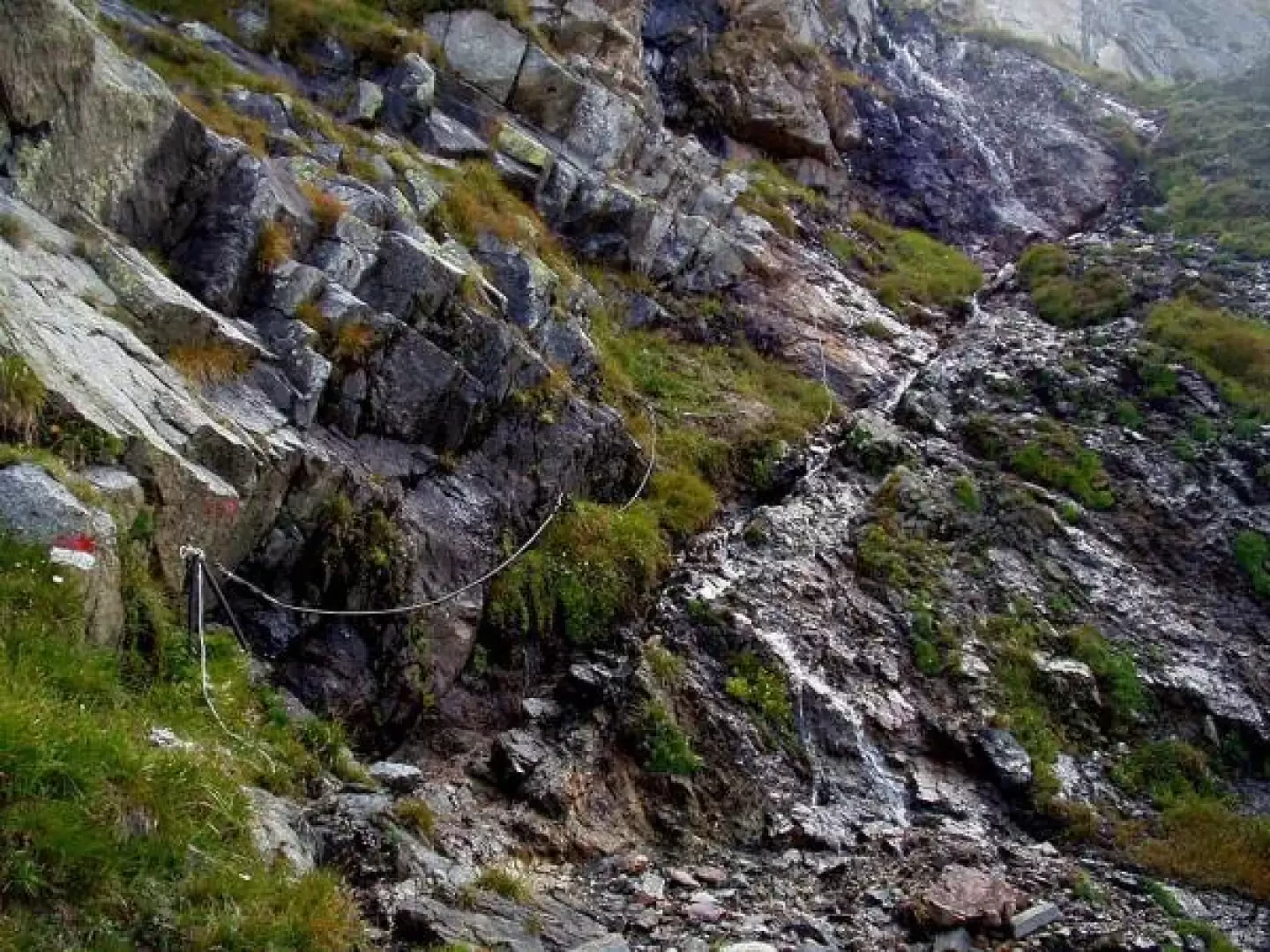
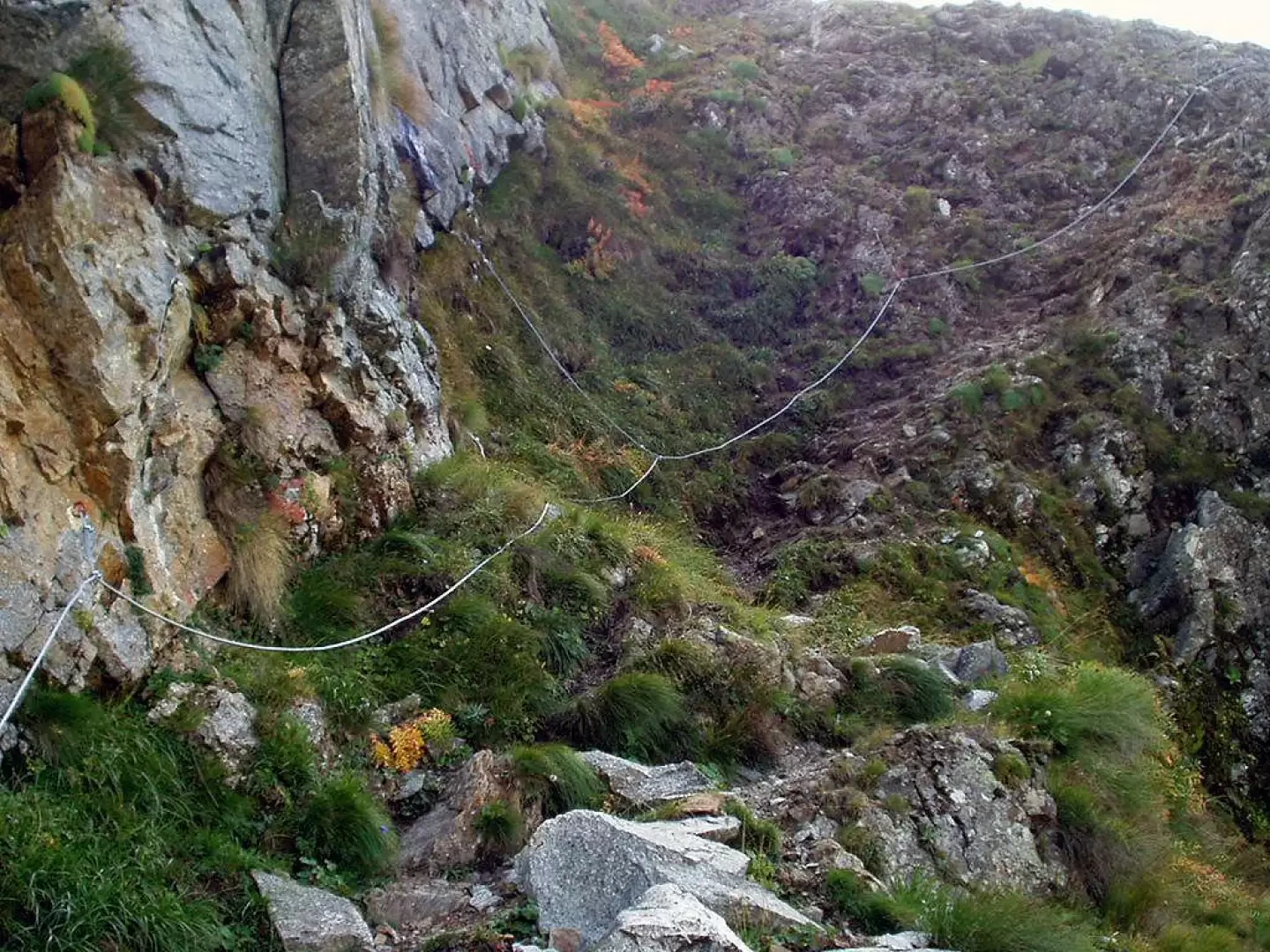
Go up the grassy slopes passing under a small snowfield (snow present even in late summer). The path dips to the right around a rocky bastion and, by means of a steep path, at times a little exposed, reaches the vicinity of a slippery waterfall, which is tackled with the aid of a section equipped with a steel cable. Shortly afterwards, a second, but much easier, equipped section is encountered. You reach a small ridge, cross, slightly downhill, a couple of gullies and reach the foot of the steep slope that, among grass, stones, gravel and slippery ground, leads to the Bocchetta di Valsoera (2683m). To the west north-west, between the Becchi della Tribolazione, the Gran Paradiso can be partially observed, while to the north-east, the north shore of Lake Valsoera and Punta Gialin can be seen.
The descent is by the same route.
Photo gallery
Comments (0)
Sign in to leave a comment