Monte Fasce, from Apparizione


Edited by:
Maurizio Loconti
Updated at: 03/11/2025
Access
From Corso Europa, take Via Tanini and then turn right onto the narrow carriageway up to Apparizione, where you turn right onto a level road to the small square by the local cemetery. Here there are a few parking spaces and the bus terminus.
Introduction
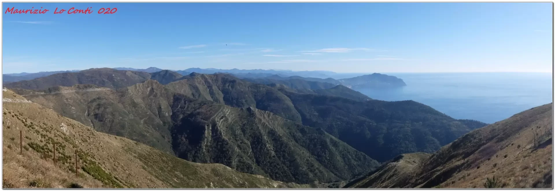
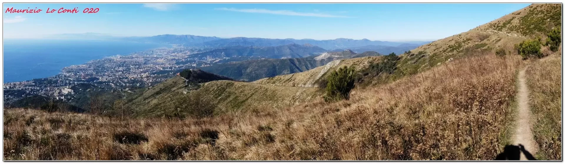
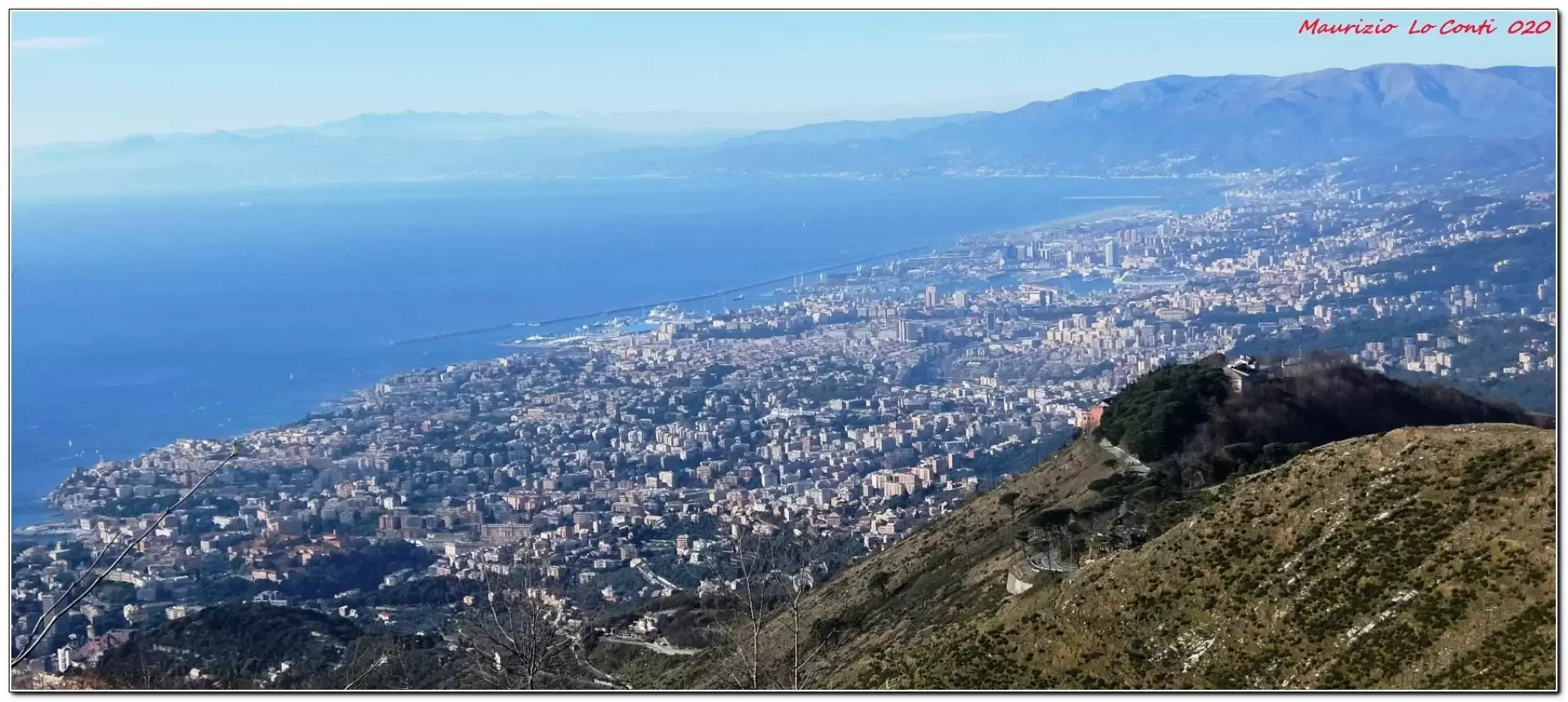
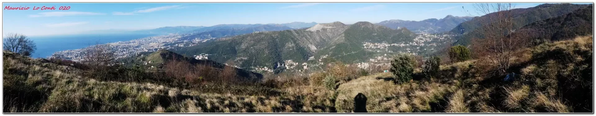
Although the city is just a stone's throw away, the excursion highlighted here should not be underestimated; it is a real hiking trail of medium difficulty, partly unmarked, that unfolds in an environment with vast, almost wild scenery, in spite, it bears repeating, of the Genoese neighbourhoods that are always clearly visible... The day was particularly favourable, with weather conditions that provided uncommon visibility!
Description
From Apparizione (200m), walk along via Crocetta di Apparizione at the beginning to the cross of Monte Borriga (540m). From the vast clearing you can dominate the whole of Genoa! After visiting the religious structure, continue by losing a few metres in altitude to the carriageway, near the Trattoria del Liberale. Continuing on, we conquer the summit of Monte Fasce at 832 m by vague traces (preferable from the ruins of a house - Pre de Ferretti - climbing up with the Fie symbols). A partial loop is possible, plunging at first towards Quinto. You arrive at a point where Fie signs appear for the link back to the Fasce road. Nearby. there is a cave called Pertuzo do Cantè with an adjoining stream and spring. Unfortunately, it is not possible to locate it. Having found the morning's route again, we head back to the starting point.
In short: Diff. E - height difference almost 650m - approx. 9km - 4h total, excluding breaks - clear weather with super visibility, moderate but almost no wind at the summit, acceptable temperatures for the period.
If you wish, here is the pdf photo file, with a little more information:
http://www.cralgalliera.altervista.org/ApparizioneFasce020.pdf
http://www.cralgalliera.altervista.org/anno2020.htm
http://www.cralgalliera.altervista.org/altre2020.htm
NB: In the case of an excursion, always check with FIE, Cai, any park authorities or other institutions, pro loco, etc, that there have been no changes that have increased the difficulties! No liability is accepted. This text is purely indicative and not exhaustive.
Info Hiking Section Cral Galliera: http://www.cralgalliera.altervista.org/esc.htm
Trips 2020 at the link: http://www.cralgalliera.altervista.org/gite020.pdf
General Information
Signposting:
Type of route:partially circular
Recommended period: February, March, April, October, November
Sun exposure:West
Objective Danger:none
Exposed Trails:none
Useful Equipment:normal daily hiking equipment
Photo gallery
Comments (0)
Sign in to leave a comment