Monte Sillara, from Prato Spilla


Edited by:
Maurizio Loconti
Updated at: 03/11/2025
Access
Get off the motorway at Aulla and from there drive up to the Lagastrello pass, then on to Prato Spilla, about 1 hour and 35 km from the toll station.
Introduction
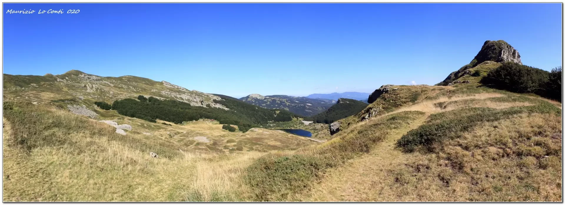
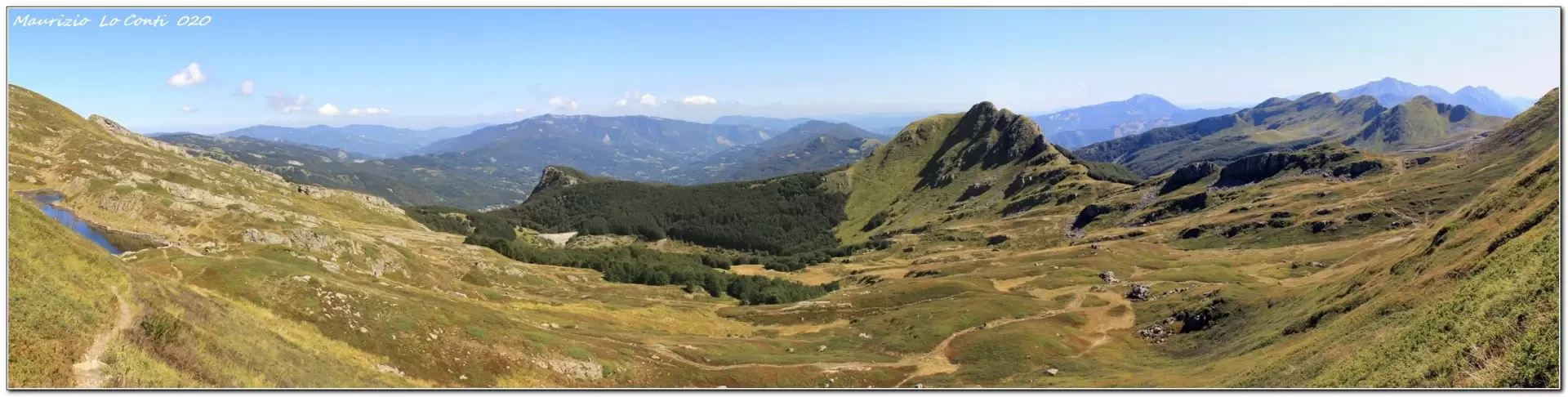
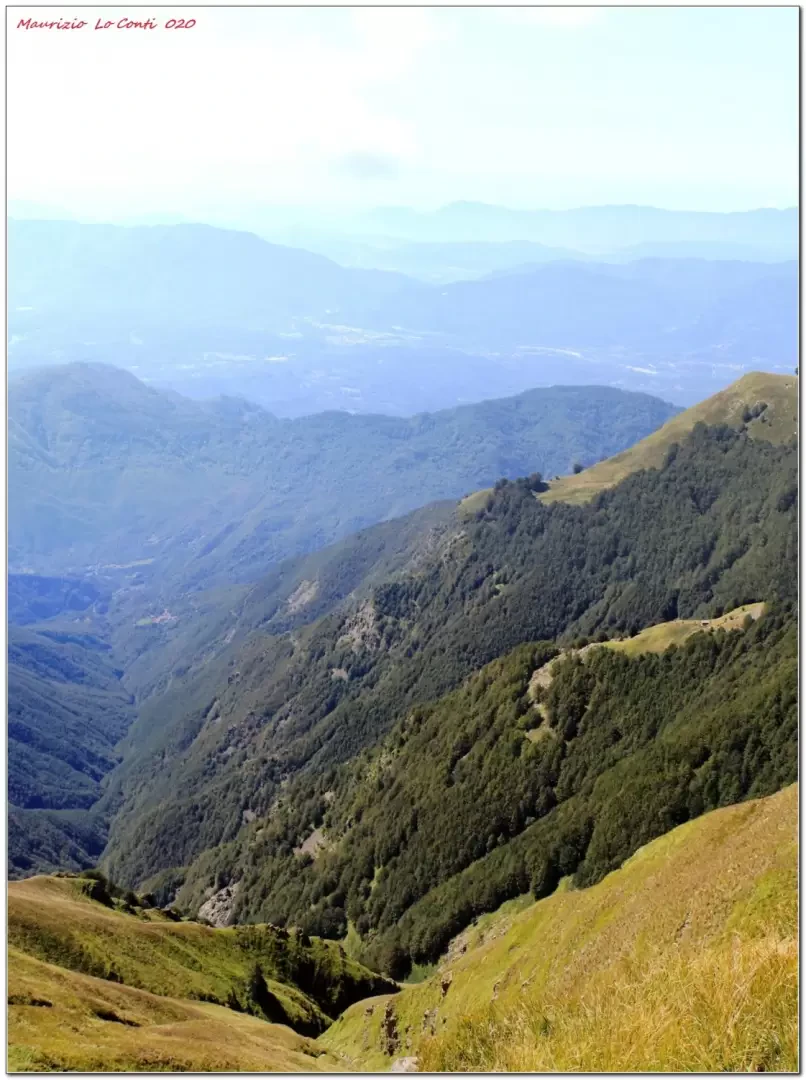
The Cento Laghi park is a scenic area of great interest. The chosen starting point is excellent because it allows you to climb up the ridge, fairly quickly, to admire a series of truly spectacular basins of glacial origin. The ring chosen is, in the end, a little long (13 km), quite tiring (about 750 m of ascent due to the numerous ups and downs, especially in the second part) and required 6 hours of walking! In this way, however, we saw no less than 8 lakes (one from a distance), many ponds and some peat bogs...
.Description
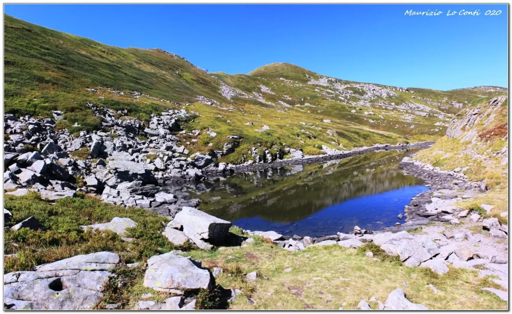
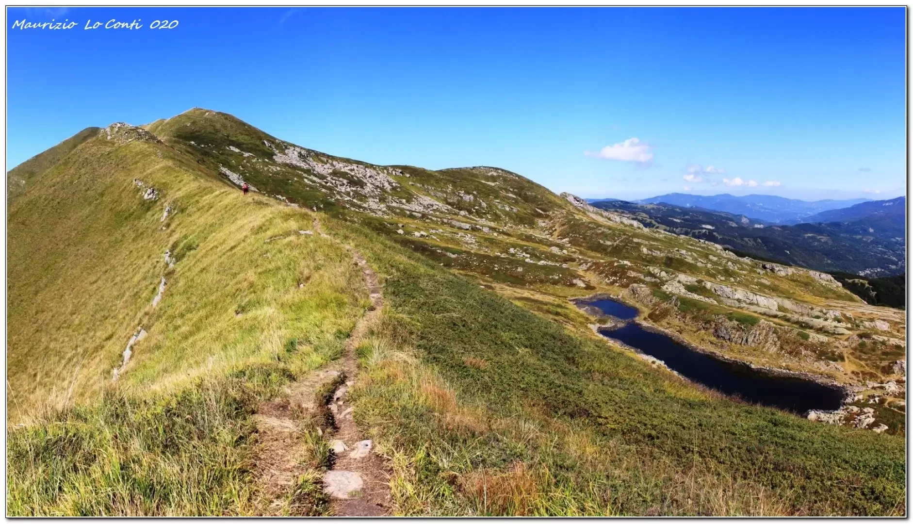
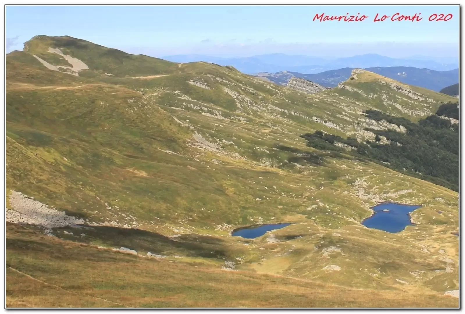
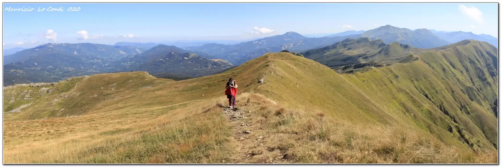
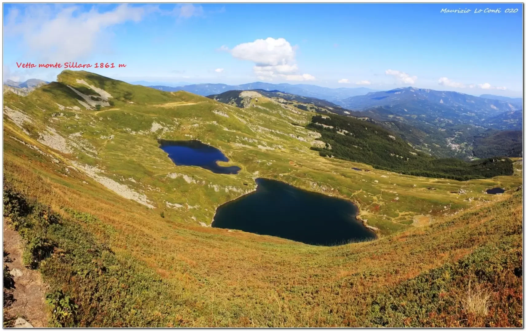
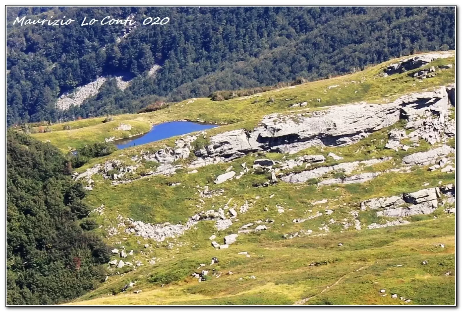
You climb along the ski slope and further on you cross the Cai symbols, which you follow uphill. You turn right and plunge into the dense beech forest. One emerges from the vegetation and the view sweeps away. You continue to gain metres... In 1h20 you touch Martini Lake 1714 m. A few more minutes and there is the Giovarello pass 1762 m. The views become vast... The Gulf of La Spezia can be glimpsed. In succession, we pass the two peaks of Bragalata, 1836 m. In view of the Compione pass, 17994 m, the two homonymous ponds stand out to the right. One also passes Monte Nuda di Iera (1840 m). The two lakes of Sillara stand out. In the end, we decide to reach the peak of Sillara 1861 m, the highest point in the Parma area; it is really daring, with a wall that drops for hundreds of metres... a little Madonna welcomes us on arrival (1h25 - tot. 2h45) and it is the right time for a short break.
We set off again and in a semicircle, skirting a peat bog, we approach the Sillara lakes 1730 m, amidst a sea of blueberry plants. Next, we keep to the left, an obvious but unmarked track leading to the Compione lakes (45' - 1681 m). You now find the flags again and climb up the Frasconi rock to an obvious notch. From here, the Lago Verde (Green Lake) can be seen: look for a path that descends and follow some cairns, but it is only a shortcut that enters the woods, finding the Cai signposts again... which then come from the Cagnin shelter 1590 m. You still lose altitude towards Lago Verde (Green Lake) and leaving the flags behind, you come to a spring; it is quite a beautiful basin (1507 m - 1h15). Climb up towards Lake Ballano and then descend on a wide track. The lake (1330 m) is not clearly visible (dam inaccessible). On a comfortable road we return to Prato Spilla passing by the adventure park (1h15), with a couple of final ups and downs.
All in all: Diff. E - Disl. 750 m - 6h - 13 km. Average walking comfort: Sufficient in the first section then poor. Best period: summer.
as well as the pdf photo file, with a bit more info:
http://www.cralgalliera.altervista.org/PratoSpilla020.pdf
http://www.cralgalliera.altervista.org/anno2020.htm
http://www.cralgalliera.altervista.org/altre2020.htm
Previous visit to the area: http://www.cralgalliera.altervista.org/RifSarzana019.pdf
Trips to nearby upper Tuscany: http://www.cralgalliera.altervista.org/GiteApuaneAltaToscana.htm
Approach: Prato Spilla (1350 m) is located in the upper Val Cedra, close to the Lagastrello pass (on the border between the provinces of Parma, Reggio Emilia and Massa Carrara), and is a tourist resort with a number of winter facilities. There is a hotel there, which, if desired, makes the trip easier.
December 2020 Update:
A few friends of the Fie, after seeing the single shots and photos in the pdf 'PratoSpilla020', asked me for the effort to prepare an article for the magazine 'Escursionismo'.
With pleasure, I accepted the challenge and, after a few years, I returned to write for that periodical.
I gave it a try and the result is at the link:
http://cralgalliera.altervista.org/Rivescursionismodic020CentoLaghi.pdf
All the excerpts that came out in the publication in question:
http://cralgalliera.altervista.org/articoliRivEsc.htm
NB: In the event of an excursion, always check with Fie, Cai, any park authority or other institutions, pro loco, etc., that there have been no changes that have increased the difficulties! No liability is accepted. This text is purely indicative and not exhaustive.
Photo gallery
Comments (0)
Sign in to leave a comment