Mount Mao


Edited by:
Maurizio Loconti
Updated at: 03/11/2025
Access
From the A10, (Savona or Spotorno), drive up the coast to the scattered village of Bergeggi, leaving your car near the church of San Martino (108 m).
.Introduction
Short, very scenic loop with beautiful vines overlooking the sea.
Description
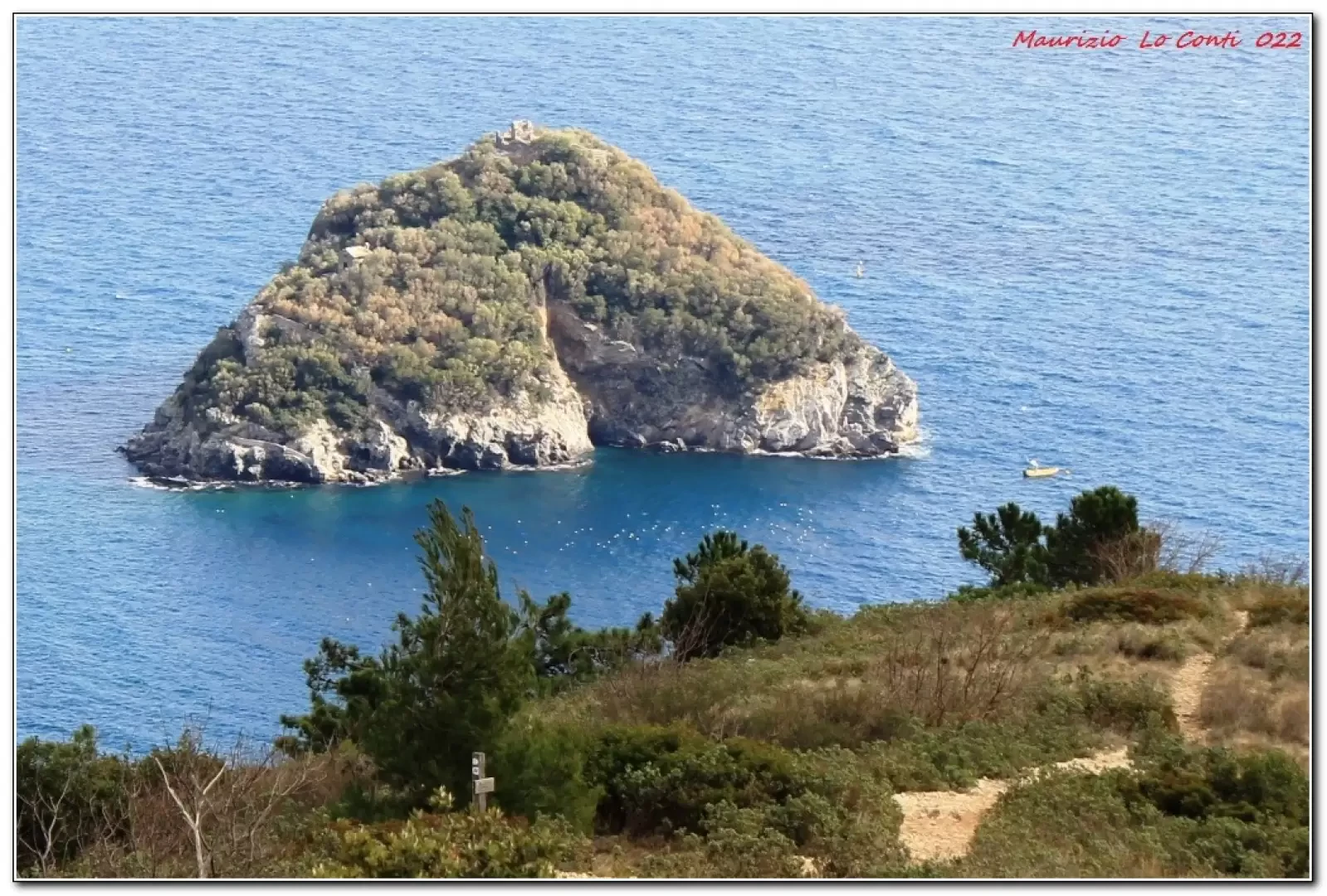
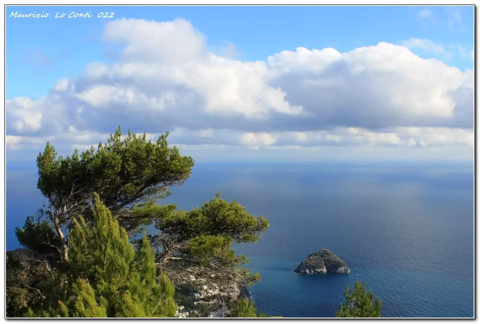
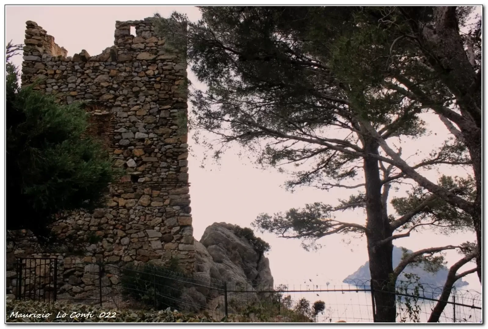
You go up a lane between houses and then a side road. Finally, you come out of a residential complex. On the first floor of the same, you enter the condominium garden to admire the Saracen Tower and the island of Bergeggi below. After the customary photos, one retraces one's steps to the road closed off with parking spaces where the geometric figures Fie stand out, directing one to a flight of steps on the left. Now, you walk along the path, gaining height with the symbols and paying close attention to the various turns present. Having passed a picnic area, we join a dirt track that we follow as far as the S. Elena gorge. Here we turn left, rejoining the wide road, which, however, has the major defect of passing not too far from a dump, with all the disadvantages of the case. At a crossroads, turn left uphill to an open space where an isolated bench stands out, ideal for taking a break. After the break, we ascend the nearby peak of the very scenic Mount Mao (440 m). A demanding descent begins on a slippery terrain due to the many small stones... there are many tracks plunging downwards and it is a bit confusing as to the right direction to take... The signs are practically non-existent... In the foreground, there is always the islet of Bergeggi! From a pylon on the Alta Via del Golfo dell'Isola it is best to turn left in a way that is, at last, convenient. At the next fork, keep to the right on the level until noticing a short flight of steps that descends to the left and takes you back to the innermost part of the valley (Strada Valle del Bosco, without even a theoretical marker). Having found a double junction, already crossed on the outward journey, we proceed straight ahead, finding houses and asphalt. In short, there is the morning walk and back to the car.
In summary. Dif. E - height difference +400 m - 8 km x approx. 3h/3h15 Tot
+ all the breaks to see the various places you come across.
Travel comfort: sufficient, but very poor during the steep descent.
Best time: autumn to spring (avoid periods after the rains).
Time: medium. Tour interest: medium/high
In addition to the pdf file with some news:
http://cralgalliera.altervista.org/AnelloBergeggi022.pdf
http://www.cralgalliera.altervista.org/altre2022.htm
after clicking on the link, press F5 to refresh the page...
NB: in the case of an excursion, always check with FIE, Cai, any park authority or other institutions, pro loco, etc., that there have been no changes to the route, that there have been no changes that have increased the difficulties! No liability is accepted. The present text is purely indicative and not exhaustive.
Info Hiking Section Cral Galliera: http://www.cralgalliera.altervista.org/esc.htm
Trips 2022 at the link: http://www.cralgalliera.altervista.org/gite022.pdf
General Information
Signposts: Partial Fie
Tour type:circular
Recommended period: October, November, December, January, February, March, April
Sun exposure:south-east
Photo gallery

Comments (0)
Sign in to leave a comment