Moneglia, crossing from Riva Trigoso

Edited by:
Maurizio Loconti
Updated at: 18/10/2025
Access
You can park near the Riva Trigoso station (from Via Gramsci - Sp 370), a 4 (four) minute train ride back.
Introduction
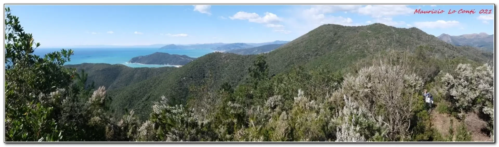
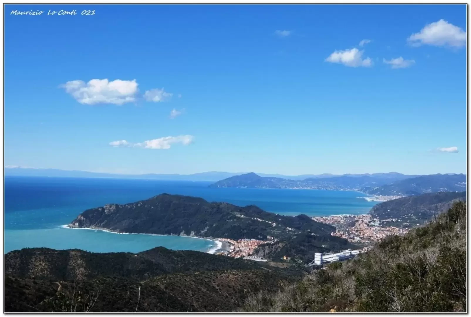
From Riva Trigoso to Moneglia, along the high variant of the Moneglia and Comunaglia mountains.
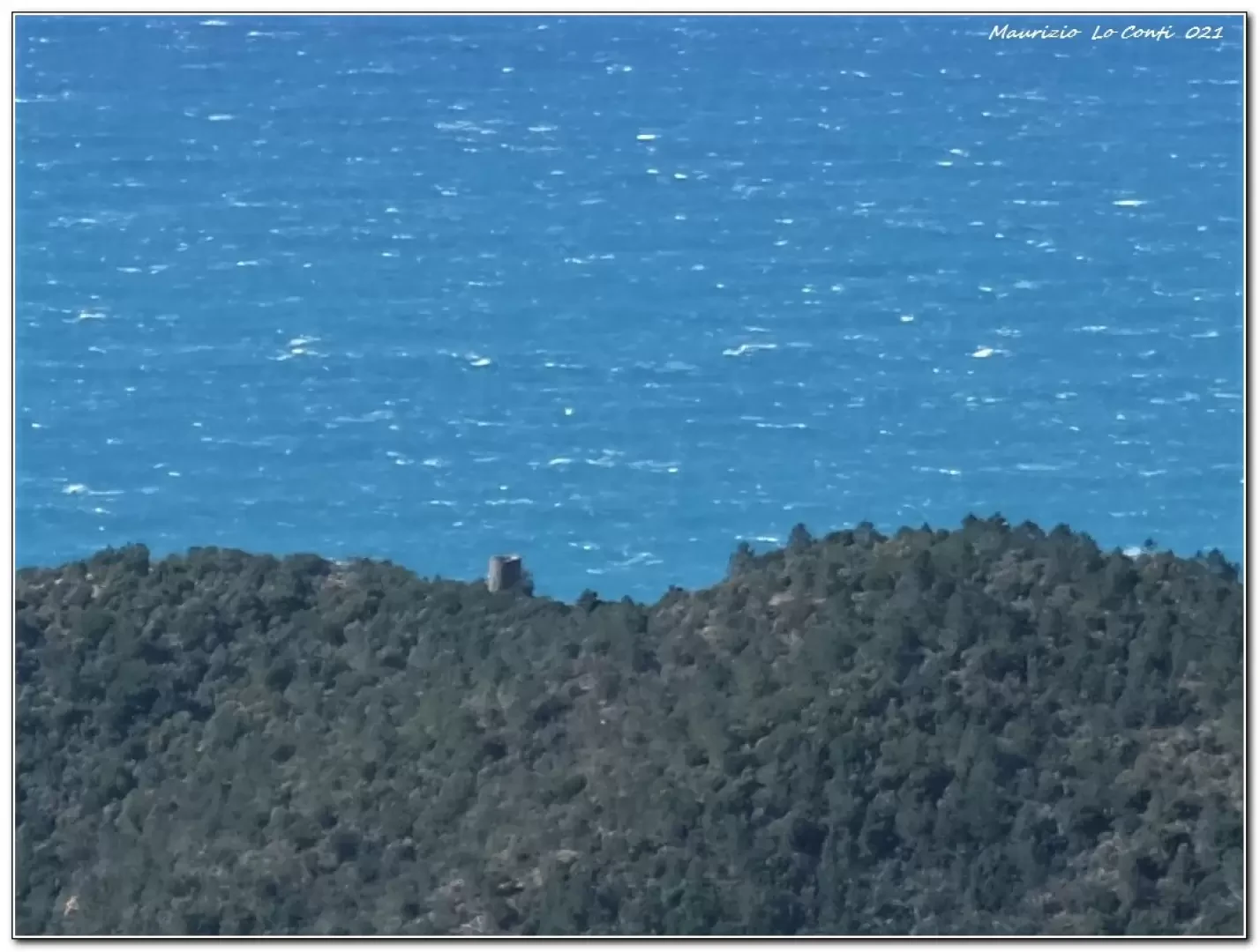
This is a different version of the more classic crossing that passes by the Punta Baffe (*) tower, with a slightly greater difference in altitude. The places, so compressed between the mountains and the sea, promise wonders that are certainly not disappointed, as well as sweeping views...
Description
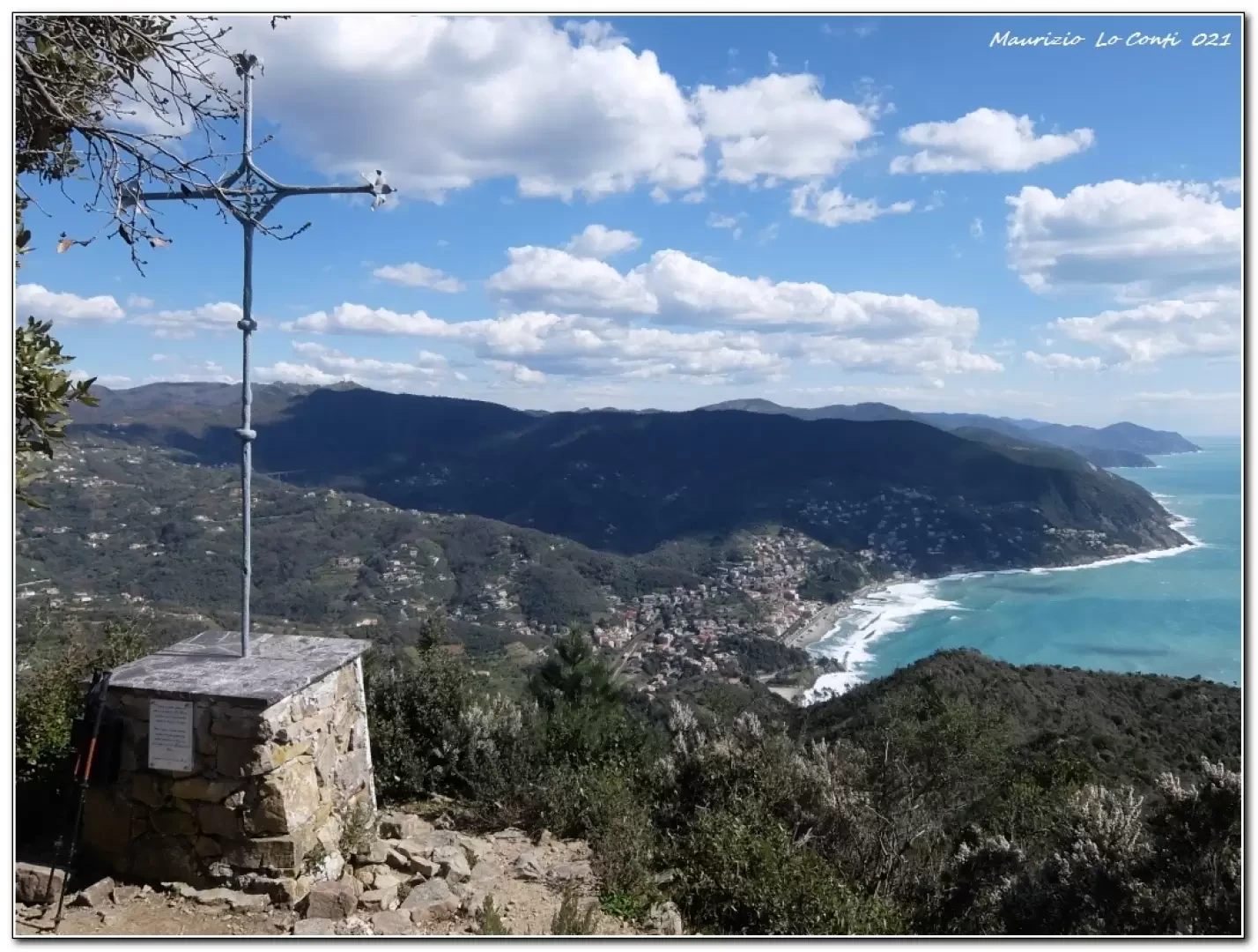
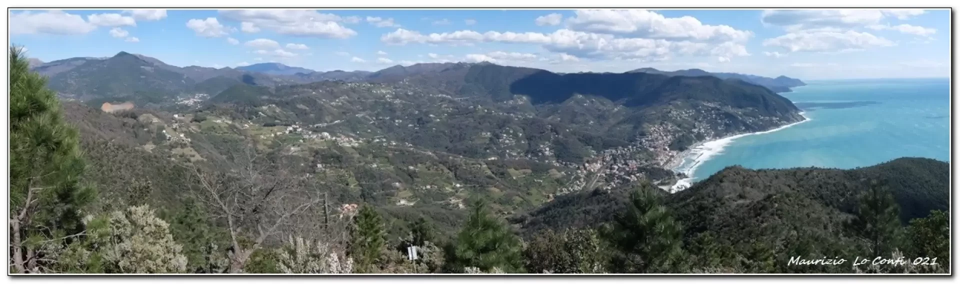
From the car park, continue in the same direction, then turn left (after about 250 m) following the diversions that takes the asphalt road. The road becomes a dirt track and turns left twice. Gradually, a grandiose panorama opens up. In 1h20, you arrive at the colle Lago (panche - 310 m) where you first go left and then right, climbing again through the low vegetation. The climb becomes more strenuous until you reach the ridge (on the right on the level) that precedes the summit of Monte Moneglia, where you can take a break (tot. 2h - 521 m). Afterwards, you descend, steeply, with some slight difficulty. At a crossroads, go right for the Comunaglia peak, located at 444 m. In this way, just below the summit, an exceptional view is gained (cross). One descends steeply again until one joins the track of the classic crossing, which is certainly busier than the high variant, and finally arrives at Moneglia (return 2h). By train back to Riva Trigoso where the car awaits.
In short: Diff. E - height difference 500 m - 7 km - about 4h total + stops - weather: good with a little wind. Route comfort: good on the ascent then almost poor on the descent. Best time: autumn to spring, avoiding cooler days. Tour interest: high.
If you want, here is the photo pdf file, with a bit more news:
http://www.cralgalliera.altervista.org/RivaTMoneglia021.pdf
http://www.cralgalliera.altervista.org/anno2021.htm
http://www.cralgalliera.altervista.org/altre2021.htm
NB: in the case of an excursion, always check with FIE, Cai, any park authority or other institutions, pro loco, etc., that there have been no changes that have increased the difficulties! No liability is accepted. The present text is purely indicative and not exhaustive.
Info Hiking Section Cral Galliera: http://www.cralgalliera.altervista.org/esc.htm
Trips 2020/21 at the link: http://www.cralgalliera.altervista.org/gite020.pdf
Galleria fotografica