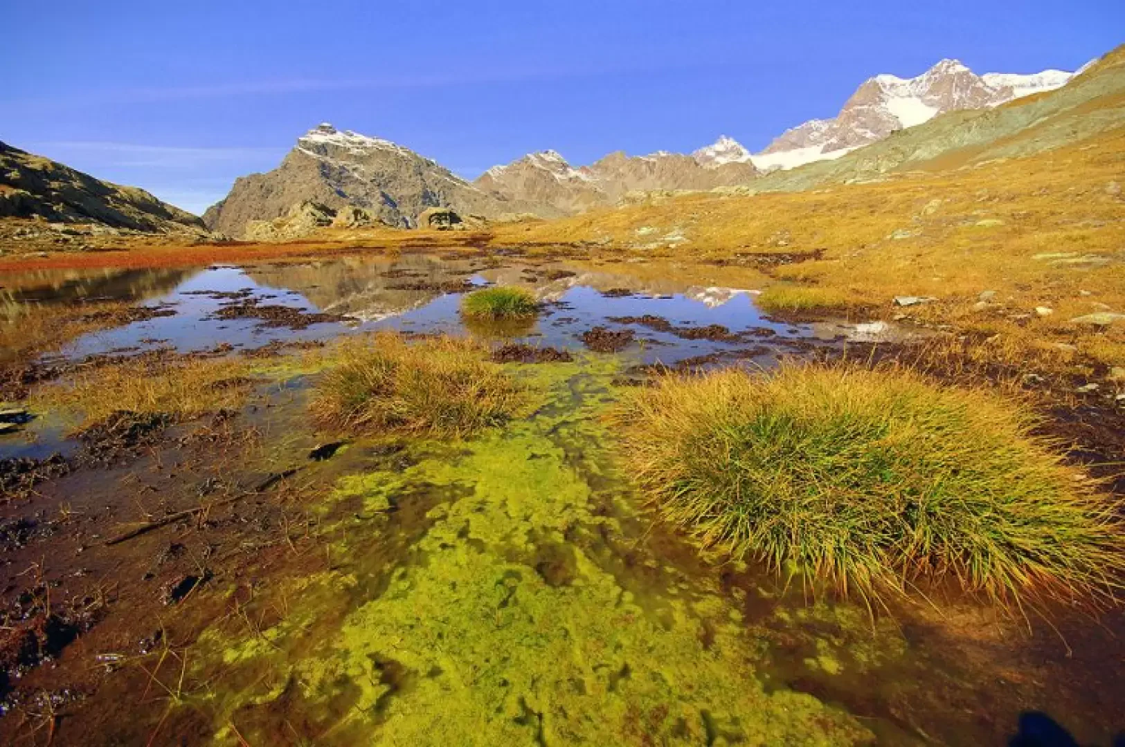
Lakes of the Whites, from Lake Gera

Access
Da Milano a Sondrio lungo le statali 36 e 38; alla rotonda all'ingresso della città si svolta a sinistra in direzione Valmalenco. Si risale tutta la valle fino alla località Campo Moro, dove finisce la strada pubblica ed asfaltata. Generalmente è possibile proseguire (sbarra sempre aperta) su buona sterrata fino al parcheggio ai piedi dell'altissima diga di Alpe Gera.
Introduction
This hike should only be done in clear weather for two good reasons: firstly, the peaks of the Bernina and Scalino groups would otherwise remain hidden; secondly and more importantly, since you often have to proceed by sight without tracks or signs, it would be very easy to get badly lost. Very beautiful with little snow (and knowing the route); dangerous with heavier, untracked snow loads. In the latter case, bear in mind the initial mountaineering difficulties: a few hundred metres in a horizontal traverse on 45° avalanche ice.
Description
From the wide forecourt 2070m, following the abundant signs, along an easy path and then along a footbridge, climb up the wall of the Alpe Gera dam (Alp Sgera); continue along the narrow track to the right along the lake, turning right towards the Poschiavina Valley (Val Pus-ciavina). To the left is the path to Alpe Gembrè, from which we return. The cemented track rises to overcome the glacial step and suddenly opens out onto the flat in a completely different environment: an environment that all the guidebooks describe as 'bucolic' or 'idyllic'. We find ourselves in a valley carved out between mountainous rocks with a pastureland bottom where the stream meanders; on the left the numerous huts of the Alpe Poschiavina (Alp Pus-ciavina) 2230m. The path, marked in yellow paint (Alta Via della Valmalenco), goes past the huts and, with a few bends, crosses a rocky step that supports a new plateau of pastures (Mut de la Cagna). Here we leave the classic route - towards the Passes of Ur, Canciano and Campagneda - to climb diagonally up the left bank (some animal tracks): we proceed with a constant gradient until we find a grassy hollow at the foot of a rocky wall (a shepherds' shelter at the base of a detached boulder). From this point, the direction of travel is reversed and, still diagonally, one ascends towards a bland vent: along the way one intercepts a good path that is worth following. Just beyond the little mouth we find two beautiful little lakes - the first one now very peaty - which take their name from an overhanging band of pale rocks: Laghi dei Bianchi (Laach dii Sggianch). Upstream of the second lake, you notice the rounded bank of a gully: you climb it steeply on loose, friable ground, arriving at a longitudinal depression, which you cross; along the line of maximum slope - a hundred metres or so - you reach a second longitudinal depression traversed by traces of a path. Here there are good varnished markings, which you follow to the left; you walk along a beautiful 2600m-high hanging terrace, which is home to some snowmelt pools. Having reached an outcrop - in view of the glacial waterfalls on the other side - the trail goes up and down through a scree slope to a second outcrop overlooking the Valle Confinale ("Val da Canfinaal"): the Anghileri-Rusconi bivouac 2654m can be seen at the top right. You face a steep gully, which descends towards the pastures at the bottom of the valley, exiting via a ledge to the left. On the level, over very soft pastureland, we head left towards the hanging threshold of the Valle Confinale: suddenly the grass ends and the path, stony and well marked, plunges down to the Alpe Gembrè (Alp Sgembrè) 2215m below. Following the signs for Campo Moro (Cammoòr), take a wide track that descends almost to the level of the Alpe Gera lake: immediately after a semi-gallery, go up the left edge of an active landslide. We are at the level of the entrance to the Poschiavina valley, but do not reach it; instead, we descend to the right along an ugly little path with rocky steps, which soon takes us back to the junction signposted earlier. From here we retrace our steps along the cart track that leads back to the starting area along the dam. The evident walls of rough serpentine that flank the dam and the Gera reservoir and the first shelf of the Poschiavina Valley are home to a series of beautiful, long, well-equipped climbing routes of moderate difficulty (max 6a/6b). The only drawback is the temperature: you can only climb well in summer; altitude and exposure form ice as early as September.
.