Seone Lakes, from Vonzo

Edited by:
ATL_canavese_valli_di_lanzo
Updated at: 29/05/2025
Introduction
The route runs entirely through the long Vallone di Vassola. In case of fog, the trail may present difficulties, especially in the upper part of the Vallone, so it is suitable for trained and experienced hikers.
Description
Before embarking on the hike, we recommend a short visit to Vonzo, a typical mountain village. From the church square turn back about 30m and take the tarmac road that leads off to the left of the main carriageway.
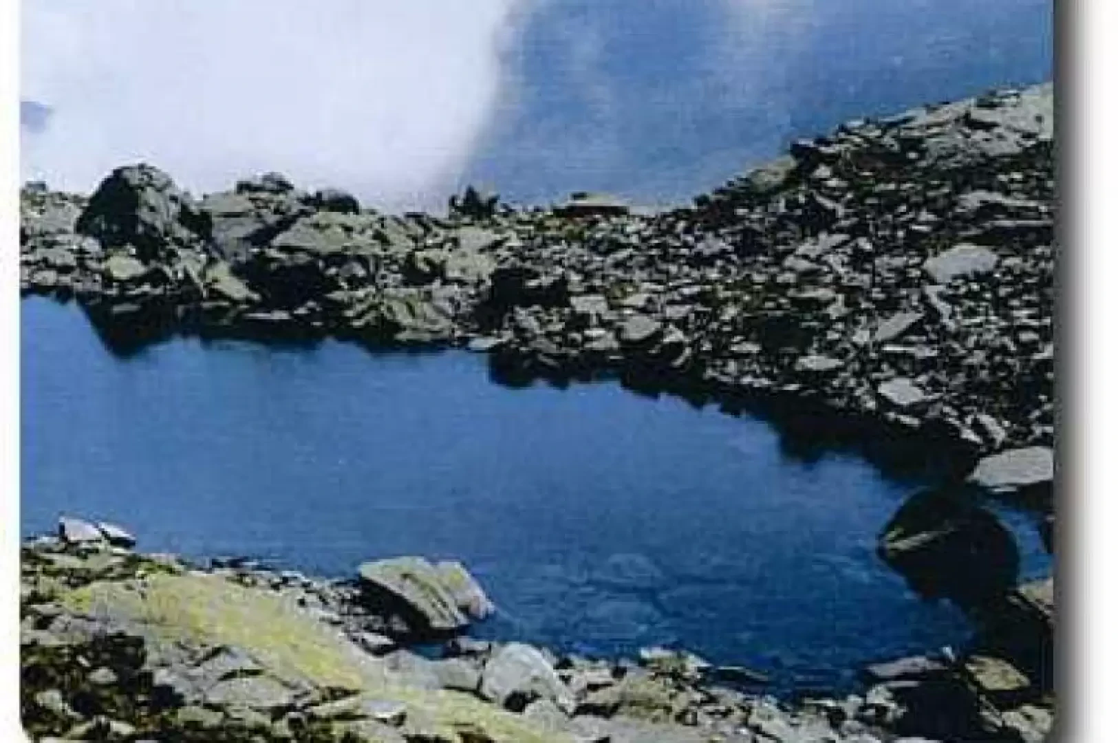
After about 30 minutes, turn left at a fork and you will reach the hamlet of Chiappili (1439m), where the Chapel of San Vito stands out with its characteristic portico supported by two cylindrical columns, typical of Val Grande architecture. Leaving the houses, continue to the right until you come to a dirt road; continue to the left, penetrating the rugged Vallone di Vassola: six kilometres of protruding walls and rushing waterfalls, where the silence is only interrupted by the whistling of marmots. You soon reach the Piano di Vassola, where you will encounter two characteristic stone arch bridges dating from medieval times (Alpe Vassola, 1660m). Follow the path without crossing the bridges and penetrate into the thick vegetation until reaching Alpe Balmot (1894m, 2h00'); continue halfway up the slope and, after a short downhill stretch, cross the Rio Vassola (it is advisable to use a handrail): here the path becomes less evident and it is necessary to follow the characteristic stone "cairns". Having climbed the slope, enter a basin characterised by mounded rocks and reddish-yellow erratic boulders on which the Alpe Rossa di Sotto (2094m) stands.After another short climb, which leads into a narrow, wild gorge, we reach the terrace of Alpe Veilet (2223m, 3h00'), from where there is a suggestive view of the amphitheatre that borders the upper part of the valley: Gran Bernardè, Colle della Terra di Unghiasse, Picchi del Seone, Monte Bessun, Colle della Coppa and Monte Tovo. Leaving the alpine pastures on the right and skirting a grassy hump, continue to the right, walking under a rocky wall. From this point, the walk becomes strenuous, with hairpin bends and rocky steps up to a small waterfall: after crossing a stream and skirting a small lake, continue to the right, leaving the main track. In a short time you will reach the picturesque Seone Lakes (4h00'): the Lower Lake (2514m) and the Upper Lake (2540m).
Descent
Following the ascent route. The route can be connected to the Unghiasse Lakes route, continuing from the Lago Superiore towards the upper valley, until reaching the Colle della Terra di Unghiasse.