Lake Bino


Edited by:
ms.srl
Updated at: 22/12/2024
Description
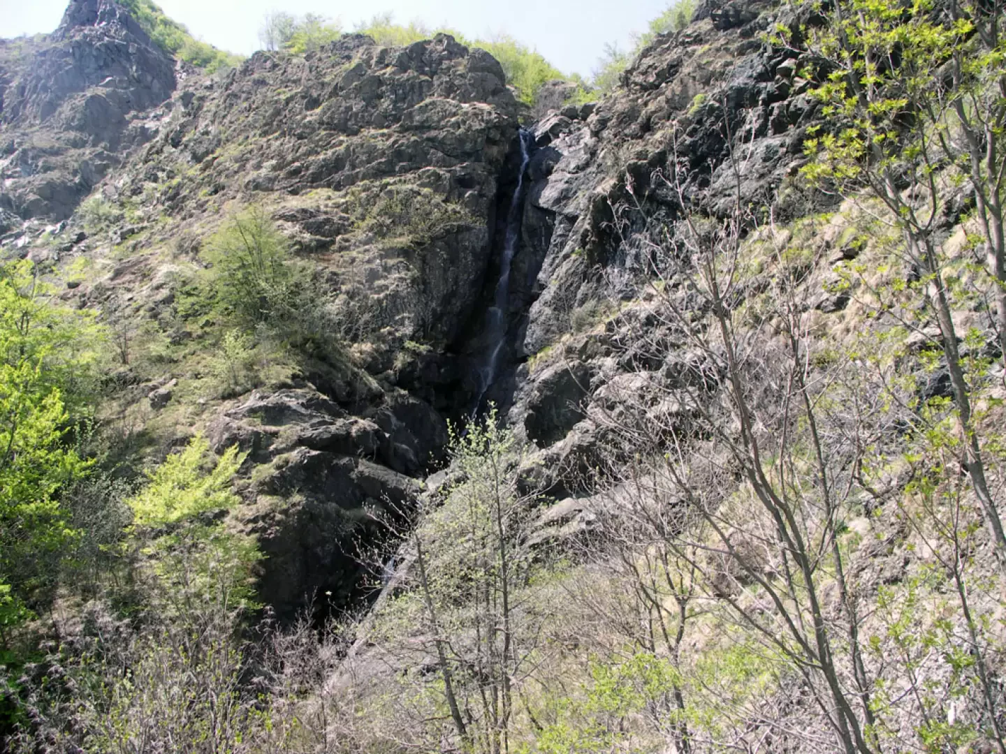
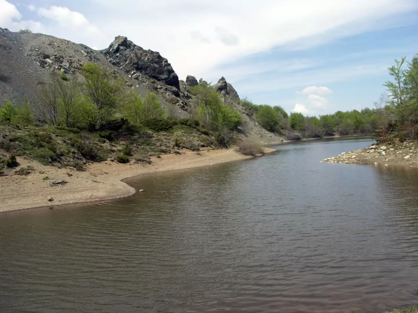
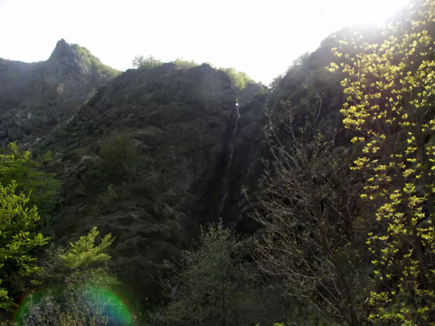
From the little garden of the little church of Ferriere, a peaceful and suggestive place at 832 metres, the signpost [033] immediately leads us to cross the cobbled road between the old houses to come out onto the mule track that leads to the village of Roffi. Once past the lovely group of stone houses, we take the little road on the right through the last of the fields (in springtime they are carpeted with primroses, anemones, dog's teeth and crocuses) and then enter the wood of tall beech trees. The area of undergrowth, which is particularly rich in water, so much so that in some passages it is almost marshy, is unusual and suggestive, but one appreciates the beauty of the place above all as one climbs along the stony ridge of the Lardana torrent, towards the Rocca dell'Aquila and the Cascata, which begins to make its voice heard in a decisive manner. Having crossed the watercourse by means of a wooden footbridge, you approach the most accessible side of the waterfall where, with a series of controlled progressions on scattered rocks, if you wish, you can access a splendid and evocative area right at the foot of the main drop, measured (with the altimeter) at about eighty metres: you will find yourself in a gigantic rock pothole at the end of a vertical natural plumb line that the water has carved out over the years. Truly spectacular. Reluctantly, we leave the spectacle of the water and the path soon becomes steep and difficult (steel rope handrail) due also to the sagging ground, but it is only a short stretch until we reach the wooded summits overlooking the valley. An advisable diversions to the left (not marked, rely on your 'tested' sense of direction) leads in a few minutes to the highest point of the Lardana waterfall: it is very suggestive, but be careful not to lean out too far... Having resumed -tiringly- the beautiful path, you ascend through alternating glades and wooded areas and then, after a short descent through easy grassy slopes, you reach Lake Bino, located at an altitude of 1284 metres. The lake stretches out with its characteristic elongated shape in a pleasant basin lined with small streams and dotted with colourful flowers. It is difficult to find our picnic spot, as the place offers so many simply enchanting corners. The descent is by the same route as the ascent, but we assure you that, due to the varying light and panoramic views, it will be a pleasant walk to the end of the day.
Photo gallery
Comments (0)
Sign in to leave a comment