Cerisola, from the San Bernardo pass


Edited by:
Maurizio Loconti
Updated at: 22/03/2026
Access
From Garessio, easily reached from the Ceva exit of the A6 motorway, turn for Albenga along the SP 582. You pass the hill, with its many wind turbines, and descend on the Ligurian side to Cerisola (a hamlet of Garessio, 15 km from the town centre). You leave the first car and drive back with the other, almost to Colle San Bernardo. You park about
You need two vehicles.
.Introduction
The San Bernardo pass (957 m) is a pass in the Ligurian Alps through which the Av passes, while with regard to Cerisola (520 m), the name of the village is said to derive from the cherry tree (a plant that was present in the area and that, given the favourable exposure, ripened earlier than usual). The dirt road has several forks.... which is awkward... not knowing where to go... And yet, after all, it is simple... at every crossroads with a wide road, you must always keep to the left... This is the simple secret, revealed, of today... unless new ways are opened... of course...
Description
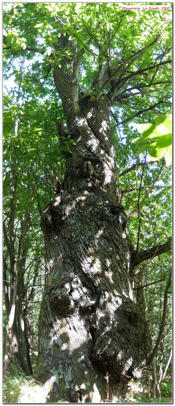
The excursion is a hike (without symbols!) that winds through the silence of lonely forests, in search of one of the ancient salt routes that led from the coast to the interior . It is facilitated by the chosen development: from top to bottom... We start out on a dirt road (905 m) that breaks away from the asphalt. You cross the 1st fork where you keep to the left downhill and afterwards cross a characteristic wooden bridge made of logs. You now begin to gain height in a denser forest (several notable chestnut trees). You come to the 2nd fork and turn left. A plateau is reached and here the descent begins. You ignore an access road to a private property (so it is not a turnoff...) and continue straight ahead. At the next two forks, turn left until you find a ford and a few metres beyond the 5th fork. You pass the remains of a house and, almost immediately, there is a bridge to cross (6th fork). Just above, you enter the hamlet of Cerisola. It is hot and you look for a shady spot by the church of San Pietro. A gentleman, perhaps the Don (in perfect 'Camino de Santiago' style, when it comes to hospitality...), invites us into the parish's communal areas... it is an authentic panacea! The building has very thick walls and there is a pleasant cool .... as well as a bathroom and a kitchen where we make coffee! We eat, take a rest sitting at the tables and before leaving, we thank him, leaving an offering in the church. Before long, we find the car parked in the morning (about 500 m).
.
In short: Diff. E (if it were signposted it would become easy T) - difference in altitude +150m -550m - 3h - 8 km
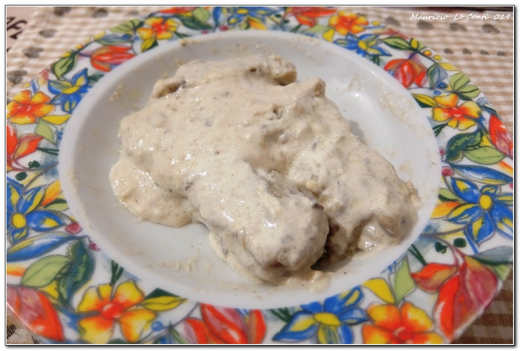
Gastronomy: Polenta bianca della Val Tanaro is an ancient dish typical of the area. It is prepared with local products, such as potatoes, buckwheat flour - originally the only flour used -, wheat flour, sheep's cheese, butter, cream and mushrooms.
NB: in the event of an excursion, always check with FIE, Cai, any park authorities or other institutions, pro loco, etc., that there have been no changes that have increased the difficulty! No liability is accepted. This text is purely indicative and not exhaustive.
Cover photo: log bridge
Recommended best period: from spring to autumn, avoiding the hottest days
Total time: 3h
Starting altitude 902 m
Earrival altitude: 500 m
Difference: +150 m -550
Maximum altitude 902 m
First of all, if you would like some individual shots:
http://cralgalliera.altervista.org/2006F1Carrareccia.jpg
http://cralgalliera.altervista.org/2006F2Castagno.jpg
http://cralgalliera.altervista.org/2006F3Castagno.jpg
http://cralgalliera.altervista.org/2006F4Castagno.jpg
Polenta bianca di Pollini:
http://www.cralgalliera.altervista.org/1907S2PolentaBiancaPollini.jpg
as well as the pdf photo file, with a bit more info:
http://www.cralgalliera.altervista.org/ColleSanBernardoCerisola020.pdf
http://www.cralgalliera.altervista.org/anno2020.htm
http://www.cralgalliera.altervista.org/altre2020.htm
Previous visits to the area:
http://www.cralgalliera.altervista.org/GiteValTanaro.htm
Comments (0)
Sign in to leave a comment