Bivacco Baroni, from La Rasega


Edited by:
Franco Pelosato
Updated at: 15/03/2025
Access
Starting point, on foot, to reach the Valle Adamé: La Rasega - locality in the hamlet of Valle in the municipality of Saviore dell'Adamello.
To reach the locality of "La Rasega" take the road to Cedegolo then turn right onto the road to Fresine and Valle (the junction is located immediately after the bottleneck in the centre of Cedegolo; not to be confused with the second junction, for Cevo and Saviore, which is located further on, in the village of Demo). The route climbs about 10 km (at Fresine continue straight on) and then, after the hamlet of Valle, continues along the valley on a conveniently level tarmac road for another 2 km or so until you come to a group of farmhouses and a small football pitch, where you can park, either immediately before the sports ground or immediately afterwards.
Introduction
A very long hike that requires good training and familiarity with walking at high altitude and overcoming considerable altitude differences.
Description
When the road beyond the 'Rasiga' is practicable, you can continue on to Malga Lincino, saving about 50 minutes of walking time. (the road is narrow, has some critical hairpin bends, but is asphalted and not steep). Going on foot from the 'Rasiga', follow the road to the Lincino malga, then continue to the right along the well-marked path. The initial stretch, from the "Rasiga", after the first two hairpin bends, can also be walked on the path (which is not very well signposted) that is on the left, passes close to the mountain and comes out on the road at the "Stella Alpina" restaurant. The 'Edelweiss' is a bar-pizzeria in 'Le Crüste': it is a characteristic building with 'näif' decorations and edelweiss in relief on the granite walls, the work of the late owner, a well-known mountaineer and former local partisan.
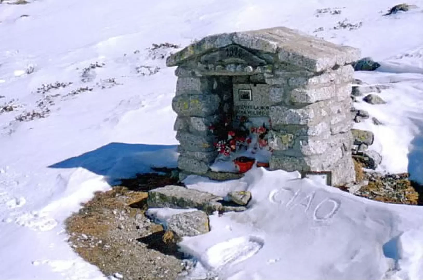
Continuing on, now on the road, we pass by the "Le Crüste" hut; then we reach the "Morcc de Töle" locality, where there is a shrine commemorating a tragic event from the early 19th century: an avalanche hit and killed a large group of young people who were going "per isiga". Going per isiga meant going with a basket, on the mountain slopes, even in very steep places, to collect grass (the isiga is a grass characteristic for being stringy and resistant to tearing), taking it home or to the farmstead to feed the livestock, as they did not have enough meadows to grow hay. It was particularly tiring as well as dangerous work. Immediately further upstream (visible by the protective fence now in place) there is evidence of a kiln for the manufacture of quicklime: the area is characterised by the presence of limestone rocks and is part of that belt that extends from Concarena, through Colombé, and Lincino to Baitone. This oven, albeit in its simplicity, is preserved intact as it was also used in very recent times (1940s).
We then reach the Lincino malga and at the first hairpin bend we follow the path that starts on our right, and we tackle the 'müla' (this is how the Lincino-Adamé path is called), in about an hour we arrive in Adamé. On the level path immediately after the junction with the uphill path, there is a memorial stone in memory of four young men who were victims of an avalanche on the Castellaccio gully.
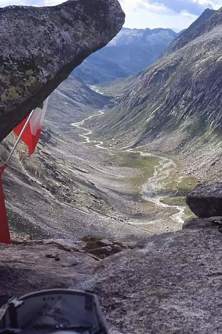
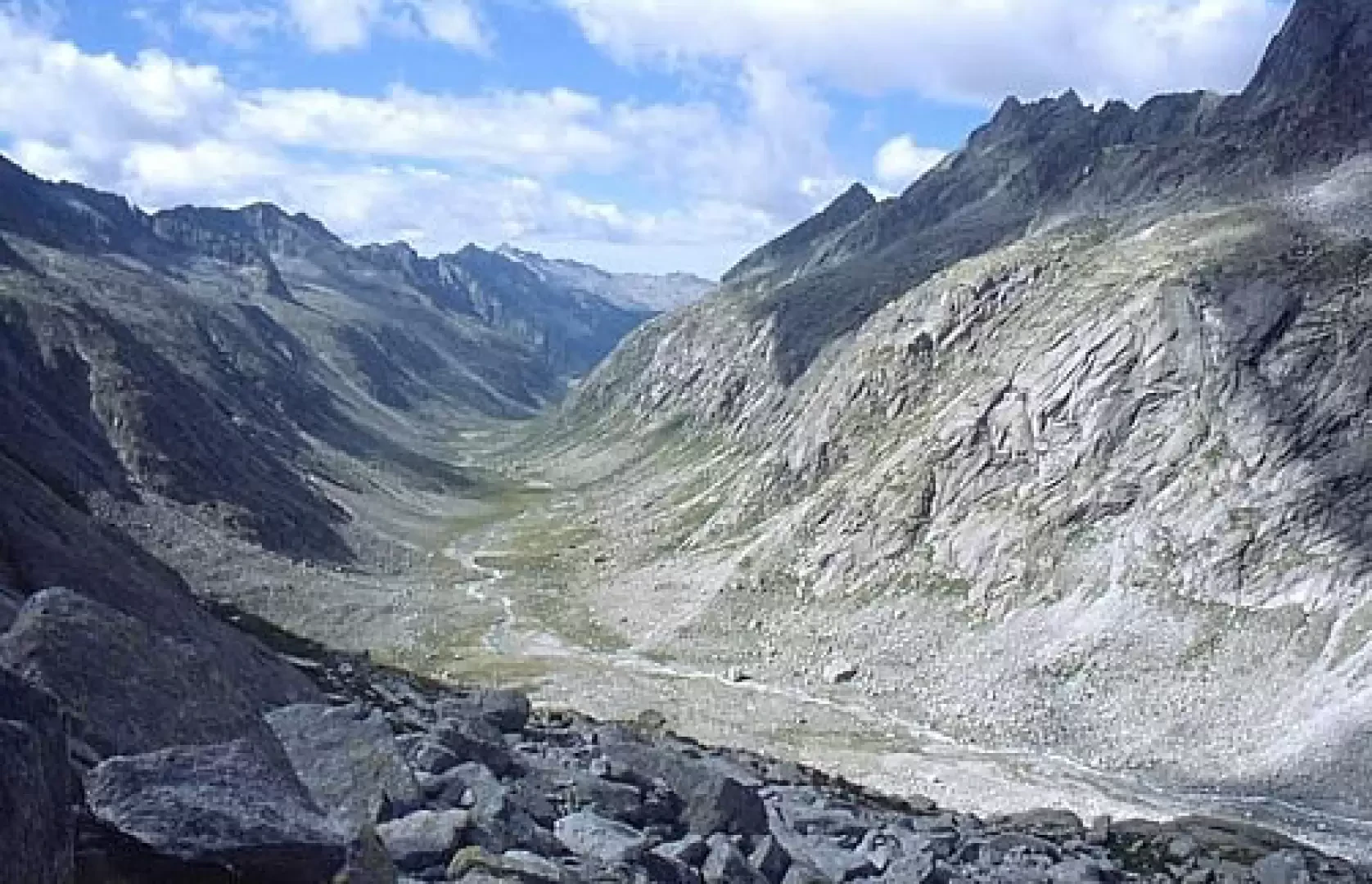
We go to the right and here we are in Adamé, here are the water catchment works and the refuge. We continue on the path, which from here on is the [1] (of the Alta Via dell'Adamello), leaving the torrent to our right; up to the hut it is practically flat, then it climbs up to overcome a slight glacial step. After the first step, a second one follows, then we come to a new flat area, this time very wide. At this point, the Adamé hut is visible, at the bottom, where the valley bends to our left. You can see, to the left, two "casine di mezzo" and to the right the Adamé hut of the CAI Cedegolo. From the hut up to the Baita, under normal conditions it takes about an hour.
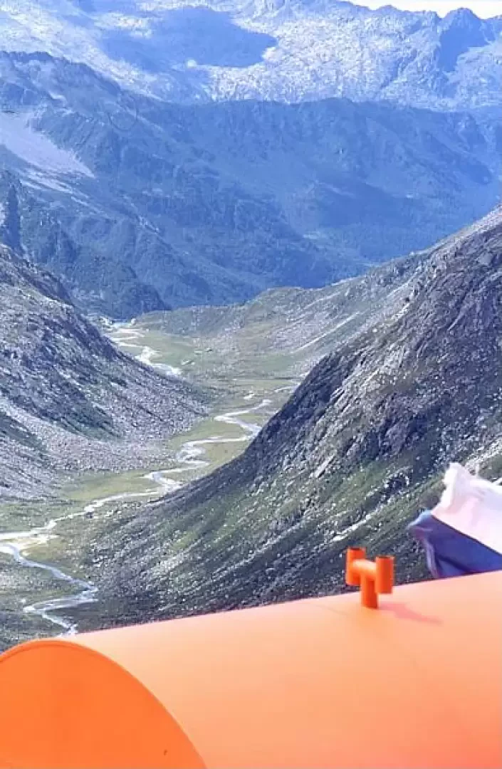
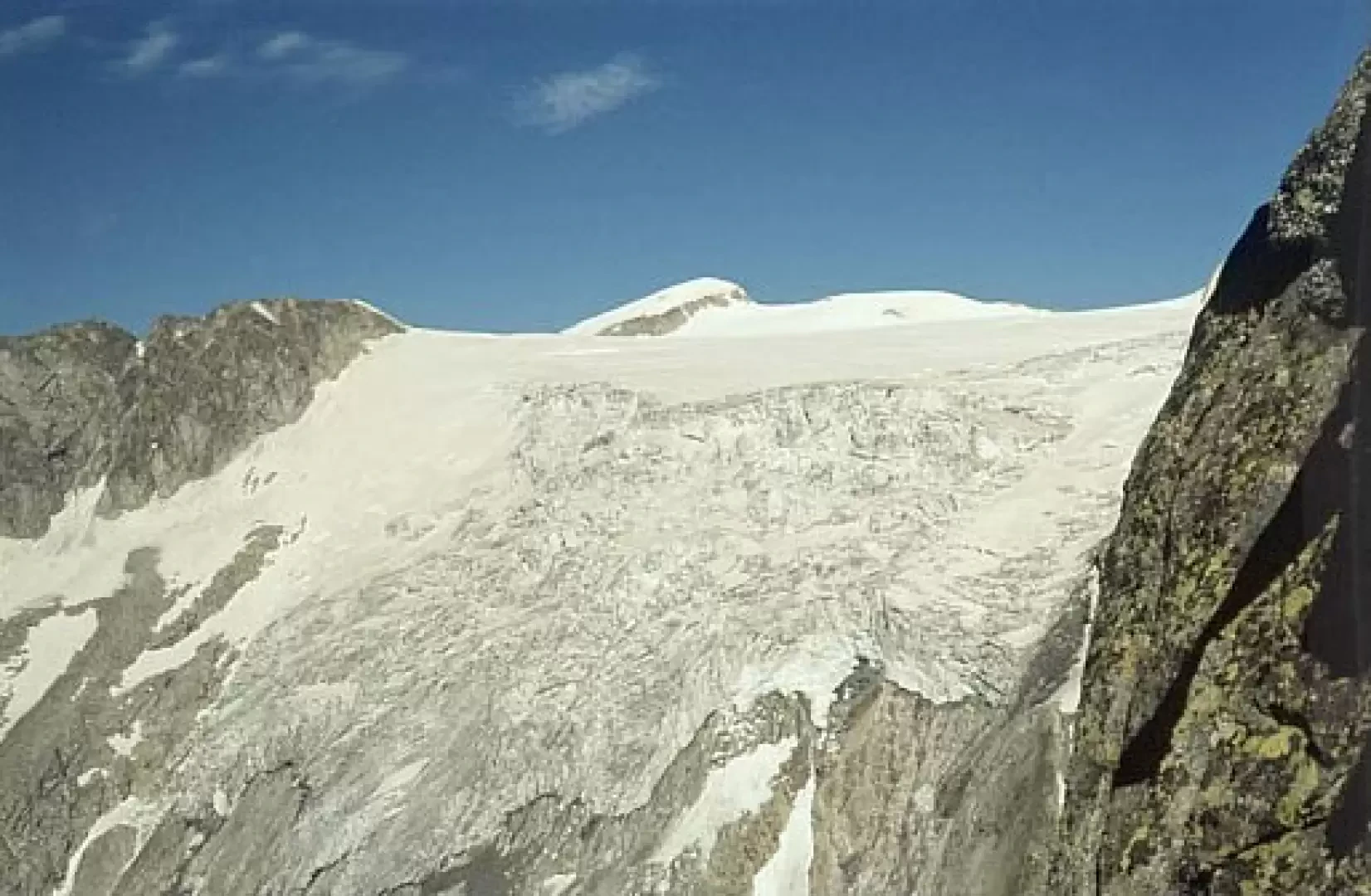
We continue along path [30], moving to the orographic left of the valley, across the little bridge just after the baita. After the bridge, we continue along the valley, on the orographic left bank; we pass the junction for the Porta Buciaga pass, which is shortly after the little bridge, on our right; we pass near the Mario Nolaschi shrine, then in front of the "Qùal del Manzuler", where there is (on the orographic right of the torrent) the junction for the Poia pass; we climb the glacial step and then cross, always keeping to our right, the entire alluvial plain. At this point, the head of the Adamè valley appears to us in all its grandeur! At the end of the plain, there are a few ascents (in modest steps) and then we face the ascent to reach the top of the large moraine on the orographic left; we follow this watershed for a stretch, then turn right, cross a gully with large morainic boulders and then, moving further to the right, climb some modest precipices, until we meet, on our left, a channel well cut into the rock. Climb up this gully, taking care if there is still some snow because it is very steep; indeed, if you cross in June or earlier, it may be necessary to be equipped with an ice axe and crampons; in the later seasons, when there is no snow, it is enough to climb a few steps with the help of your hands. Once past this gully, go up along the line of maximum slope on loam and minute moraine, then turn to your right and, on a large moraine, halfway up the slope, you will reach the spur on which the Baroni bivouac is perched: we are at 2880 m, and with a stupendous view of the glacier at the head of Adamè and the whole valley, as far as the Lissone refuge.
General Information
Path:from La Rasega
Signposts:15, 1 and 30
Type of route: a/r
Recommended period: June, July, August, September
Objective Danger:none
Sun exposure: south
Exposed sections:none
Water: -
Photo gallery
Comments (0)
Sign in to leave a comment