Surrier

Edited by:
Massimo Martini
Access
From the motorway barrier at Aosta-West, keep left and follow the signs for Aosta - Saint-Pierre. After one kilometre, at the roundabout, take the second exit to join the Strada Statale . Continue for 4.3 kilometres, passing the village of Saint-Pierre, until you reach a roundabout with the Gran Paradiso National Park sign. Take the first exit and continue on the for a further 4.2 kilometres until reaching Arvier and the roundabout dedicated to cyclist Maurice Garin. Take the second exit and continue on Via Corrado Gex to Leverogne, one kilometre away. At the fork, keep left and take the Regional Road . Climb for 15.8 kilometres, passing the main town of Valgrisenche, until you reach the village of Bonne. From here, proceed on the narrow municipal road for another 5.9 kilometres, climbing the valley on the orographic left until reaching, after a short descent, the 🅿️a pay car park in Surrier, where you can leave your car.
[0h50'] - [31.9km]
How to get there with GMaps
How to get there with Apple Maps
The directions provided have been carefully checked as of the date the route was surveyed. However, it is highly recommended to check for any changes that may have occurred since then, especially regarding the route to the starting point. Before embarking on your journey, it is advisable to consult up-to-date navigation tools for accurate and up-to-date directions. We recommend the use of satellite navigation apps, such as Google Maps or Apple Maps, to ensure the most accurate and safe route.
Introduction
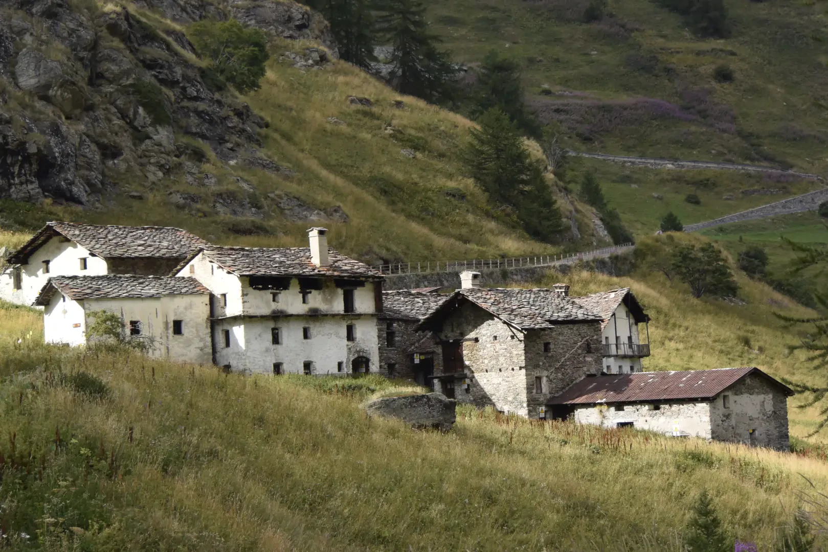
Surrier is a small village in Valgrisenche, Aosta Valley, located along the road leading to the main town and the lake of Beauregard. The village, gathered around its stone and wooden houses, retains the charm of a traditional alpine settlement nestled among pastures, forests and severe mountains.
Description
The village, now uninhabited, is best known as a starting point for hikes in the terminal part of the Valgrisenche, thanks to the large car park located along the road.
Like many other hamlets in the valley, Surrier has origins linked to agro-pastoral life. The old stone dwellings, with slate roofs, testify to the use of local materials and traditional building techniques. During the 20th century, the hamlet underwent profound transformations due to mountain depopulation and the construction of the Beauregard dam in the 1950s, an intervention that altered the road network and land use in the valley.