Settimo Vittone

Edited by:
Massimo Martini
Access
Settimo Vittone can be reached through the state road (ex Via delle Gallie), which connects Canavese with Valle d'Aosta; the proximity of the Quincinetto motorway exit and the presence of the Tavagnasco railway station favour public and private mobility. Car parks are available at the main town and in the main hamlets.
.Introduction
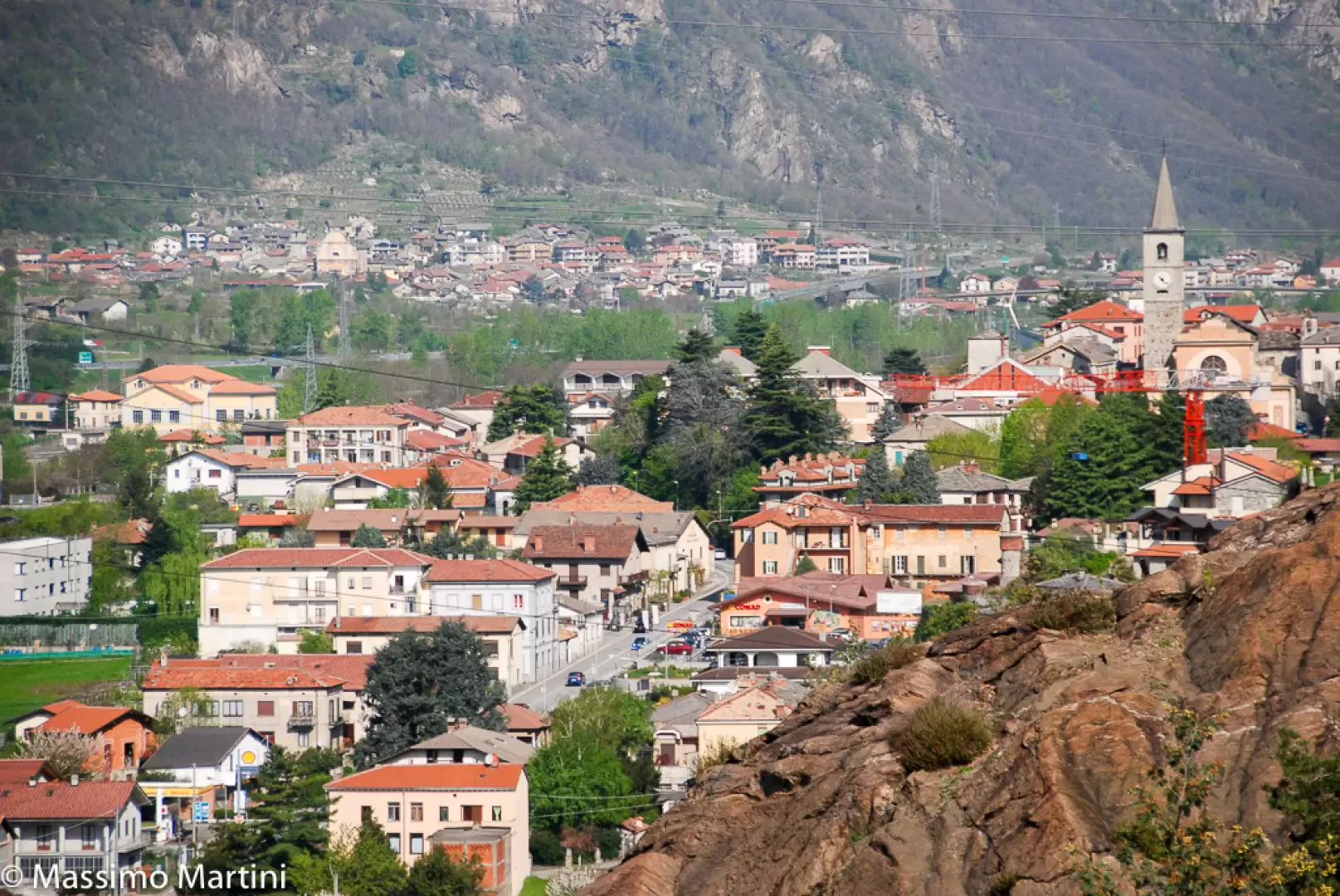
Settimo Vittone, located in the northern part of Canavese, within the metropolitan city of Turin, extends over an area of 23.26 km², covering a strip from Dora Baltea to the alpine foothills of Colma di Mombarone (2,371 m), the highest point of the municipality. Situated at 280 metres above sea level, the main town acts as a natural crossroads between the plain and the upper valley, outlining a landscape of ancient terraces, vast wooded areas and cultivated fields, framed by the scenic presence of the mountain slopes that lead to the first stretches of the Biellese Alps and the moraine greenhouse of Ivrea.
Description
The place name 'Settimo' recalls the historical position along the Via delle Gallie, located at the seventh Roman mile from Ivrea; 'Vittone' was added in the Middle Ages, probably linked to a local figure of historical value or to the parish church of the same name. The main hamlets are Montestrutto, Cesnola and Torre Daniele in the valley, while the alpine locality of Trovinasse is located at high altitude; various minor villages, rural nuclei and ancient alpine pastures traditionally used for summer transhumance complete the picture. The territory is bordered by numerous neighbouring municipalities: Andrate, Borgofranco d'Ivrea, Carema, Donato, Graglia, Lillianes, Nomaglio, Quassolo, Quincinetto, Tavagnasco.
The resident population, currently around 1,530-1,576 inhabitants ('settimesi'), is distributed between the main town and the various hamlets. The variety of the landscape and the richness of the natural environment, marked by the presence of the Colma di Mombarone and numerous hiking trails, have favoured the development of historical routes such as the Canavese variant of the Via Francigena. The centre preserves elements of great interest: the Parish Church of San Lorenzo, a rare example of pre-Romanesque architecture with an early Christian baptistery attached, and the numerous rural and religious testimonies scattered along historic mule tracks. The local tradition is deeply linked to the 'Desnalpà', the transhumance festival, which celebrates the return of the animals from the mountain pastures with historical and cultural events, emphasising the link between the population and its pastoral resources.
The Piedmontese language is still widespread; the name in dialect is 'Ël Seto Viton'. The patron saint is Saint Andrew the Apostle, celebrated on 30 November and linked to the religious history of the village. The presence of numerous alpine pastures, including the well-known Maletto, testifies to the historical pastoral vocation and the scenic value of the alpine areas, which also enhance the area from a hiking point of view.
Information
Area: 23.26 km²
Altitude:2,280m
Maximum elevation: 2,371m - Mombarone Ridge
Number of inhabitants: 1.576 (2024)
Name in dialect: Ël Seto Viton
Inhabitants' name: September
Patron Saint: Saint Andrew (30 November)
Bordering municipalities: Andrate, Borgofranco d'Ivrea, Carema, Donato, Graglia, Lillianes, Nomaglio, Quassolo, Quincinetto, Tavagnasco
Website: www.comune.settimovittone.to.it