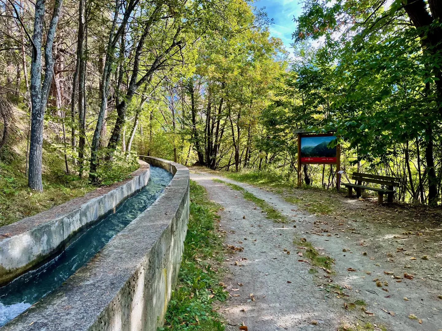
Ru d'Arlaz

Access
Leaving the motorway at the Verrès exit, enter the roundabout and take the second exit. Proceed in the direction of the town centre and, after 300m, turn left onto the regional road for Val d'Ayas. Follow the regional road for 6.5 kilometres, passing the village of Challand-Saint-Victor and, at the village of Châtaignere, turn left following the signs for Abaz. Go up the communal road, pass the village of Abaz and, after 2.5 kilometres, reach Col d'Arlaz where, on the left, there is a car park 🅿️ where you can leave your car free of charge.
[0h16'] - [9.0km]
How to get there with GMaps
How to get there with Apple Maps
The information provided here was verified at the time the route was surveyed. Before setting off, it is advisable to ensure that no substantial changes have occurred on the route to the starting point. We therefore recommend the use of the satellite navigation apps provided by Google or Apple for up-to-date and detailed directions.
Introduction
The Ru d'Arlaz is an ancient irrigation canal located in Valle d'Aosta, in the Val d'Ayas, which runs between the municipalities of Challand-Saint-Victor and Montjovet. This historic route runs at an average altitude of about 1,000 metres above sea level, passing through coniferous forests, sunny slopes and rock formations offering panoramic views of the central valley of the Dora Baltea. The Ru follows the contours of the territory, accompanying the walker on a journey through history and nature, skirting the orographic left side of the valley and offering suggestive panoramic viewpoints. The route is easily accessible from Verrès, less than 10 kilometres away, and is a natural link between the Val d'Ayas and the Montjovet area, making it a very interesting hiking route.
Description
The origin of the Ru d'Arlaz is part of the long tradition of the rus, the artificial irrigation canals that, since the Middle Ages, were essential to convey water to the cultivable areas of the Aosta Valley. The name Arlaz may derive from a local toponym referring to the hill of the same name, a natural passageway used since antiquity to connect the lower Ayas Valley with the central valley. Its construction probably dates back to the 14th century, when the inhabitants of the area had to contrive to overcome the difficulties related to the scarcity of water in the higher areas. The Ru draws its water from the Evançon stream and transports it along the mountainside, serving an area that would otherwise have remained arid and unproductive.
One of the most fascinating geological features along the route of the Ru d'Arlaz is the Flambeau d'Arlaz, a rock formation that emerges solitary from the ground with a slender and imposing shape. This rock, shaped by erosion over the centuries, is shrouded in local legends about ancient mountain spirits or signs left by the gods. The climate along the Ru is influenced by the sunny exposure of the slope on which it runs: in winter, the path may be affected by some icy sections, while in summer it offers pleasant shade in the sections covered by vegetation.
Access to the Ru d'Arlaz is simple and can be done from various points along its route. The route is mostly flat and follows the natural course of the canal, making it suitable even for less experienced walkers. One of the main entrances is located near the hamlet of Orbeillaz, in Challand-Saint-Victor, from where a well-marked path runs along the canal in the direction of Montjovet. Those wishing to walk the entire stretch can start from Montjovet and follow the Ru to Challand-Saint-Victor, taking about two hours. There are no actual refuges along the route, but some rest areas allow you to rest and enjoy the panorama. There are also points of natural interest nearby, such as the Orbeillaz waterfall, a suggestive waterfall that deserves a short diversions from the main path.
Although the Ru d'Arlaz is not directly linked to any important historical figures, it is a concrete testimony to the ingenuity of Alpine communities in managing natural resources. Its construction and maintenance were for centuries entrusted to the inhabitants of the area, who handed down from generation to generation the knowledge necessary to preserve it. Today, the Ru route is valorised as a hiking itinerary and offers a unique perspective on the history and rural life of the Aosta Valley.
Local hiking guides often mention the Ru d'Arlaz as one of the most fascinating routes in the lower Ayas Valley, recommending it for its accessibility and historical and scenic value. Some hiking itineraries include the Ru as a link between Montjovet and Challand-Saint-Victor, suggesting detours to the Col d'Arlaz or the Isollaz waterfalls. Publications dedicated to the network of Valdostan rus cite it as one of the best preserved examples of these ancient irrigation canals, testifying to their fundamental role in the history of Alpine agriculture.
Information
Height:from to 1,031m
Mountain group:Monte Rosa Alps
Points of interest
- Col d'Arlaz
- Cascata d'Arlaz
- Orbeillaz