Pollino National Park

Edited by:
Massimo Martini
Access
Access to the park is facilitated by a road network connecting the main centres such as Rotonda (headquarters of the management body), Mormanno, San Severino Lucano, Viggianello, Castrovillari and Lauria. From the north it can be reached from Basilicata via the unable to parseediterranean motorway , exit Lauria Nord or Sud, continuing along the state road; from the south and east it can be accessed from the Calabrian connections, with entrances at Morano Calabro, Castrovillari and Civita. Good parking facilities are available near the visitor centres and main entrances, and several regional bus lines provide connections with the Sapri, Lagonegro and Castrovillari railway stations, with services varying according to season and timetables updated on the official websites.
Introduction
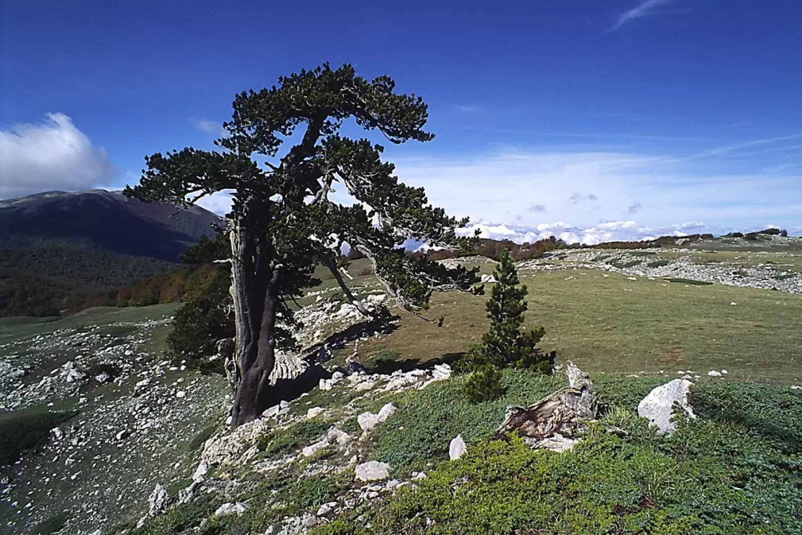
The Pollino National Park extends between Basilicata and Calabria, encompassing the provinces of Cosenza, Potenza and Matera and covering an area of approximately 192,565 hectares: it is the largest national park in Italy and, since 2015, has been recognised as a UNESCO Global Geopark site for its geological value and biodiversity. The area encloses the Pollino massif, the symbolic peak together with Serra Dolcedorme (2,267 m), and a complex network of valleys and plateaus that change appearance according to altitude, geology and seasonality. The area embraces environments that alternate between dolomitic relief, deep gorges and glacial cirques and beech, silver fir and high pasture woods. Characteristic is the Pino Loricato, a plant presence exclusive to the Pollino and the Balkans, which survives on the most impervious walls at over 1900 metres.
Description
Biodiversity is one of the Park's strong points: more than 2,000 plant species recorded and a fauna that includes the golden eagle, the Apennine wolf, roe deer, wild boar, otters in the waterways and numerous rare reptiles and amphibians. The natural environment is shaped by the historical presence of human communities of Arbëreshe and Lucanian culture, which have preserved rich traditions and a sustainable relationship with the territory. The Pollino is a place of myths and popular narratives: between the Raganello gorges and the Frido and Lao torrents, stories, legends and agro-pastoral practices linked to the area's villages have stratified.
Information
Year founded: 1995
Area: 1925.65 square kilometres
Maximum elevation: Mount Pollino (2248m)
Municipalities concerned: Calvera, Castelluccio Inferiore, Castelluccio Superiore, Castelsaraceno, Castronuovo di Sant'Andrea, Carbone, Cersosimo, Chiaromonte, Episcopia, Fardella, Francavilla in Sinni, Latronico, Lauria, Noepoli, Rotonda, San Costantino Albanese, San Giorgio Lucano, San Paolo Albanese, San Severino Lucano, Senise, Teana, Terranova di Pollino, Valsinni, Viggianello, Acquaformosa, Aieta, Alessandria del Carretto, Belvedere Marittimo, Buonvicino, Castrovillari, Cerchiara di Calabria, Civita, Francavilla Marittima, Frascineto, Grisolia, Laino Borgo, Laino Castello, Lungro, Maierà, Morano Calabro, Mormanno, Mottafollone, Orsomarso, Papasidero, Plataci, Praia a Mare, San Basile, San Donato di Ninea, Sangineto, San Lorenzo Bellizzi, San Sosti, Sant'Agata di Esaro, Santa Domenica Talao, Saracena, Tortora, Verbicaro
Institutional site: www.parcopollino.it
Contacts: www.parcopollino.gov.it/index.php/contatti