Majella National Park

Edited by:
Massimo Martini
Access
The Park is easily accessible by car thanks to the motorway (from the north, exit Pescara) and motorway (from Rome or Naples). The main access points are at Sulmona, Guardiagrele, Caramanico Terme and Lama dei Peligni, all equipped with information points and tourist services. There are several visitor centres, eco-museums, equipped access points and various types of accommodation facilities, from mountain refuges to hotels and agritourisms, located both inside the villages and in the surrounding nature. An extensive network of trails allows excursions suitable for all levels of experience, and some sections are also designed for people with disabilities or special needs. Before embarking on hiking trails, it is advisable to check the official Park website for information on the state of maintenance of the trails and any seasonal restrictions
.Introduction
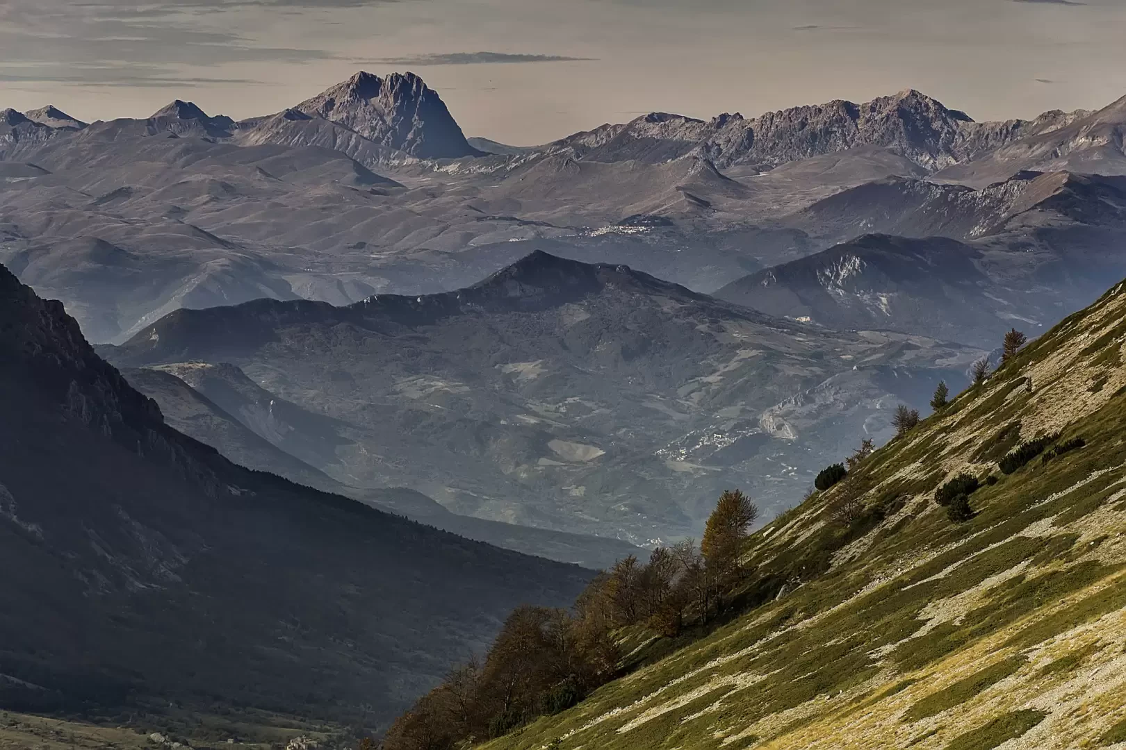
The Majella National Park lies in the heart of the Abruzzo Apennines, between the provinces of Chieti, L'Aquila and Pescara, covering an area of approximately 74,000 hectares. This mountainous territory, characterised by the massive presence of the Majella group, also includes Morrone, Monte Porrara and Monti Pizzi. Since 2021, it has been recognised as a UNESCO Geopark for its unique geological and natural diversity. The highest altitude is reached by the 2,793 metres of Monte Amaro, the highest peak in the park. The landscape alternates between karst plateaus, deep river valleys and canyons, with scenery stretching as far as the Adriatic Sea, some 30 kilometres away. A distinctive feature is the extraordinary wealth of wildlife and the presence of numerous endemic species, including the Apennine wolf and the Marsican bear. The historical and spiritual context is enhanced by rocky hermitages, valuable villages and ancient paths that cross the 'Mother Mountain'.
Description
The territory consists of an extensive karstic area rich in caves and plateaus, on which dense beech forests, mountain pine forests, secondary pastures and rare high-altitude meadows alternate. Along its more than 1,200 km of official trails, there are both family trails and hiking and mountaineering routes reserved for experts. The flora includes around 2,200 species, including many endemics of the central Apennines; the fauna includes the stable presence of wolves, Marsican bears, deer, chamois and golden eagles. Among the park's special features are the tholos, traditional stone huts once used by shepherds and farmers, and the historic hermitages frequented by Abruzzo's hermit saints. Historic villages such as Sulmona, Pacentro, Sant'Eufemia a Maiella and Caramanico Terme offer further reasons for scenic, cultural and architectural interest.
Information
Year of foundation: 1991
Area: 740.95 square kilometres
Maximum elevation: Monte Amaro (2793m)
Municipalities concerned: Civitella Messer Raimondo, Fara San Martino, Gamberale, Guardiagrele, Lama dei Peligni, Lettopalena, Montenerodomo, Palena, Palombaro, Pennapiedimonte, Pizzoferrato, Pretoro, Rapino, Taranta Peligna, Ateleta, Campo di Giove, Cansano, Corfinio, Pacentro, Pescocostanzo, Pettorano sul Gizio, Pratola Peligna, Rivisondoli, Rocca Pia, Roccacasale, Roccaraso, Sulmona, Abbateggio, Bolognano, Caramanico Terme, Lettomanoppello, Manoppello, Popoli, Roccamorice, Salle, San Valentino in Abruzzo Citeriore, Sant'Eufemia a Maiella, Serramonacesca, Tocco da Casauria
Institutional site: www.parcomajella.it
Contact: info@parcomajella.it