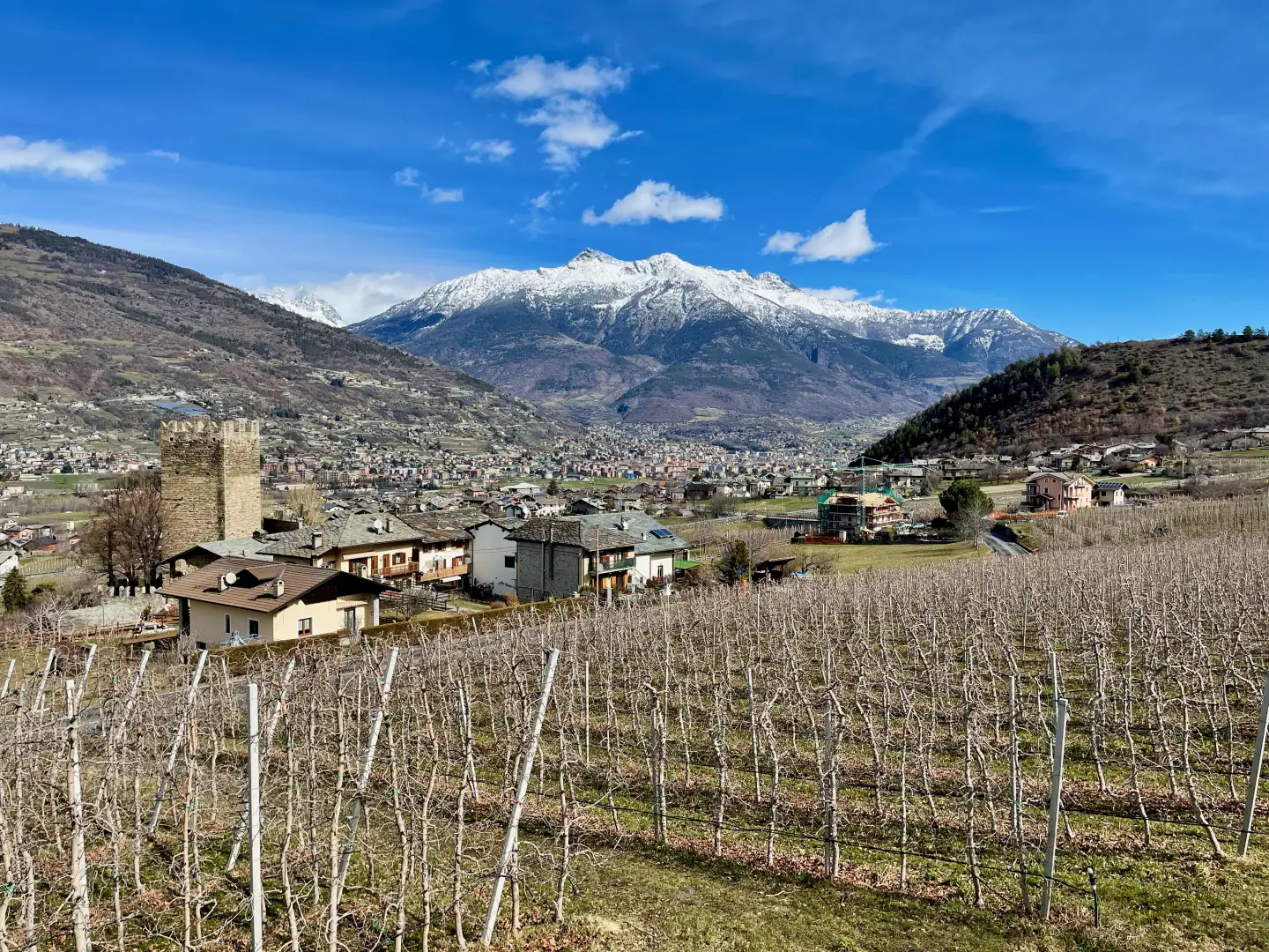
Gressan

Introduction
Gressan is a municipality in Valle d'Aosta located on the right bank of the Dora Baltea river, a short distance from the city of Aosta. The commune extends over a territory that ranges from flat and green areas to mountainous peaks, reaching an altitude of 3090 metres. Thanks to its strategic position between the valley floor and the mountains, Gressan has an agricultural tradition rooted in Roman times, when the land was used as agricultural land. Today, it is known for fruit-growing, particularly apple cultivation, and for its Pila ski resort, which attracts tourists from all over the world.
Description
The name Gressan derives from the fundus Grattiani, an ancient Roman settlement that has left visible archaeological traces in the municipality, such as rustic villas and tombstones dating between the 1st and 3rd centuries AD. The proximity to Aosta favoured the settlement of noble families, such as the De Balnea family, who contributed to the growth of the municipality in the Middle Ages, and to the construction of castles and towers, such as that of La Plantà, probably dating back to Roman times, although some historians date it to the 14th century.
The territory of Gressan is characterised by a flat part, a hilly area rich in pastures and woods and a mountainous area that hosts the slopes of the Pila ski resort. The unspoilt nature, with the Gran Couta nature reserve, or Doigt de Gargantua, offers ample opportunities for hiking and outdoor activities. The climate varies from continental in the flat area, warm in summer and cold in winter, to mountainous in the higher areas.
The ski resort of Pila, located at 1800 metres, has subverted the traditional agricultural economy, transforming Gressan into a winter tourism destination. Easily accessible from Aosta by cable car, Pila offers an extensive network of ski lifts and downhill skiing slopes, and is famous for its sun exposure, making it perfect for skiing even in periods of low natural snowfall. In summer, on the other hand, the municipality is a destination for hikers and nature lovers, who explore the Macchia della Magona and the surrounding mountains.
The history of Gressan is intertwined with that of the Salassi, an ancient population that inhabited the Aosta Valley before the Roman conquest, and with the Roman era itself, which has left significant evidence in the area. Many Roman artefacts, including coins and tombstones, are preserved in the Archaeological Museum of Aosta. In the Middle Ages, the municipality was a feud disputed between several noble families, and in the 14th century, the De Graciano and La Cour families built castles and towers that still bear witness to Gressan's rich history.
The cultural traditions of Gressan are strongly linked to rural life and religious festivities. The Apple Festival in October celebrates local fruit-growing and the apple harvest, while other popular traditions such as the Easter 'Gaude' and Carnival with the figure of 'Harlequin' keep local traditions alive. In addition, the municipality hosts the Bataille des Reines, a competition of strength between cattle, which is a symbol of local agriculture and Valle d'Aosta traditions.
Gressan has preserved its agricultural character, despite the development of tourism. Animal husbandry, with the production of fontina cheese, and apple cultivation are still crucial sectors of the local economy, while viticulture has seen renewed development. Livestock breeding, particularly of local breeds, contributes to the fertility of the soil, thanks also to the ancient irrigation system that makes use of the abundant spring water.
The villages of Gressan, scattered over various plateaus, feature traditional stone houses that bear witness to the municipality's rural history. The villages of Clapey, Molline and Bertin are among the oldest, while new settlements have sprung up along the connecting roads that link Gressan to Aosta and other neighbouring municipalities. In addition to historic chapels such as the one at Molline, the commune maintains a network of hiking trails and paths that lead to breathtaking views.
Information
Area: 25.30 sq km
Altitude: 626m
Maximum elevation: Punta della Valletta (3090m)
Number of inhabitants: 3135
Name in dialect:
Inhabitants name:
Patron Saint: Saint Stephen (26 December)
Website: www.comune.gressan.ao.en
Webcam:
Bordering municipalities: Aosta, Aymavilles, Charvensod, Cogne, Jovençan, Sarre
Villages and hamlets: La Bagne, Barral, Barrier, Bénaz, Bonella, Borettaz, Bovet, La Cerise, Chamen, Champlan, Chanté, Chérémoz, Chez le Rû, Ciel-bleu, Clair, Clérod, La Cort, Crétaz, La Cure de Chevrot, Eaux-froides, Échandail, Étrepiou, Favret, Les Fleurs, La Fontaine, Gerdaz, La Giradaz, Gorret, Grand-Cerise, Impérial, Jacquin, Letey, Leysettaz, La Magdeleine, Moline, Naudin, La Palud, Pâquier, Perriail, Pila, Pilet, La Piscine, Plattaz, Plein Soleil, Rémaz, La Roche, Ronc, Surpillod, Taxel (chef-lieu), Tour de Ville, Vignettaz, Vilvoir, Viseran
Landscapes: